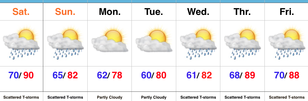
 Highlights:
- PM storms
- Dry midweek
- Wet close to the work week
- Much cooler air looms
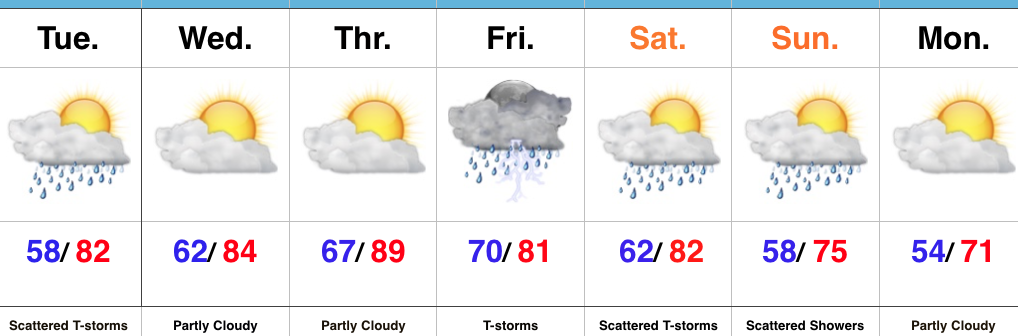
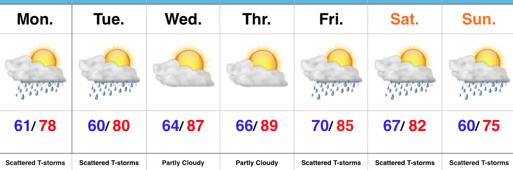
Busy Times…Upper level energy and just enough instability could spark another round of scattered showers and thunderstorms this afternoon and evening. Similar to Monday, these will be quick-movers, but shouldn’t be quite as strong as yesterday.
Dry weather will return through midweek and while pleasant air will still be with us Wednesday, a more humid feel will develop Thursday. Showers and thunderstorms will begin to creep back into the picture Thursday downstate, but we believe most of central Indiana should remain rain-free.
We’ll be in a “squeeze play” of sorts to close the work week and head into the weekend. A cold front will drop in from the north while remnant tropical moisture moves north out of the Deep South. Widespread showers and thunderstorms should result, including the potential of locally heavy rain.
The big story over the weekend into the last week of the month will be unseasonably cool air. Enough upper level energy will be around in a fast northwest flow aloft to lead to shower chances Sunday, otherwise early next week looks stunning- including plentiful sunshine, dry air, and unseasonably cool temperatures.
Upcoming 7-Day Precipitation Forecast:
- Snowfall: 0.00″
- Rainfall: 1.00″ – 1.50″
 Highlights:

 Highlights:
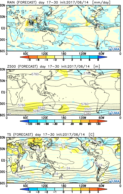
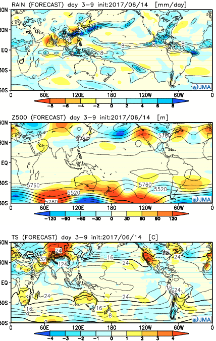 Week 2:
  Weeks 3-4: