While “nuisance” type showers are possible through the daytime hours, most of Thursday will provide a break from significant rainfall. Unfortunately, additional periods of moderate to heavy rain will return as we wrap up the work week and head into the weekend. In particular, we’re targeting the following for additional heavy rainfall:
- Overnight Thursday into Friday morning
- Overnight Friday into Saturday morning
- Saturday afternoon/ evening
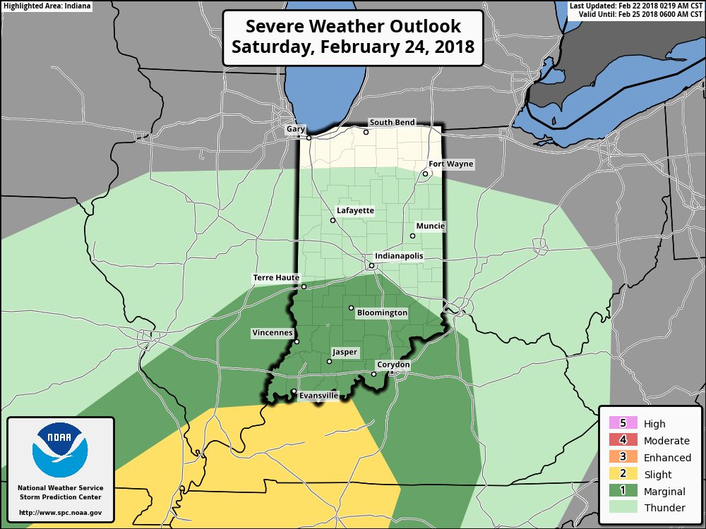
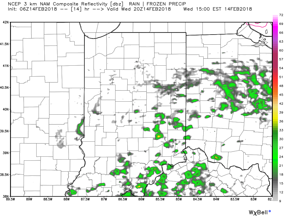
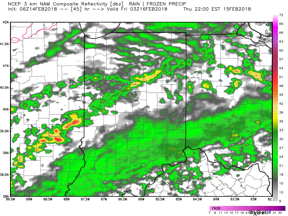
 Embedded thunderstorms may target southern Indiana late tonight and Friday morning before more widespread thunderstorms (a couple could become strong) Saturday. The Storm Prediction Center (SPC) has included the southern half of the state in a “marginal risk” of severe thunderstorms Saturday.
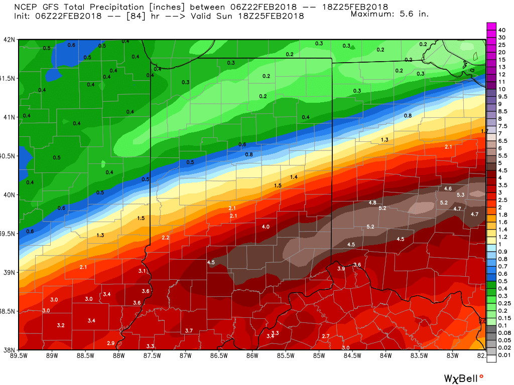
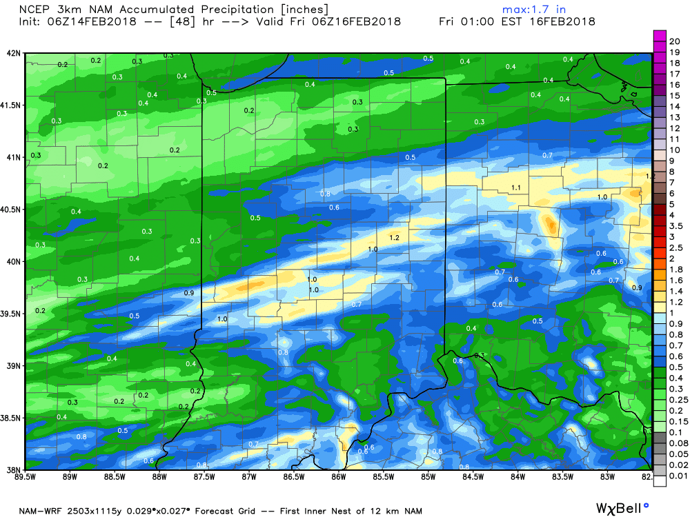
 All total, additional rainfall between now and Sunday morning should reach 2″ to 3″ across a widespread portion of the southern half of Indiana with locally heavier amounts.
 We’ll finally dry things out as we close the weekend and head into early next week as high pressure settles overhead.
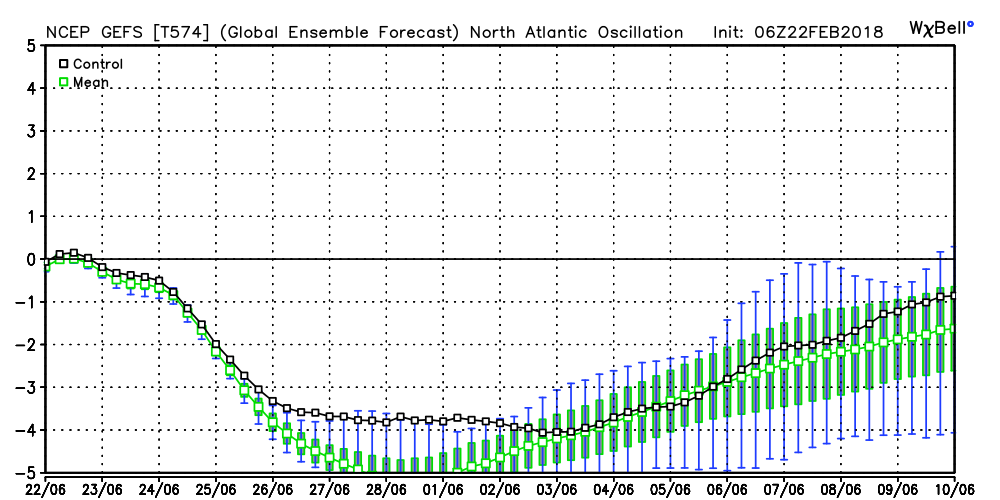
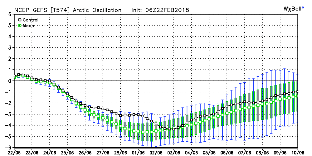
 Next week will begin a pattern transition from the unseasonably warm weather we’ve enjoyed as of late to a colder regime for the first half of March. We note models continue to tank the NAO and AO.
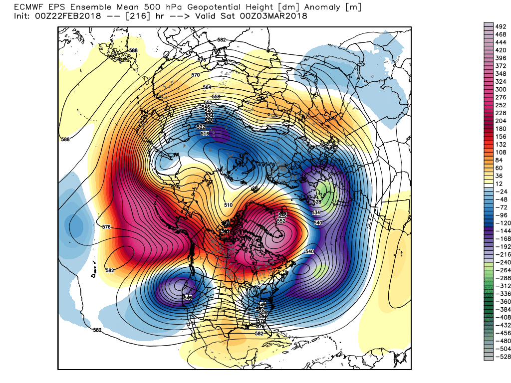
 Accordingly, the models are seeing the trough and associated colder than average pattern returning to the eastern half of the country as we rumble through the first half of March. With such a strong block in place, this can turn into an active pattern for a couple weeks to go along with the cold. Both the GEFS and EPS agree on the overall look.
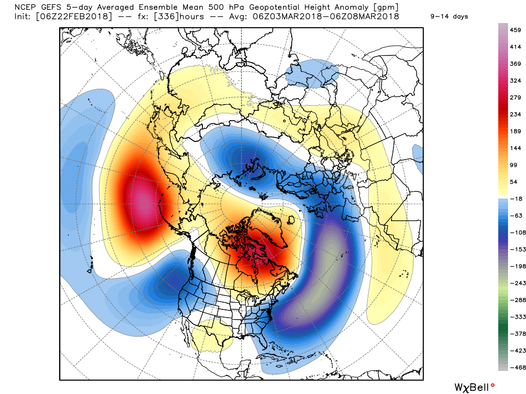 While there’s no way to get specific on the individual storm threats that will eventually come with this pattern, the potential is present for a few storms to “bowl” underneath the block through the first 10-15 days of the month. Each storm will have the capability of delivering wintry precipitation, but this can also be a tricky time of year where most, if not all, ingredients need to come together to create significant wintry events. In a winter that’s been frustrating to central Indiana snow lovers (frigid, but dry first half and milder, wetter second half), perhaps it would be fitting to get a couple good snow dumps in March (when most are wanting and ready for spring)…
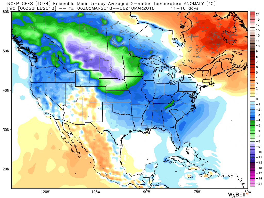
Colder times return for the first half of March.
 III. We’ll turn briefly colder to close the work week. A couple of light snow showers are possible Friday morning and a wave of low pressure will “try” to push moisture into the cold air Saturday. As of now, we remain unimpressed with the prospect of impactful wintry weather Saturday, but have included the potential of wet snow in our Saturday forecast. Precipitation appears to be very light. Nonetheless, we’ll continue to keep an eye on things.
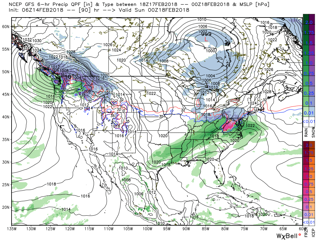 IV. The pattern continues to scream and warm and wet next week as a big ole southeast ridge remains in place. This will direct the steering current into the TN and OH Valley regions and multiple waves of rain, occasionally heavy, will result beginning early next week and continuing into the middle and latter portions of the week. Widespread 2″ to 3″ totals with locally heavier amounts seems to be a good bet next week.
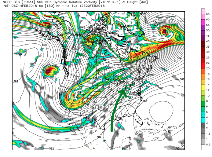
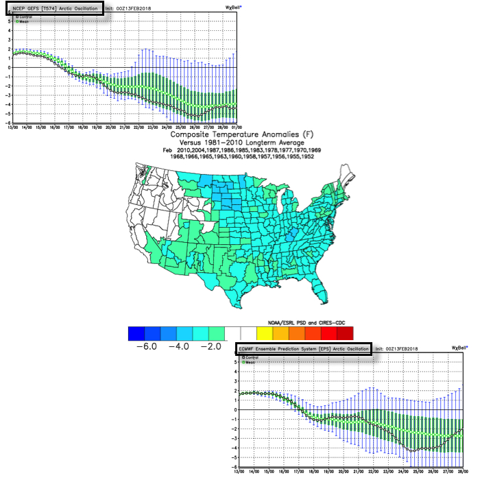
 V. We note data continues to suggest a colder period looms as we close out the month of February and head into March. Note how the GEFS and EPS continues to tank the Arctic Oscillation (AO). Winter’s not over, not by a long shot…