An approaching storm system will help pull spring-like air into the region for at least a couple days later this week. Highs will go into the lower 70s Thursday and middle to upper 70s Friday. After a winter that’s certainly overstaying his welcome, that will feel mighty nice!

Highs will zip into the mid and upper 70s Friday!
Unfortunately, the nice spring-like feel won’t last. A cold front will sweep through the state Saturday with showers and thunderstorms late Friday night into the daytime Saturday, followed by a dramatic wind shift and much colder air for the second half of the weekend behind the frontal passage.
 As upper level energy moves overhead, mixed rain and snow showers will fall early next week.
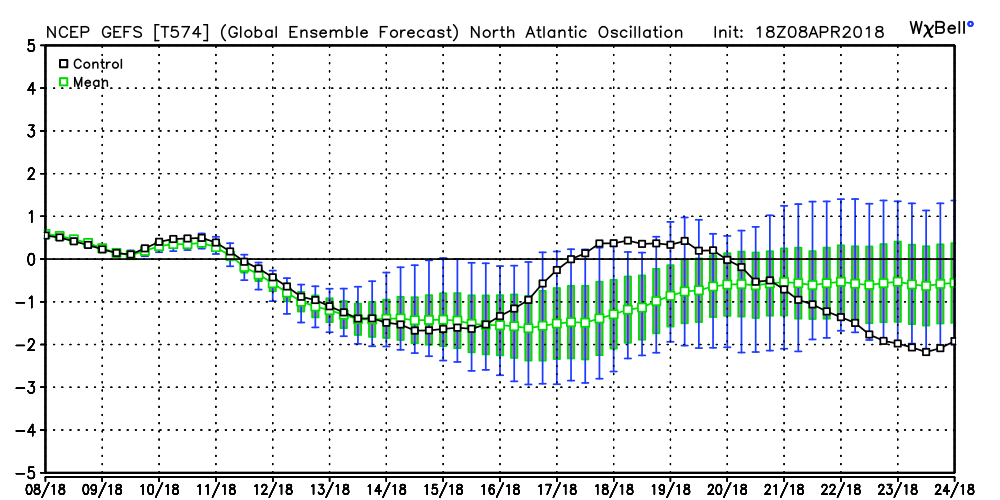
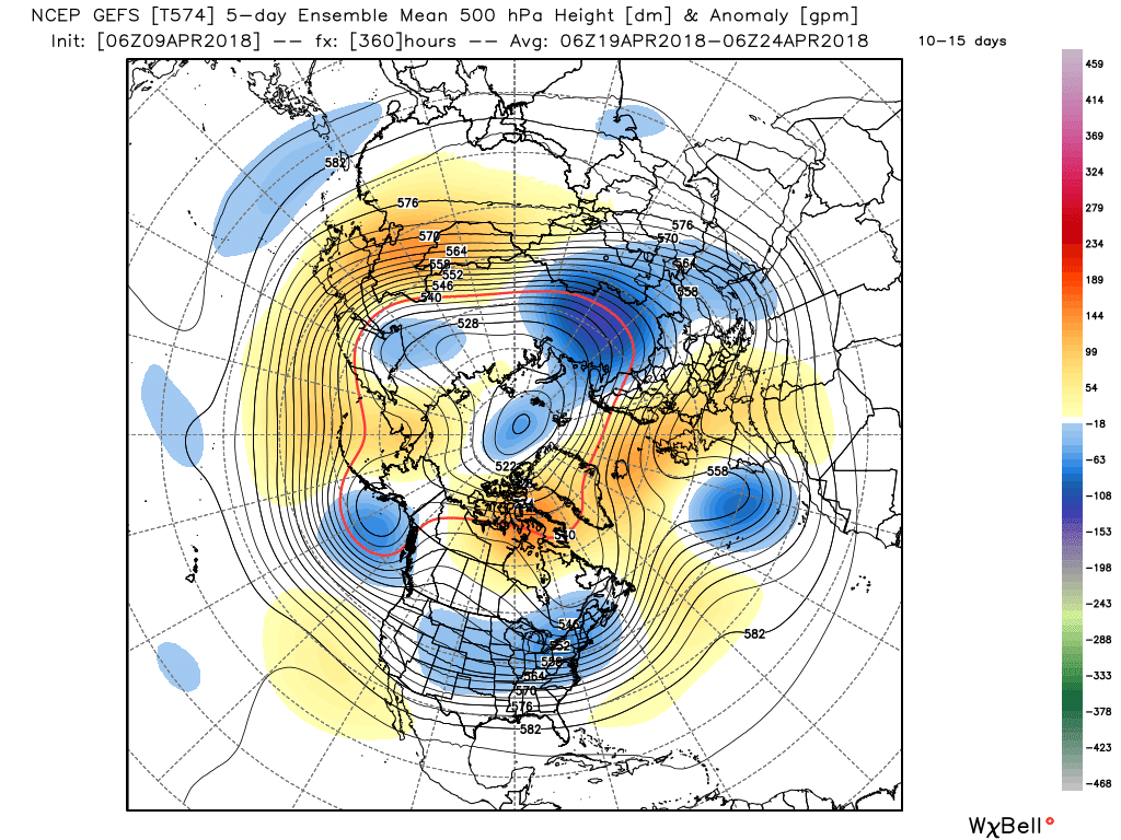
 Longer term, the negative NAO will continue to lead to prolonged colder than average temperatures. At this point, we think this pattern will run at least through the remainder of April.
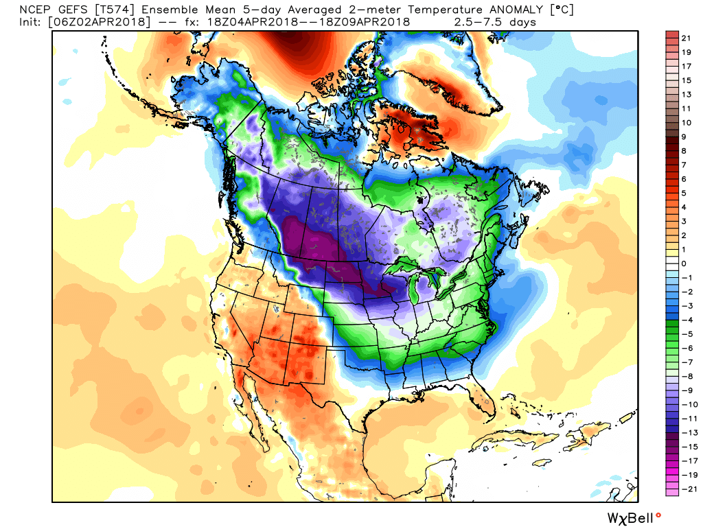
 The end result? You know it: a persistent eastern trough and associated colder than average feel…

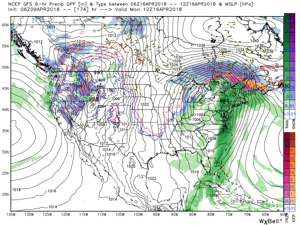
 III. Our next focus is on the prospects of late week/ weekend snow. Models will continue to struggle with the finite details over the next few days. I’m not so sure the suppressed look displayed currently is the correct one. Let’s remember, this time last week models were taking our Easter storm well to our south. We’ll keep a close eye on things over the next few days.
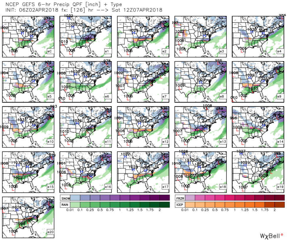 IV. Regardless of whether we get additional snow down or not, a first-class late season arctic blast will drill south this weekend. This will be cold enough to keep temperatures in the 30s for highs Friday and Saturday. Brutal stuff for early-April when average highs are around 60…