Today is the proverbial “calm before the storm” as sunny skies give way to increasingly cloudy conditions during the afternoon and evening. We remain dry today and pleasant, too, with highs around 50 across most central Indiana reporting sites.
Things will begin to change rather quickly during the overnight as rain builds into the state from northwest to southeast, especially after midnight. As we move through the predawn hours (5a to 7a time frame) we expect rain to transition to wet heavy snow across central parts of the state, including Indianapolis.
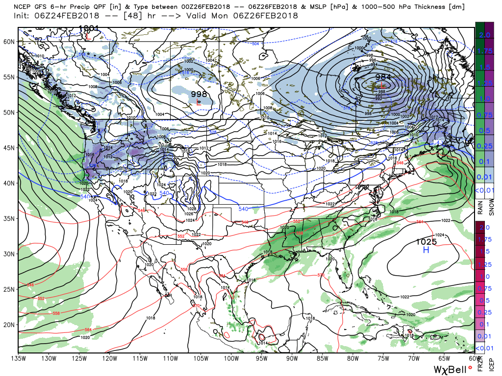
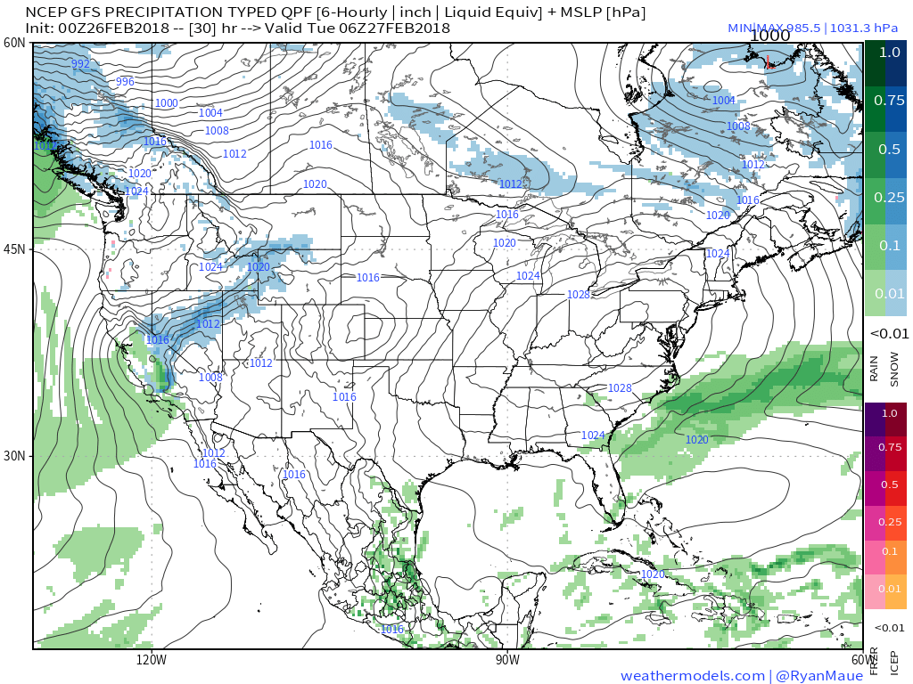
The culprit? Surface low pressure tracking off the lee of the Rockies (today) into the Missouri boot heel (Saturday evening). Add in a blocking high to the north and this will help provide the cold needed to lead to our winter storm. From an overall pattern perspective, this “blocky” regime is really what’s been missing for the better part of the past few years as we’ve written in previous posts. It’s no coincidence that with the blocky regime, central parts of the state are in line for the biggest winter storm in years. Also of interest is the correlation between late winter blocking patterns and what the next winter can provide, along with other items (another story for another day), but there’s reason to believe we may be on the cusp of returning to winters featuring more snow in the coming 2-3 years.
Back to the present:
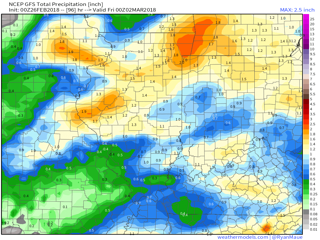
Our snowfall forecast includes a widespread swath of 4″ to 8″ amounts through the heart of the state.
 We remain very impressed with the prospects of banding which could include snowfall rates of 1″ to 2″ per hour Saturday morning into the afternoon hours. With such snowfall intensity, even marginally cold surface/ pavement temperatures will allow for slick and hazardous travel across many central Indiana communities Saturday. Additionally, within localized heavier bands, don’t be surprised for a report or two of thundersnow across central Indiana. Please share your reports with us as things unfold tomorrow! Finally, an icy mixture of sleet and freezing rain will also mix with the snow at times along the southern periphery.
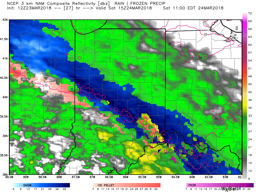
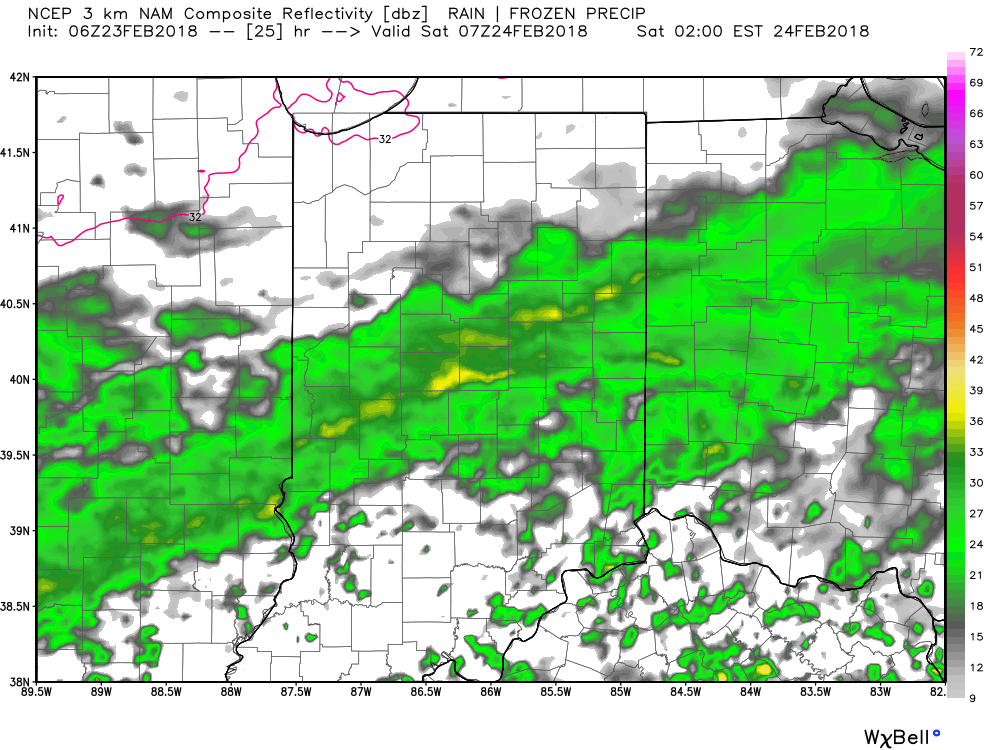
Forecast radar 11a Saturday
Snow should begin to diminish in overall coverage and intensity by Saturday evening- from northwest to southeast. By that point in time, we’re left with the clean up duties from what will likely be the heaviest snow in a few years for some of us. The other item to touch on: gusty winds as we still expect 30 MPH + gusts during the day Saturday.
With all of that said, let’s remember March snow events always offer “surprises-” no matter how much we try to eliminate those surprises. There will be winners and losers with this event in the snow department.
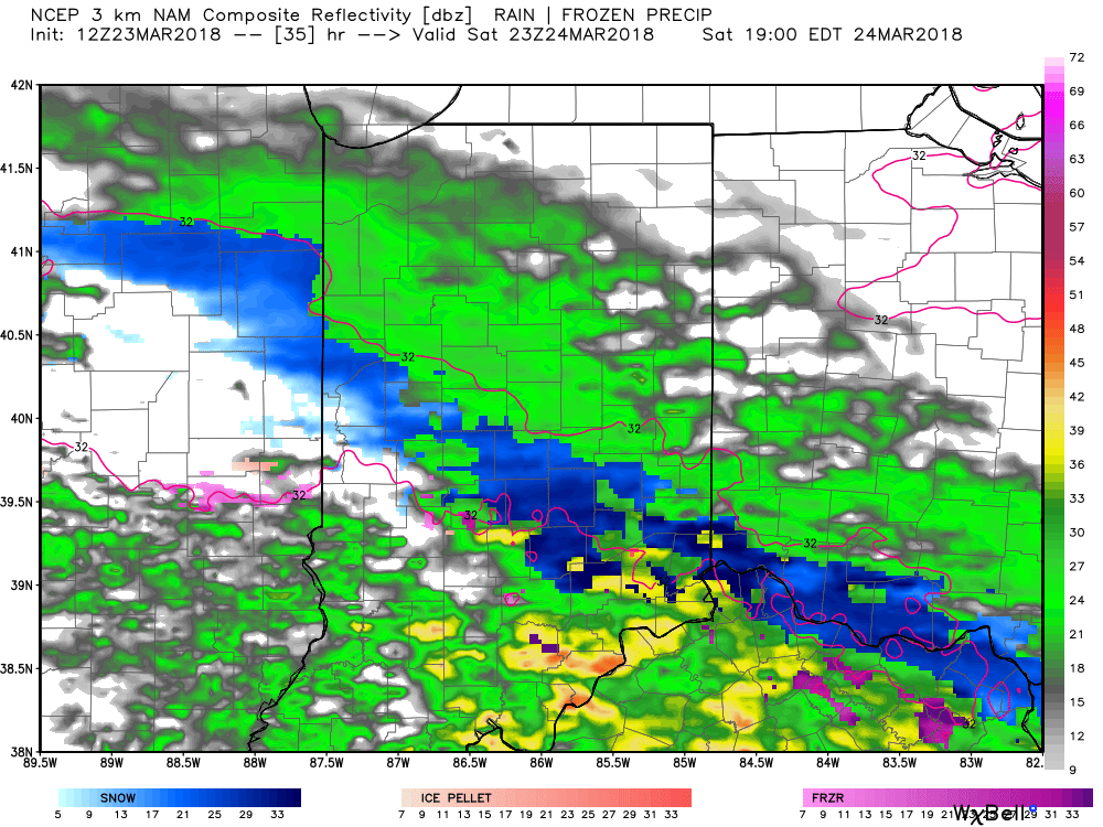
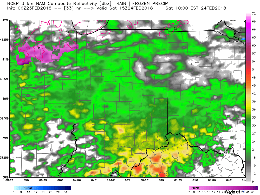
Forecast radar 7p Saturday.
Sunday will feature a return of dry conditions, as well as a return of the sunshine!
 II. Our next weather maker will arrive midweek and provide a few showers Wednesday (not a huge deal from a precipitation perspective). However, as a deepening surface low tracks into the Great Lakes Thursday morning, a period of heavier rain and even thunder is possible. In general, this looks like a 0.50″ to 1.00″ type event.
 III. Somewhat cooler air will whip in behind the low, allowing leftover precipitation to end as a couple wet snowflakes across the northern half of the state Friday morning. The bigger story will be the “bumpy” start to Friday with strong and gusty north winds.
 IV. High pressure returns for the weekend and with it will come a return of sunny skies. Though the mornings will be frosty, afternoon temperatures will “warm” to pleasant levels, especially with the increasingly strong early-March sun angle.
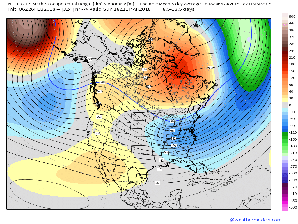
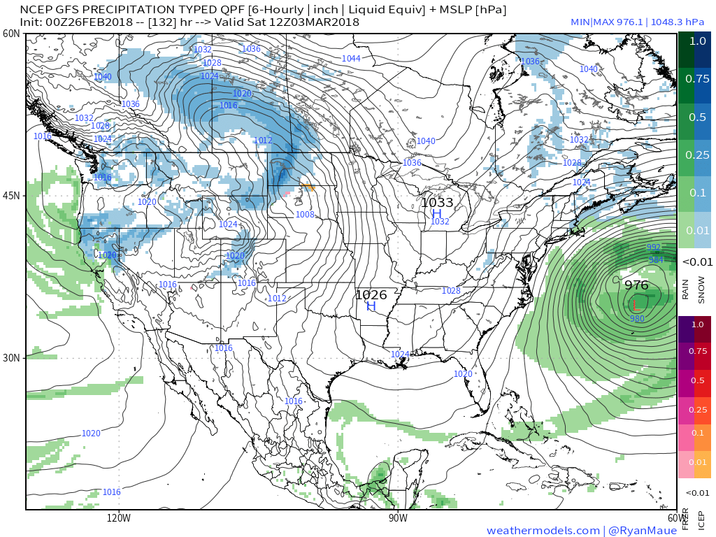 V. Looking ahead, let’s keep a close eye on the second week of March. Potential is present for a stormy period to emerge under the block. We note the GEFS and EPS (respective ensembles of the GFS and European models) are in relative agreement on a stormy, cold look during this time frame. While far too early for specifics, the potential is there for a rather widespread wintry event from the Plains into the Northeast.
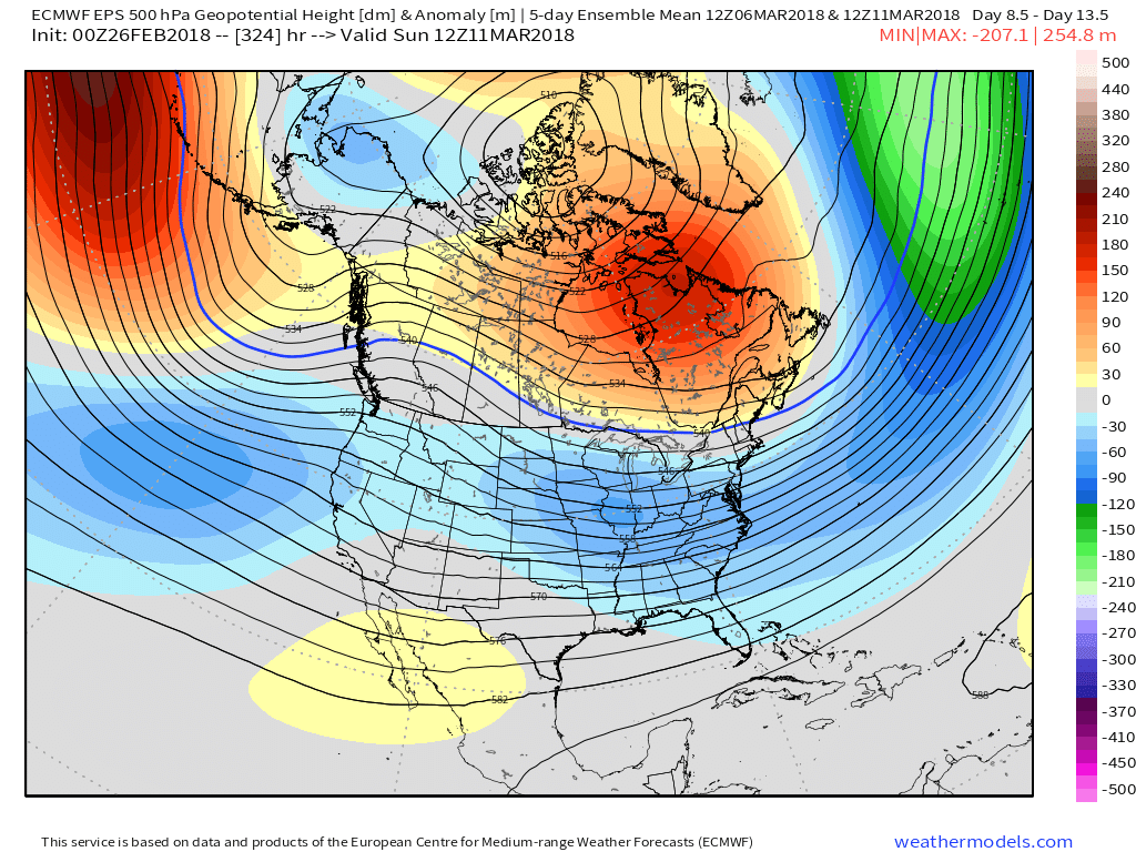
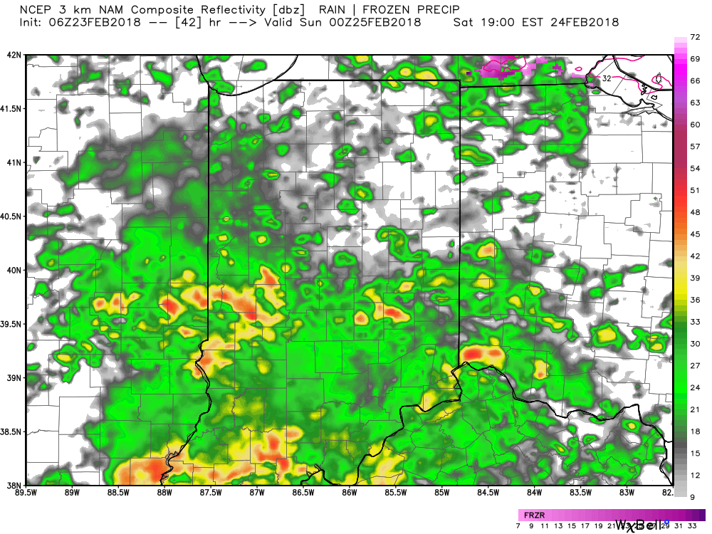
 Our Saturday morning will be dominated by soaking rains as moisture continues to stream across the Midwest and Ohio Valley, including central Indiana. Add in temperatures in the lower to middle 40s and you have our official approval to sleep in this morning. 🙂
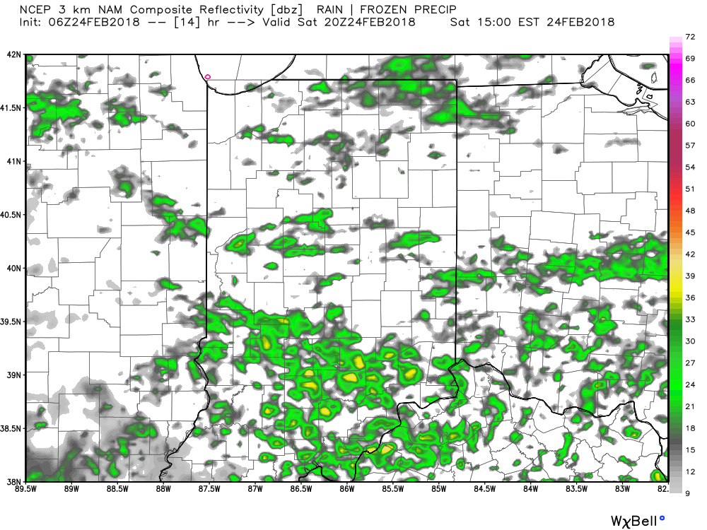 Widespread rain and embedded thunderstorms will return by evening, and forecast radar products at 8p and 2a Sunday show the stormy times well:
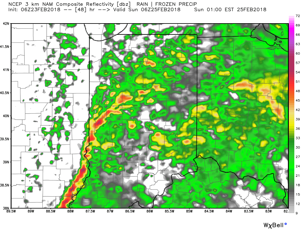
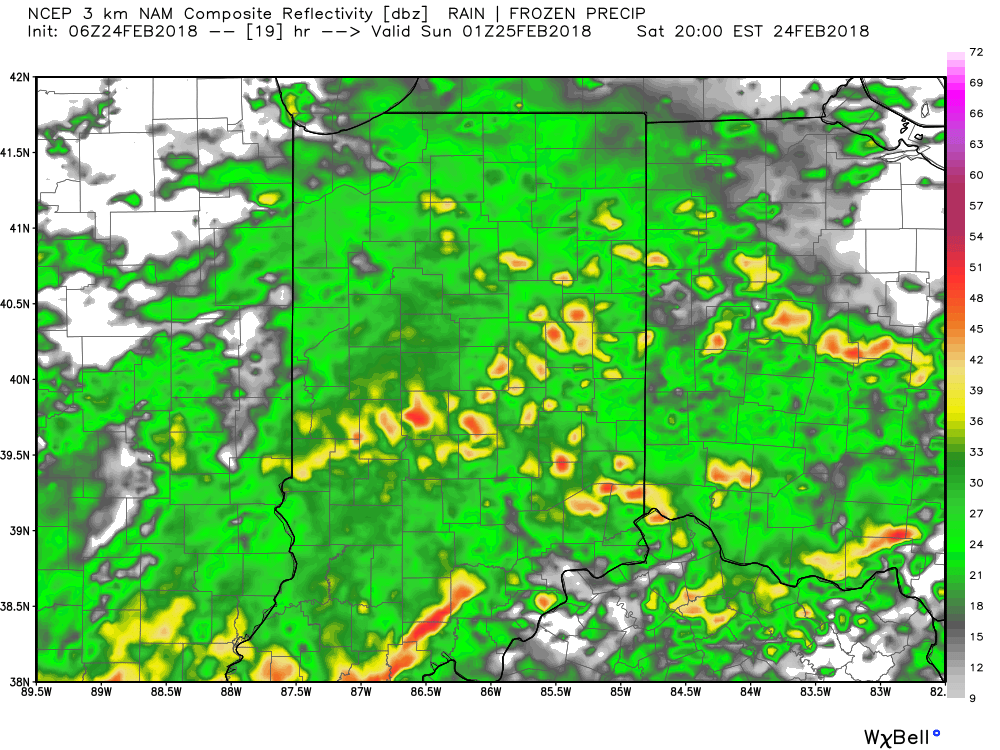
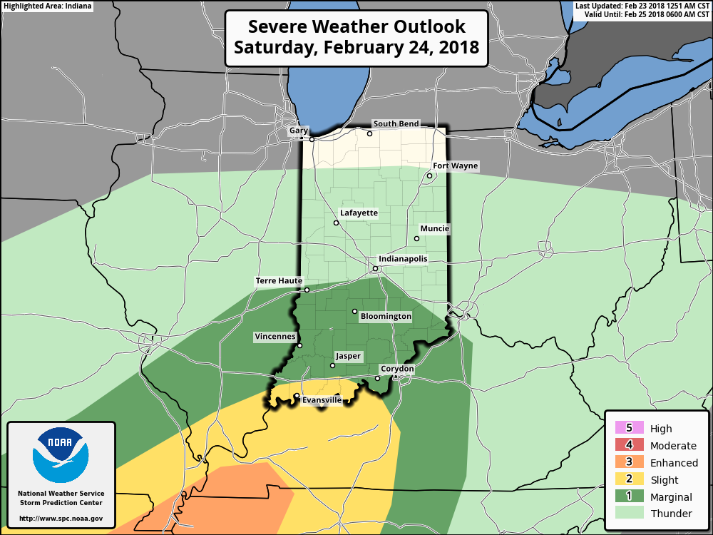
 A couple of storms may become strong to severe (especially downstate). Accordingly, the Storm Prediction Center has expanded the threat of severe weather to encompass more of the state.
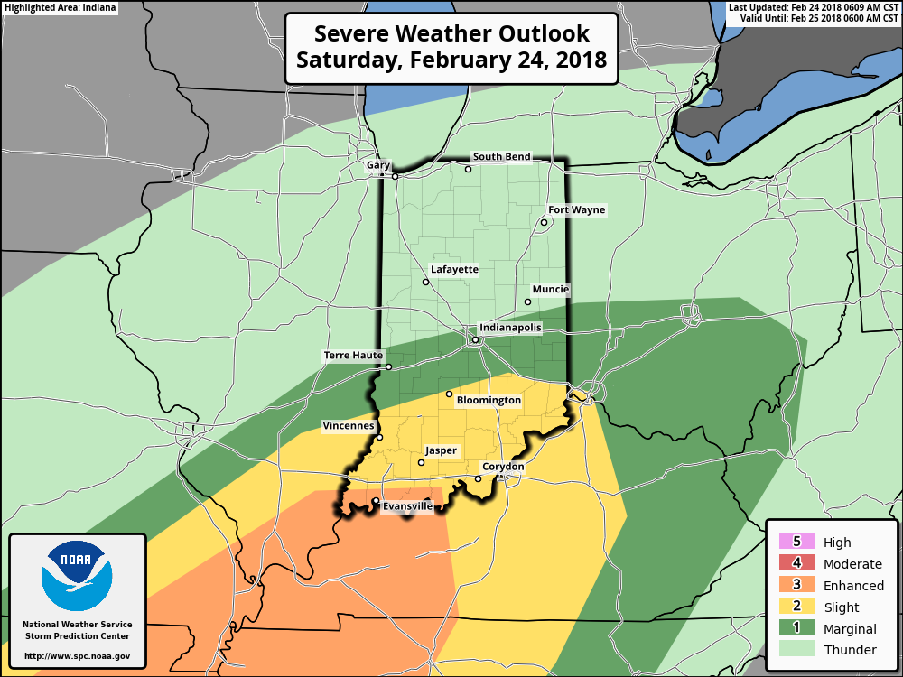 After early morning storms head east Sunday, high pressure will build in with drier conditions and increasing sunshine Sunday. It’ll be a very nice close to the weekend, and calm, pleasant conditions will continue as we progress through the early portions of the new work week.