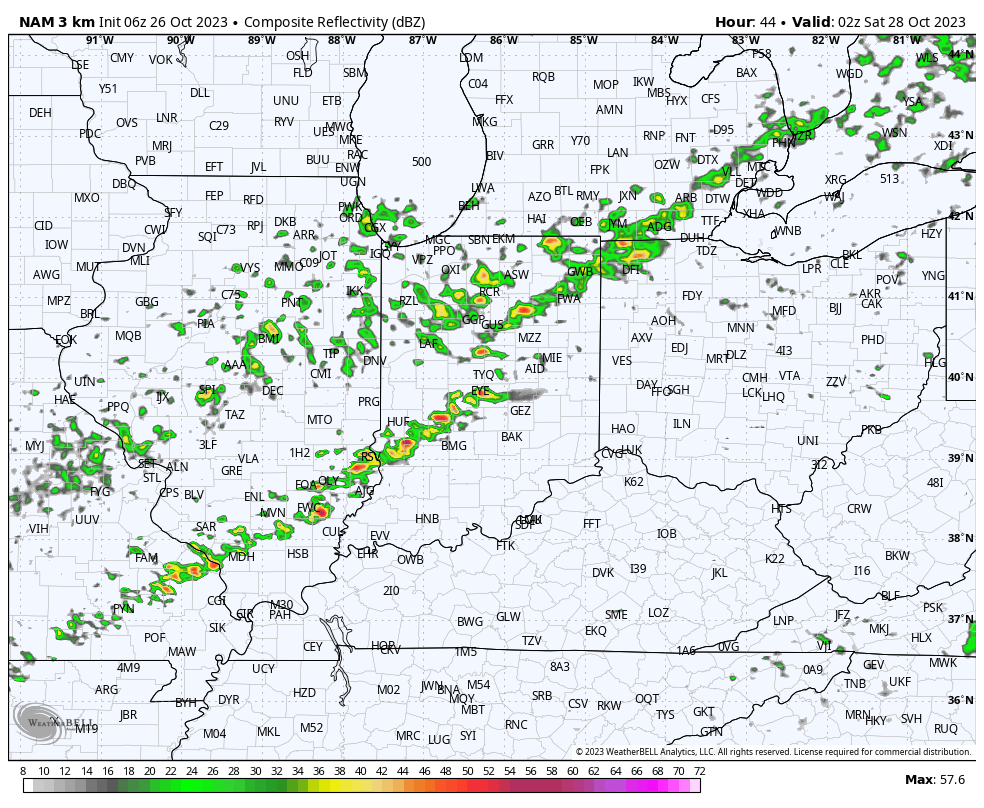
Updated 12.09.23 @ 10:51a We’re tracking a narrow line of showers and embedded thunder this morning. This is in association with a cold front that will pass through central IN…
You must be logged in to view this content. Click Here to become a member of IndyWX.com for full access. Already a member of IndyWx.com All-Access? Log-in here.
The next couple days will be the last of temperatures in the upper 70s to lower 80s until next spring. The first of 2 cold fronts will settle into central Indiana tomorrow evening followed by a strong frontal passage Monday. If you rather go right to the punch line instead of reading through the rest of this post, trick or treaters will need the heavy cold gear this year.
A few showers will skirt northern counties later this evening but the lions share of the next 36 hours will be rain-free. A line of showers and even thunderstorms will be associated with Friday evening’s cold front.
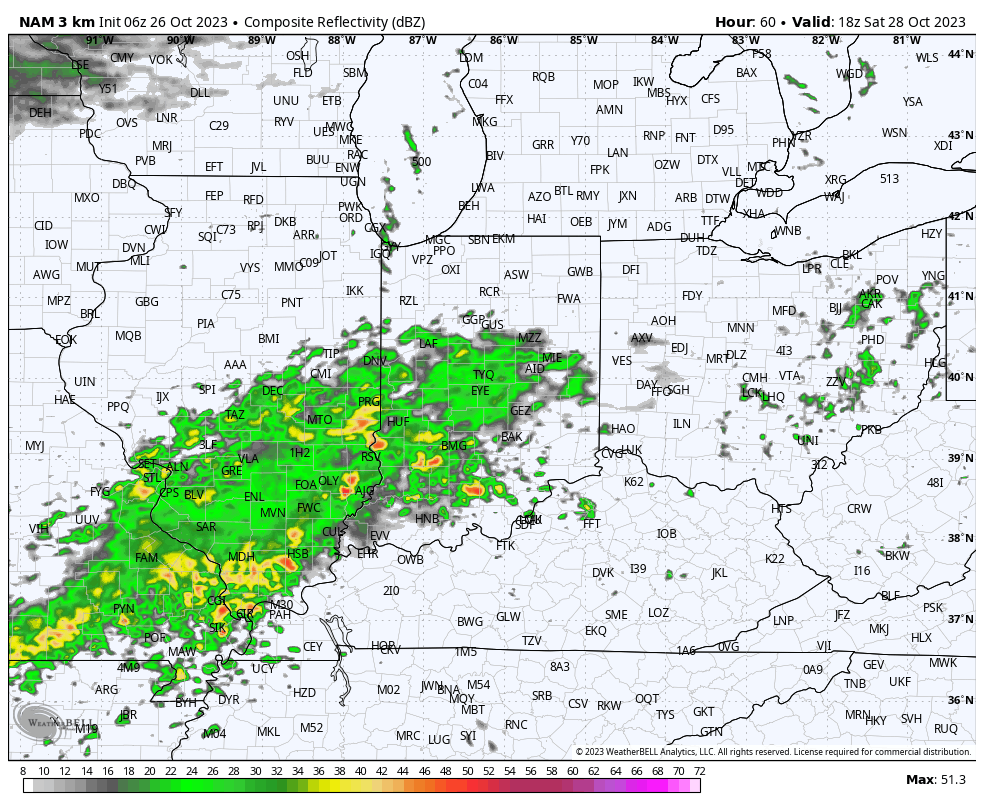
A much more widespread, heavier rain will build into central Indiana through our Saturday afternoon. It’s this period, continuing into Sunday where the bulk of our widespread 1”+ rain will come. A smaller axis of heavier totals (2”+) likely sets up shop south of the city, itself.
After a “step down” process to cooler air Friday into Saturday, the bottom will really fall out Monday. This will set us up for a downright cold Halloween (lows in the upper 20s with highs in the lower 40s). Add in winds and the “feels like” will be in the 10s and 20s into the 1st day of November.
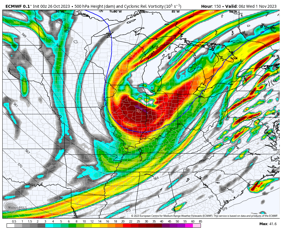
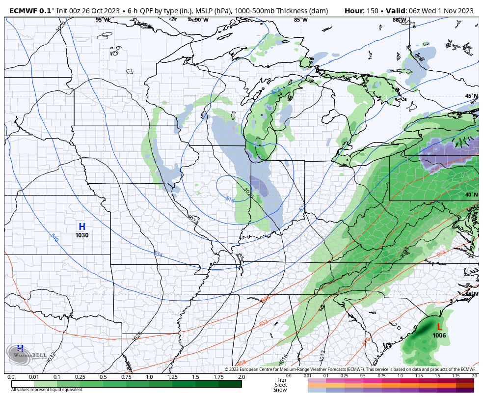
If that isn’t enough, trailing upper level energy will push into the area Halloween night and have enough moisture to generate snow showers late into Wednesday morning. A renewed push of gusty winds can also be expected during this time period.
Coldest mornings of this stretch will likely take place next Wednesday or Thursday with overnight lows into the middle to upper 20s.
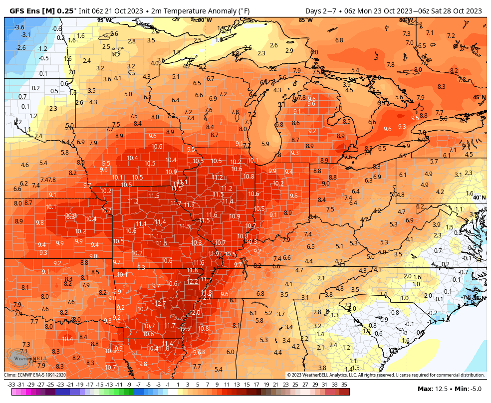
The upcoming week will feature a pattern shift, albeit a transitional one, that will drive unseasonably warm temperatures north into the Ohio Valley and Great Lakes region. This will be on the heels of the first widespread frost of the season Monday morning. Ah, Indian summer at its finest.
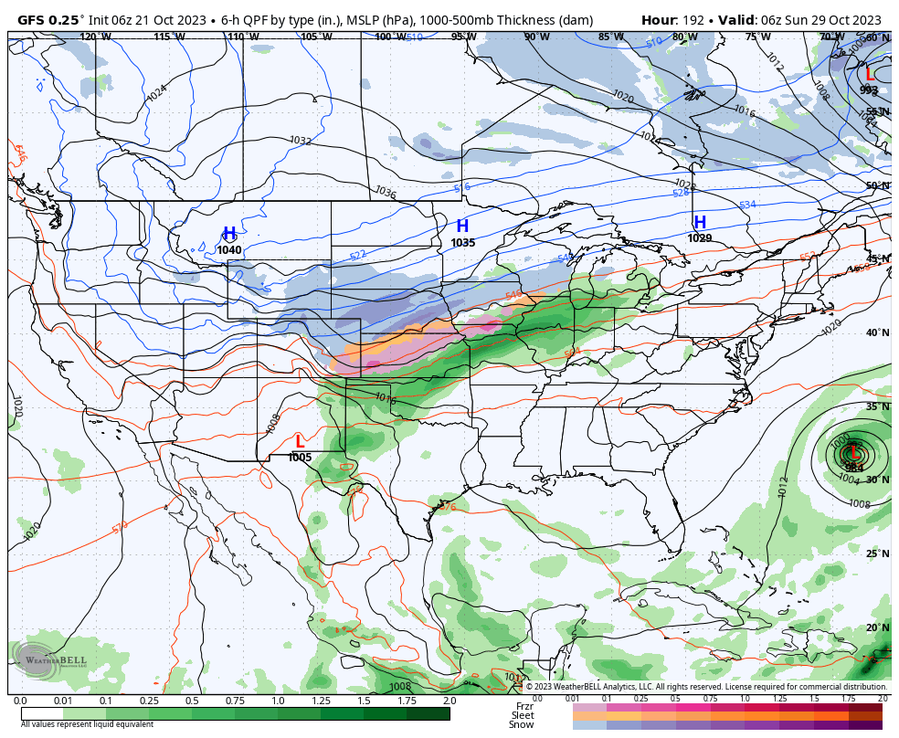
A couple of disturbances will try to make inroads into this ridge mid and late week, but will likely struggle in providing much in the way of precipitation or cooler air initially. As we push into the latter part of next week and the Halloween weekend, a larger storm system is anticipated to move east out of the Plains region. This storm will likely deliver the first widespread winter impacts (outside of the mountains of course) of the fall season.
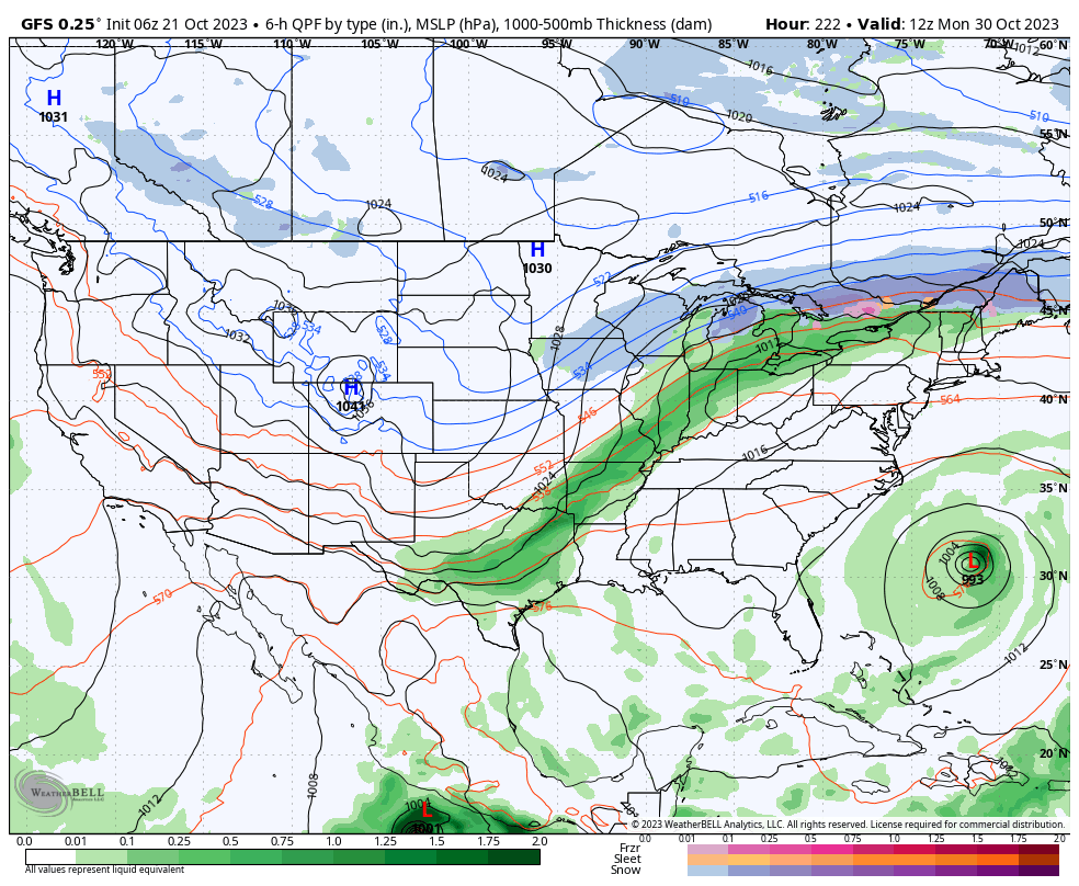
Specifics will be fine tuned as we get closer, but we expect a widespread rain (perhaps a clap of thunder) here next weekend followed by sharply colder weather prior to Halloween, itself.
We’re left with a much different pattern to open November. This is the type regime that will likely lead to the first lake effect snow in the snow belt, drive the 1st widespread freeze into the Ohio Valley, and result in highs in the 40s in the wake of the frontal passage.
Farmers and those with ag interests, we’d suggest wrapping up harvest 23 efforts by mid next week if at all possible. Conditions will certainly become harsher and less favorable by next weekend. More to come…
You must be logged in to view this content. Click Here to become a member of IndyWX.com for full access. Already a member of IndyWx.com All-Access? Log-in here.
You must be logged in to view this content. Click Here to become a member of IndyWX.com for full access. Already a member of IndyWx.com All-Access? Log-in here.