Updated 02.19.24 @ 8:37a An upper level ridge will expand across the eastern portion of the country as we close February and open March. The result will be an increasingly…
You must be logged in to view this content. Click Here to become a member of IndyWX.com for full access. Already a member of IndyWx.com All-Access? Log-in here.
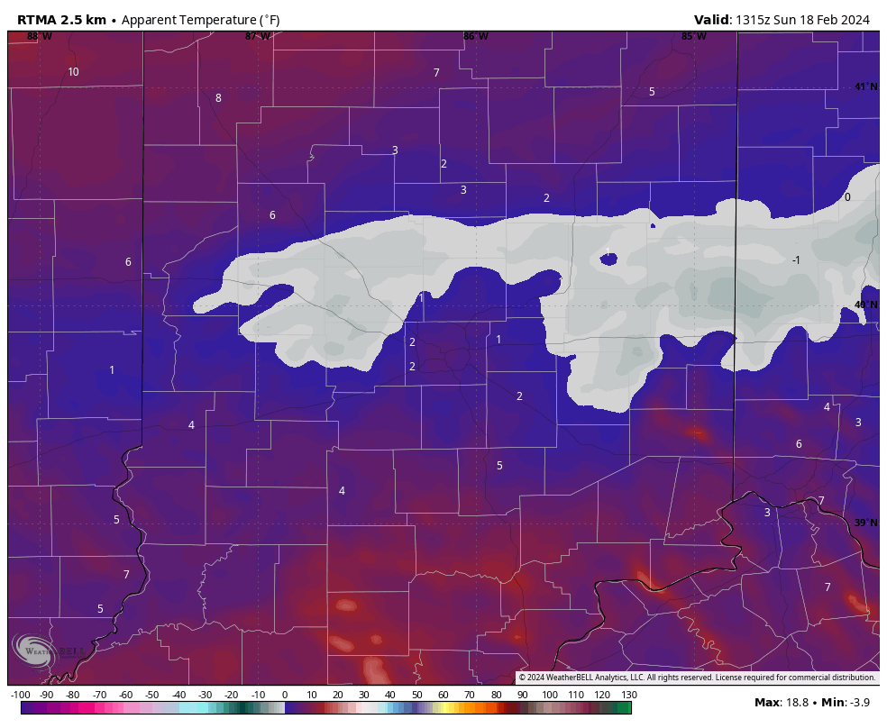
Though we dealt with a bitter start to the day, those strong and gusty southwest winds signal a regime change through the 1st half of the work week. Highs will pop into the 60s even by midweek- a far cry from this morning’s sub-zero “feels like” over the heart of the fresh snowpack.
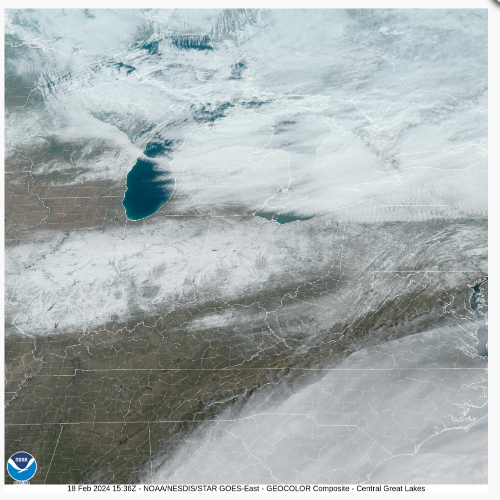
This morning’s visible satellite image shows clear skies across our region and the fresh snowpack.
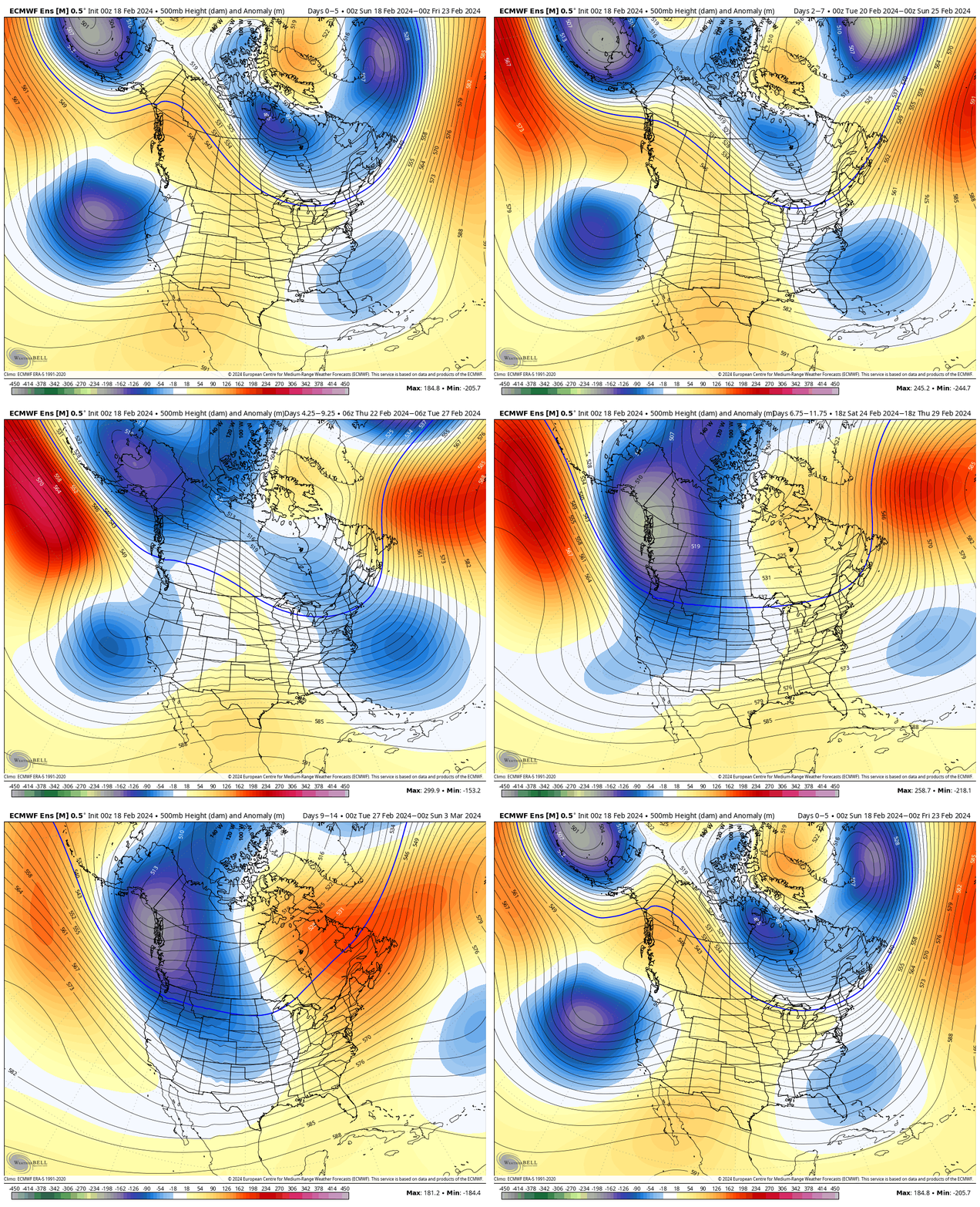
The upcoming 10-day period will feature an expanding ridge across the East and the ‘mean’ trough position settling into the West.
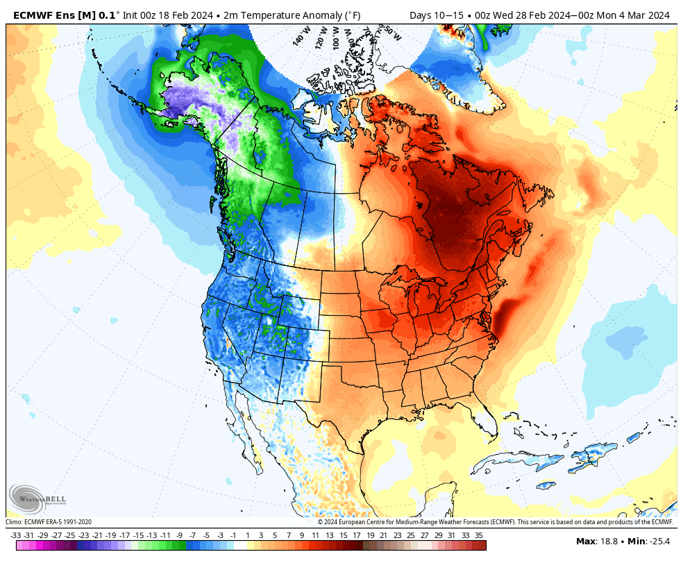
After another brief shot of cold air this weekend, a significant unseasonably mild pattern will arrive next week. Cold settles into the West.
The developing upper air pattern will lead to a more active storm track to close February and open March. See the anticipated above normal precipitation pattern taking hold. This is likely a sign of what the balance of meteorological spring will feature.
In the week ahead, we continue to track a rain maker Wednesday night into Thursday and a brief “jolt” of cold for the weekend.
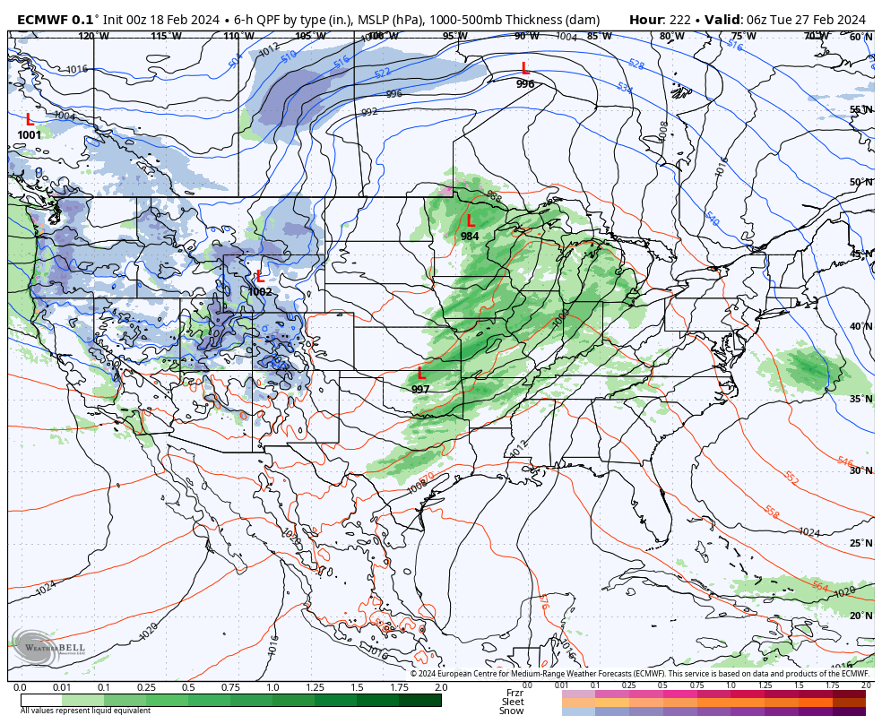
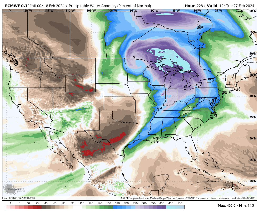
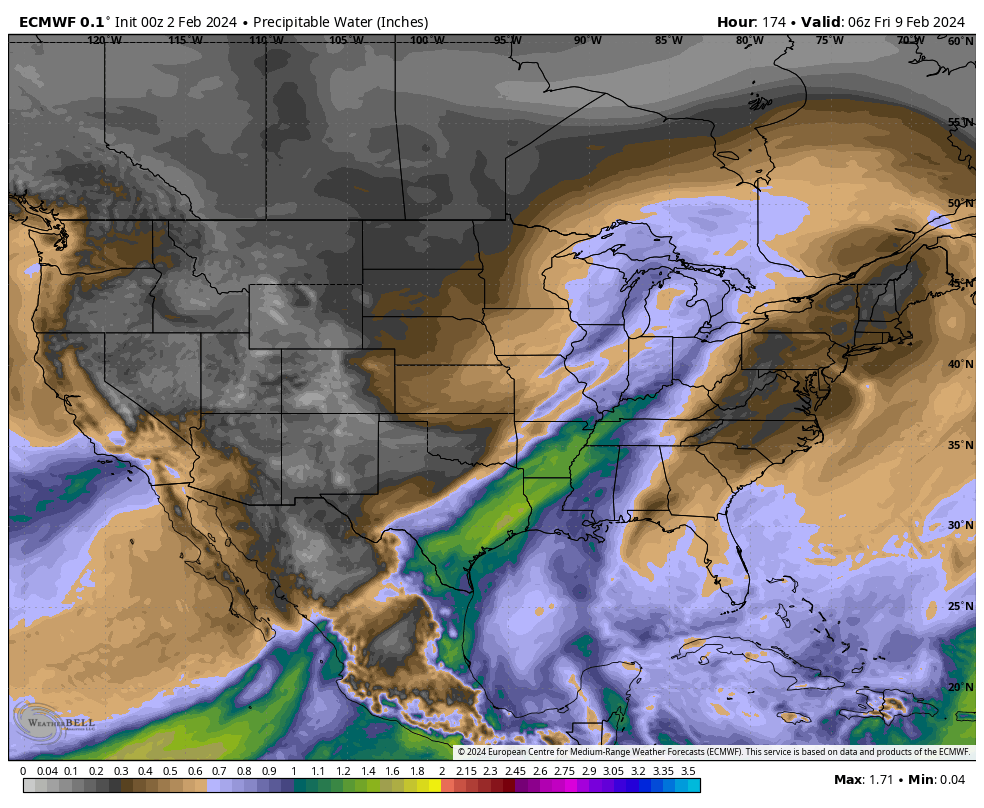
Looking ahead to next week, a more widespread and stronger storm should take aim on our area. Though still a ways off, the signal is one that looks like this feature will be able to tap into the Gulf of Mexico, allowing for a more widespread, potentially, heavier rain event and also the chance of storms.
Note precipitable water values (PWATs) are forecast nearly 300% of the norm.
As we get closer, we’ll have to keep tabs on instability levels and available energy for the prospects of storms. More on this Day 8-10 feature in the coming days. Make it a great Sunday!
Updated 02.16.24 @ 12:14p Snow will continue to overspread the remainder of central Indiana through the afternoon and fall moderately at times. Localized banding should develop this afternoon and these…
You must be logged in to view this content. Click Here to become a member of IndyWX.com for full access. Already a member of IndyWx.com All-Access? Log-in here.
Though we still have a few weeks left of meteorological winter, spring and the #Plant24 season will be here before we know it! The headlines that we anticipate to claim the coming months include the following:
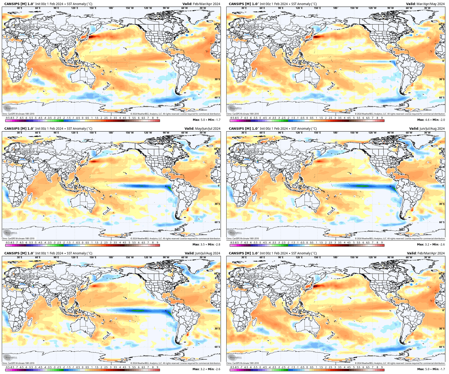
El Niño likely continues to collapse; La Niña state by late spring/ early summer
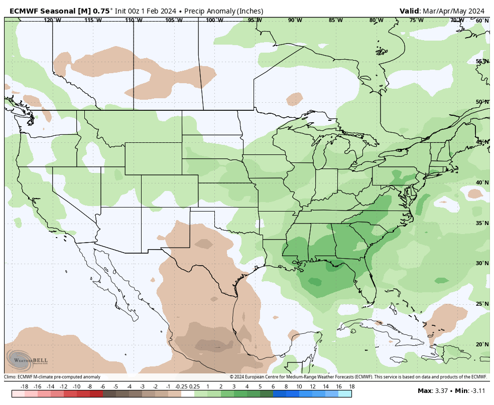
Widespread wetter than average conditions anticipated for a large chunk of the country, including central Indiana. Opportunity for above average severe weather episodes during the March through May (meteorological spring) time period.
Time to prep for a hyper active hurricane season along the Gulf and Southeast US coastlines.
Long range, seasonal forecast models, continue to show the current El Niño collapsing and moving swiftly towards a La Niña late spring and early summer.
This transition will certainly have impacts on the anticipated precipitation and potential of a busier severe weather season this spring. We forecast a rather swift Nino collapse and subsequent onset of La Niña, which ups the ante for a wet spring, not only locally, but across a widespread chunk of the country. Undoubtedly, this could lead to plant24 impacts (delays) at times.
Seasonal products see the above average rain expected for spring 24.
European Seasonal Precipitation Anomalies March through MayJMA Precipitation Anomalies March through May
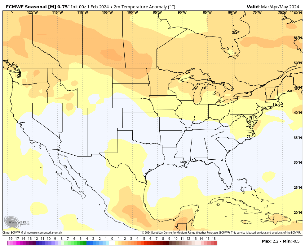
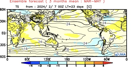
From a temperature perspective, we forecast widespread milder than normal temperatures as a whole for the season across the northern tier, including central Indiana. We caution though that the way we get to slightly (1° to 2° above normal on the season) milder overall may include wild swings through the season. For example, we forecast a colder than normal 1st half of March, the potential of a significant flip to warmer the 2nd half and a cooler pattern to return for the bulk of April.
European seasonal temperature anomalies March through MayJMA temperature anomalies March through May
IndyWx.com Spring/ #Plant24 Outlook for central Indiana:
Temperatures that average 1° to 2° above normal overall for the March-May period.
Precipitation that runs 125% to 130% of normal during meteorological spring.
Wishing the best of luck and positive vibes to all in the months ahead, especially our #AGwx partners. Happy spring!
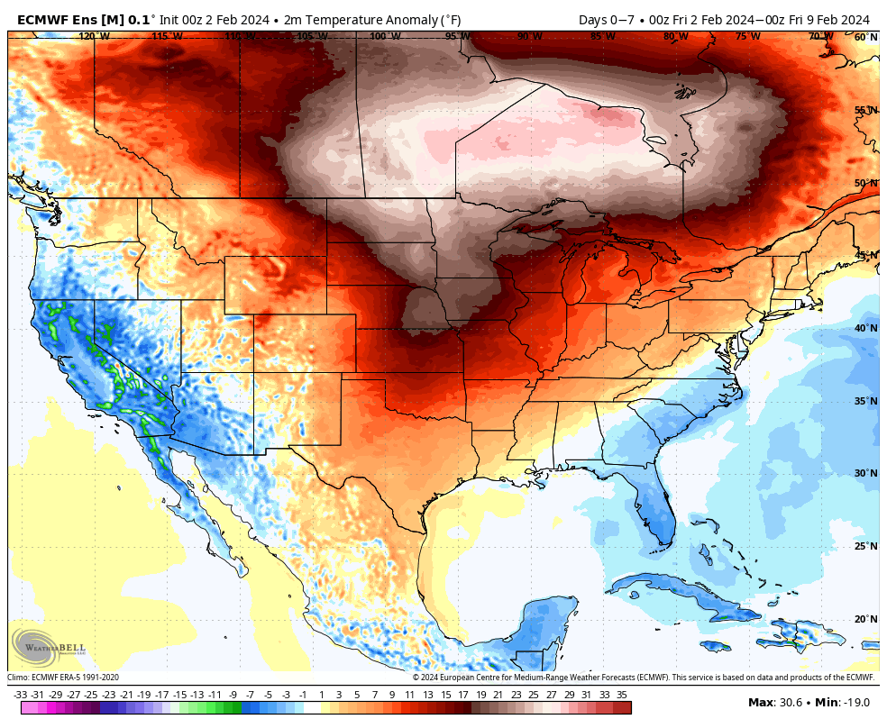
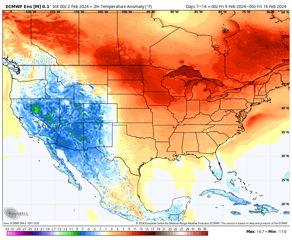
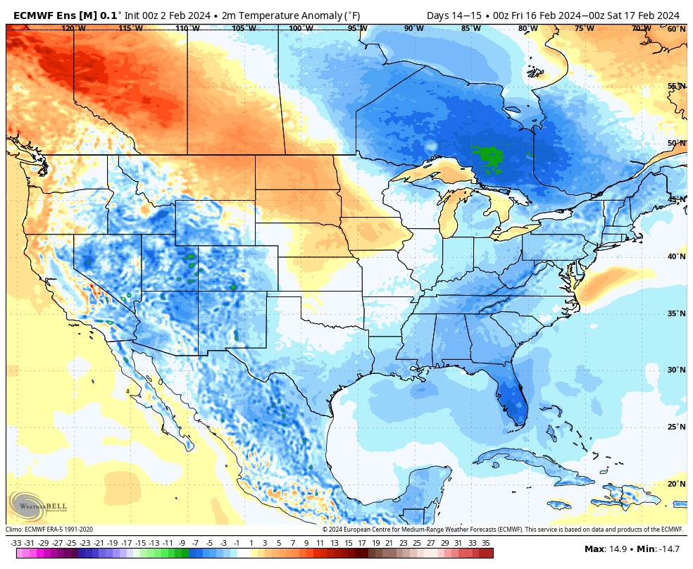
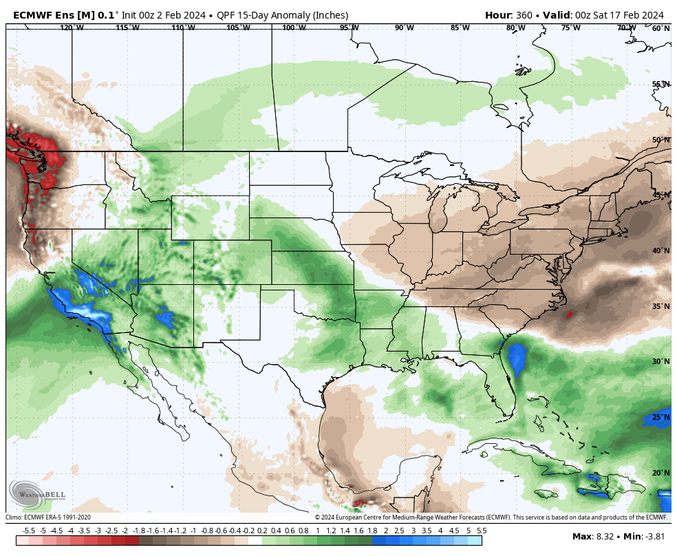
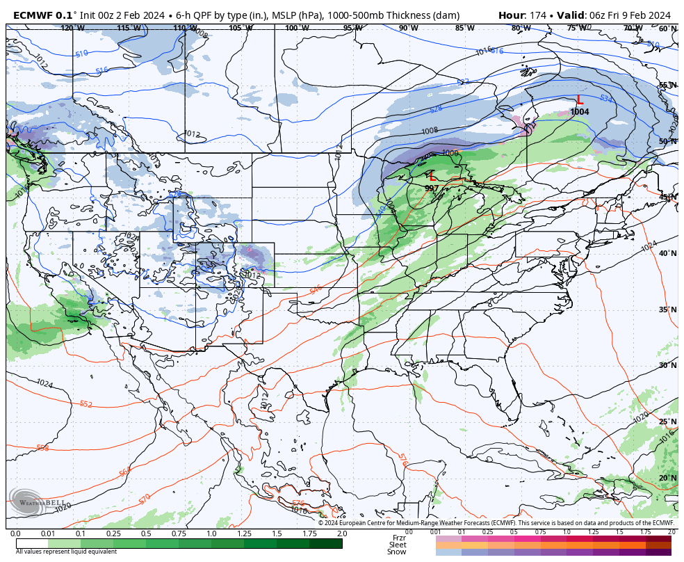
We don’t see any reason to deviate from the longstanding ideas on the overall pattern evolution ahead. February will continue to provide an unseasonably mild and quiet stretch through the first 1/3 of the month ahead of a pattern transition back to colder around or just after 2/10.
2/2 – 2/8
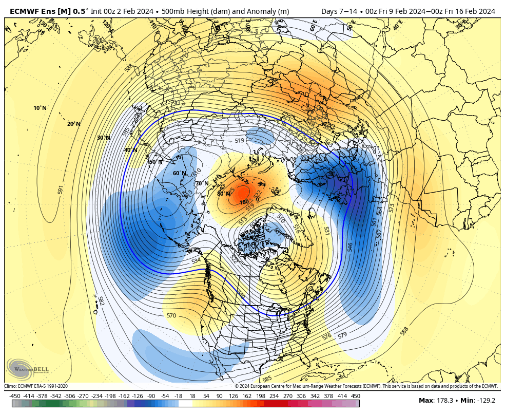
2/9 – 2/16
Note the ridge begins to break down across the East during the Week 2 period above. This is the transition to colder times, locally, as heights begin to build across western Canada and the northeastern Pacific. By mid-month, we’re talking about an entirely different pattern as a trough continues to deepen across the East along with unseasonably cold air become more entrenched.
In the shorter term period, not only are we talking about unseasonably warm temperatures (it’ll push 60°+ here late next week) but also incredibly quiet weather. In fact, we aren’t looking at another opportunity for measurable precipitation until next Thursday.
A warm front and trailing cold front will return a round of unsettled weather (rain and even thunderstorm potential) here as we get set to close the work week next week. More on expected rain coverage and amounts as we get into the weekend and next week.