VIDEO: Oppressive Feel Gives Way To Strong Storms…
You must be logged in to view this content. Click Here to become a member of IndyWX.com for full access. Already a member of IndyWx.com All-Access? Log-in here.
You must be logged in to view this content. Click Here to become a member of IndyWX.com for full access. Already a member of IndyWx.com All-Access? Log-in here.
 Highlights:
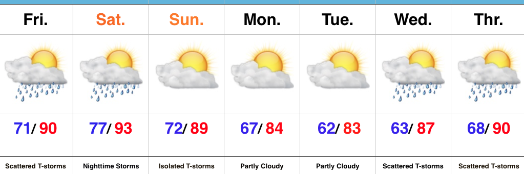
Mother Nature Calls…Many awoke early this morning as a complex of thunderstorms rumbled southeast into central Indiana. Some local rain gauges are already registering 2″+ across the region. Eventually, we think clouds will thin enough later today to allow temperatures to zoom close to 90°. Factor in the moisture-rich nature of our air mass and heat indices will approach 105° later this afternoon.
We’ll keep mention of scattered storms this evening and while most of the daytime Saturday looks dry, we’ll have to keep a close eye on Saturday night as models try to deliver another round of storms into central Indiana. Ingredients will be in place for the potential of severe thunderstorms Saturday night, with damaging winds being the biggest concern from a severe perspective.
A frontal boundary will push south and we’ll finally begin to see humidity levels fall as we close the weekend and open next week. It’ll feel very refreshing during the Monday-Tuesday stretch.
Heat, humidity, and storm chances return by the middle of next week.
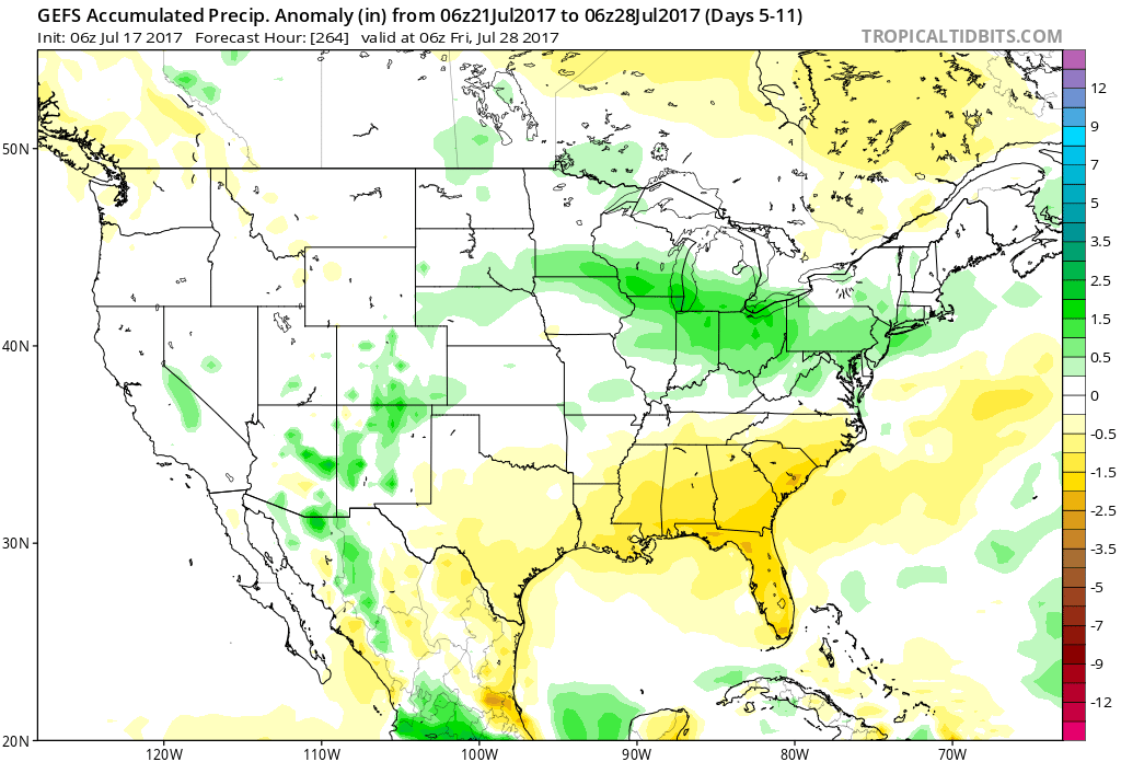
Upcoming 7-Day Precipitation Forecast:
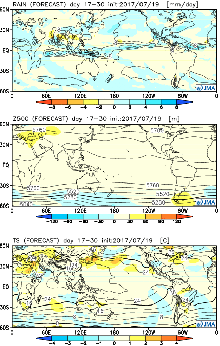
The new JMA Weeklies are in and highlighted by the following:
Week 1:
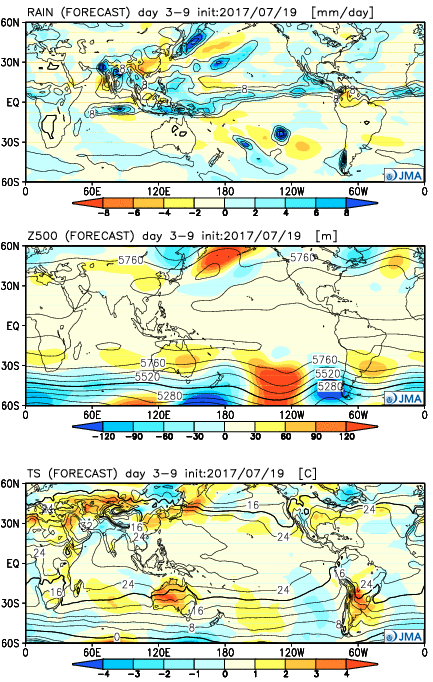
Hottest anomalies remain across the central region, but the days are numbered on this pulse of heat and the JMA Weeklies suggest a cooler, more seasonal, pattern looms to close July and open August. We note the wet regime across the Southwest region, where associated cooler anomalies are also located.
 Week 2:
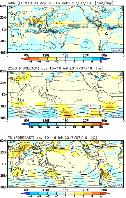
It’s a “book end” hot pattern that includes heat along both the Northwest region and a developing hot pattern over the Northeast. The central region, including here on the home front, looks very seasonal. With a subtle northwest flow aloft, we’ll have to be mindful of storm complexes at times.
 Weeks 3-4:
Our attention is drawn to the heat across the Northeast region and the cooler, wetter regime (relative to average) across the Southwest. Locally, there aren’t any strong indications for big time heat or heavy rains.
 Highlights:
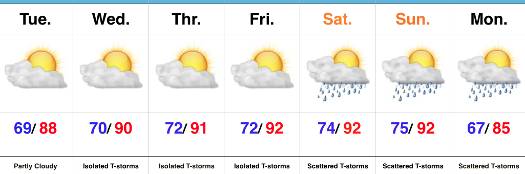
Air You Can Wear…The big weather story will be the increasingly hot and humid feel as we progress through the week and on into the weekend. The combination of dew points in the 70s and wet soils across the state should “beat back” the heat from getting to where it otherwise could (mid-upper 90s), but it’ll feel oppressive, nonetheless. Plan to hydrate and wear cool, lightweight clothing if you plan to be outdoors for any length of time.
While we can’t completely rule out a renegade storm through Friday, most neighborhoods will remain free of any rain through the remainder of the work week. Better coverage of showers and thunderstorms will increase over the weekend into early next week as the transition from hot, humid weather begins to give way to a more pleasant feel.
Upcoming 7-Day Precipitation Forecast:
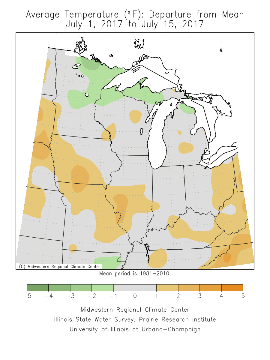
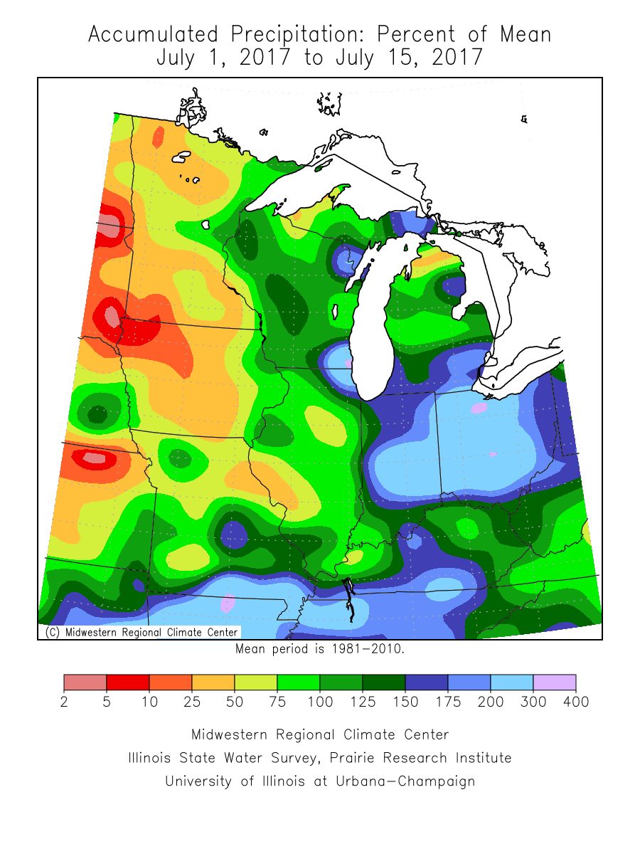
1.) July, MTD, is running slightly cooler (- 0.1°) and much wetter (+ 2.31″) than average across the region.
 2.) While the radar is rain and storm-free this morning, a left over boundary, combined with daytime heating will help spark isolated to widely scattered storm coverage this afternoon.
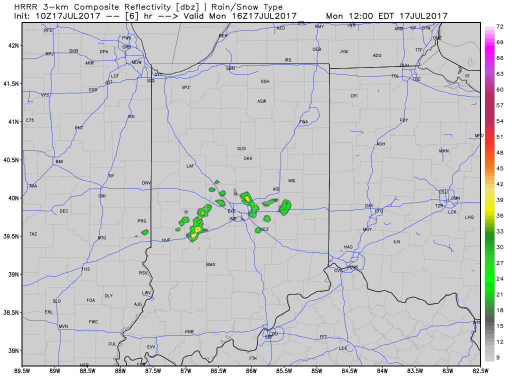 3.) The big weather story this week will be an increasingly hot and humid feel once to mid and late week, including the weekend. While today will continue the theme of slightly cooler than average from the weekend, we’ll more than make up for the refreshing feel later this week. Highs will push to around 90° Wednesday through Sunday as the ridge expands.
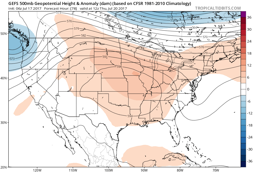 4.) Despite the hot and humid feel that develops this week, it won’t last. Like so many other times this summer that heat tries to build east, the transient weather pattern will continue to prevent it from “hitting and holding.” You guessed it, as we transition from the hot conditions to cooler weather next week, rain and storm chances will be on the increase, including the potential of heavy rain. As of now, best rain and storm chances appear lined up for late week through the weekend and into early next week.