It’s Still Summer, After All…
 Highlights:
- Dry pattern continues today
- Mid week storms
- Questions abound this weekend
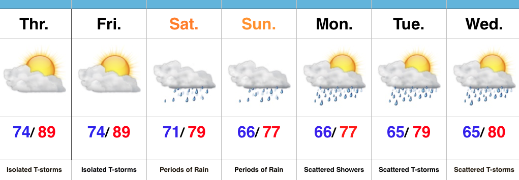
Heat And Humidity Return…High pressure will give way to an approaching cold front as we progress from early to mid week. Ahead of the front, a southwest air flow will transport an increasingly warm and muggy air mass northward. It’ll, unfortunately, feel much more humid Wednesday and Thursday. With the frontal boundary nearby and the increased humidity, expect scattered to numerous thunderstorms Wednesday and Thursday (along with locally heavy downpours). A couple strong storms are also possible.
We still think drier air will press into central IN to wrap up the work week and head into the first half of the weekend. That said, moisture returns as early as Sunday and leads to a mention of thunderstorms, especially during the PM. Stay tuned as we continue to fine tune timing.
Upcoming 7-Day Precipitation Forecast:
- Snowfall: 0.00″
- Rainfall: 1.00″-1.50″
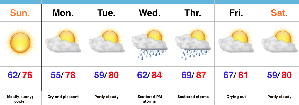
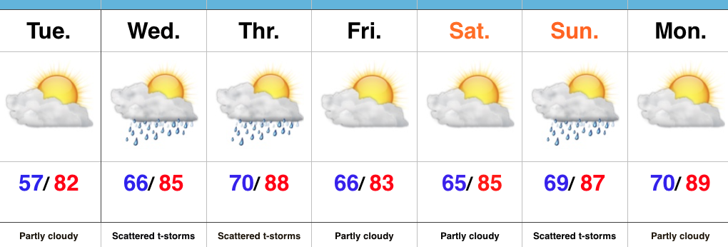
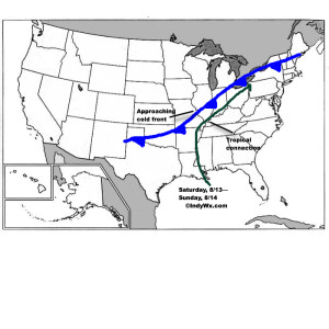 Despite lackluster model output from our American suite (latest NAM and SREF data, for instance, paints rainfall totals under 1″ across most central IN neighborhoods), the European remains consistent on the evolution of things from this weekend into the middle of next week. We’ll lean more towards it’s solution at this juncture. Simply put, when you have a stalled frontal boundary entraining tropical moisture, expect problems. Precipitable water values will approach and even exceed 2″ at times this weekend. Dew points will remain in the upper 60s to lower 70s along and south of the boundary. Where the boundary stalls will be key in determining the heaviest rain totals and resulting flood problems that will ensue. For now, here’s the best idea we have in regards to local 4″+ totals between this weekend and next Wednesday.
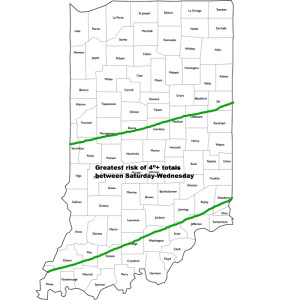 It should also be pointed out that we’re not looking at all day rains Saturday through Wednesday, but instead “waves” of moisture throughout the period. Areas of locally heavy rain will be with us, but we’ll also see dry periods in between. Thankfully, as we move into the latter portions of next week, drier times should return.