Well-Earned Break From The Heat, Humidity On Deck…
 Highlights:
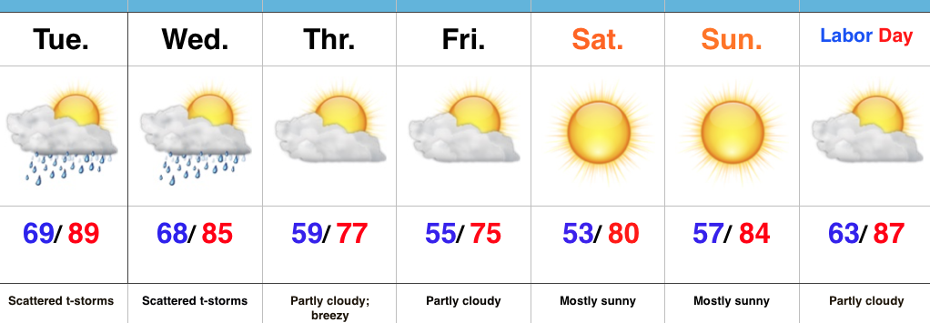
- Scattered storm chances remain for now
- Drier and much cooler air on deck
- Dry, but hot Labor Day looms
Breath Of Fresh Air Awaits…Once we get through the next (48) hours, a much more pleasant, early fall-like, air mass awaits. Beforehand, we still have plenty of heat and humidity to deal with, along with the all-too-familiar mention of scattered (but heavy) thunderstorms. Thankfully, a cold front will push through the state Wednesday night into Thursday morning and usher in a much cooler and drier air mass to wrap up the work week and head into the long holiday weekend. High pressure will supply a refreshing northeasterly flow Thursday into Friday, supporting breezy conditions and much cooler air. It’ll be the type air mass that will make you take notice fall isn’t that far off, after all.
As we push closer to Labor Day, itself, our air flow will back around to the southwest and assist with a warmer and increasingly moist brand of air for the holiday, into the majority of the Week 2 period…
Upcoming 7-Day Precipitation Forecast:
- Snowfall: 0.00″
- Rainfall: 0.50″-0.75″ (locally heavier totals)
 2.) HRRR futurecast radar delivers thunderstorms into central IN around the lunchtime hour.
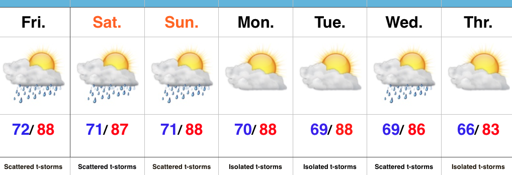
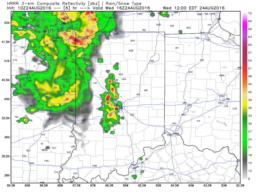 3.) Scattered thunderstorms remain Thursday (some strong to severe), but drier air will briefly push in across the northern half of the region Friday. We think from Indianapolis and points north, it’ll be a very pleasant end to the work week. That said, “briefly” is the key word. Moisture will surge north again Saturday and Sunday and isolated to scattered storms will follow suit.
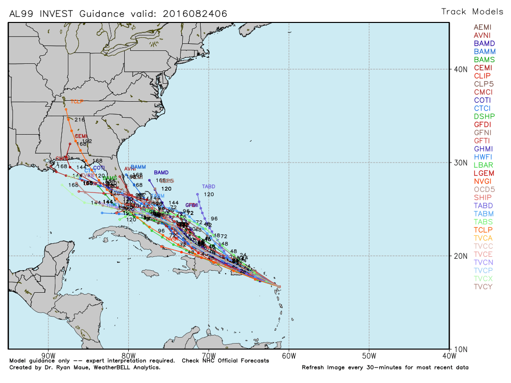
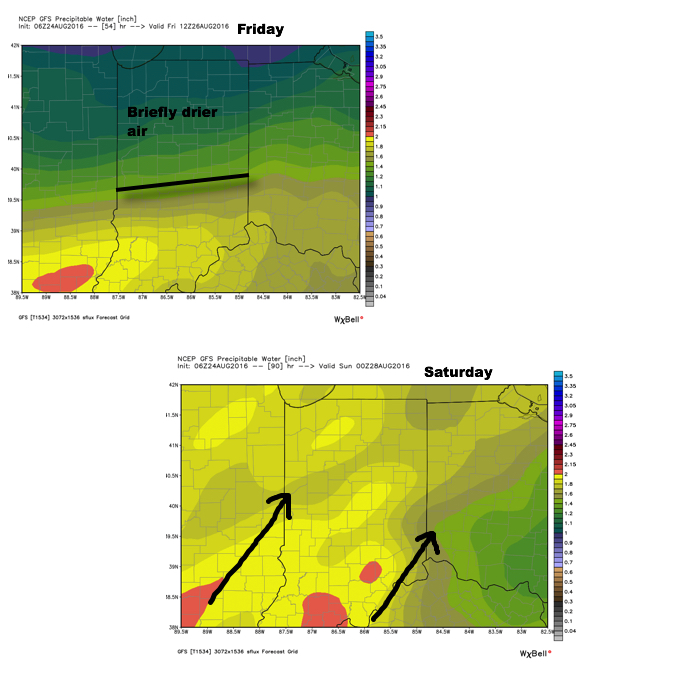 4.) Attention next week will shift to the tropics. There are many more questions than answers at this point, but understand the potential is there for significant tropical troubles next week. Intensity and track are far from etched in stone, but if your travels take you to the Gulf Coast, we suggest you remain abreast of the latest developments- particularly the southeastern FL coast and the north-central Gulf Coast.