Looking Ahead To Spring…

Meteorological spring begins in a few days (runs March through May).  We’ve already touched on the expected busy severe weather season and want to dedicate this post towards looking deeper into the weather pattern and the resulting precipitation and temperature impacts.

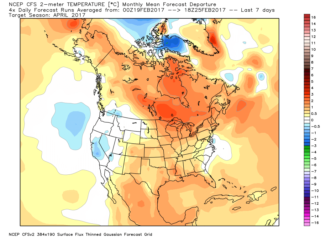
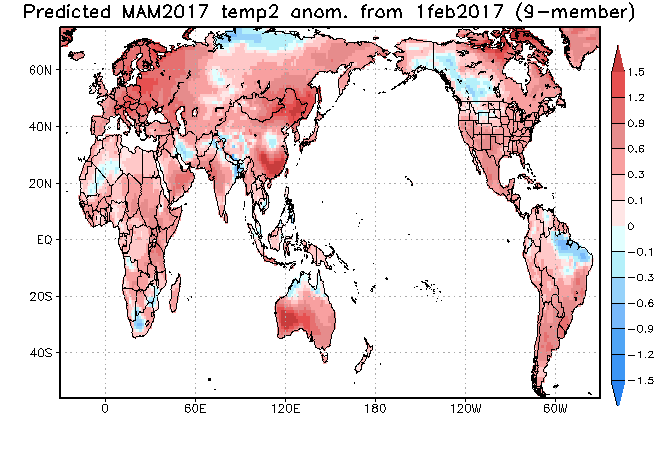
The latest longer-range data continues to be in very good agreement on the upper air pattern.  In short, the balance of the spring season looks to offer up a continued theme of warmer than average temperatures for our region.  (Not saying we won’t have to deal with a wintry “trick or two” over the first couple weeks of March).  When we look at spring, as a whole, we believe it’ll be one known more for the warmth and active, stormy times.

CFSv2 March Temperature Anomalies
CFSv2 April Temperature Anomalies
CFSv2 May Temperature Anomalies
JAMSTEC March through May Temperature Anomalies

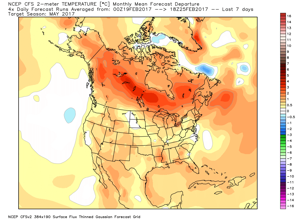
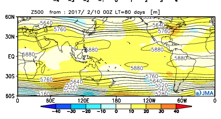
The latest JMA monthly idea is one that has to raise an eye brow as it would paint an early summer across the Ohio Valley and Great Lakes.  Anomalous warmth (true summer-like air) would develop with a strong ridge over the Great Lakes and northeast.  This is something we’ll have to keep an eye on.  A big caveat here is how strong and quickly the coming El Nino develops.  It should be noted, El Nino years can feature some of the hottest air early, not late, in the summer season (relative to averages), and the JMA would, indeed, yield an early summer with such a look.

JMA May Forecast 500mb Pattern

It should also be noted modeling is suggesting a wet look, locally, especially during the early portions of spring.  The JAMSTEC and JMA are particularly bullish on a wet pattern.

JAMSTEC March through May Precipitation Anomalies
JMA March through May Precipitation Anomalies

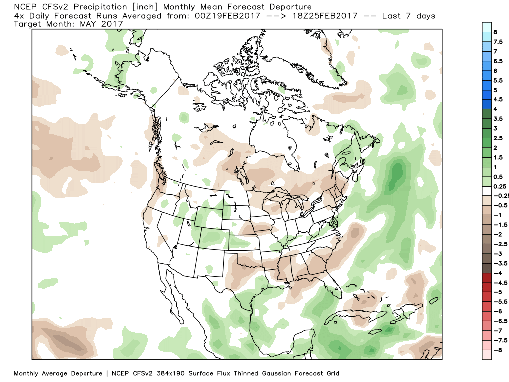
The CFSv2 hits the wet March hard before a drier regime mid and late spring.

March Precipitation Anomalies
April Precipitation Anomalies
May Precipitation Anomalies

In closing, we seem to have a bit of a bumpy ride in front of us as meteorological spring begins.  While Old Man Winter hasn’t been seen much as of late, don’t be shocked if he makes his presence felt a few more times through the first half of March- both from a cold and snow perspective.  That said, data really points towards more of an overall warm regime developing the second half of the month, and continuing through the majority of spring, for that matter.  We’re keeping a close eye on May for an early summer-like feel to take hold, locally.  Subsequent JMA updates will be monitored closely.  We also remain confident of an active severe weather season.  Note the tendency of model data (above) to pull the mean trough position to the northwest March into April.  The clash of late-season wintry conditions west, combined with unseasonably warm temperatures across the east (not to mention the warmer than average Gulf of Mexico) likely will equal busy times as we progress through the spring severe weather season.

Warm Winds Give Way To Rain And Cooler Air…

screen-shot-2016-10-17-at-7-34-57-amHighlights:

  • Warm SW winds
  • Cooler air arrives mid week with rain
  • Much cooler to close the week

A Little Something For Everyone…The big story over the next 24-48 hours will be unseasonably warm temperatures, but equally as impressive, strong and gusty winds (30-40MPH).  Enjoy the extended period of shorts and short sleeves, but please note a “big hair warning” is in effect through Tuesday night.  🙂

A cold front will slip through the state Wednesday (from north to south) and could spark a scattered shower as it drifts south.  Eventually the front will stall along the KY border.  This is in response to an area of low pressure developing to our southwest.  The surface low will lift northeast and help spread widespread soaking rain across the state Thursday.  Additionally, we’ll note a much cooler air mass and winds that will shift around to the north in the PM, helping drive a much cooler close to the week.  Moderate to locally heavy rainfall can be expected Thursday.

As we get set to put a wrap on the week, we’ll get back to weather we’d expect for this time of year: dry, cool, and crisp!  In fact, patchy frost is possible Saturday morning across outlying areas away from the city.

Upcoming 7-Day Precipitation Forecast:

  • Snowfall: 0.00″
  • Rainfall: 1.00″ – 1.50″

Remarkable Summer Feel Through Mid Week; Late Week Changes…

Before we talk about the warmth, we have some showers and embedded thunder to deal with across parts of the region today.  Best rain chances today will be along and north of I-70, but a few showers could scoot south later this afternoon.  We note most concentrated rain should fall through the early afternoon hours before moving out to allow for a dry evening.

Forecast radar 1p, courtesy of Weatherbell.com
Forecast radar 12p, courtesy of Weatherbell.com
Forecast radar 2p, courtesy of Weatherbell.com

We get back to a dry pattern Monday and Tuesday.  Along with the dry conditions, unseasonably warm temperatures can be expected.  Along with the summer-like feel, very strong southwest winds will be noted (gusts to 30-40 MPH).

A strong SW flow will promote 30-40 MPH gusts early week. Courtesy of Tropicaltidbits.com
The warmest temperature anomalies will be located over the Ohio Valley this week. Courtesy of Tropicaltidbits.com

Highs Monday and Tuesday will top out in the lower to middle 80s and rival records across central IN.  While that’s impressive enough, overnight lows of 65-70 are almost unheard of.

Overnight lows Tuesday morning will be close to 70 degrees. Courtesy of Weatherbell.com

Cooler air will begin to move in by late week as a trough replaces the warm ridge.  While we’re very confident on the much cooler feel, details in regards to the specifics around rain timing and amounts remain “muddy” at best.  We’ll forecast best rain chances to arrive Thursday, but caution this may have to be fine tuned as we move forward.  Highs that were in the 80s for early week will crash late week (upper 50s to lower 60s).

European ensemble shows the cool and unsettled late week pattern. Courtesy of Weatherbell.com

As of now, next weekend looks dry and cool, but it was only yesterday that rain chances looked like they may continue into the early portions of the weekend. Stay tuned.  As previously mentioned, temperatures will be much cooler (upper 30s to lower 40s for lows and lower to middle 60s for highs).

Complete 7-day will be posted later!

From Summer To Fall…

screen-shot-2016-10-15-at-9-03-37-amHighlights:

  • Stretch of unseasonably warm, summer-like weather
  • Turning much cooler late in the period
  • Unsettled to close the work week

Near Record Warmth Gives Way To A Cooler Feel…We have to deal with low clouds and areas of fog this morning, but expect enough wind to mix things out and return us to a variably cloudy sky this afternoon.  Significantly warmer conditions are on tap today than what we’ve dealt with over the past couple days.  Winds will become gusty this afternoon (20-30 MPH).

Scattered showers will drop south Sunday.  These will impact mostly northern locations (north of I-70) and won’t be a big deal.

Monday and Tuesday will feature strong and gusty southwest winds (30-40 MPH), dry conditions, and near record warmth.  Highs in the lower 80s for mid October is downright impressive, but the warm overnight lows in the mid to upper 60s is almost unheard of for this time of year.  Enjoy the stretch of extended summer.

Our weather pattern will offer up an increasingly chilly regime late week and the overall evolution of a storm system is still up in the air in regards to rain timing and amounts.  For now we’re leaning towards a wet, chilly, and blustery forecast Thursday and Friday.

Upcoming 7-Day Precipitation Forecast:

  • Snowfall: 0.00″
  • Rainfall: 1.50″ – 2.00″

Warm & Windy This Weekend; Changeable Weather Next Week…

Central Indiana will enjoy a nice open to the weekend. High pressure will scoot off to the east and allow a warmer, but blustery return southwesterly flow. Though we’ll be warmer tomorrow, winds will increase and gust to 30-40 MPH late in the day. Highs will top out in the middle to upper 70s.

Sunday will feature an increase in cloudiness, but most shower activity should remain across northern and north-central parts of the state. Even in areas that receive rain Sunday, amounts will be light and insignificant. Here’s a look at what the radar may look like Sunday afternoon. It’ll be another unseasonably warm day as highs top out between 75°-80°, despite the increase in cloud cover.


Speaking of warmth, that will be the major story for early and middle parts of the work week. Highs around 80° and warm overnight lows in the 60s (where our average high should be) can be expected with dry, but windy, conditions in play. Extended summer, anyone?!


Changes are brewing for the latter portion of the week and that will require most of our attention over the weekend as far as sifting through the various details. While confidence is high in a transition to drastically cooler conditions, the evolution of specifics concerning rain chances results in a much lower level of confidence. As it stands now, we’ll increase rain chances for the late week period (late Wednesday into Thursday), but the duration of wet weather is up in the air. The GEFS (below) shows the wetter pattern returning.


Note the various ensemble solutions (above) of how the upper air pattern may look in the 8-10 day period. Solutions range from a drier and downright chilly look (European) to one that’s cooler, but still unsettled (GFS, GEM). Time is required to continue to fine tune things.

All of that said, as previously mentioned, we’re much more confident in the cooler look to close October. The GEFS sees that, as well.