 Highlights:
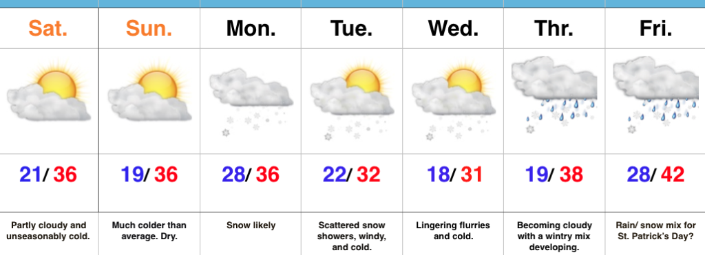
- Much colder than average
- Snow prospects to open the week
- Busy pattern continues
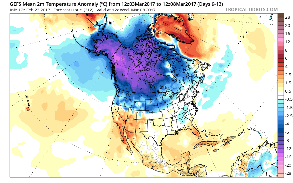
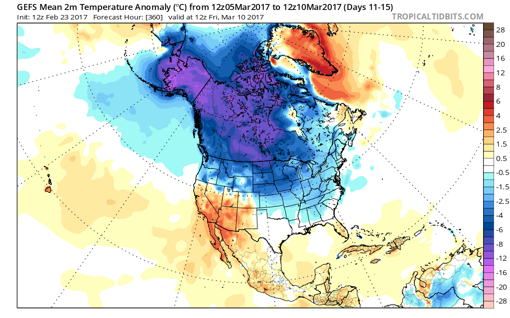
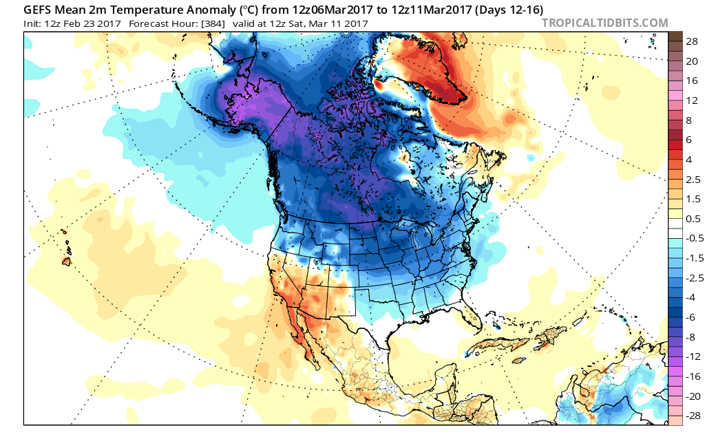
Locked In A Cold Pattern…The stretch of spring-like, unseasonably warm, conditions we enjoyed through most of February and to open March will be all but a distant memory once to this time next week. A major reversal to a colder than normal pattern is now with us and will feature lows into the teens on a few nights over the upcoming week.
Additionally, we continue to highlight the fast-moving northwest flow aloft. This kind of regime wrecks havoc on forecast models and, accordingly, we have lower than normal confidence in the specifics late in the work week. Stay tuned.
Before we get to late week, we have a disturbance (that will eventually help feed a blockbuster Nor Easter) that will deliver snow as we open up the work week. This time of year, snow intensity and time of day mean a world of difference between an accumulating event, or not. Snow should overspread central Indiana before sunrise Monday and will likely accumulate before the higher sun angle takes over and lighter snowfall rates result in a lack of daytime accumulation. As reinforcing cold air filters in Monday night, additional light accumulation will be possible in scattered heavier snow showers that will continue into Tuesday. All-in-all, this doesn’t appear to be a huge event, but a few slick spots will be possible Monday morning before that higher March sun angle gets to work. We’ll keep a close eye on things.
Moving forward, we’re confident on the overall colder than normal pattern that will continue into Saint Patrick’s Day, but, as mentioned above, fine tuning will be required with the potential of a late week storm system to contend with.
Upcoming 7-Day Precipitation Forecast:
- Snowfall: 1″ – 3″
- Rainfall: 0.25″ – 0.50″
 This warmer regime is the sign of stormy times that will develop as we move into Tuesday. An initial round of showers and thunderstorms will impact central Indiana Tuesday morning and the HRRR forecast radar is picking up on this nicely, especially during the predawn hours.
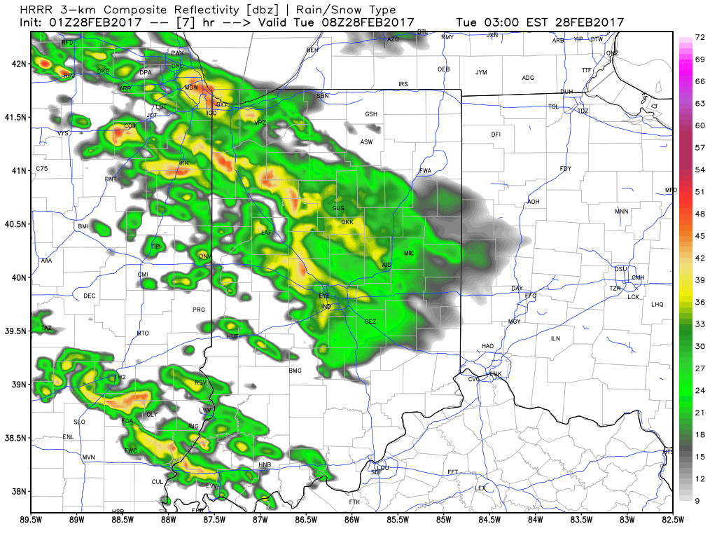 The wet, stormy start to the day will give way to a mostly dry time of things through the majority of the daylight hours Tuesday, but our concentration will be on the Tuesday night-Wednesday morning period, as the potential exists for some rather turbulent weather.
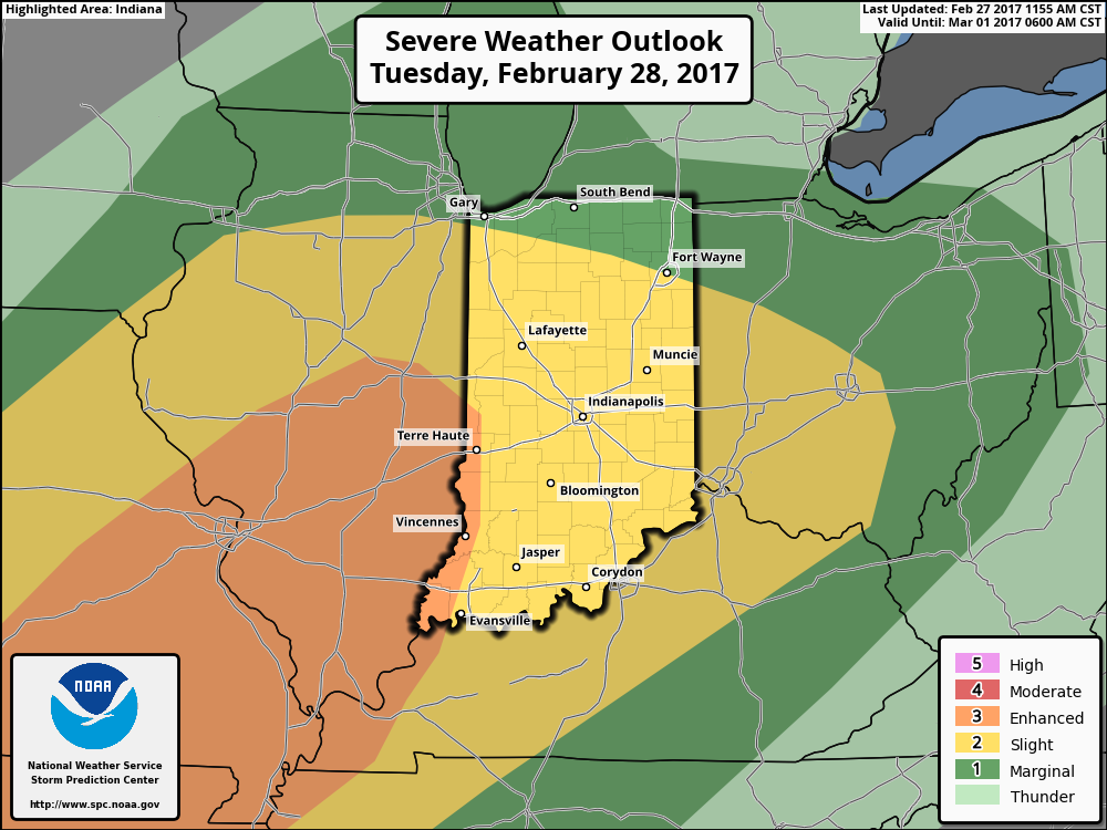 Modeled radar suggests things may begin to get “busy” around these parts late evening and during the overnight. The latest high resolution NAM (hot off the press as of this update) paints a rather ominous look as midnight nears Wednesday morning.
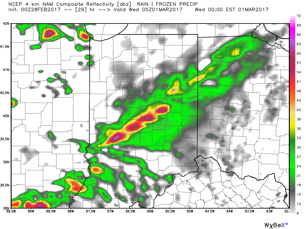 We then note modeling bringing the squall line through central Indiana during the overnight and predawn hours. We’ll have to fine tune timing as we move through the day Tuesday, but we bracket the hours of 2a and 6a when a concentrated line of strong to severe storms rumbles through the state (northwest to southeast). Hail and damaging straight line winds are of greatest concern, but a quick spin-up tornado can’t be ruled out.
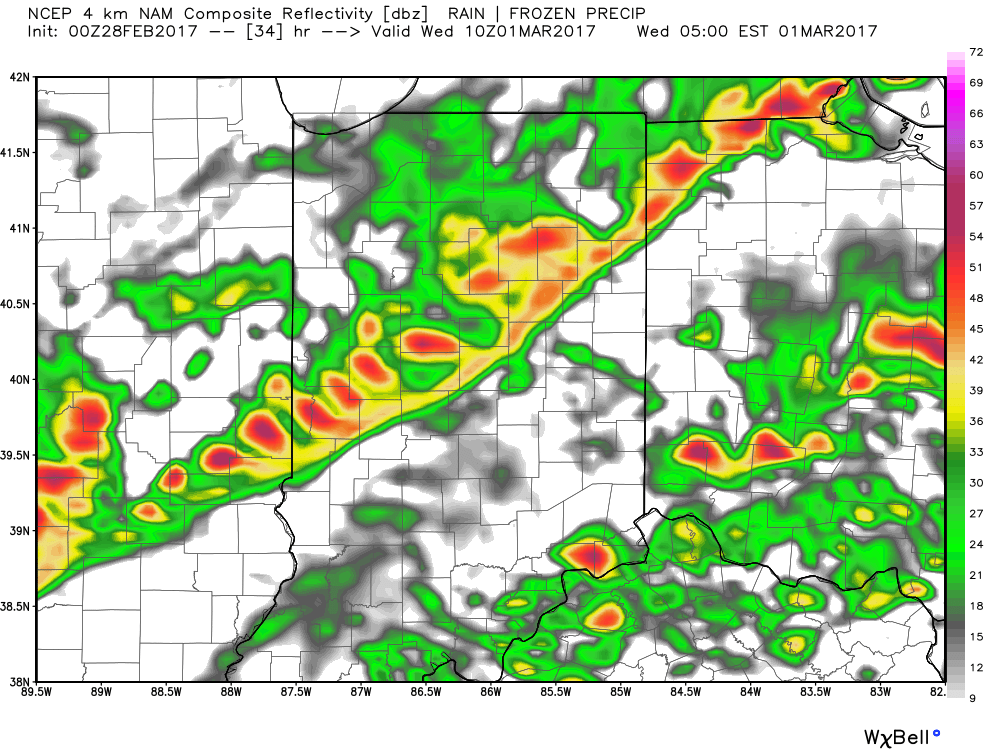 Our weather will turn quieter, but colder, as Wednesday progresses into Wednesday evening, including blustery conditions with falling temperatures.
 That said, the chilly late week conditions won’t last long, and a gusty southwesterly air flow will develop as early as Saturday. This will help give temperatures a significant boost Saturday afternoon after a cold start to the day. 60° is possible Saturday afternoon and the mercury may approach 70° Sunday!
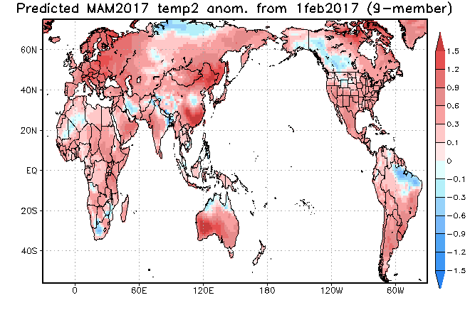


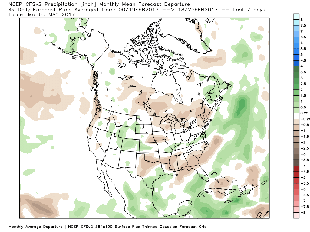
 Longer-term indications would suggest the period of chilly, wintry-like, air has a window to take over, but the window is small. Trends would seem to yield warmer solutions once past mid-month, with perhaps a “stick and hold” spring regime taking over.
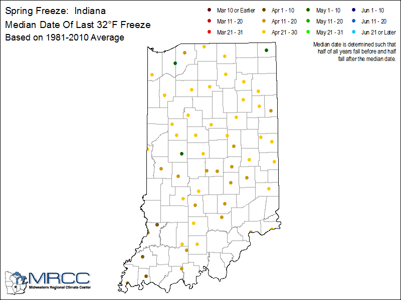
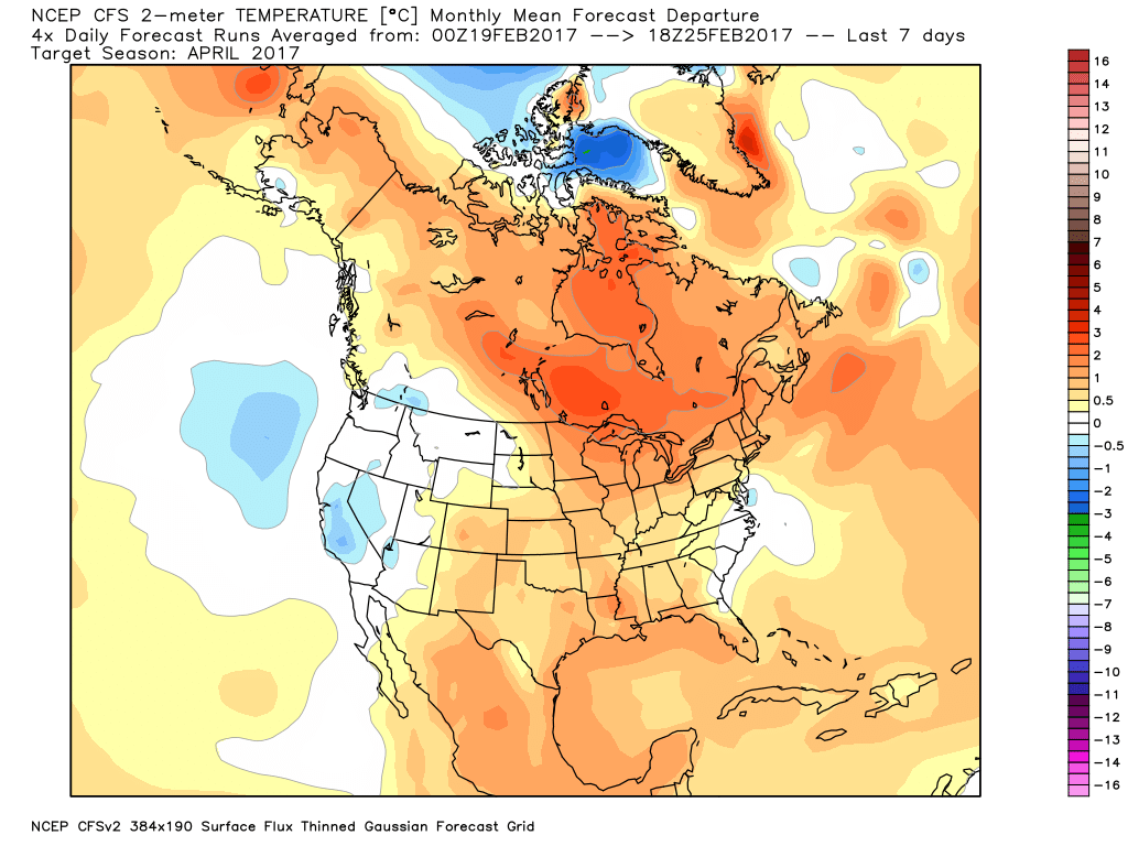
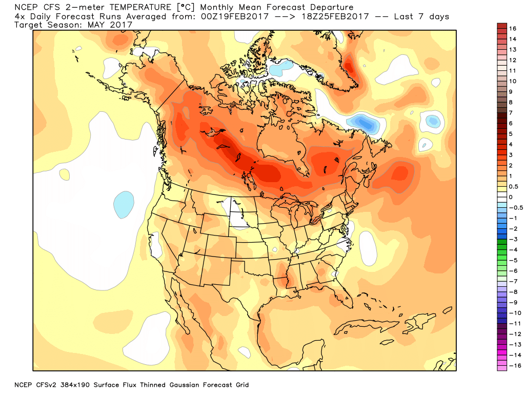
 The anomalous warmth is impressive enough, but perhaps the most impressive is the duration of the unseasonably warm, April-like, warmth. By the time all is said and done (Friday night), many communities will set multiple new records for so many consecutive days of 60°+ level warmth in the month of February. That doesn’t set well for spring vegetation. Given the look to the overall pattern in the weeks ahead, it’s hard to deny the glaring signs for additional well above normal warmth (speaking in “overall” terms). Accordingly, vegetation will likely continue to sprout and bloom early with such a pattern- even as far north as here in central IN.