We’re growing closer and closer towards the period we’ve been thinking would present one last round of cold, wintry weather (relative to normal) for the ’18-’19 season.
While the stormy idea will likely end up being correct, the significant cold that we thought would “spread out” (as opposed to being confined to the NW and northern Plains) is in jeopardy.
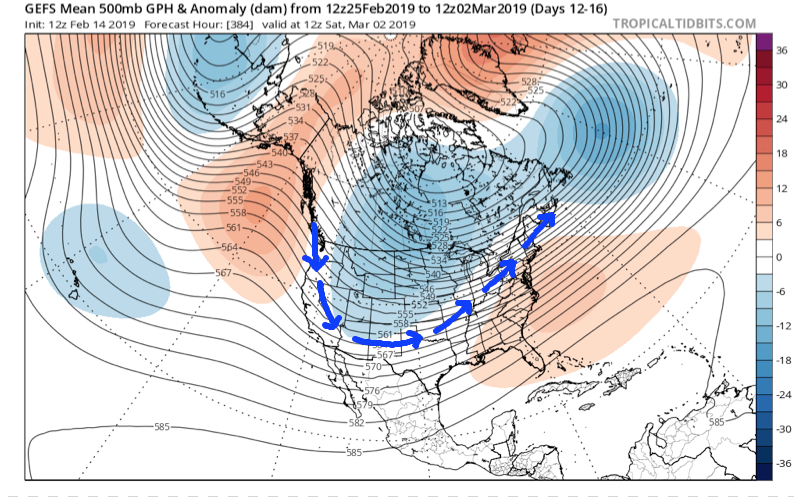
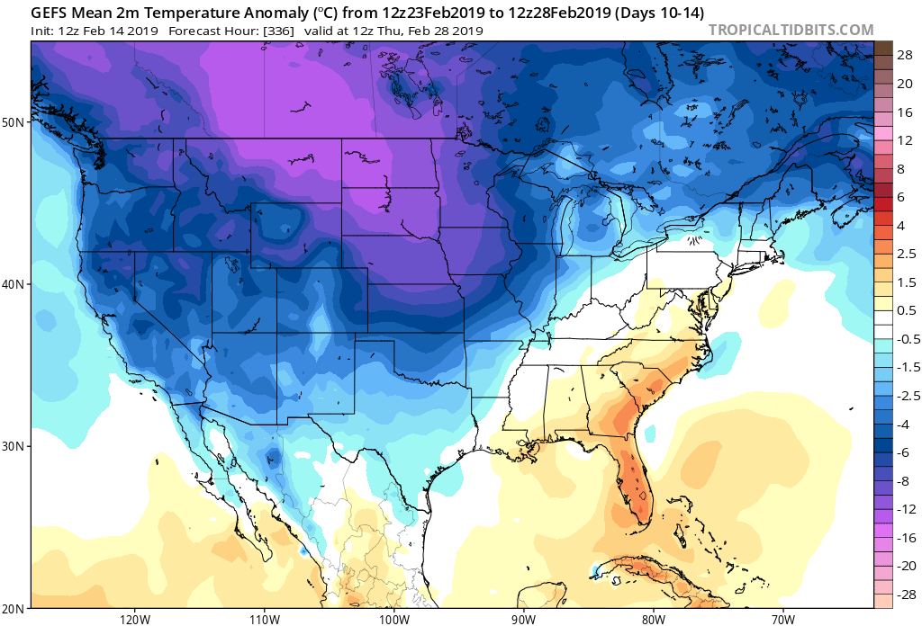
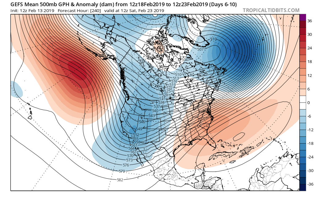
The overall upper air pattern over the upcoming few weeks will likely continue to be dominated by a mean trough position across the central and west, along with the persistent southeast ridge.
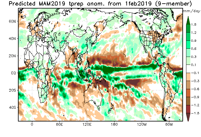
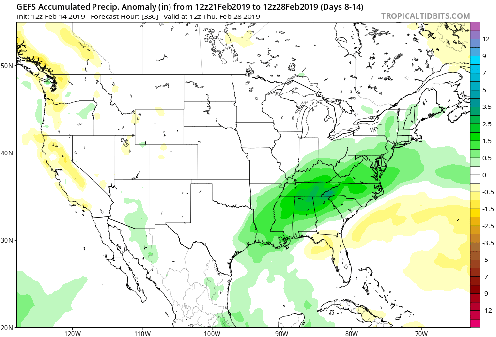
This will continue to result in above normal precipitation into the first week to 10 days of March, with a very active storm track.
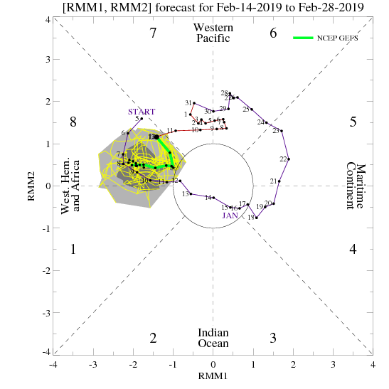
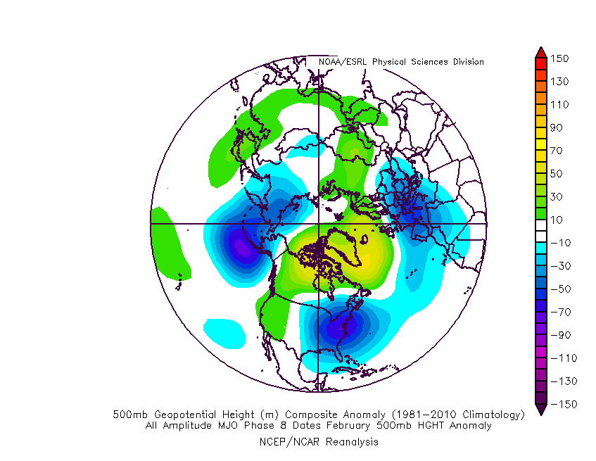
From a temperature perspective, the baseline of our ideas being centered on the MJO appears to be the error in our forecast. It’s not that the MJO isn’t heading into Phase 8 (it’s officially there now, as noted below), but it appears other teleconnections are “trumping” this cold ingredient.
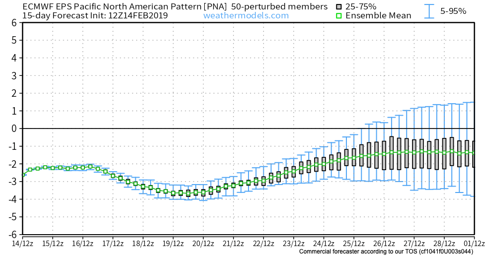
The combination of the positive Arctic Oscillation (AO) and negative Pacific North America pattern (PNA) are the drivers and are showing no signs of wanting to let go of the wheel.
The AO is forecast to remain strongly positive into early March.
The PNA is forecast to remain negative into early March.
Note how both of the above support that southeast ridge and associated relative warmth.
At one time, it appeared as if the North Atlantic Oscillation (NAO) would dip negative, however, that’s no longer the case.
While the active idea will come to fruition, the cold (at least to the magnitude we thought) will have a difficult time. That isn’t to say that enough cold air won’t get involved with a couple of these storms to result in wintry precipitation of significance, but rather that sustained cold will be tough to come by. Snowfall (of the heavy, wet variety) very well still could end up above normal with these moisture-laden systems over the next few weeks.
European Weekly Update
The new European Weeklies are in and follow the idea above nicely. They forecast a very stormy pattern to persist over the next few weeks with a battle ground between cold to our northwest and warmth to our southeast. We’ll have to be watchful for a couple of storm systems capable of delivering heavy amounts of precipitation. Given the teleconnection states over the next 6 weeks, it continues to look like any sort of significant wintry weather will need to take place before mid-March. Thereafter, warmer than normal times are expected, including true spring-like weather emerging. I know most can’t wait…