You must be logged in to view this content. Click Here to become a member of IndyWX.com for full access. Already a member of IndyWx.com All-Access? Log-in here.
You must be logged in to view this content. Click Here to become a member of IndyWX.com for full access. Already a member of IndyWx.com All-Access? Log-in here.
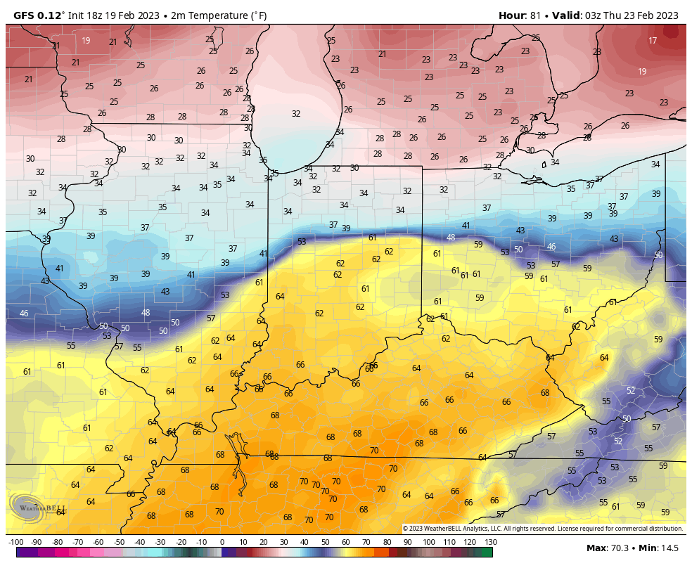
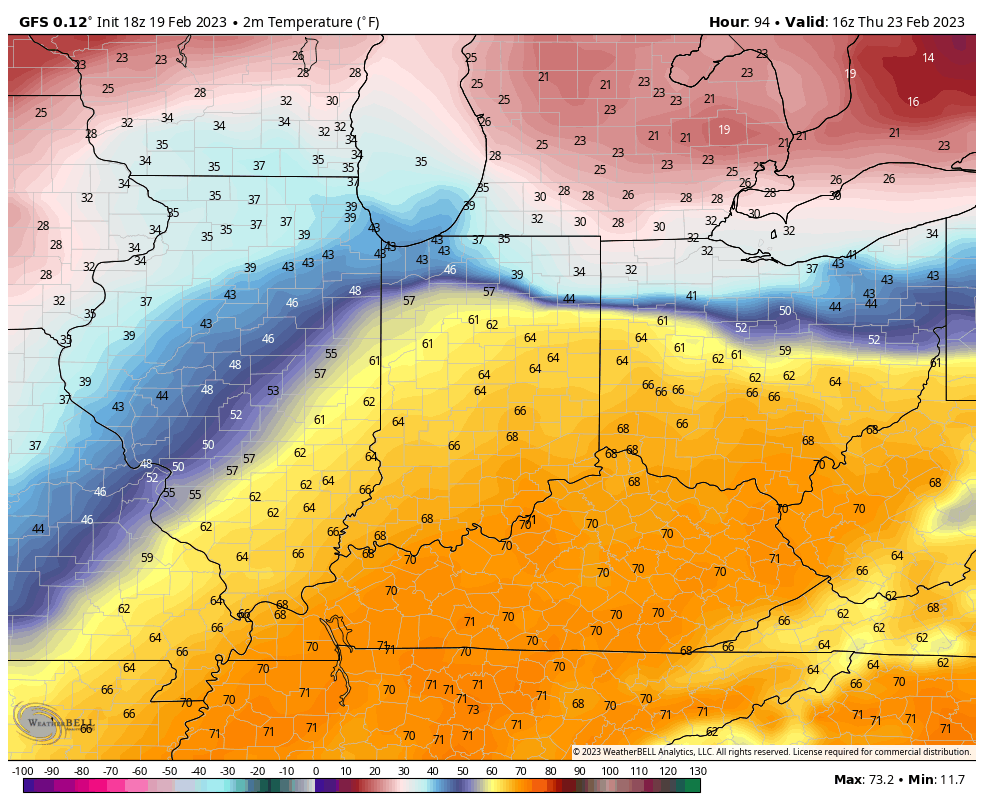
Spring will most certainly be in the air this week, at least for some. At the same time, there will be all sorts of whaling and gnashing of teeth for other areas that will be close to basking in the warmth, but yet so far at the same time. Note the significant temperature gradient that will set up shop across the region in the Tuesday through Thursday time frame.
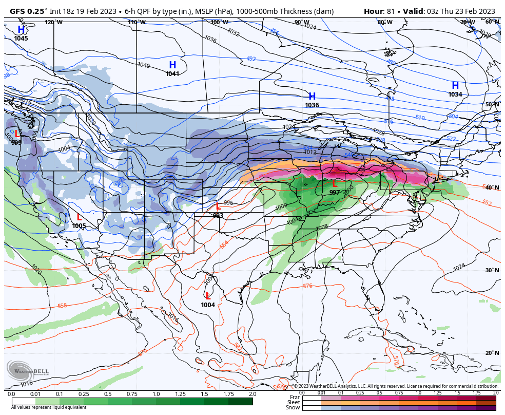
A well organized area of low pressure will ride east along the stalled boundary separating the chill and near record breaking warmth. This feature will be responsible for widespread rain, locally, and an icy mixture of precipitation across the southern Great Lakes region. Steadiest rain will likely fall Wednesday evening and night before drier, colder air works in here to close the work week.
Despite a widespread 0.50” to 1” of rain during the aforementioned time period, at least the southern 2/3 of the state will enjoy 60°+ (in some cases 70°) weather midweek. Yes, spring fever will be running rampant.
We’ll likely do this all over again late in the weekend or early next week…
You must be logged in to view this content. Click Here to become a member of IndyWX.com for full access. Already a member of IndyWx.com All-Access? Log-in here.
You must be logged in to view this content. Click Here to become a member of IndyWX.com for full access. Already a member of IndyWx.com All-Access? Log-in here.