Updated 02.08.24 @ 6a A weak frontal boundary will limp into the state later this evening. Ahead of the front, anticipate unseasonably mild air and a gusty day. A few…
You must be logged in to view this content. Click Here to become a member of IndyWX.com for full access. Already a member of IndyWx.com All-Access? Log-in here.
Updated 02.07.24 @ 7:21a A strong southerly flow will help pull up unseasonably mild air into the region as we close the work week. Highs will flirt with 60° Thursday…
You must be logged in to view this content. Click Here to become a member of IndyWX.com for full access. Already a member of IndyWx.com All-Access? Log-in here.
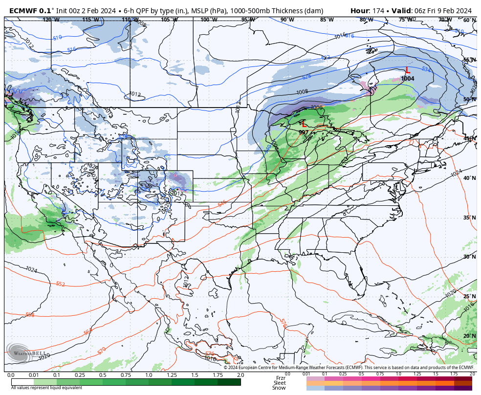
We’re pushing 6 days now since our last measurable precipitation and that unusually calm, boring stretch of weather will continue for a couple more days. Despite some low clouds at times, expect our quiet and unseasonably mild weather pattern to continue. A late week frontal passage (FROPA) will pull a true taste of spring north into the Ohio Valley and lower Great Lakes Thursday into Friday. We still don’t anticipate this being a significant precipitation maker for central Indiana.
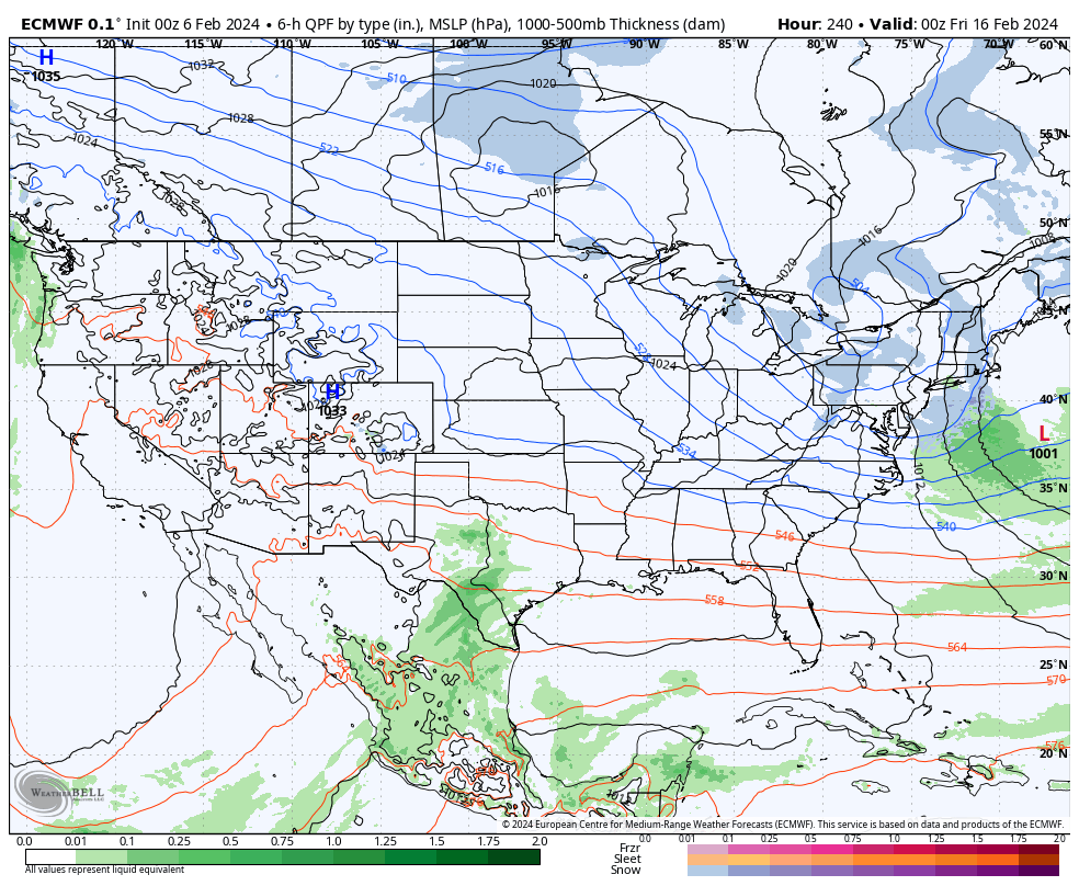
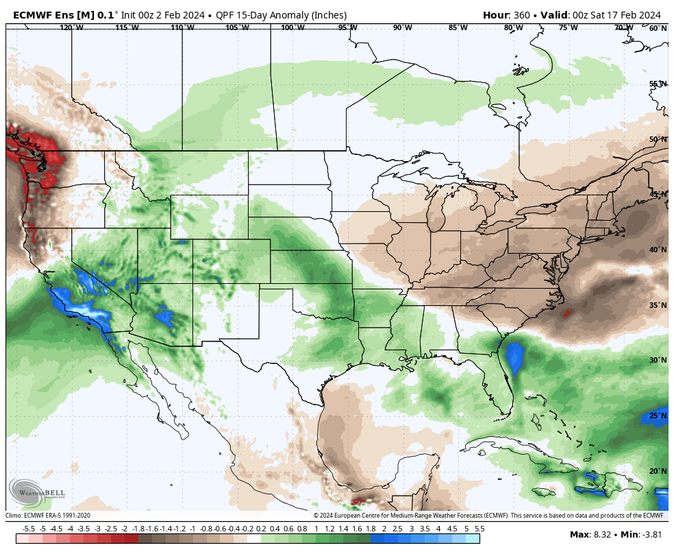
A secondary (much stronger) low pressure system will ride along this pressing boundary and impact areas to our east (and south) with heavier precipitation over the weekend into early next week. The southern Appalachians once again may “cash in” on a hefty snow event.
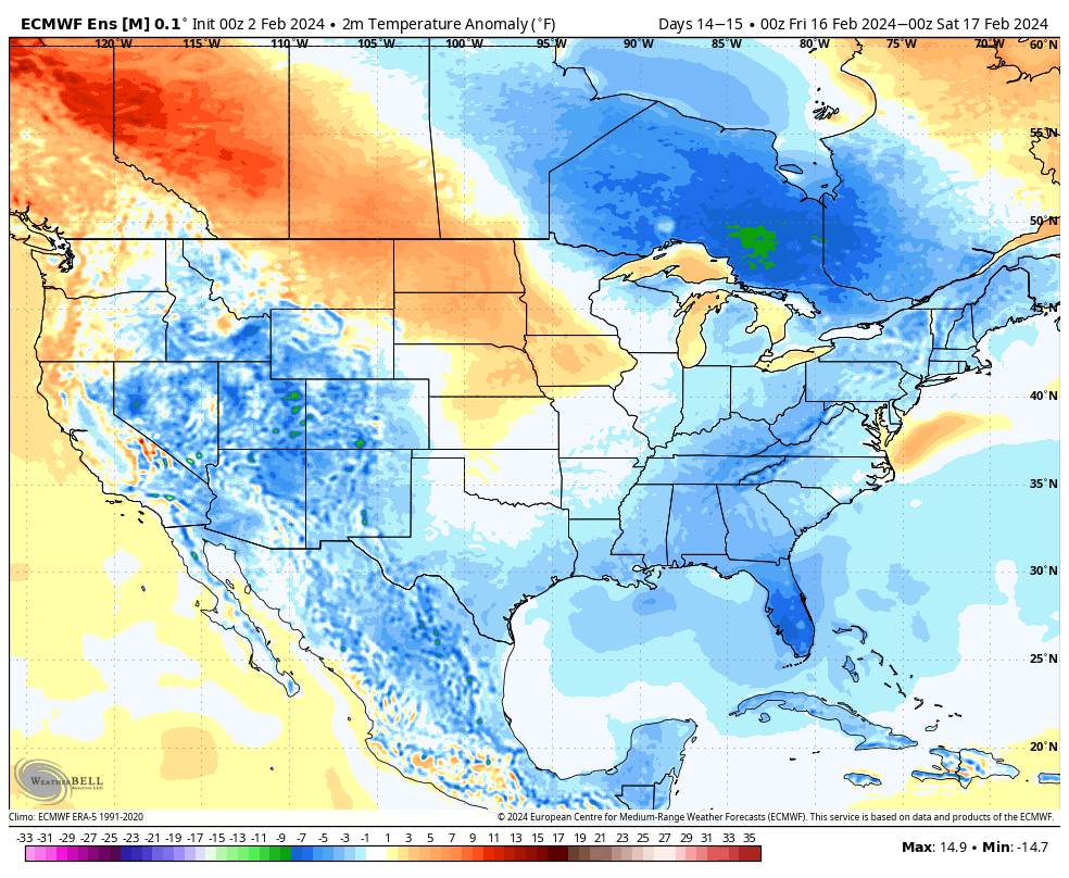
This more active period comes as a wholesale pattern change gets underway with a significantly colder air mass aimed to overwhelm much of the Lower 48 as we push into next week.
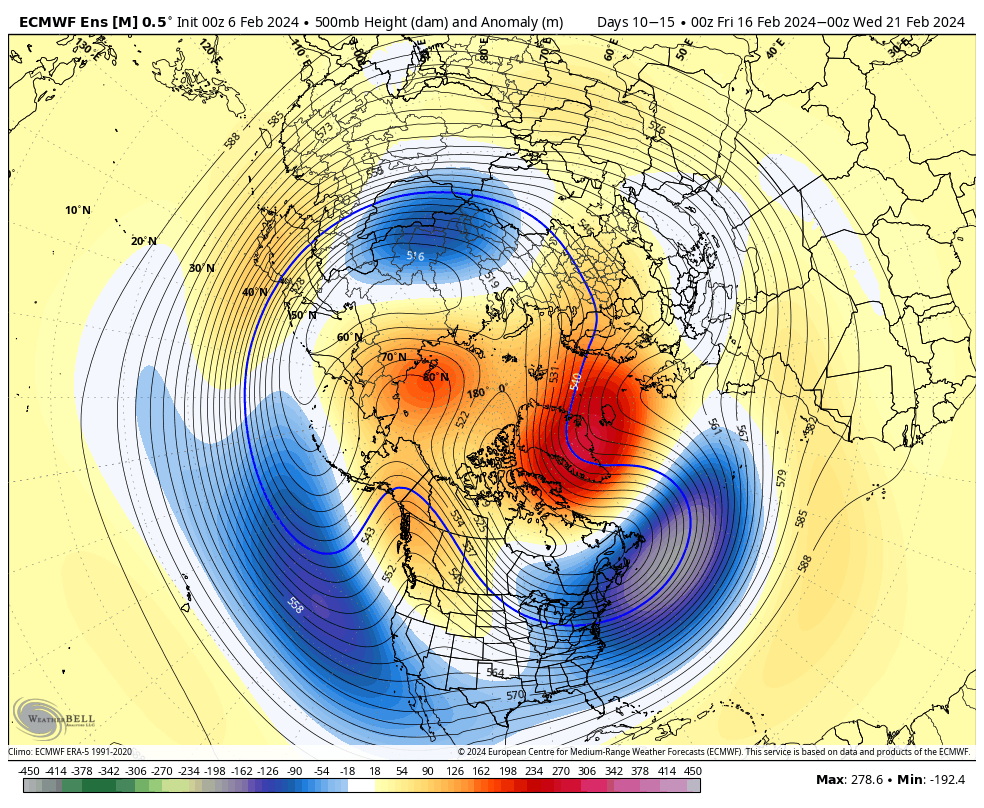
We note longer range models showing cross polar flow setting up late February. To no surprise, the ante is upped for the threat of a period of significant cold prior to month’s end.
We’ll watch for the threat of new winter weather opportunities to emerge during this colder pattern down the road.
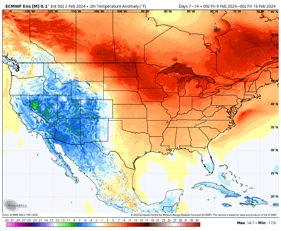
We don’t see any reason to deviate from the longstanding ideas on the overall pattern evolution ahead. February will continue to provide an unseasonably mild and quiet stretch through the first 1/3 of the month ahead of a pattern transition back to colder around or just after 2/10.
2/2 – 2/8
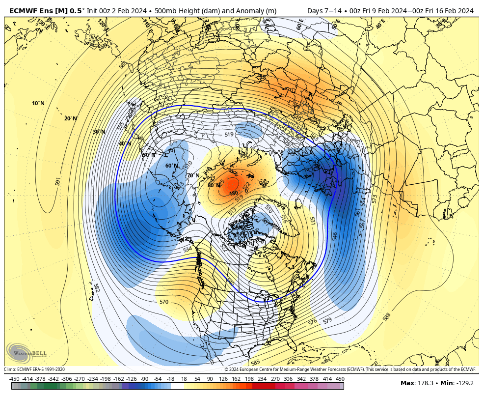
2/9 – 2/16
Note the ridge begins to break down across the East during the Week 2 period above. This is the transition to colder times, locally, as heights begin to build across western Canada and the northeastern Pacific. By mid-month, we’re talking about an entirely different pattern as a trough continues to deepen across the East along with unseasonably cold air become more entrenched.
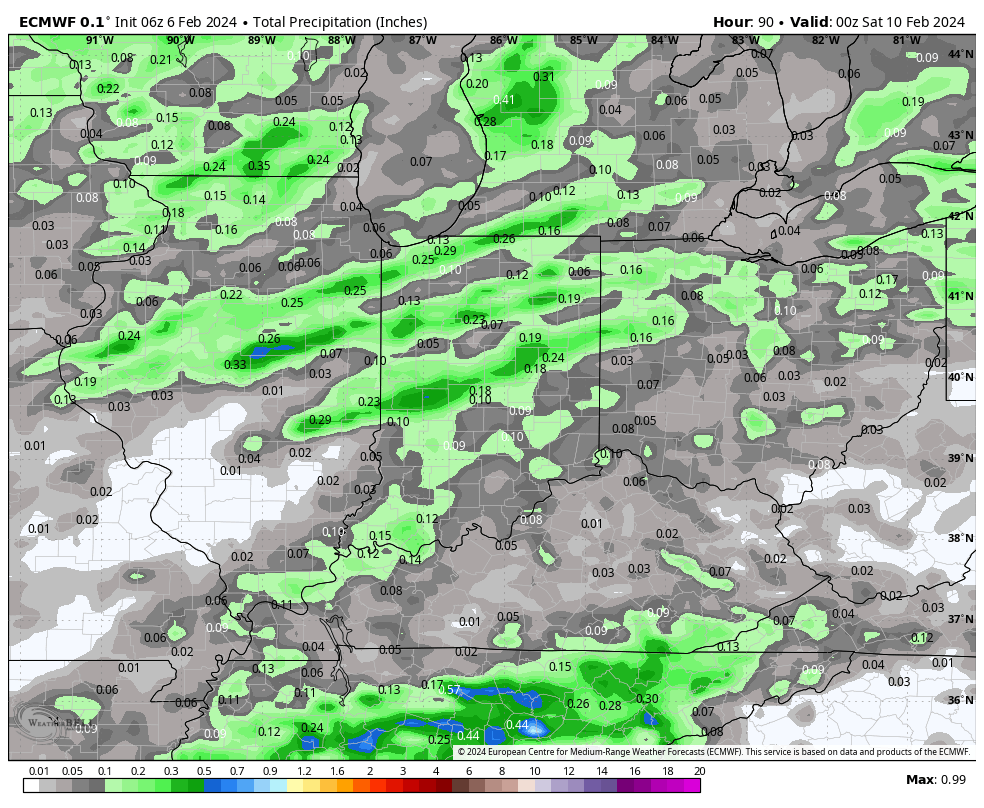
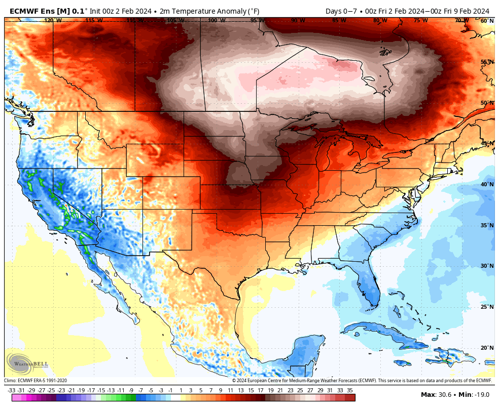
In the shorter term period, not only are we talking about unseasonably warm temperatures (it’ll push 60°+ here late next week) but also incredibly quiet weather. In fact, we aren’t looking at another opportunity for measurable precipitation until next Thursday.
A warm front and trailing cold front will return a round of unsettled weather (rain and even thunderstorm potential) here as we get set to close the work week next week. More on expected rain coverage and amounts as we get into the weekend and next week.
Updated 02.01.24 @ 7:45a Aside from a dry back door cold front overnight, all is quiet in the weather world, locally, but changes are on the horizon around the 10th…
You must be logged in to view this content. Click Here to become a member of IndyWX.com for full access. Already a member of IndyWx.com All-Access? Log-in here.