Unseasonably Dry And Calm Open To February; Winter’s Return…
Updated 01.31.24 @7:06a
In the short term, there’s really nothing of significance to discuss. We have no changes to our thinking that February opens on an unusually dry and mild note. In fact, we don’t forecast our next opportunity of measurable precipitation until late next week or next weekend.
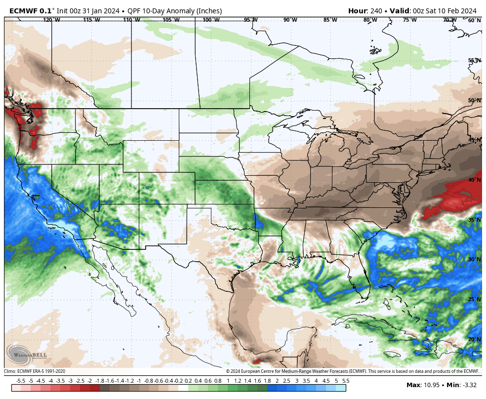

Despite the well earned thaw that we’ll enjoy now, winter is far from over. In fact, not only do we forecast a return to a cold, wintry pattern around Feb 10th (give or take a day or two), but it’s easy to build a case that this should be a more prolonged cold blast when compared to its January predecessor. The reason? Alignment with the teleconnection suite (emphasizing the anticipated strong negative NAO). We also anticipate the MJO getting into Phase 8 by mid-month which opens up the window for the potential of more extreme cold.
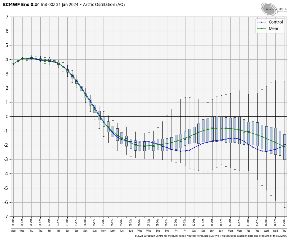
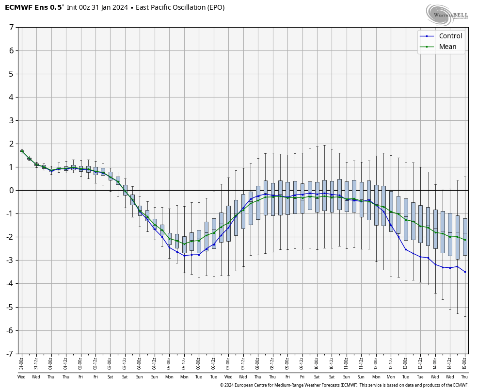
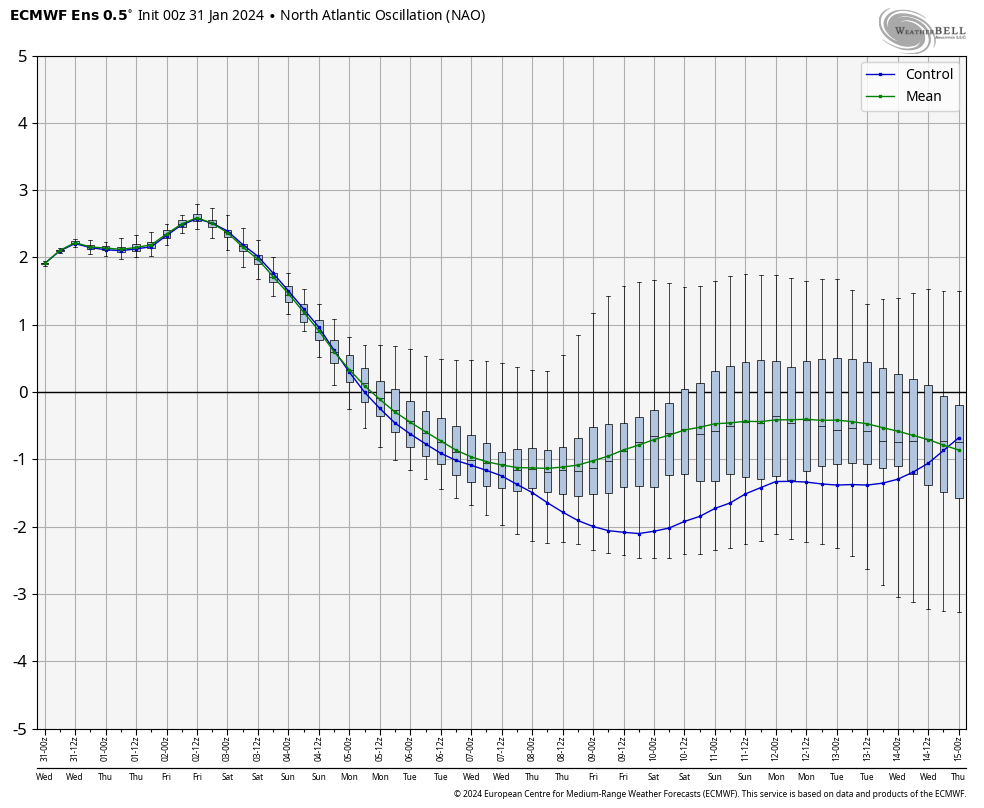
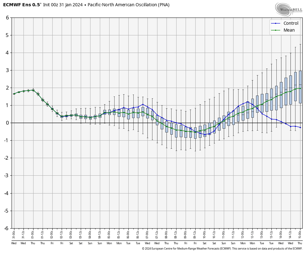
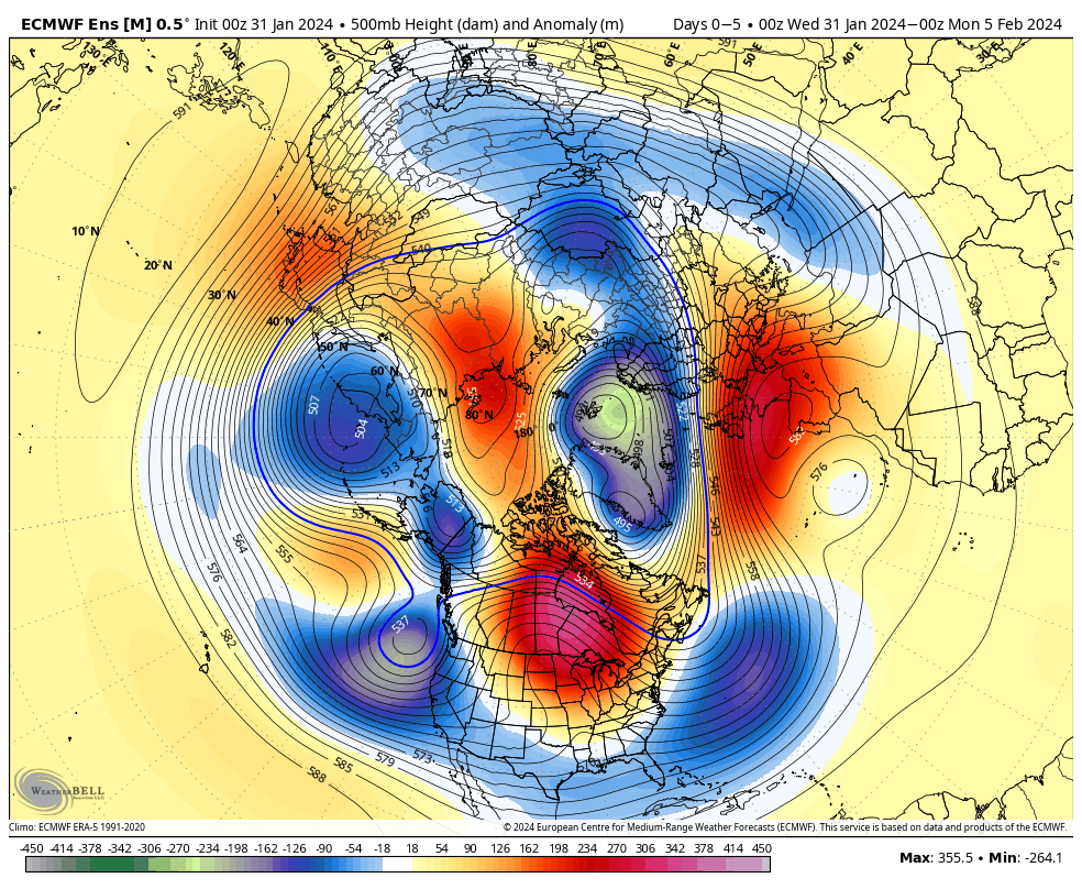
To no surprise, the latest ensemble data is pointing towards where the pattern is heading once past the first 1/3 of February.
Once we lock into the colder pattern, thinking here is we’ll remain locked in with an overall cold signal to close Feb and open March (first 10-14 days). It may be a “rubber band” type pattern. Cold to open before an abrupt flip to significantly warmer (hot?) conditions for the second half of March.