The MJO is rolling right into the notorious cold (for this time of year) phase 3 as we open up the new year.
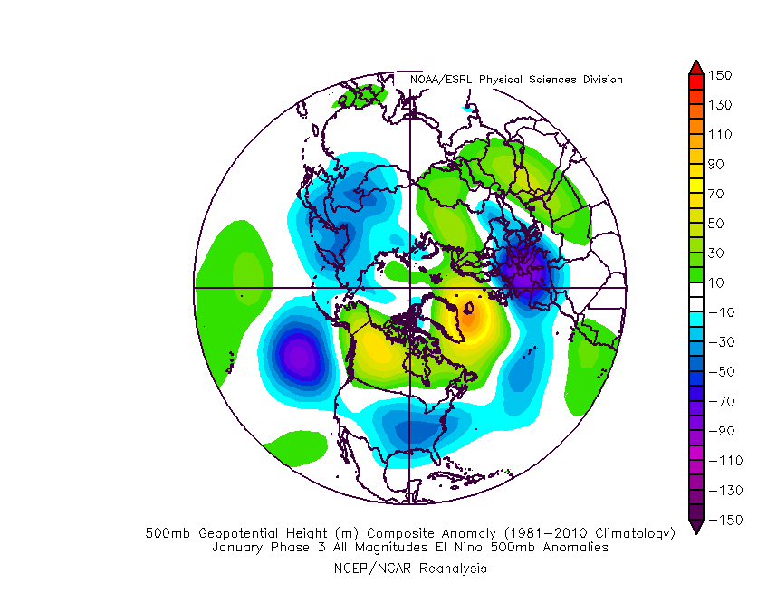
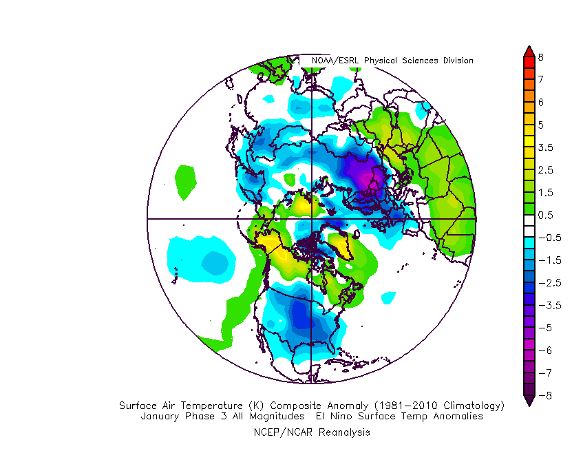
The composite analog for phase 3 in January from an upper air and surface temperature anomaly standpoint:
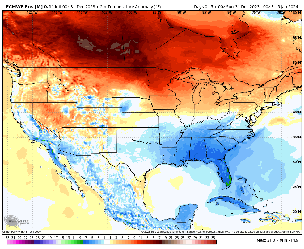
Ensemble guidance shows the widespread colder than normal temperatures overspreading the country. Like clockwork, this is almost identical to the Phase 3 analog above.
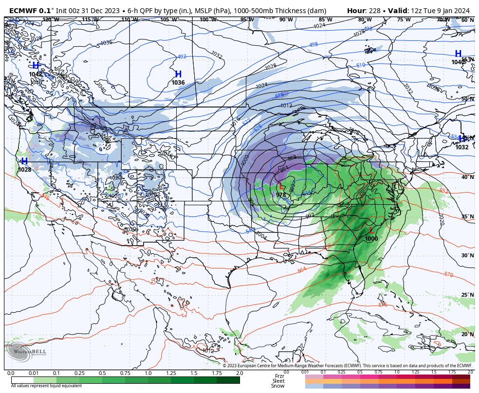
After a quiet week, we’ll watch 2 storms in the 5-10 day period. The first comes along next weekend. While still far too early to get detailed, this one does have potential to serve up some wintry mischief to the Ohio Valley, including central Indiana.
The second storm follows and it’s behind this feature that more of a truly arctic air mass will get involved in our pattern.
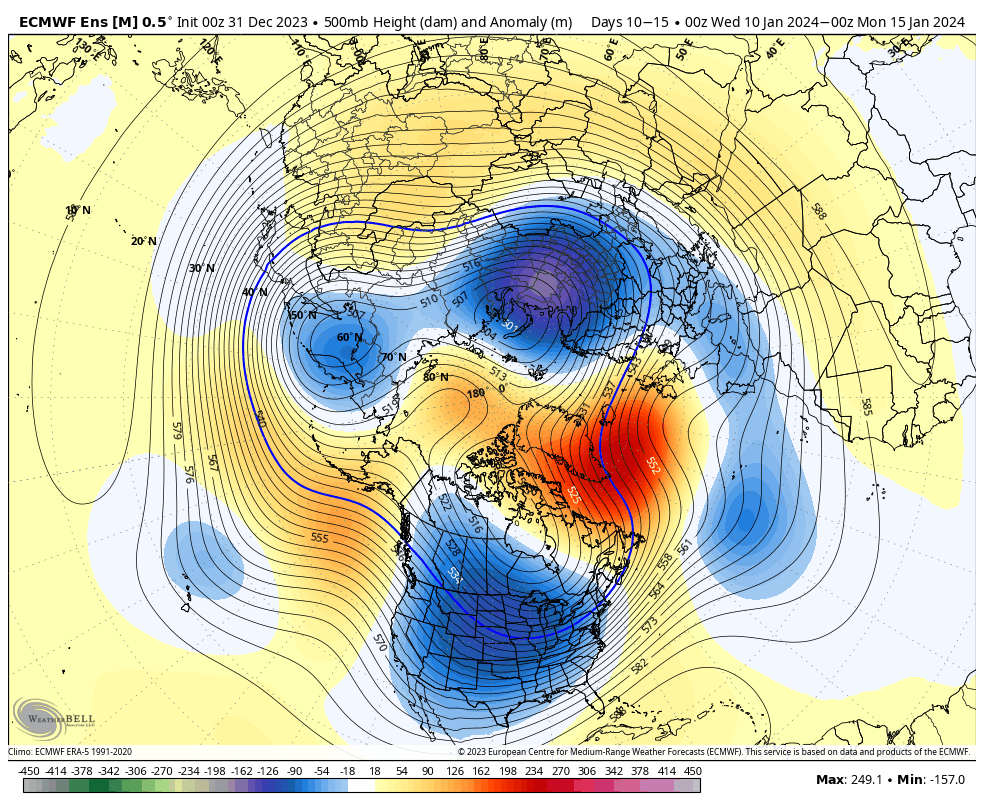
The pattern will stay busy as the arctic air presses in. At the same time, note the Greenland block beginning to form. Winter weather enthusiasts have to be chomping at the bit by that 10-15 day look. Needless to say, we can expect a rapidly expanding snow pack across the Lower 48 over the next couple weeks.
Thereafter, all eyes will remain on the MJO. Do we roll into the “null phase,” such as what the European suggests or swing through the traditionally mild/ warm phases such as the American guidance portrays? Stay tuned…
Despite our New Year’s Eve clipper, we’re heading for an unusually quiet weather pattern to open up the new year. The upcoming 10 days are forecast to run well below average from a precipitation standpoint.
In fact, after tomorrow’s light snow, it may not be until late next weekend or closer towards January 10th that we’re talking about our next precipitation chances. Rare, indeed, for this time of year.
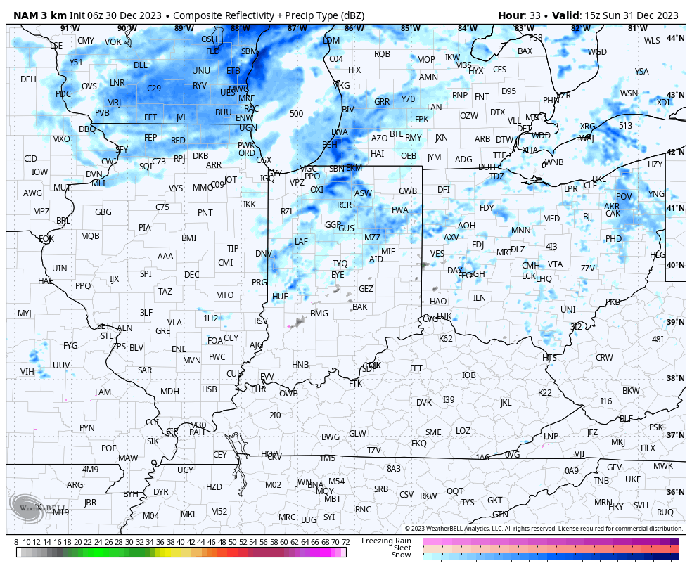
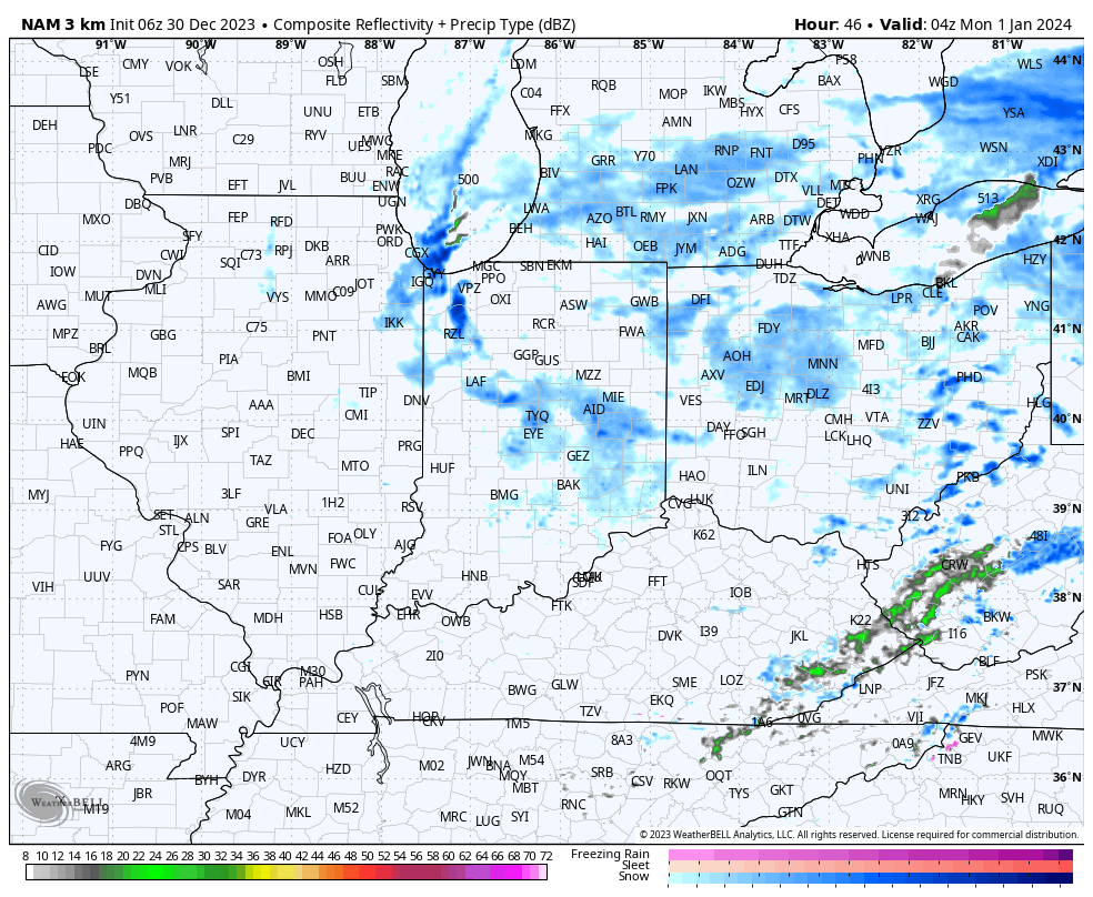
Back to this morning’s headline and our clipper. Sunday should dawn dry but light snow will begin to become more widespread across central Indiana by mid to late morning.
Light snow will continue to fall through the early afternoon before we get into a brief lull in the activity. During this time frame we can also expect 10-20 MPH winds which may limit visibility slightly as the light snow falls. Daytime accumulation, if any, should be no more than a dusting.
After the lull in the activity, a second round of light snow will develop towards 10p to 11p, or so.
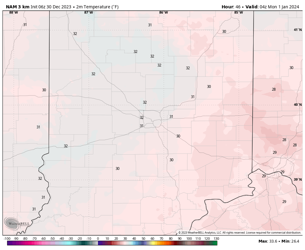
Though still light in nature, temperatures will settle below the freezing mark as this secondary batch of light snow falls.
While certainly not a heavy event by any means, just enough light snow and temperatures falling below freezing will likely create some localized slick spots across central Indiana tomorrow evening.
(Snow removal Clients, salting is recommended tomorrow evening).
Those with NYE plans out and about should allow extra time traveling home tomorrow evening. Light snow will diminish during the overnight and drier conditions should return for New Year’s Day, itself.
First, if you didn’t have a chance to see our thoughts after the European Weeklies came in, you can check that out here.
After the snow across portions of western and southern Indiana the past couple days (thank you for all of the reports, by the way), the next feature we’re tracking has to do with a clipper system that will dive southeast across the upper Mid West and into the Ohio Valley New Year’s Eve. This will certainly be moisture-starved, but should have just enough to work with to generate snow flurries and scattered snow showers by late Sunday morning, continuing in off an on fashion into the afternoon and evening.
A weak clipper system will offer up a few snow showers New Year’s Eve.
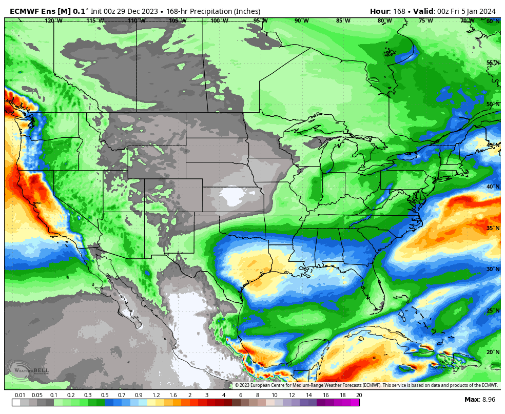
That’s really all there is to track, locally, over the upcoming 7-day period. The predominant storm track will shift off to the south during this time frame as an active, El Niño induced, southern jet takes hold. The one potential feature of interest is out towards the end of next week. We’ll keep an eye on it, but as of now, it looks like the phasing of energy will take place just a little too far east for anything of “excitement” here.
Temperatures will continue to cool closer to seasonal averages and perhaps a bit below normal over the upcoming 10-14 days. Greatest cool anomalies will be located across the western and southern tier during this timeframe.
Updated with European Weekly thoughts 12/29/23 @ 7:09a
There’s no reason to change any of our thoughts concerning how things play out over the next 24 hours with our upper level low pressure system. That idea from yesterday is available here. In short, it still appears as if parts of west-central Indiana are still greatest at risk of seeing light wet snow accumulation (of course some of our friends in southwest Indiana are already enjoying waking up to snow on the ground this morning).
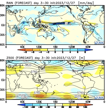
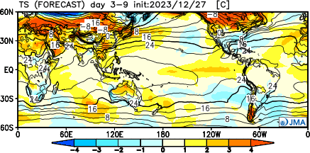
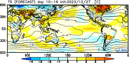
As we look ahead to the upcoming 3-4 weeks (will add to this post later tonight after having a chance to see the updated Euro Weekly teleconnections), it appears as if we’re heading right towards more of a predominant El Niño regime with an active southern storm track and most persistent cold, relative to average, taking up residence across the southern tier. The updated JMA Weekly model portrays this best over the course of the upcoming 28 days:
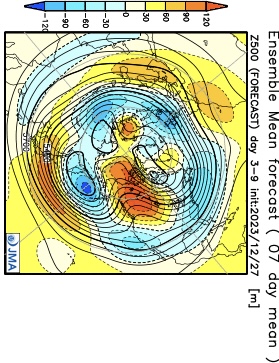
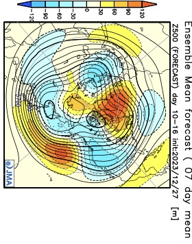
Modeling continues to struggle with the MJO evolution over the upcoming 2 week period. While this doesn’t impact the idea of colder times in the short-term period, it does have great implications beyond mid-January. The kind of amplitude shown off the American guidance (image 1 below) would threaten to deliver a much warmer than average period, locally, beyond mid-month. Meanwhile, the European (image 2 below) continues to suggest a collapse into the neutral phase.
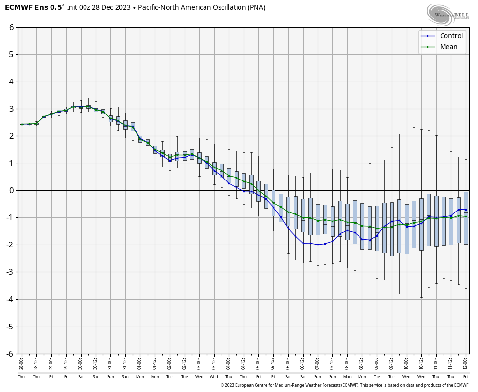
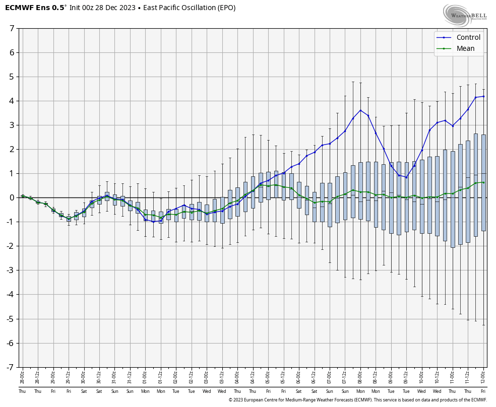
The 2 primary other pattern drivers include the PNA and EPO through mid-January. Beyond this point, we’ll start to incorporate the likes of the NAO and AO into our forecast (hence another reason why we’re interested in seeing how the Euro Weeklies show this later today).
Simply based on how the PNA/ EPO combo is forecast, the first week would open with cooler temperatures transitioning into the region and then we would likely see moderation in the week 2 to early week 3 timeframe.
Week 1
Week 2
While we’re certainly transitioning to a cooler and more active pattern over the upcoming couple weeks, compared to where we’ve been to this point in meteorological winter, it’s not yet to a point where anything looks excessively cold or, for that matter, snowy.
That doesn’t mean that there won’t be a couple storms to track that could offer up some meaningful winter weather potential here, but I just don’t see a sustained cold, snowy pattern taking foot through mid-January. Beyond that point, we’ll have to monitor which more extreme solution plays out. Based on everything going on by that point, it’s still likely to be a situation where either more persistent (and significant) cold or warmth develops.
European Weekly update 12/29/23
The new European Weeklies show a warmer option for the 2nd half of January, but contradict their own teleconnections during this time frame. The model goes to a strong negative AO, positive PNA, negative NAO, and a neutral EPO. Of course we’ll have to see what the MJO ultimately ends up doing but that combo strongly argues for the colder option for the 2nd half of January.
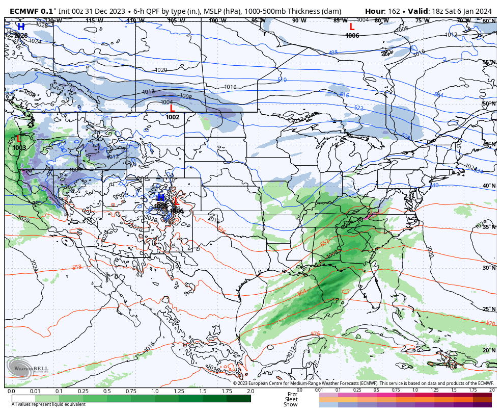
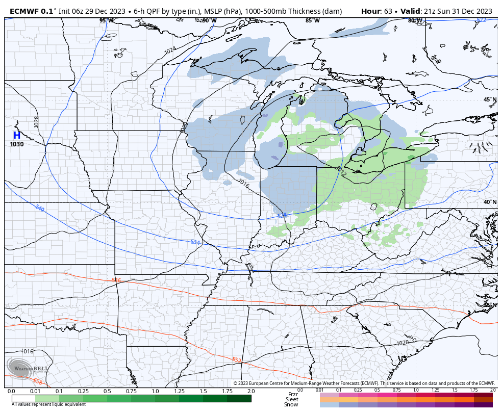
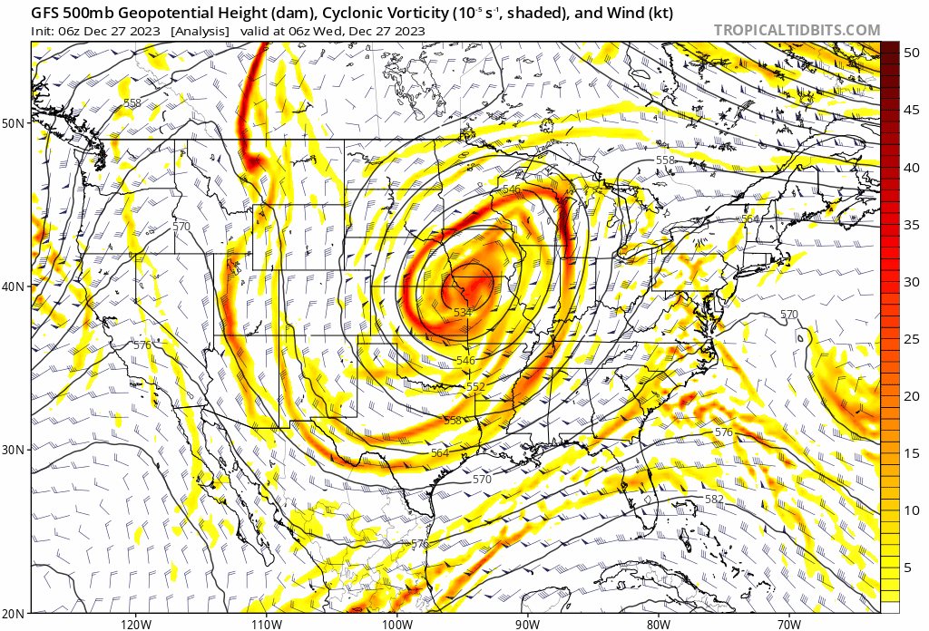
A big ole slow moving cut off upper level low pressure system will pinwheel out of the upper Midwest this morning into the TN Valley and Southeast by the weekend.
These features are always known for “surprises” and it’s up to forecasters, including yours truly, to eliminate those surprises over the next couple days. The challenging part with this particular setup is that colder air will be arriving into the region as the more organized bands of precipitation are pivoting south. Precipitation intensity will also be a big player in this event. The heavier, or more intense, precipitation rates will be able to cool the column of air perhaps a bit quicker than most short term model guidance may currently see.
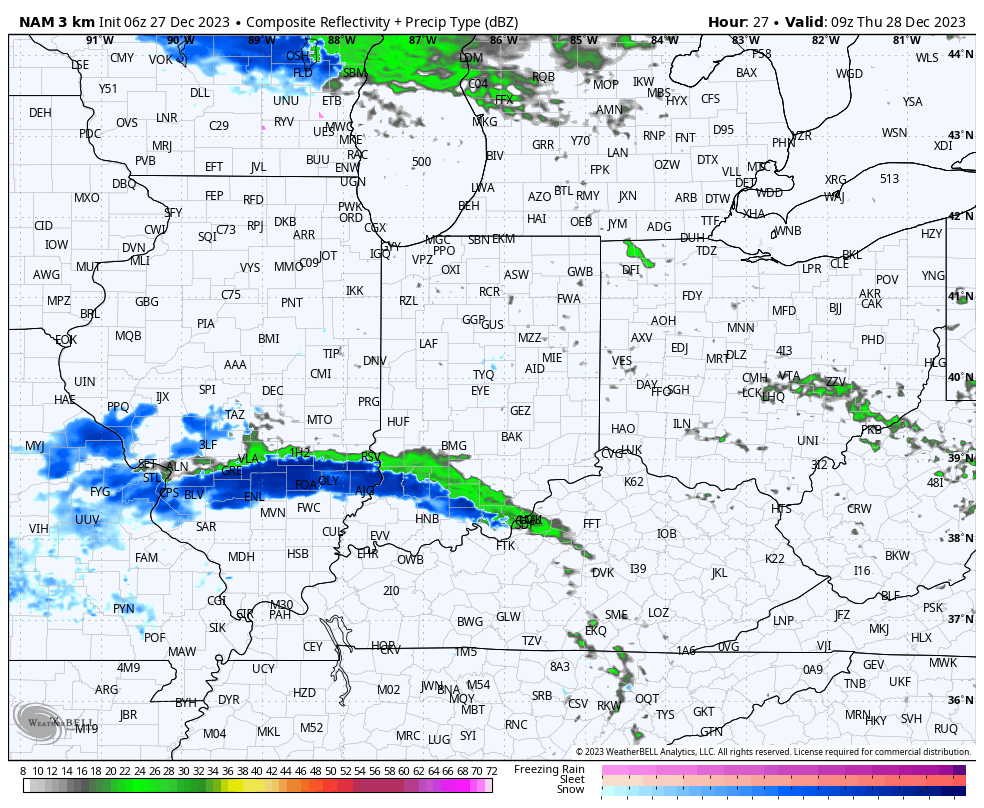
So what does this all mean to me? Today is quiet. After patchy fog burns off, we’re looking at more in the way of sunshine building in. The initial band of precipitation will likely setup tonight across southwestern Indiana. While this will start out as a cold rain, precipitation should switch over to snow prior to sunrise and some localized wet accumulation of snow is likely across Southwest Indiana by daybreak Thursday.
Meanwhile, back up this way, after a dry start to the day, precipitation is expected to become more widespread by early to mid afternoon. As nightfall sets in, rain will likely turn to wet snow showers. Admittedly tricky trying to determine where the steadiest band of precipitation will prevail, the best idea at this point will be across west-central Indiana, including places like Frankfort, Lafayette, Crawfordsville, and Terre Haute. Here, light wet snow accumulation of 1” to 2” seems like a good bet by Friday morning.
Precipitation will diminish from north to south across western Indiana Friday morning. Dry conditions will return until a reinforcing jab of cold air arrives New Year’s Day with scattered snow showers.