Category: snow

Lunchtime Rambles: Flooding & Severe Highlight Short-Term; Wind-Whipped Snow Midweek And Looking Ahead To An Opportunity For A Briefly Calmer Window…

Updated 04.01.24 @ 11:28a

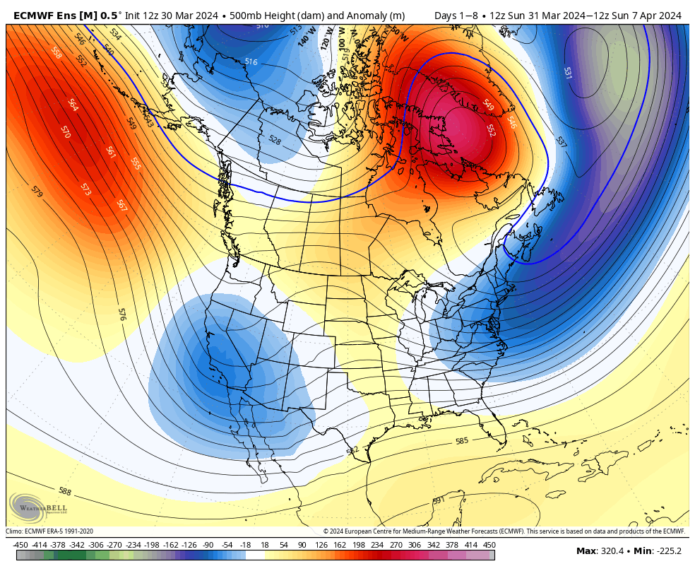
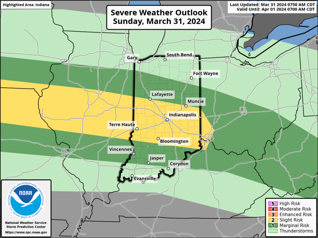
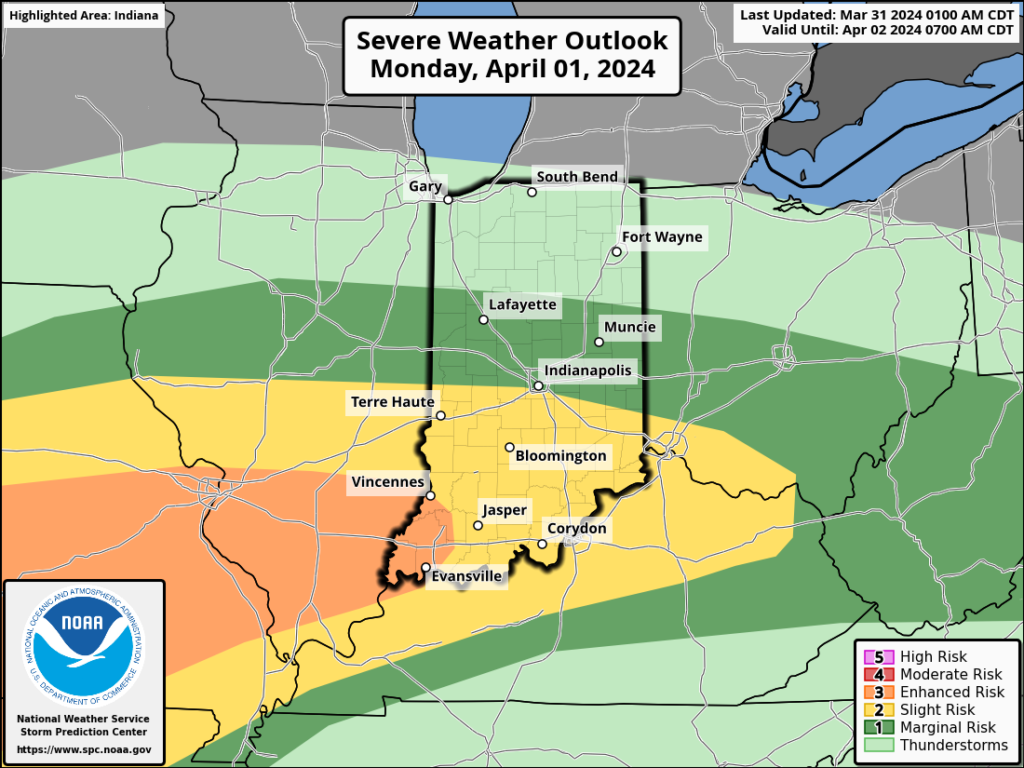
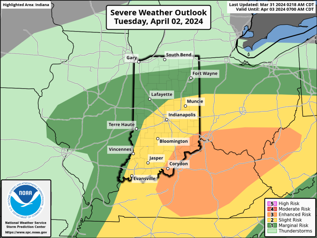
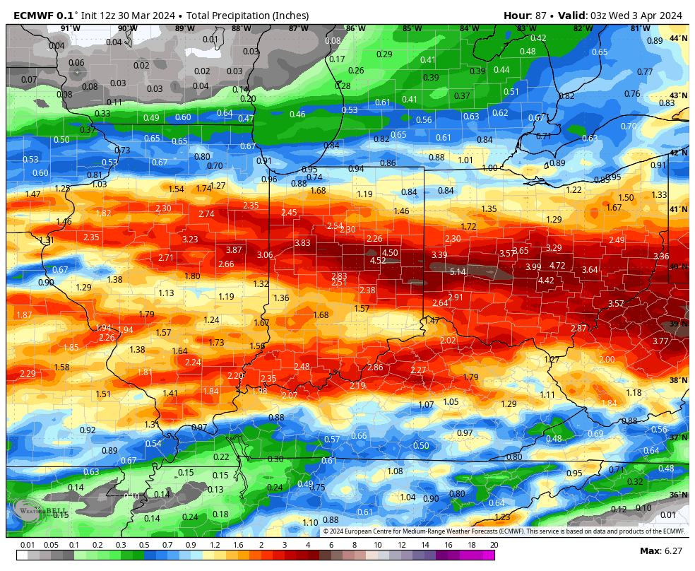
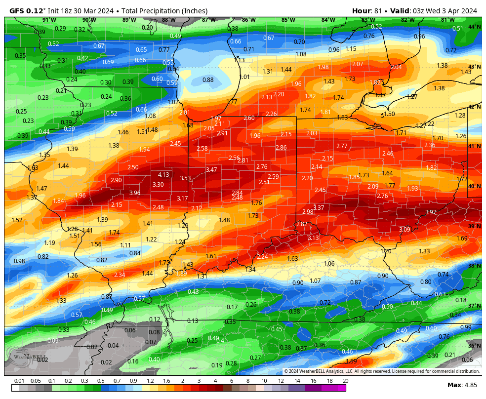
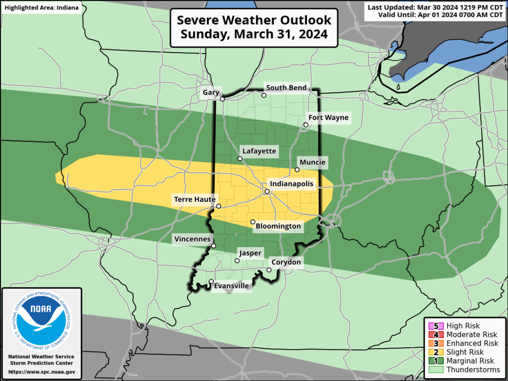
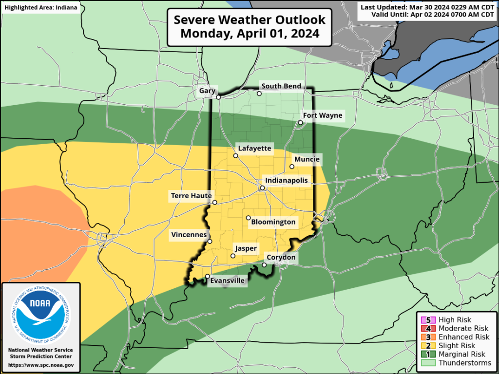
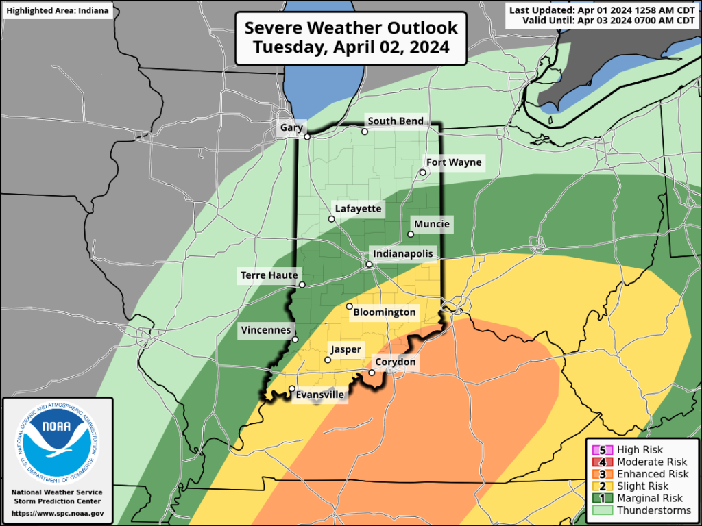
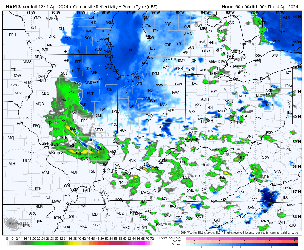
I. Things will turn quite active later tonight and into our Tuesday. Multiple rounds of heavy rain and strong thunderstorms will track across central Indiana. As heavy rain trains over the same area, localized flooding will develop Tuesday morning into the afternoon hours.

A threat of severe weather is also present, including large hail and even a couple tornadoes. Given the current parameters, it wouldn’t be a surprise if the fine folks at the Storm Prediction Center expand the current risk zones a bit further north for both the Day 1 and Day 2 outlooks. We’re still tracking a potential line of severe weather Tuesday PM after the multiple rounds in the morning. We’ll want to remain weather-aware tonight and Tuesday across central Indiana.

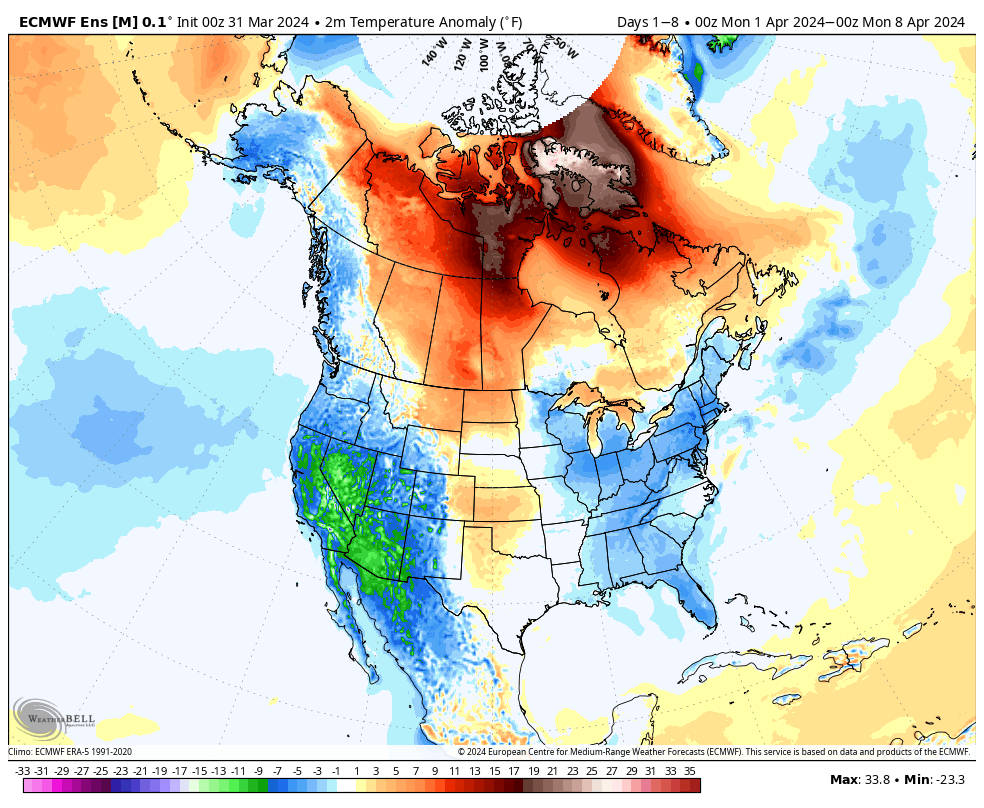
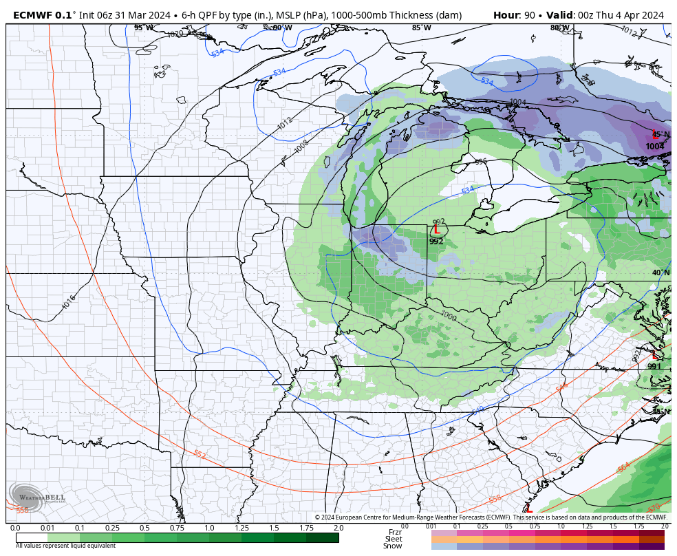
II. Much colder air will pour in here Wednesday and as the closed upper level low swings through the Great Lakes and Ohio Valley, a renewed area of precipitation will expand across the area Wednesday night into Thursday. Rain will mix with and even change to wet snow in spots across central Indiana during this time. Heavier wet snow bursts will lead to slushy accumulation on grassy surfaces.

Northwest winds will result in lowered visibility and a harsh feel (given the time of year) with wind chills into the 10s and 20s at times.

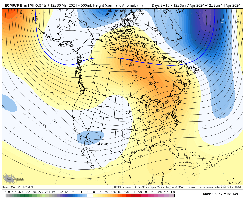
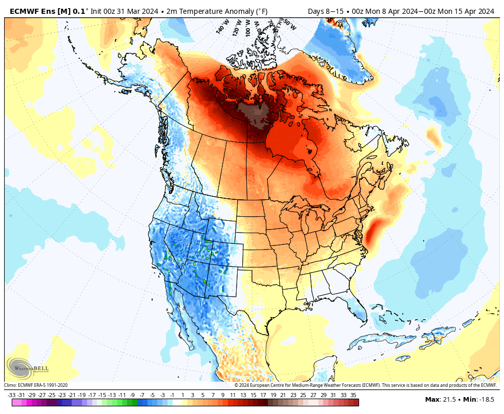
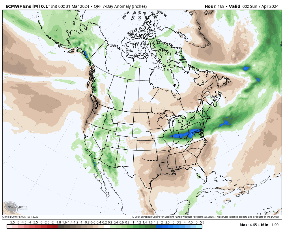
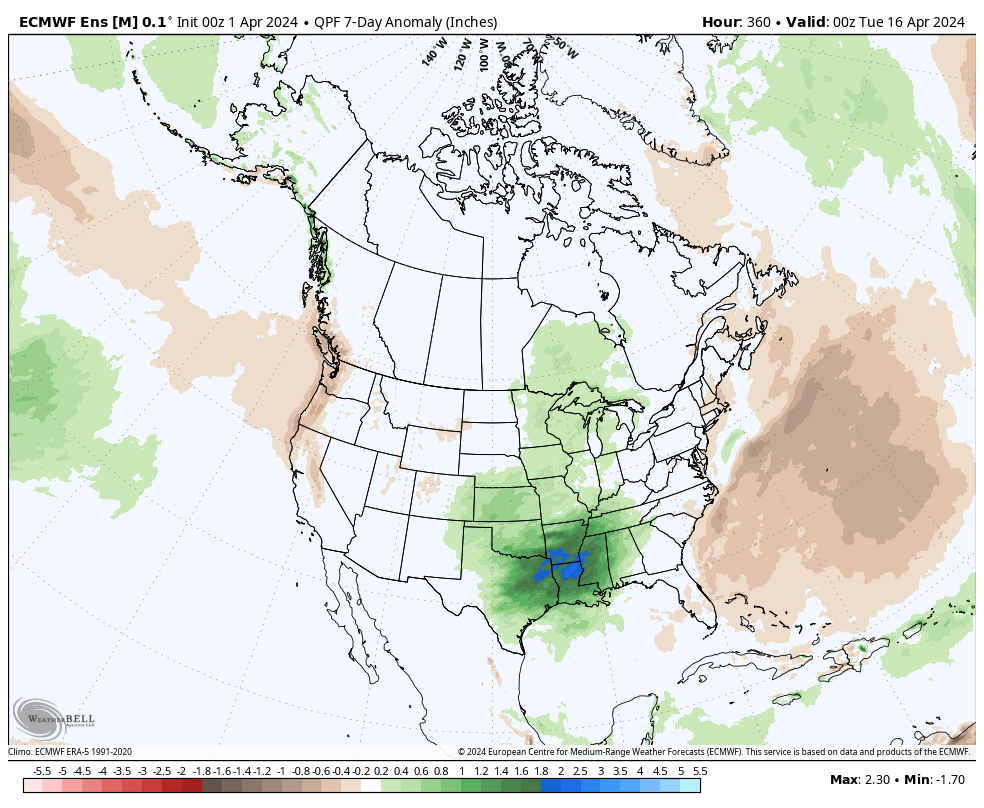
III. While we’ll briefly dry out in the 6-10 day, the pattern continues to present an active look down the road, including above normal rainfall projected in the Week 2 timeframe through the Plains and into the mid South and western Great Lakes region.

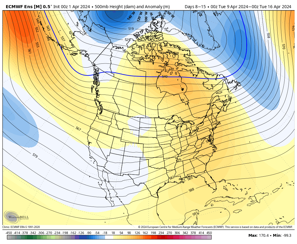
All in all, we don’t see any extended periods of dry weather on the horizon over the next few weeks as a whole.

Permanent link to this article: https://indywx.com/lunchtime-rambles-flooding-wind-whipped-snow-midweek-and-looking-ahead-to-an-opportunity-for-a-briefly-calmer-window/

Weekly #AGwx And #Severe Weather Outlook…

Updated 03.31.24 @ 7:26a

The upcoming immediate term will be headlined by a multi day heavy rain and severe weather episode. A stalled frontal boundary will serve as the pathway for multiple waves of low pressure to ride along through Tuesday. In addition to a heavy rain and flooding threat (primarily targeting immediate central and north-central Indiana), we’ll also likely have to deal with (3) rounds of severe storms. We’ll allow our short-term products to handle those severe threats, but just know all modes of severe are on the table with the greatest emphasis being on large hail with this setup. Should a couple discrete cells develop near or just south of the boundary then an elevated tornado threat would ensue. Again, we’ll have a fresh post hoisted later this afternoon or evening on that.

Overall, there’s no change in the idea of an active pattern continuing from Week 1 (image 1 below) into Week 2 (image 2 below).

The cooler pattern behind our early week storm system will reverse in significant fashion Week 2. – Transitional regime at its finest.

Week 1 temperature anomalies

Week 2 temperature anomalies

The busy nature of the pattern is reflected in the upcoming 2 week precipitation anomalies.

Severe weather will be possible at least across a portion of our immediate viewing area starting this evening and continuing daily through Tuesday.

Colder air will crash in here Wednesday and as an upper low swirls overhead, wet snow will develop. Snow may even fall heavily enough to accumulate on grassy surfaces in spots Wednesday night into Thursday morning.

*Upcoming 10-Day Rainfall Projection: 3” to 4”+

Permanent link to this article: https://indywx.com/weekly-agwx-and-severe-weather-outlook-49/

Saturday Evening Thoughts On The Pending Heavy Rain/ Severe Event…

Updated 03.30.24 @ 5:07p

There’s not much, if anything, to change regarding the setup and anticipated outcome of the Easter Sunday through Tuesday timeframe. Periods of heavy rain will get going Sunday PM and we’ll also need to watch for the threat of severe storms not only tomorrow afternoon/ evening but again Monday.

Midday models are latching onto a widespread 2”-4”+ event.

The Storm Prediction Center (SPC) has increased the threat area tomorrow afternoon. Large hail is greatest concern but an isolated tornado can’t be ruled out.

All modes of severe are on the table Monday, including tornado potential once again.

If all this wasn’t enough already, a much colder air mass will plunge into the region by midweek allowing rain to mix with and change to wet snow Wednesday evening into Thursday morning. The snow may even be heavy enough for slushy accumulations in spots.

Spring at its finest across the great Hoosier state…

Permanent link to this article: https://indywx.com/saturday-evening-thoughts-on-the-pending-heavy-rain-severe-event/

Quiet Open To The Week Gives Way To More Active Times…

Updated 03.18.24 @ 7:55a

The story to open the work week will be a quiet one. For a change, we’re talking about a chilly air mass settling overhead. That colder air will also feature a return of drier times.

Despite a few scattered light snow showers today, we’ll stay on the dry side until Friday.

Multiple hard freezes can be expected this week. Tuesday morning will once again feature lows deep into the 20s area-wide.

The good news? Sunshine and calm conditions can be expected during the majority of the week ahead.

That will all change by Friday as a couple low pressure systems team up to return unsettled weather to our region. Friday looks wet and chilly as of now. Rain won’t be heavy, but more of a nuisance. It’ll be a good day to hunker down and watch Day 2 of the tourney. 🏀

Though Friday won’t feature a significant storm system, it will signal a change for a more active Week 2. Heavier rain and the possibility of stronger storms can be expected next week and we’ll have more details on this as we navigate the coming days.

Permanent link to this article: https://indywx.com/quiet-open-to-the-week-gives-way-to-more-active-times/

VIDEO: Weekly #AGwx And #Severe Weather Outlook…

Updated 03.17.24 @ 8:10a The theme for the bulk of the week ahead will be both cooler and drier. A few mornings will feature a hard freeze, including overnight lows…

You must be logged in to view this content. Click Here to become a member of IndyWX.com for full access.  Already a member of IndyWx.com All-Access?  Log-in here.

Permanent link to this article: https://indywx.com/video-weekly-agwx-and-severe-weather-outlook/