December so far has been a battle between the cold northern tier and warmth south. The so-called “battle zone” has been located over our neck of the woods and lead…
You must be logged in to view this content. Click Here to become a member of IndyWX.com for full access. Already a member of IndyWx.com All-Access? Log-in here.
Mixed Rain/ Snow Showers…Colder air will pour into the region on gusty north and northeast winds through the early week stretch. Left over moisture will produce scattered mixed rain and snow showers Tuesday, particularly during the morning.
Cold Mid Week…Dry, but cold conditions can be expected through the middle and latter portion of the work week. Temperatures will run below average, but at least we’ll enjoy a little vitamin D!
Milder Air Coming…Our air flow will shift around to the southwest over the weekend into early next week and this will help promote much milder times- at least for a brief period of time. We caution though that a much different look (and feel) awaits by the middle and latter part of next week and this will likely set the stage for a cold end to December, including Christmas.
Half & Half Weekend…After a wet Friday today will begin a drier theme that will continue through the weekend. Despite the overall drier regime, don’t expect much in the way of sunshine today. Instead we’ll deal with considerable cloudiness, patchy drizzle, and blustery winds shifting around to the northwest. We’ll introduce more in the way of sunshine into your Sunday forecast with high temperatures a few degrees below the average high of 42.
Early Week Cold Front…A frontal boundary will move through the region Monday and could have a couple showers as it blows through the state. Colder air will move in behind the front for mid week and may be accompanied by a few flurries or a scattered snow shower Tuesday.
Dry Ending…Indications at this point are that we’ll enjoy dry conditions to wrap up the work week along with slowly moderating temperatures.
There’s been a ton of conversation as of late about where this overall weather pattern is heading. Perhaps it’s the Christmas season that brings out the conversation as everyone is hoping for that cold pattern to provide a White Christmas.
While in the short-term cold will continue to dominate, we’re becoming increasingly confident of an unseasonably mild stretch of air in the mid-range period. That’ll take us up to the week before Christmas…
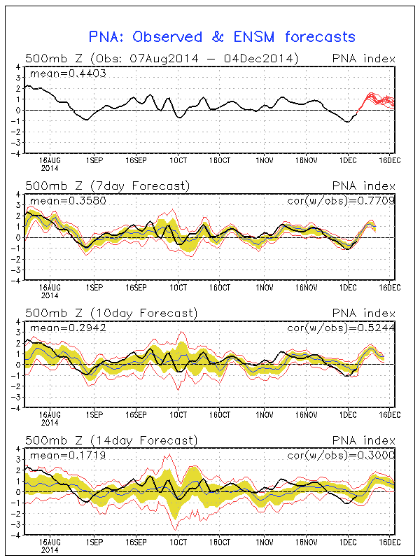
In the short-term, the positive PNA will continue to be the primary driver in our pattern. This will ensure a colder east through the majority of week 1 (through next Friday).
A positive PNA pattern typically leads to below normal heights (trough) and associated cooler than normal pattern across the eastern region.
Modeling sees the cool east in week 1 and warm west- typical of a positive PNA pattern:
There are changes in the mid-range period that’ll have lovers of winter and cold frowning. Many of our long-term readers know how we use the “typhoon rule” as a good indication of what we can expect across our region 6-10 days down the road. As stated multiple times in the past (want to give credit where credit is due), we learned this from the great Joe Bastardi. For those that are new here, I’ll describe this very briefly (you can read through the archives, if you’d like, for a longer/ more detailed description). Typically when you have a recurving typhoon in the WPAC, that suggests a trough (colder pattern) across the central and eastern Lower 48. On the flip side, when you have a westward moving typhoon, that’s a good indication of eastern ridging (warmer pattern).
Courtesy of the Joint Typhoon Warning Center, Super Typhoon Hagupit is forecast to move on a general westward trajectory.
This is a very good sign of a much milder than normal period in the mid-range (days 8-12). Modeling, in return, is going towards a warm pattern (associated ridge) week 2:
The GFS ensembles and NAEFS agree on the warmth and given what we’ve discussed above, so do we:
In fact, it wouldn’t surprise us to see high temperatures in the 55-60 degree range during a day or two week 2.
Really quick and before we end- lovers of winter weather, there’s absolutely NO reason to throw in the towel. In fact, indications in the long range suggest the trough collapses into the east during the week leading up to Christmas and that could provide for all sorts of wintry “mischief” when almost all of folks are wanting snow…
Much more on that in the days ahead. Have a great night!
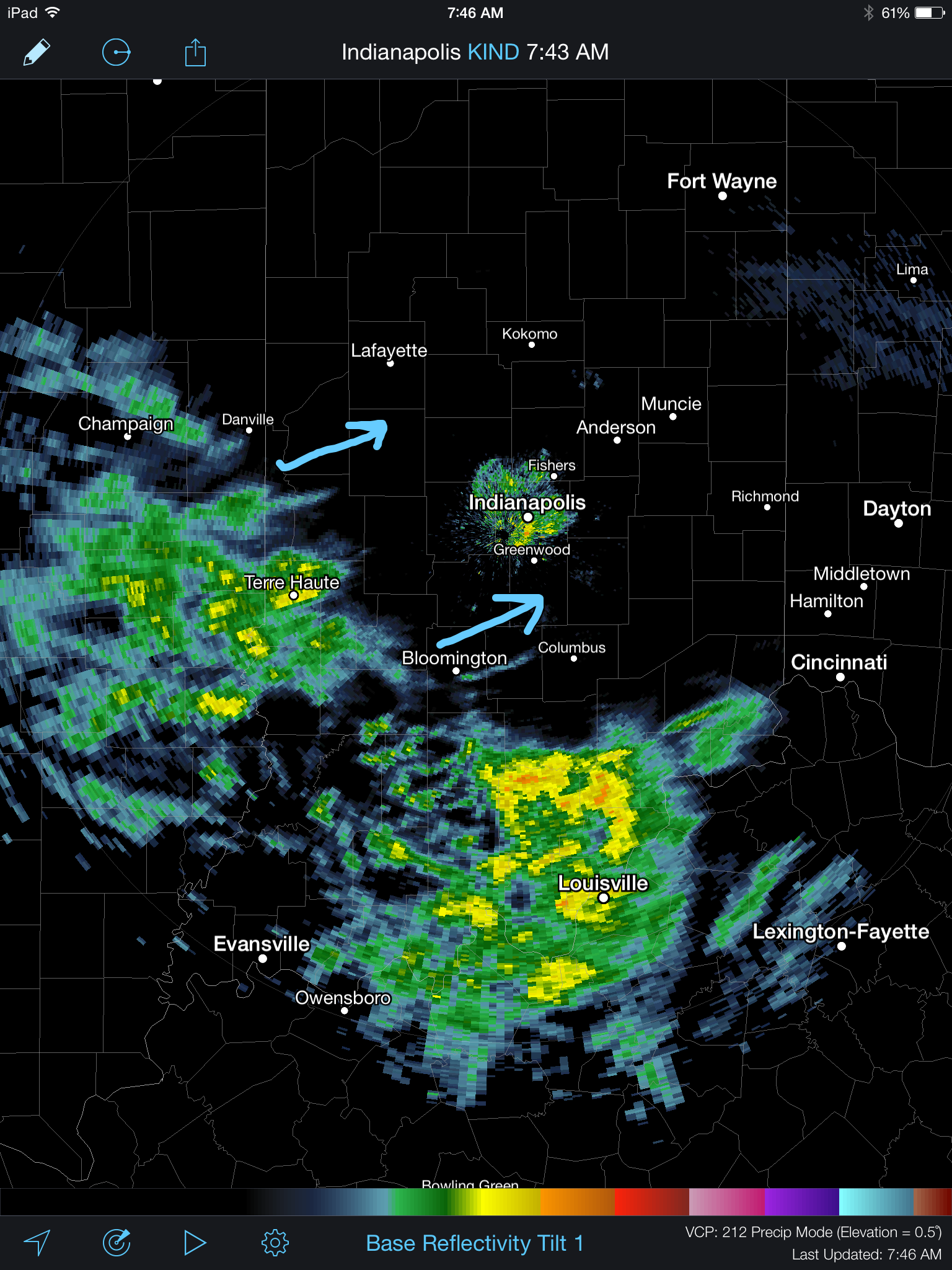
A wintry mix of sleet and freezing rain continues to advance slowly northeast this morning. Thankfully, most of the rush hour should be over by the time any of this wintry precipitation arrives and we have a couple things going for us this morning: 1.) Drier air is giving this precipitation a tough time advancing northeast and 2.) by the time the precipitation arrives, temperatures will be marginal for many road problems, if any. By far the more concerning issues are off to the southwest of Indianapolis, including places like Terre Haute (where moderate snow was reported at 9am).
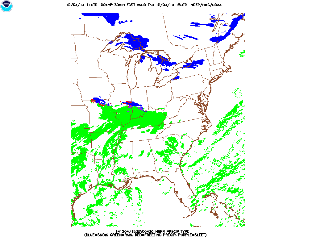
The HRRR slowly pushes the wintry mix along the I-70 corridor this morning.
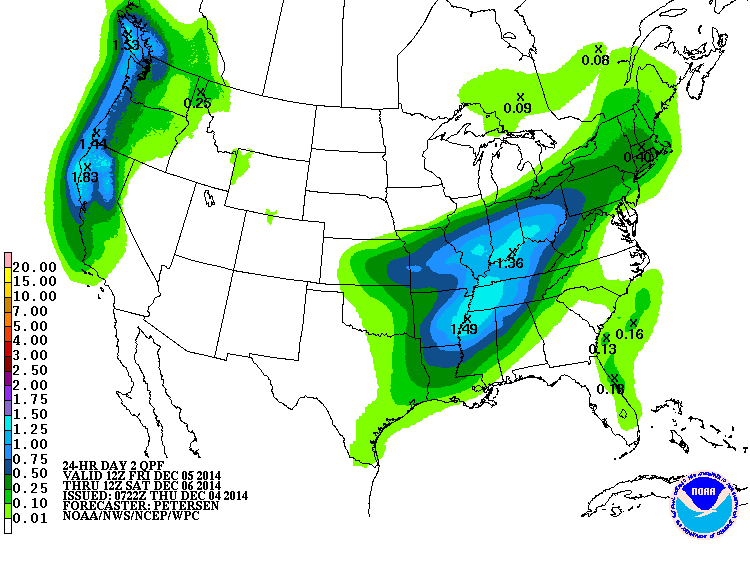
Attention then turns to a heavy rain event Friday into Saturday morning. Widespread 1-2″ amounts are expected.
Forecast radar shows periods of heavy rain overnight Friday into Saturday morning.