Updated 01.22.25 @ 7:53a The coldest readings this morning actually took place a little after midnight (when most of central IN was as cold as 3° to 6° below zero).…
You must be logged in to view this content. Click Here to become a member of IndyWX.com for full access. Already a member of IndyWx.com All-Access? Log-in here.
Updated 01.21.25 @ 7:45a Bitterly cold, arctic air will continue its grip on our region as we roll into the middle of the week. A weak system will serve up…
You must be logged in to view this content. Click Here to become a member of IndyWX.com for full access. Already a member of IndyWx.com All-Access? Log-in here.
Updated 01.20.25 @ 4:14p I. Bitterly cold, arctic air will continue to grab the headlines, and rightfully so, over the next few days. It still looks like we’ll remain stuck…
You must be logged in to view this content. Click Here to become a member of IndyWX.com for full access. Already a member of IndyWx.com All-Access? Log-in here.
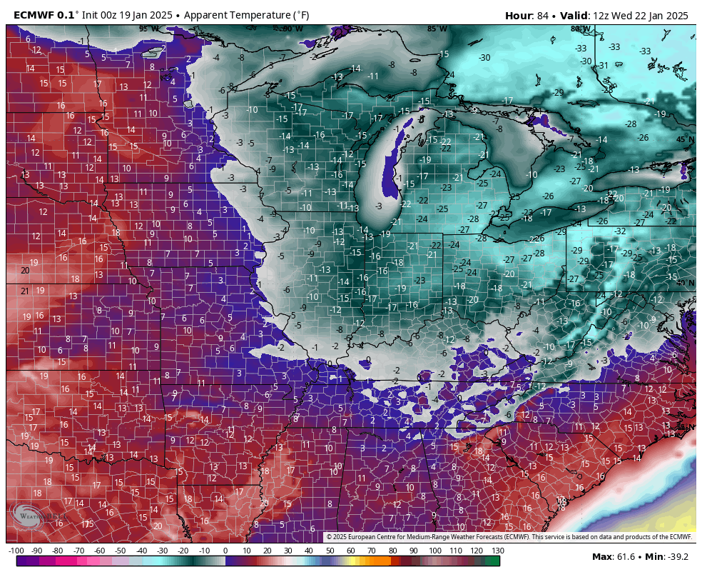
Updated 01.20.25 @ 7:28a Old Man Winter will have a firm grip on our region through the middle of the week. Dangerously cold wind chill values of 20° to 25°…
You must be logged in to view this content. Click Here to become a member of IndyWX.com for full access. Already a member of IndyWx.com All-Access? Log-in here.
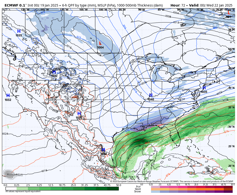
Bitterly cold air will dominate weather headlines over the next few days (along with a rare significant southern winter storm). Back up this way, despite some light snow showers today (and another opportunity Friday), we’ll remain unusually quiet and calm from a precipitation perspective. There’s really no reason to waste a lot of pixels in today’s discussion :).
A strong, sprawling arctic high will anchor our weather this week. While this will provide for bitter cold, it’ll keep us dry into the latter part of the week (after today’s light snow showers).
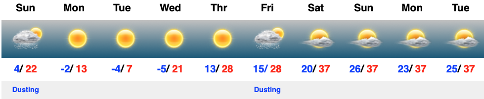
Areas that have snow on the ground will be significantly colder than the numbers listed below in the 10-day.
Wind chill values will fall into the 20° to 25° below zero range at times during the overnights and morning through midweek.
A weak system may offer up the opportunity of light snow Friday, but we’re not seeing signals of anything more significant over the next week, or so.
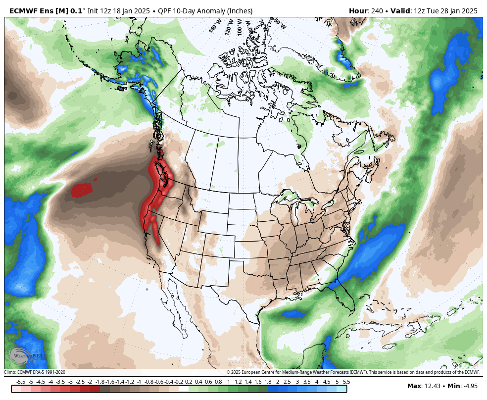
A significantly drier than normal pattern is expected over the upcoming 10-days.
Enjoy it as the pattern continues to look more active as we get into February…