Wet Start To The Work Week; Taste Of Winter This Weekend…
 Highlights:
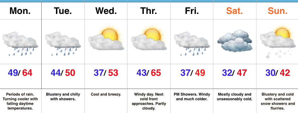
- Wet, gloomy open to the work week
- Dry midweek
- Much colder this weekend
- First flakes of the season
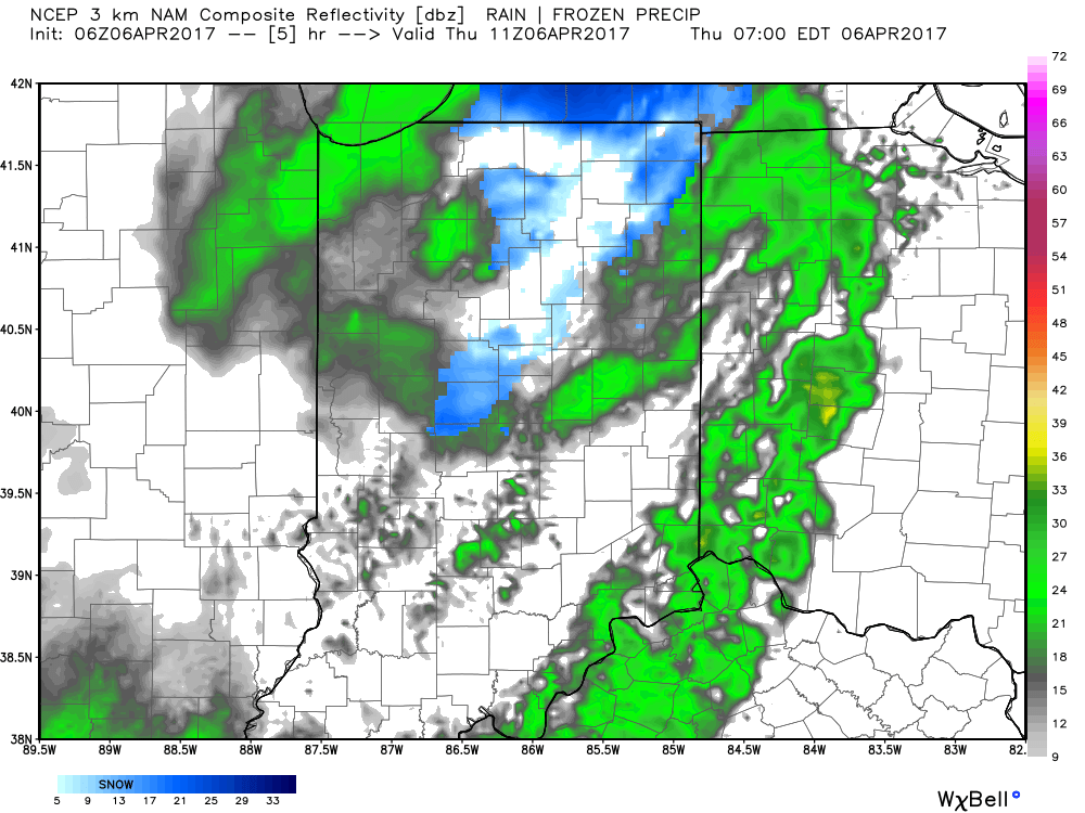
Rain Gear Required…Low pressure will track through the Ohio Valley and into the Great Lakes between now and Tuesday morning. This will result in a wet day, including periods of moderate to heavy rain. Once the cold front slips through central Indiana, we’ll notice slowly falling temperatures this afternoon. We’ll throw in a gusty NW breeze tonight into Tuesday with showers and chilly conditions remaining in place.
Drier air will work in for the midweek stretch. After patchy frost Wednesday, a cool, crisp day is on tap with increasing sunshine. Thursday will feature strong and gusty southwest winds (gusts over 40 MPH), but dry conditions ahead of an approaching cold front. That cold front will blow through here Friday with a band of showers and sharply colder air to end the work week.
The air will turn cold enough to end the growing season this weekend across central Indiana. Additionally, a combination of upper level energy and reinforcing cold air Sunday will interact with the unseasonably warm lake waters to help generate scattered snow showers and flurries. When we compare this upcoming Sunday to yesterday, it’ll add insult to injury as temperatures will be more than 30° colder…
The 2017-2018 IndyWx.com Winter Outlook is now available.
Upcoming 7-Day Precipitation Forecast:
- Snowfall: Trace
- Rainfall: 1.00″ – 2.00″
 We’ll also add wind into the mix late morning through early evening, including gusts around 50 MPH. Factor in the much colder temperatures with gusty northerly winds and you have the makings for a truly “raw” day across the region. The National Weather Service has issued a Wind Advisory until 8pm.
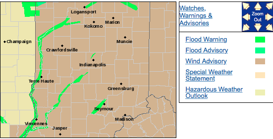 We should finally get rid of the precipitation later tonight and after a chilly Friday, weekend improvements are coming. Lows both Friday and Saturday morning will be around freezing for most central Indiana neighborhoods. After a cloudy start Friday, sunshine should return Friday afternoon as drier air works into the region. With high pressure arriving this weekend, sunny conditions can be expected and with a southwest wind developing by Saturday afternoon, moderating temperatures are on deck as well.
 In fact, after that cold start Saturday, highs should climb into the lower 60s Saturday afternoon and all the way into the lower to middle 70s Sunday afternoon!
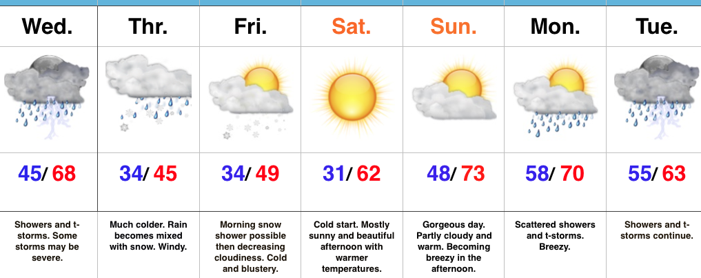 Highlights:
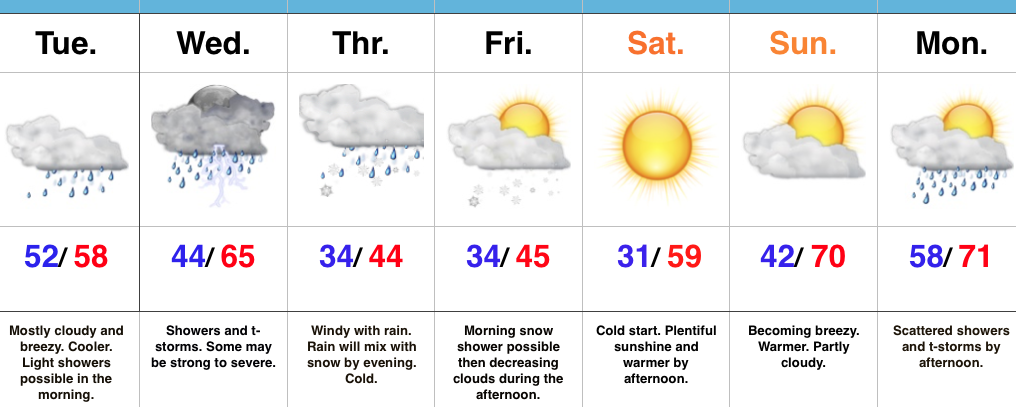 Highlights: