Dinnertime Rambles: Active Night And Sharply Colder Wednesday…
Updated 02.27.24 @ 6:42p
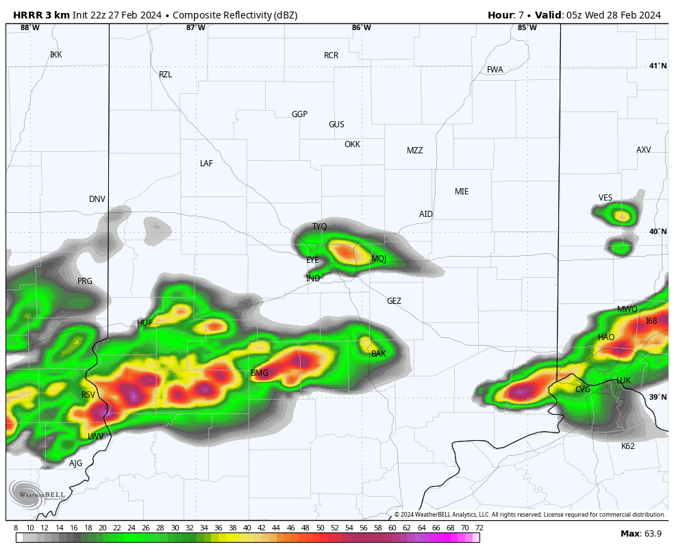
As we write this update, severe storms are firing across northern IL where a Tornado Watch has been issued until 11p (eastern). Meanwhile, all is quiet on the home front, thanks to strong “capping” in the mid levels of the atmosphere. Unfortunately, that cap likely won’t hold and we still anticipate scattered strong to severe storms to impact central and southern Indiana during the overnight.

All modes of severe weather remain on the table, including damaging straight line winds, large hail, and tornadoes. Initiation of convection across central/ southern IN should come around or just after midnight and end by 3a to 4a (west to east).
Please make sure you have a means to receive the latest severe weather alerts prior to heading to bed tonight.
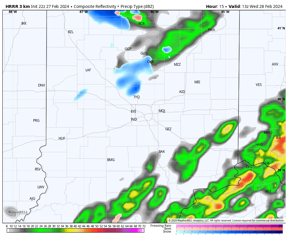
By the time most are waking up Wednesday, we’ll be talking about an entirely different array of conditions. Sharply colder air, light snow showers, and strong northwesterly winds will ensure to remind folks it’s late-February, after all.