Mid-Morning Update…
Updated 02.23.22 @ 10:04a
As we analyze downstream radar trends and fresh high resolution, short-term guidance, it appears as if the initial burst of precipitation is speeding up. It now looks like a mixture of light snow and light sleet will arrive into central Indiana between 7p and 10p.
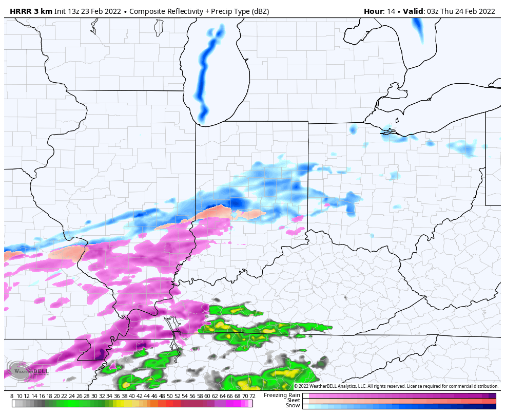
Along and north of the I-70 corridor, this should fall primarily as snow (up to 1”). Further south, a mixture of sleet and freezing rain is expected this evening (where things remains all freezing rain, a light glaze, perhaps up to 0.1”. is expected to develop on elevated surfaces by sunrise).
Our updated client brief will be posted later this evening and include additional thoughts as the 12z data streams in.