Wet, Stormy Open To The Weekend Before 2nd Half Improvements…
Updated 07.08.23 @ 6:28a
There’s no need for an alarm clock this morning, friends. A widespread complex of rain and storms continues to push into central Indiana at 6:30a.
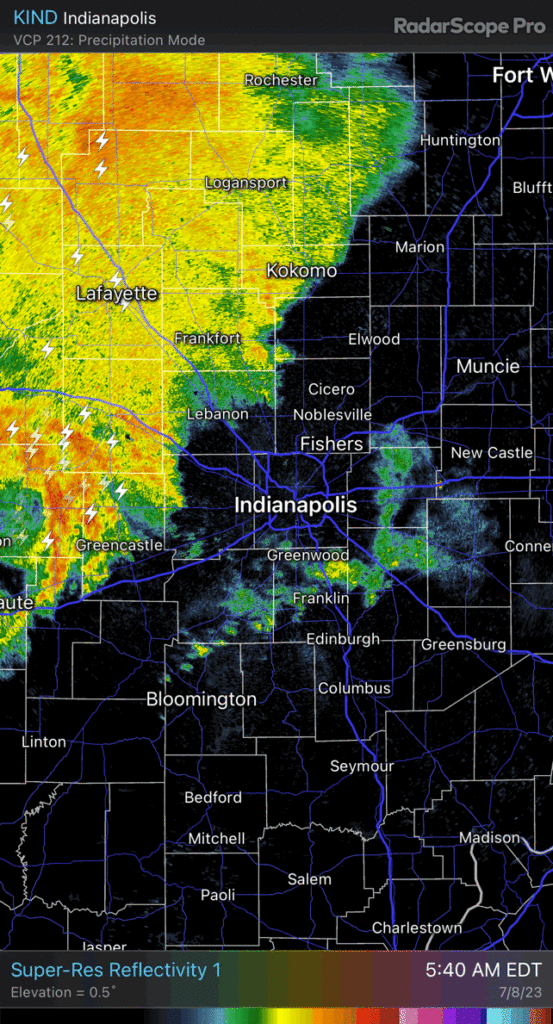
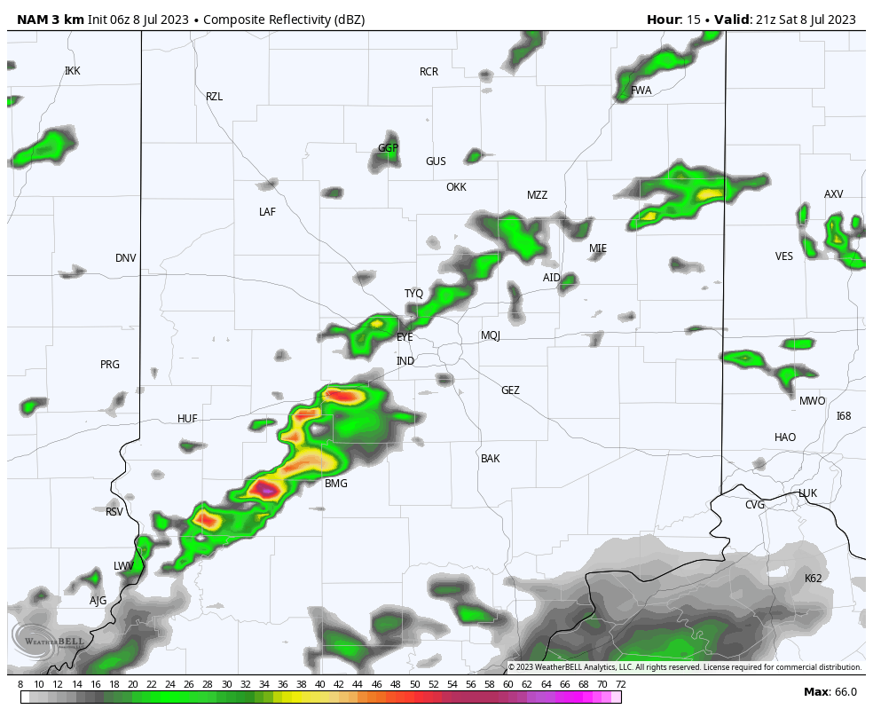
We’ll have to deal with a few hours of rain and thunder before things begin to dry out mid and late morning (west to east). Sunshine should also slowly work back into the picture enough to help destabilize things just enough for a second (less widespread) round of showers and storms by this evening. These will likely initiate around the city with more widespread coverage south.
We’ll then all enjoy a greatly improved weather pattern by tonight continuing into Sunday. Lower humidity and pleasantly warm temperatures will make up a beautiful 2nd half of the weekend.
More on the long range pattern a bit later today in our client video discussion.