Storms Fire This Evening; Early October Blow Torch…

Updated 09.26.23 @ 7a

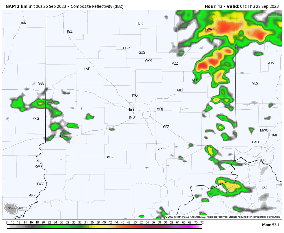
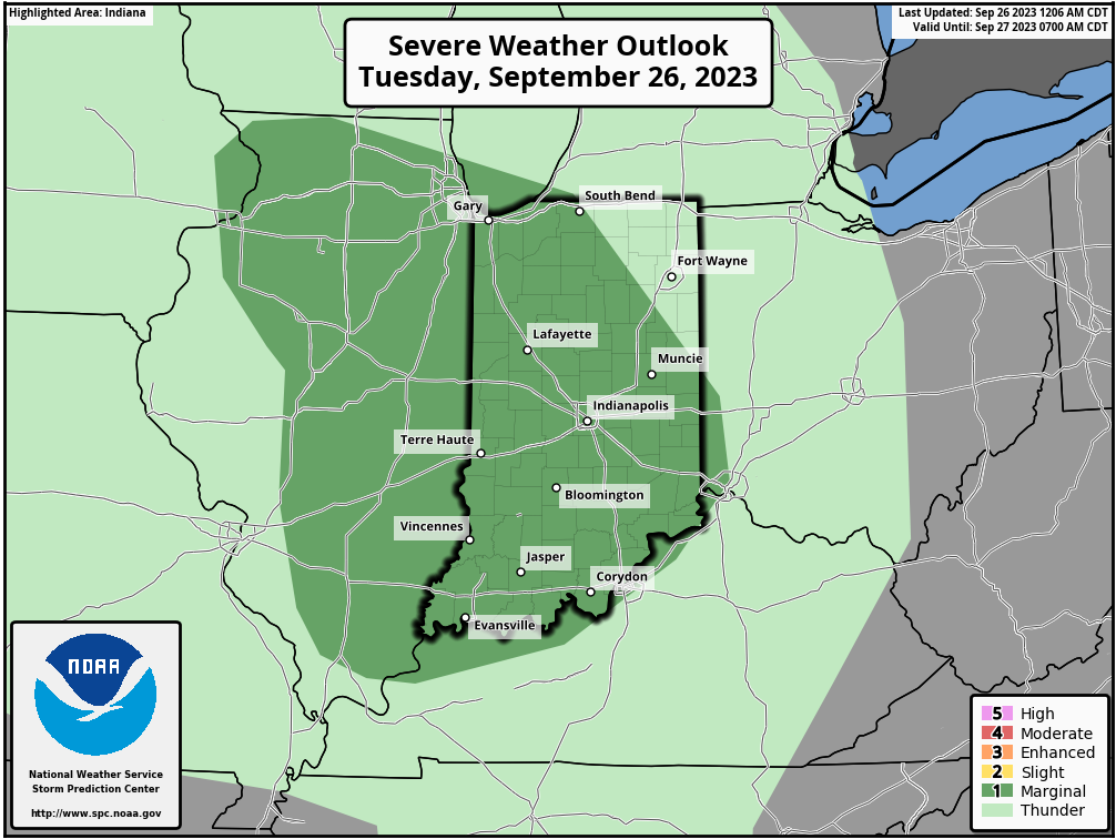
A closed upper low will pivot across the Ohio Valley over the next couple days. Our quiet start this morning will give way to “bumpy” times by evening. We expect scattered, but strong to severe storms to fire up after 5p. A couple of these could produce hail/ wind and we can’t rule out a quick spin up tornado with this setup.

The Storm Prediction Center highlights most of the area in a “marginal” risk of severe weather today, and I wouldn’t be surprised if a portion of this area (particularly western and central IN) is upgraded to a “slight” risk at some point.
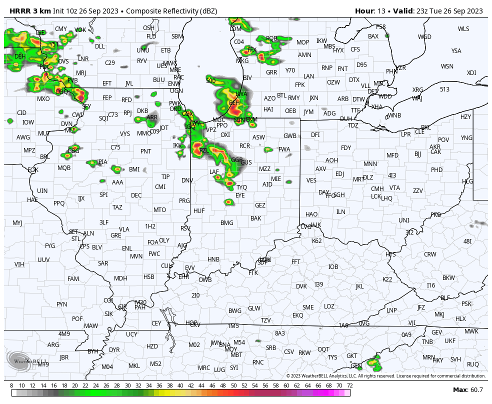
Storms should become most widespread just before sunset and continue into the overnight hours.
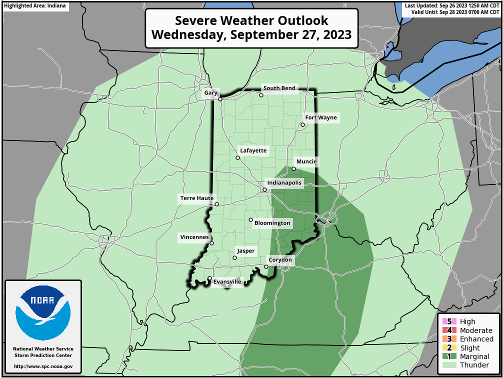
As we transition into Wednesday, morning convection will likely still linger before greatest concentration of rain and storms pivots to eastern and southeastern parts of the state by afternoon.
By the time all is said and done, many central Indiana rain gauges can expect to pick up between 0.50” and 0.75” of rain but there will be a few lucky folks that accumulate much more (type setup capable of 1”-2”+ in localized areas).

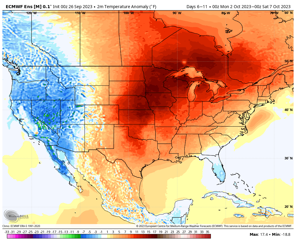
As we get set to rumble into the weekend, drier air will return and plentiful sunshine is expected. We still expect an unseasonably warm open to October with an extended stretch of days in the lower to middle 80s- good for 10° to 15° above the norm.
VIDEO: Does The Theme Continue Of Models Being Forced To Play “Catch Up” To Cooler Patterns?

Updated 09.06.23 @ 6:23a

You must be logged in to view this content. Click Here to become a member of IndyWX.com for full access.  Already a member of IndyWx.com All-Access?  Log-in here.

VIDEO: Getting To Be That Time Of Year Where Things Can Get Busy Quickly; Trending Unsettled And Cooler To Close The Week…

Updated 09.05.23 @ 7:55a

You must be logged in to view this content. Click Here to become a member of IndyWX.com for full access.  Already a member of IndyWx.com All-Access?  Log-in here.

Cold Front Offers Up PM Storms & Reinforces Pleasant Weekend Airmass; Heat Is On Next Week…

Updated 08.17.23 @ 6:04a

A quiet start to the day will give way to a noisy lunchtime period as a line of thunderstorms drops in from the northwest.

Vivid lightning, brief gusty winds, and heavy downpours can be expected.

The Storm Prediction Center has hoisted a ‘marginal’ risk of severe today. Widespread severe weather isn’t anticipated with this frontal passage.

Our unseasonably cool, pleasant airmass we’ve enjoyed the past couple days will be reinforced with this frontal passage. Lows tomorrow and Saturday morning will dip into the upper 40s in outlying areas. Dry and sunny conditions will compliment the early fall-like air. Soak it up as a period of unseasonably hot weather still awaits next week.

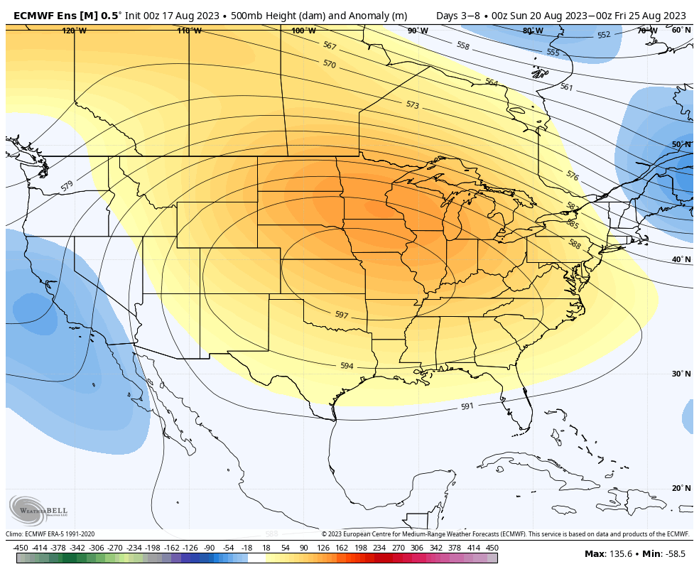
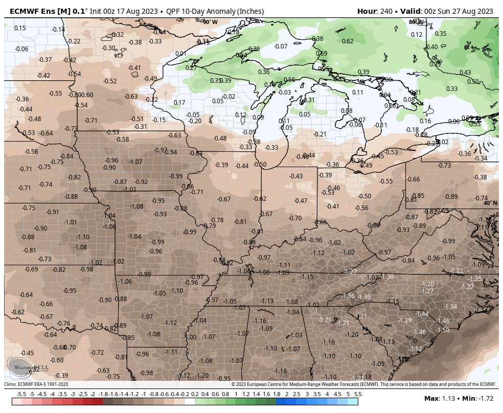
The byproduct of the sprawling ridge above? A week ahead with highs well into the 90s and an extended period of dry, sunny weather.

Monday Morning Rambles: Unsettled Open To The Work Week Gives Way To Pleasant Midweek Airmass…

Updated 08.14.23 @ 5a

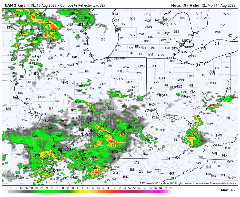
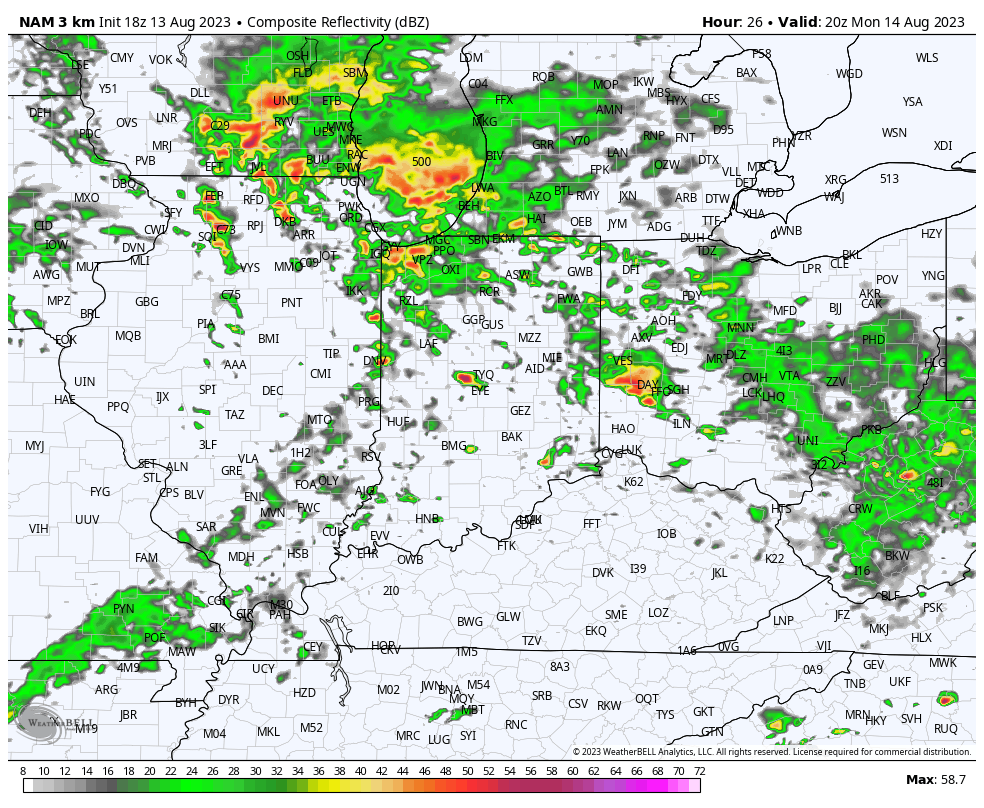
I. We’re tracking (2) cold fronts this week. The first will cross Indiana later this evening. Showers this morning will be most numerous across the southern half of the state and through east-central Indiana.

A new round of scattered storms, some of which will produce vivid lightning and gusty winds, along with locally heavy rain, will fire up ahead of the boundary, itself, later this afternoon and evening.

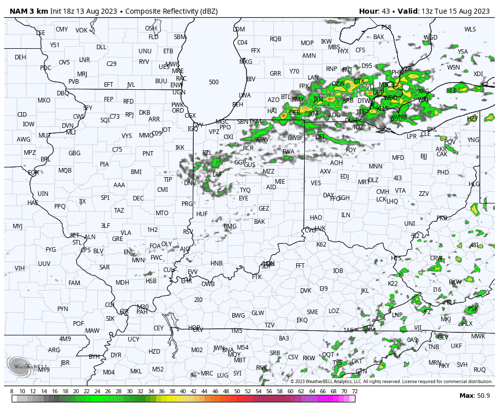
A few light showers will linger Tuesday before a much drier airmass takes hold. Cooler air will filter into the state Tuesday along with a gusty breeze at times.

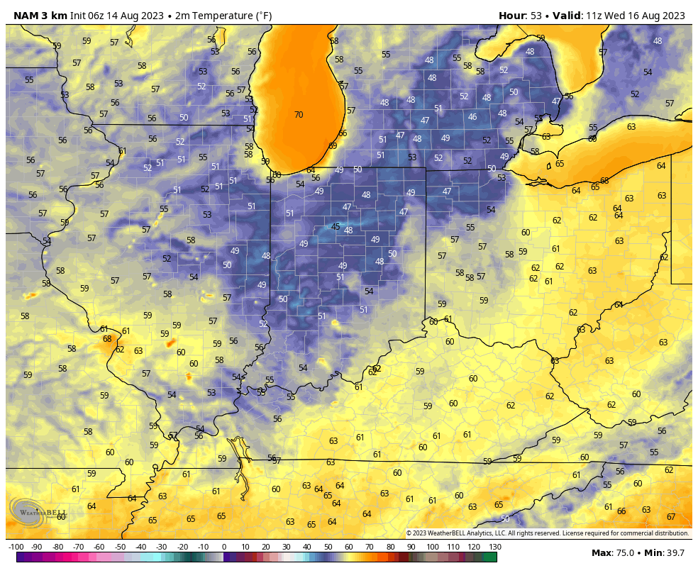
II. Speaking of drier air, how’s dew points into the 40s sound by Wednesday morning?! Are you kidding me? Not bad at all by mid August standards…

A few folks outside of the city, especially across north-central IN might even fall into the 40s to start the day Wednesday. A hint of fall, indeed…

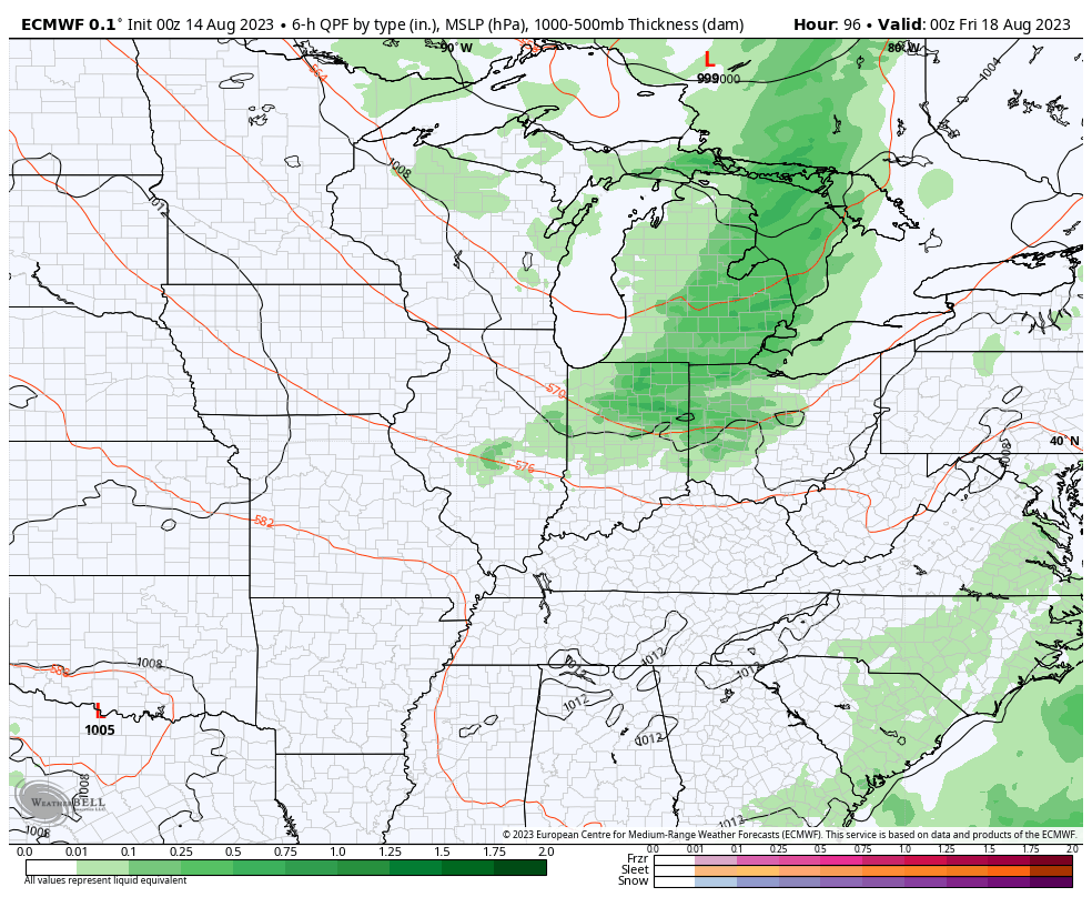
III. The next in our series of cold fronts has it’s eyes set on our region Thursday evening. After a nice start to the day, we’ll need to watch for the potential of strong to severe storms firing up by Thursday evening ahead of the boundary. We’ll closely monitor this threat over the next couple of days and provide future updates.

As of now, it looks like dry weather will return to close the work week, including right into early parts of next week. Unseasonably cool and refreshing temperatures will give way to a warming trend Week 2…