Just A Little Busy In The Forecast Office…

Updated 02.22.24 @ 7:20a

“Busy” is one way to describe the upcoming week to 10 days worth of weather as the pattern around these parts, and a large chunk of the East, takes on a spring look and feel. Everything from thunderstorms, rain, clipper snow, and an opportunity for strong to severe storms is included in the week ahead.

An area of low pressure will move through central and southern Indiana this afternoon, continuing to present scattered to numerous showers and thunderstorms across the area. While north-central Indiana has been the focal zone for early morning activity, we anticipate more of central and southern Indiana will be impacted throughout the afternoon and early evening.
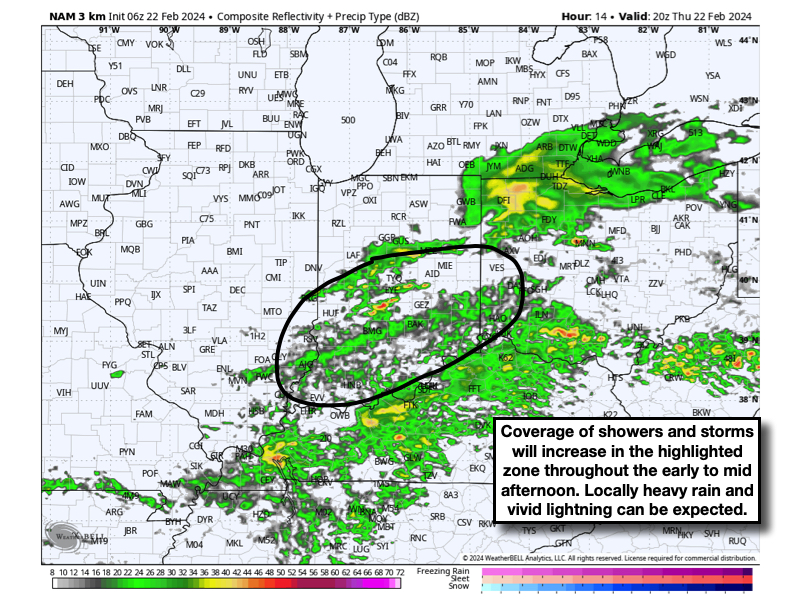
All of this precipitation and embedded thunder will push off to the south of the area around or just after dinnertime. A quiet night is on deck with cooler air flowing back into the state. This will lead to a calm close to the work week as temperatures “warm” back to around 50° Friday afternoon as sunshine returns.

As we open the weekend, a rapidly moving clipper system will drop southeast across the region, eventually leading to several inches of wet snow for the east TN and western NC mountains. Back here on the home front, a period of snow is expected to develop late Friday night and predawn Saturday. While this certainly won’t be anything like what we saw last Friday, a wet coating of snow is possible in spots as this upper air feature dives across the region. By daybreak Saturday, all of the snow will be out of the area and we’ll be talking about working in more in the way of sunshine into the mix as our day progresses. Gusty northerly winds Saturday morning will diminish as the day wears on.

A quick warm-up is on the way for the 2nd half of the weekend. In fact, highs will approach 60° Sunday afternoon (how’s that for weather whip-lash?!). These warmer times will allow a more potent round of storm to rumble across the region as we progress through the early stages of next week. A warm front will lift northeast across the region Monday with showers and then attention turns to the threat of strong to severe thunderstorm potential as we go through our Tuesday and Wednesday. More on the specific timing and severe threats (damaging straight line wind appears to be the biggest concern from this distance) with updates to come in the days ahead.

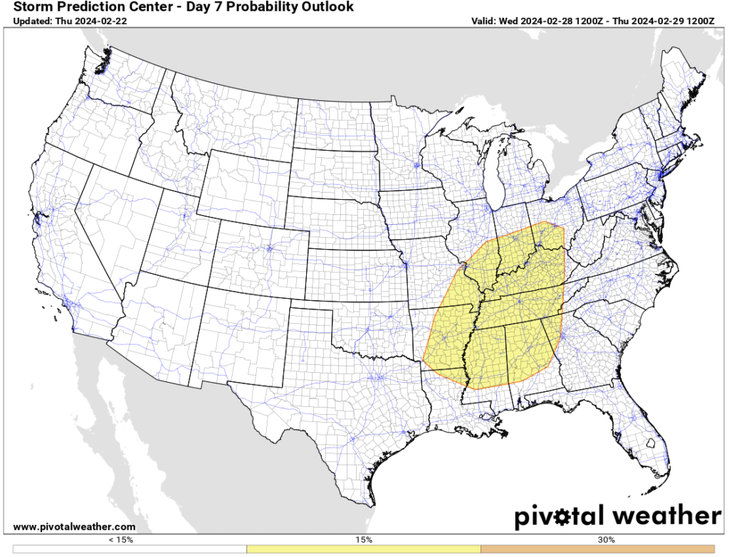
The Storm Prediction Center (SPC) is already highlighting the region for the opportunity of severe weather Tuesday and Wednesday.
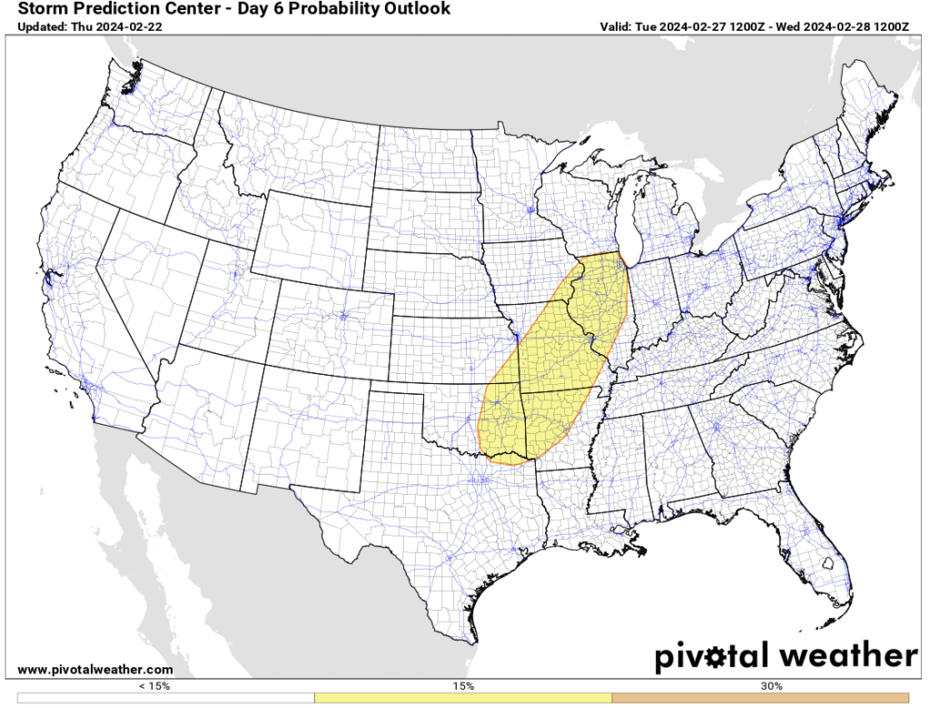
Tuesday (2/27) Severe Weather Outlook: Source SPC
Wednesday (2/28) Severe Weather Outlook: Source SPC

Spring; #Plant24 Outlook…

Updated 02.10.24 @ 7:20a

Though we still have a few weeks left of meteorological winter, spring and the #Plant24 season will be here before we know it! The headlines that we anticipate to claim the coming months include the following:

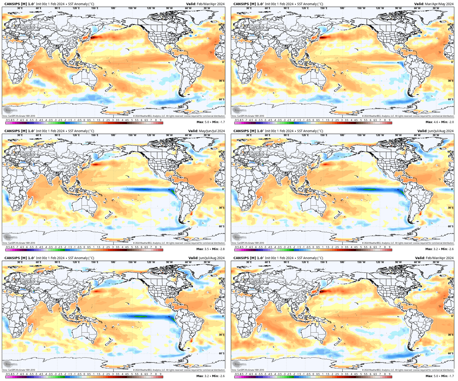
  • El Niño likely continues to collapse; La Niña state by late spring/ early summer
  • Widespread wetter than average conditions anticipated for a large chunk of the country, including central Indiana. Opportunity for above average severe weather episodes during the March through May (meteorological spring) time period.
  • Time to prep for a hyper active hurricane season along the Gulf and Southeast US coastlines.

Long range, seasonal forecast models, continue to show the current El Niño collapsing and moving swiftly towards a La Niña late spring and early summer.

This transition will certainly have impacts on the anticipated precipitation and potential of a busier severe weather season this spring. We forecast a rather swift Nino collapse and subsequent onset of La Niña, which ups the ante for a wet spring, not only locally, but across a widespread chunk of the country. Undoubtedly, this could lead to plant24 impacts (delays) at times.

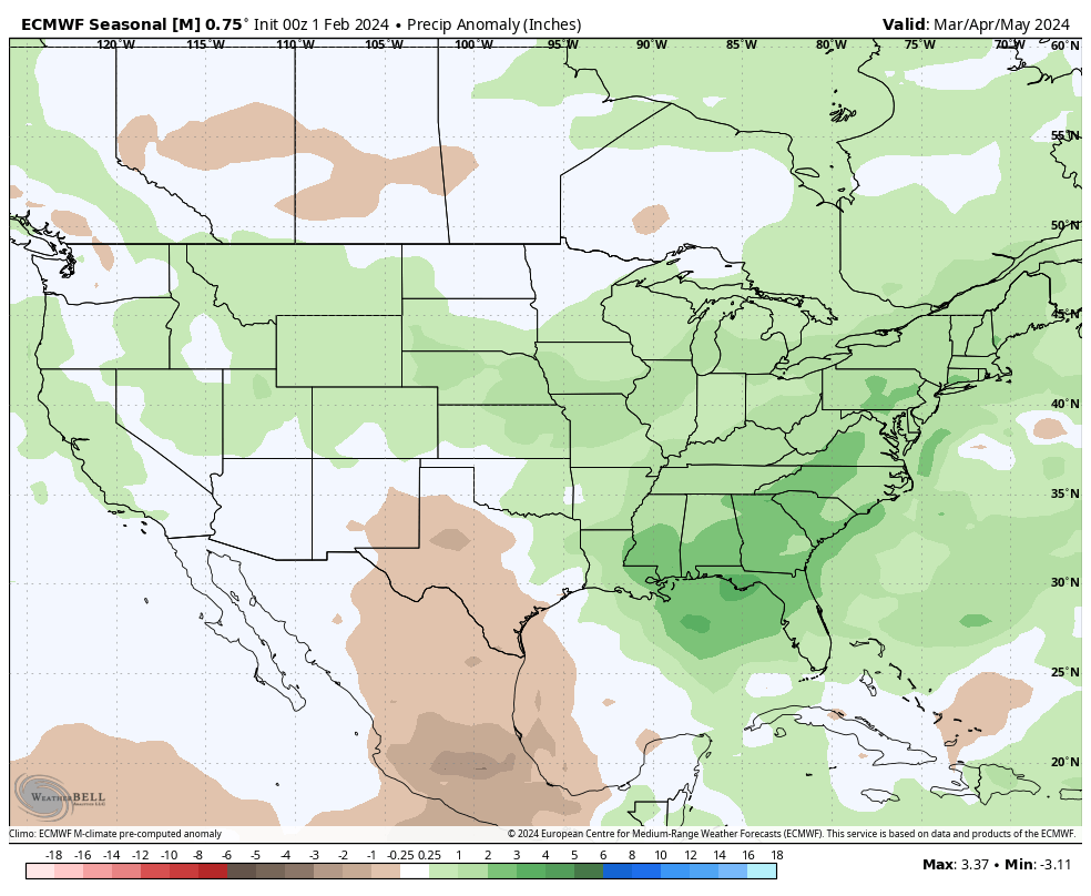
Seasonal products see the above average rain expected for spring 24.

European Seasonal Precipitation Anomalies March through May
JMA Precipitation Anomalies March through May

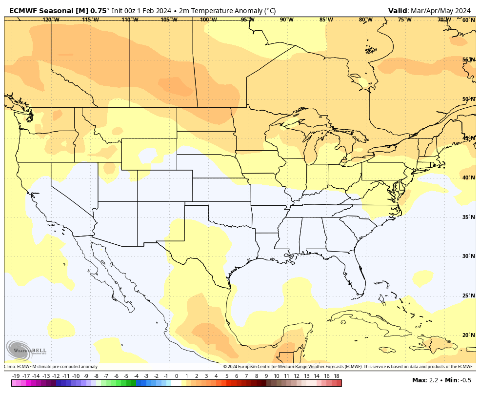
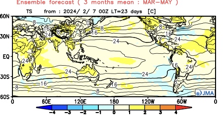
From a temperature perspective, we forecast widespread milder than normal temperatures as a whole for the season across the northern tier, including central Indiana. We caution though that the way we get to slightly (1° to 2° above normal on the season) milder overall may include wild swings through the season. For example, we forecast a colder than normal 1st half of March, the potential of a significant flip to warmer the 2nd half and a cooler pattern to return for the bulk of April.

European seasonal temperature anomalies March through May
JMA temperature anomalies March through May

IndyWx.com Spring/ #Plant24 Outlook for central Indiana:

  • Temperatures that average 1° to 2° above normal overall for the March-May period.
  • Precipitation that runs 125% to 130% of normal during meteorological spring.

Wishing the best of luck and positive vibes to all in the months ahead, especially our #AGwx partners. Happy spring!

VIDEO: Potential Of Significant Period Of Cold; #Plant24 Pattern Thoughts…

Updated 02.05.24 @ 6p Potential is on the increase for a period of notable cold during late-February. We look into this along with the staying power, and early thoughts on…

You must be logged in to view this content. Click Here to become a member of IndyWX.com for full access.  Already a member of IndyWx.com All-Access?  Log-in here.

Dinnertime Rambles: Been A Few Years, Indeed…

Updated 01.08.24 @ 5:07p

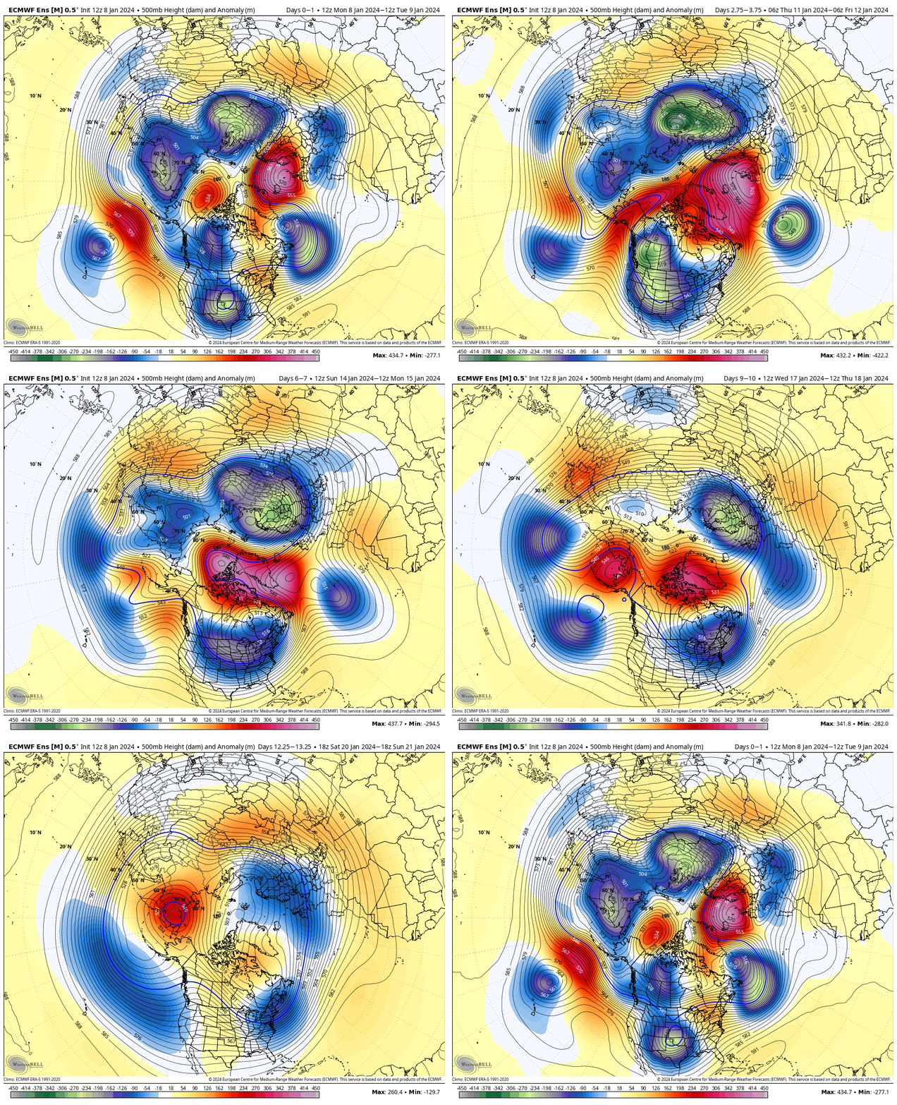
We open this evening by taking a look at the latest ensemble charts, courtesy of today’s 12z European run. While there’s simply no way of being able to guarantee the upcoming 10-day’s worth of snow in one single back yard, long suffering folks of significant winter weather across not only central Indiana, but a widespread chunk of the Ohio Valley, couldn’t ask for a more classic pattern.

First, the textbook high latitude blocking kicks off the active storm track and then bitterly cold, arctic air pours into the eastern portion of the country. Signs of this potential blocking and storminess were starting to show themselves back in the latter part of the summer. We added a couple of those analogs into building this year’s winter outlook, including the potential of blocking. By the way, it was back in January of 2019 when Indianapolis last recorded our last double digit below zero temperature (11F below zero). I still like our chances of getting into that territory between the 14th and 18th. Wind chill values will likely be much colder.

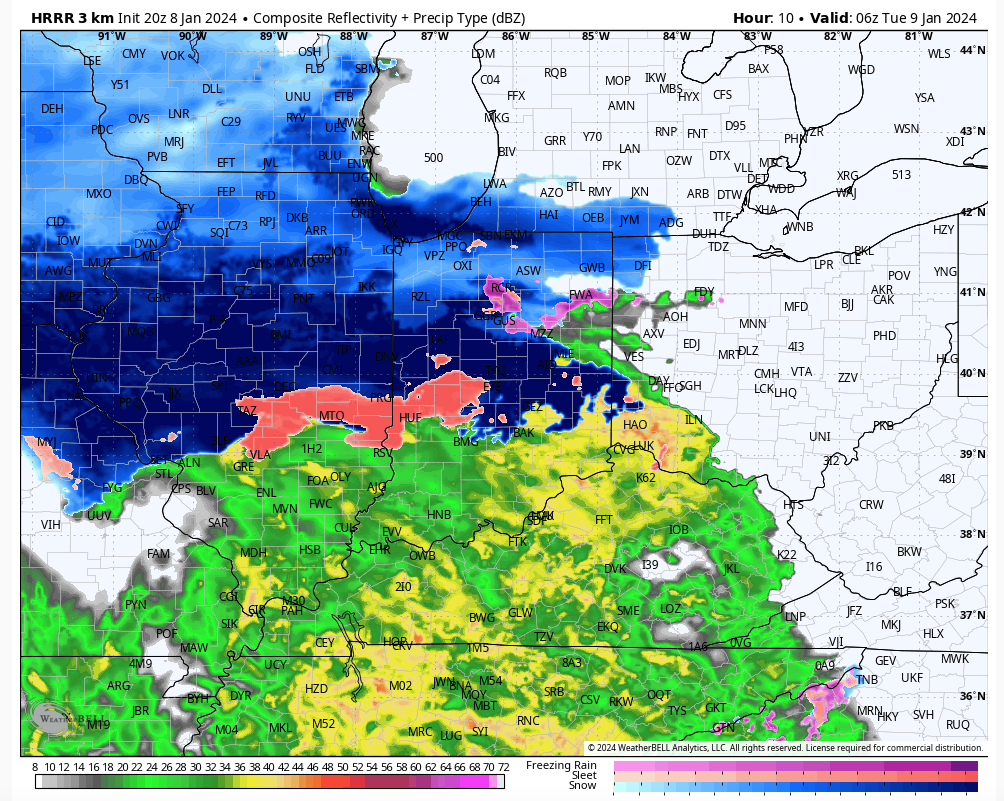
Now, back to the present. We don’t have any changes regarding tonight and predawn Tuesday. A “thump” of heavy wet snow, mixed with sleet will make for messy travel north of I-70 towards 11p to midnight, continuing into the predawn. Thankfully this will arrive when most are off the roads, but just a heads up if you have late night travel, expect slick conditions starting around 11p, or so. In fact, some of the latest guidance suggests IND may be looking at 1″/ hr snow rates during the onset of this precipitation late evening. Northern ‘burbs, it wouldn’t surprise me at all to accumulate a quick 2″ to 3″ of wet snow and then some sleet before the transition to rain predawn. Even though we’ll all be dealing with a wind-whipped cold rain by daybreak, those living from the northern ‘burbs and points north should expect slushy and slick conditions for the AM commute.

A heavy “thump” of wet snow, mixed with sleet will make things slick late tonight into predawn Tuesday.

After a brief milder surge and continued gusty winds during the daytime Tuesday, colder air will wrap back into the region allowing rain to transition to light snow tomorrow night, continuing into Wednesday morning. Additional slick spots are likely for the Wednesday morning commute, though late tonight and early Tuesday will likely be more problematic north.

Attention then shifts to our late week winter storm. While I have a hard time seeing the incredibly potent GFS solution verifying, I do like the stronger low pressure options (when compared to the flatter wave idea). – Always have to watch out for rapidly strengthening lows that like to cut up west of the mountains when you get the true arctic branch diving in with the expected trajectory currently modeled. Bottom line, at this distance we don’t see any need to deviate from the idea of rain to start, switching to a wind-whipped snow event, complete with plummeting temperatures and strong, potentially damaging, winds. I’d plan on additional travel impacts late week into the weekend.

The “big cold” follows behind this storm and then we’ll eye the opportunity for additional snow next week…

VIDEO: Another Unsettled Day; Page Turns To Extended Dry And Unseasonably Warm Stretch To Open October…

Updated 09.27.23 @ 7:41a

You must be logged in to view this content. Click Here to become a member of IndyWX.com for full access.  Already a member of IndyWx.com All-Access?  Log-in here.