 Highlights:
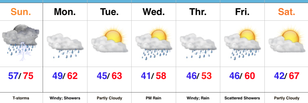
- Rain ends and sunshine arrives later today
- Pleasant Carb Day
- Stormy at times this weekend
Trend Is Our Friend Today…Showers are “pinwheeling” around an area of low pressure to our east this morning, but these will begin to diminish as we move through the late morning and into the early afternoon. In fact, we think sunshine works in here later this afternoon and provides a pleasant finish to the day!
The majority of Friday will feature sunshine and pleasantly warm conditions by afternoon. We’ll keep a close eye on the radar Friday evening/ night, but currently believe thunderstorms will remain just north of here.
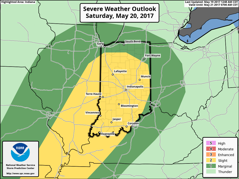
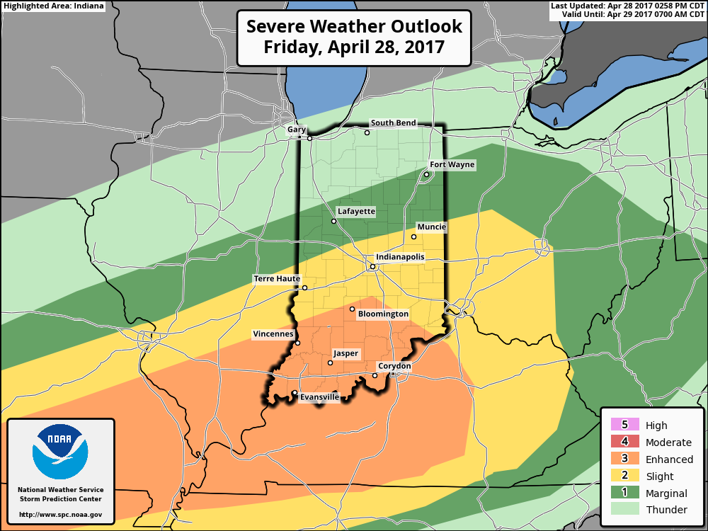
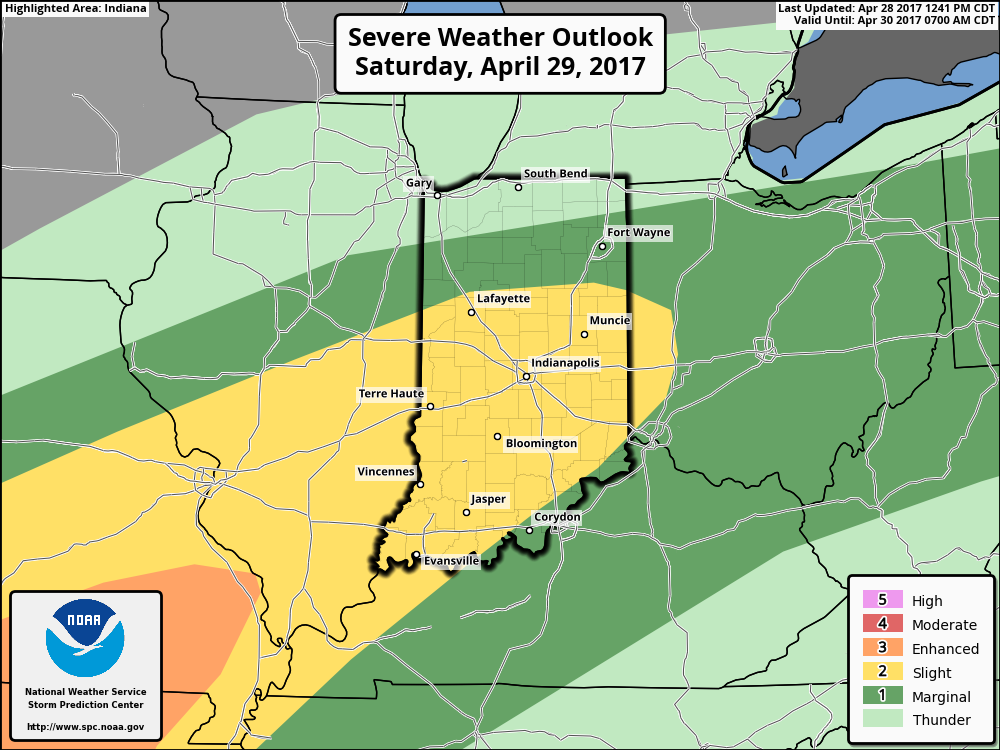
Unfortunately, the long race and Memorial Day weekend won’t be rain-free, but it also won’t be a wash-out. Most widespread thunderstorm activity should arrive Saturday evening into Sunday morning and some of these could become strong to severe. The current Day 3 (Saturday) Outlook from the Storm Prediction Center places central and southern portions of the state under a Slight Risk.
 While we can’t completely rule out an afternoon shower or storm Sunday, the most widespread activity should occur during the morning hours- before race time. Stay tuned. We’ll turn cooler early next week…
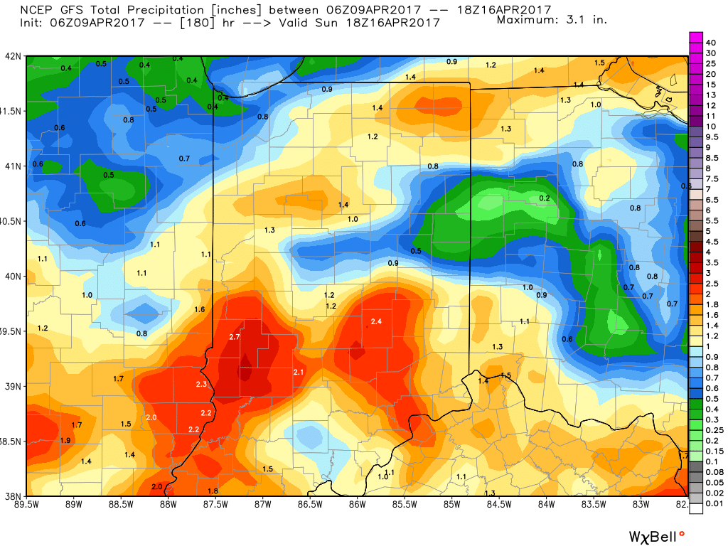
Upcoming 7-Day Precipitation Forecast:
- Snowfall: 0.00″
- Rainfall: 1.25″ – 1.75″
 The culprit is a stalled frontal boundary that lies across the center of the state. This front will “bobble” around from time to time over the next 24 hours before lifting back north as a warm front Saturday evening. Accordingly, expect a significant temperature spread from north to south today and periods of showers and thunderstorms scattered about central Indiana. With high precipitable water values, localized heavy rains are expected, but, as mentioned, this won’t be a “uniform” event and there will be “haves and have nots.” Some neighborhoods can expect to pick up a 2-3 inches of rain between now and Sunday afternoon. Greatest severe threats include large hail and damaging straight line winds with storms, but we’ll also have to monitor things for the potential of a couple rotating storms as well.
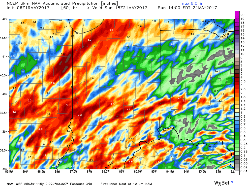
 Highlights:
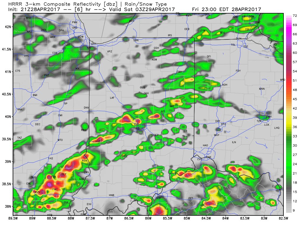
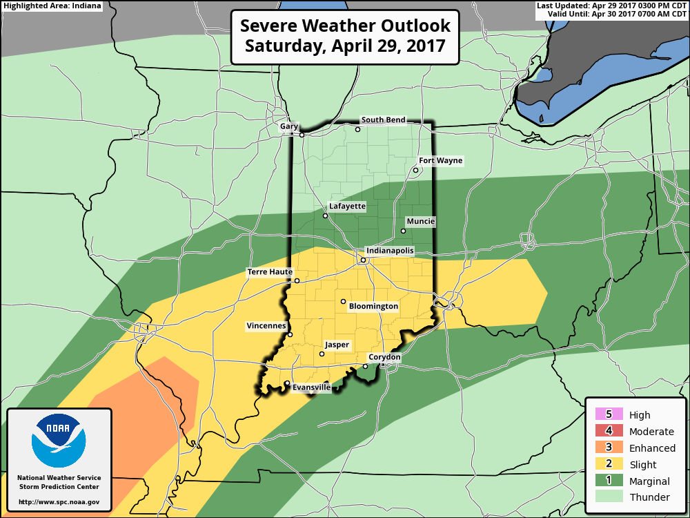 We think an eastward-advancing line of thunderstorms will blow into central Indiana later this evening (between 9p and midnight). Some of these may reach strong to severe levels with damaging straight line winds of greatest concern. Additionally, torrential downpours will occur within this line of storms.
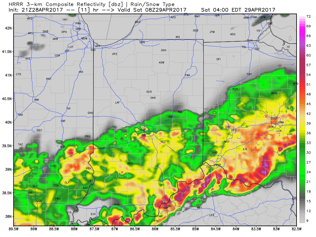
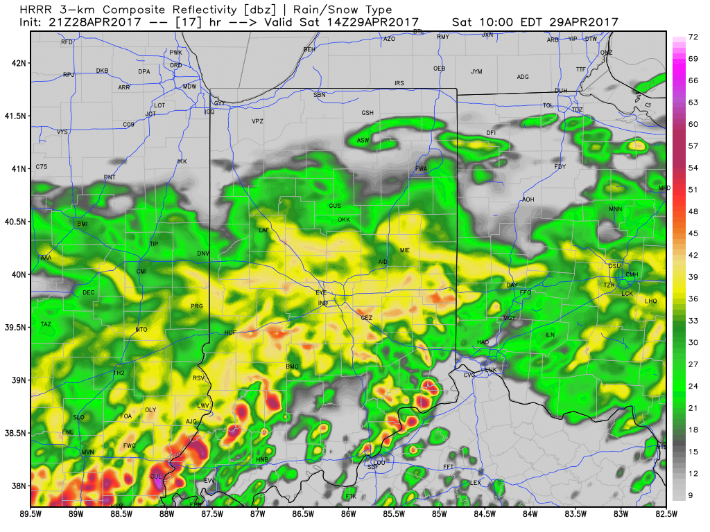
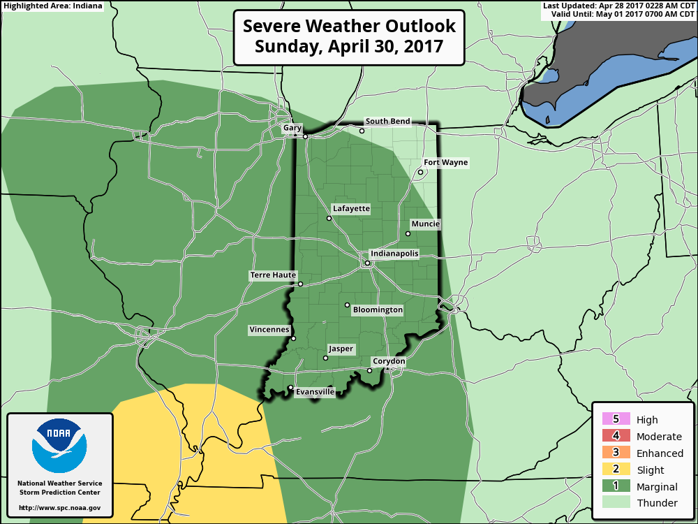 Once all is said and done, we anticipate widespread 2″-3″ rainfall totals through central Indiana, but also note there will be localized heavier amounts. Once to Monday we’ll look at a much cooler, windy, and “showery” regime. Look for falling temperatures through the day Monday and this will set the stage for the week ahead: MUCH cooler, overall…. More on that later this weekend!
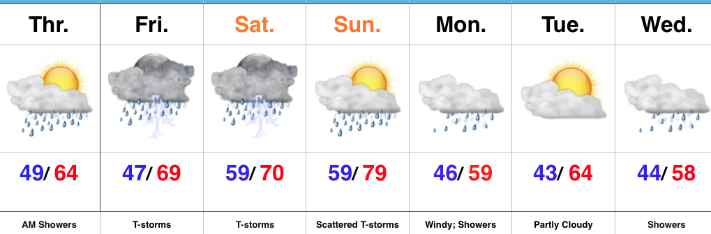 Highlights:
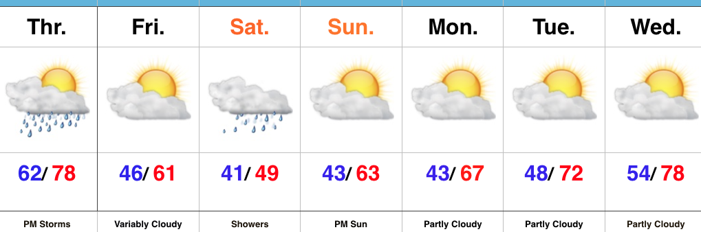 Highlights:
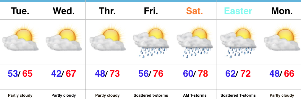 Highlights:
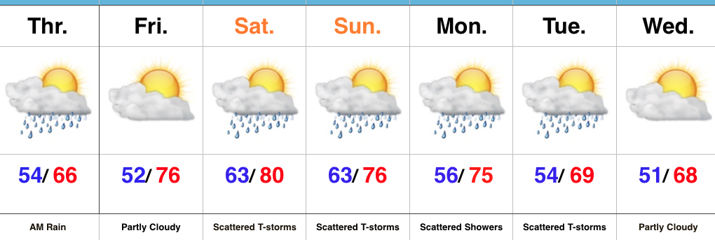
 Highs will run close to 15° above average this afternoon.
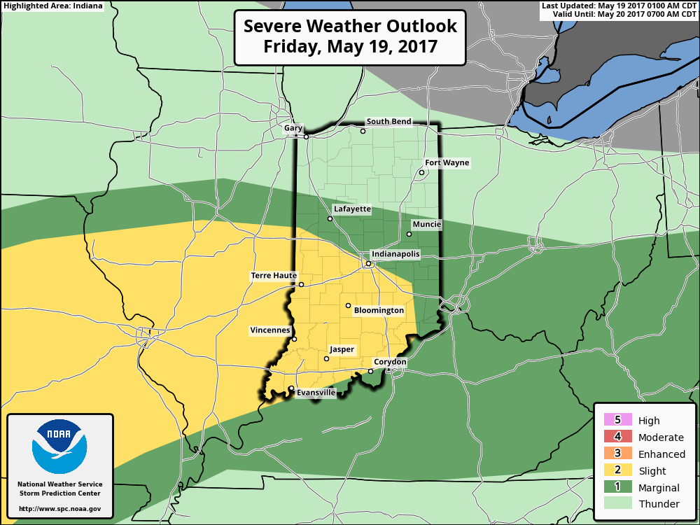
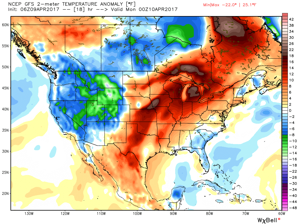 Stormy weather returns Monday as a frontal boundary slips into the state. A couple storms may become strong or severe Monday afternoon and the Storm Prediction Center highlights northwestern portions of the state for a Slight Risk. Damaging straight line winds are of greatest concern with any severe storm that may develop.
 High pressure returns for midweek and supplies a dry regime, along with increasing sunshine and temperatures that will run slightly above average (mid-40s at night and 65°-70° during the day).
 There are questions once to the end of the period as the GFS and European handle the evolution of our late-week storm differently. The GFS brings energy out into the Ohio Valley and results in unsettled weather returning Friday, continuing into Easter weekend, while the European is slower. We’ll keep an eye on things over the next few days and update accordingly. The GFS suggests some localized heavier downpours would be possible in the Friday-Sunday period as the majority of the 7-day precipitation snapshot below falls within the timeframe.