Category: Severe Weather

Rain And Embedded Thunder Increases This Afternoon; Strong Wind Event Tonight…

Our quiet Saturday will transition to a rather “bumpy” time of things by the afternoon into tonight as a storm system moves through. Showers and embedded thunder off to our southwest this morning will rumble across central Indiana this afternoon and evening.

Radar update at 11:15a

Forecast radar products show widespread showers and embedded thunder through the afternoon hours into the evening. Coverage of rain will be greatest between 2p and 6p. Some locally heavy downpours are possible. While severe weather isn’t expected across central Indiana, a few strong to severe storms, capable of damaging straight line winds, will be possible across southern parts of the state. Storm total rainfall amounts of 0.75″ to 1.25″ will be common across the region.

Attention will then shift to strong and gusty winds this evening into tonight. Gusts of 50-55 MPH will be common across central Indiana during this timeframe. Unfortunately, downed trees and potential for power outages will be on the increase tonight.

Winds will remain gusty into Sunday morning, but begin to diminish through the day.

Permanent link to this article: https://indywx.com/2019/03/09/rain-and-embedded-thunder-increases-this-afternoon-strong-wind-event-tonight/

VIDEO: Storms Rumble In This Afternoon; Looking Ahead To The Remainder Of March…

A wet and stormy time of things will develop this afternoon, followed by increasingly gusty winds tonight and early Sunday. Winds will gust in excess of 50 MPH at times…

You must be logged in to view this content. Click Here to become a member of IndyWX.com for full access.  Already a member of IndyWx.com All-Access?  Log-in here.

Permanent link to this article: https://indywx.com/2019/03/09/video-storms-rumble-in-this-afternoon-looking-ahead-to-the-remainder-of-march/

Friday Morning Video Update: Unsettled And Windy Weekend On Deck…

The weekend will feature showers and thunderstorms along with strong and gusty winds (in excess of 50 MPH at times Saturday evening-night)…

You must be logged in to view this content. Click Here to become a member of IndyWX.com for full access.  Already a member of IndyWx.com All-Access?  Log-in here.

Permanent link to this article: https://indywx.com/2019/03/08/friday-morning-video-update-unsettled-and-windy-weekend-on-deck/

Long Range Video Update: Changeable Pattern For The 2nd Half Of March Into April…

You must be logged in to view this content. Click Here to become a member of IndyWX.com for full access.  Already a member of IndyWx.com All-Access?  Log-in here.

Permanent link to this article: https://indywx.com/2019/03/07/long-range-video-update-changeable-pattern-for-the-2nd-half-of-march-into-april/

All-Access Video: Talk About a Busy Pattern…

Accumulating snow arrives tonight and we look ahead to an active weather pattern…

You must be logged in to view this content. Click Here to become a member of IndyWX.com for full access.  Already a member of IndyWx.com All-Access?  Log-in here.

Permanent link to this article: https://indywx.com/2019/03/07/all-access-video-talk-about-a-busy-pattern/

Running the Gamut; Looking Ahead to April…

We’ll apologize in advance for the long-winded post tonight, but there’s a lot to cover. Not only do we have the accumulating snow on deck, a couple of strong storm systems this weekend into the middle of next week, but the long range pattern is set to turn cold (again) after a mid-month respite. We also want to look ahead to our early thoughts towards April…

Let’s take things one at a time:

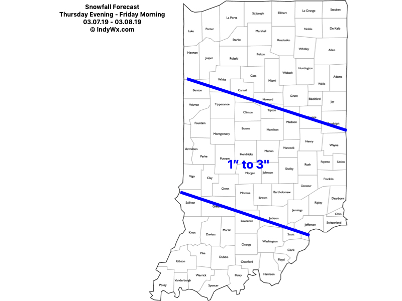
Thursday-Friday Snow

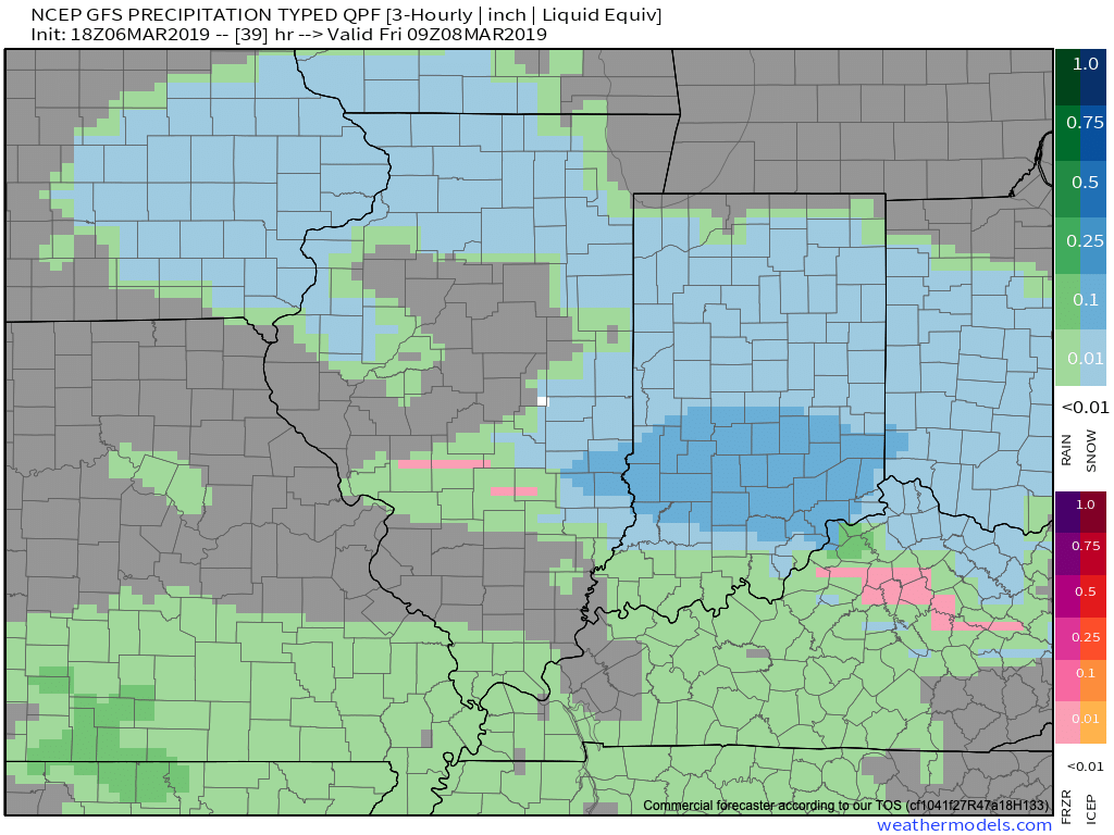
While we don’t have major changes to our ongoing snowfall forecast, we have “sagged” the swath of 1″ to 3″ snow south just a hair given the latest computer model guidance. Steadiest snow should fall Thursday night into the predawn hours Friday. We’d anticipate a slick Friday morning commute through the heart of central Indiana.

Snow should exit off to the southeast around, or just before, lunchtime Friday. As always, your ground-truth reports are welcome (feel free to send to us on Twitter or via e-mail).

Warmer Side Of Things

The ‘mean’ trough position will shift to the west (temporarily) and lead to an overall milder time of things for the mid-month stretch. Unfortunately, the milder air will come with a wetter pattern.

This milder, wetter pattern will be highlighted by (2) storms:
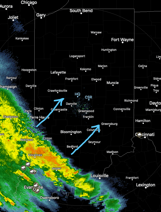
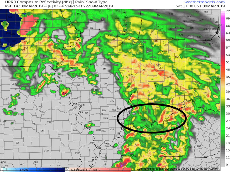
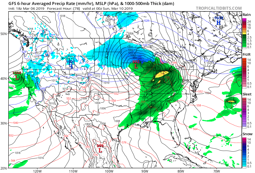
I. Saturday, 3/10

II. Tuesday-Wednesday, 3/12-3/13

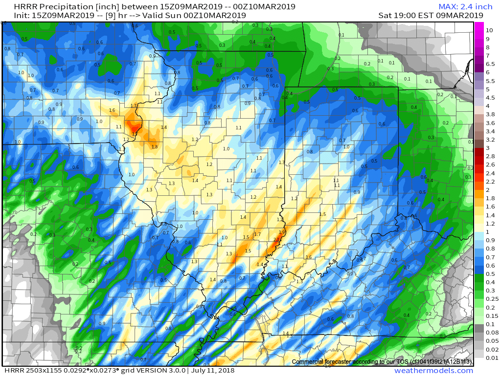
Both storm systems will be capable of producing locally heavy downpours and embedded thunder. Greatest chances of severe will remain south of central IN with this weekend’s storm, but may be further north next week. We’ll keep a close eye on things and issue Client Briefs if need be as we get closer.

A combination of the GFS and European computer models print-out rainfall totals between 1″ and 2″ over the upcoming 10-days and this seems reasonable given the fact both storm systems will be able to tap into Gulf of Mexico moisture.

From a temperature perspective, the brutal cold will come to an end behind our late week snowmaker. While “transient” chill will follow both of the upcoming storm systems, we’re heading into a much milder pattern, overall, through the mid-March stretch. Mildest air will come directly in front of the storm systems, highlighted by a couple of 60 deg. + days the middle of next week.

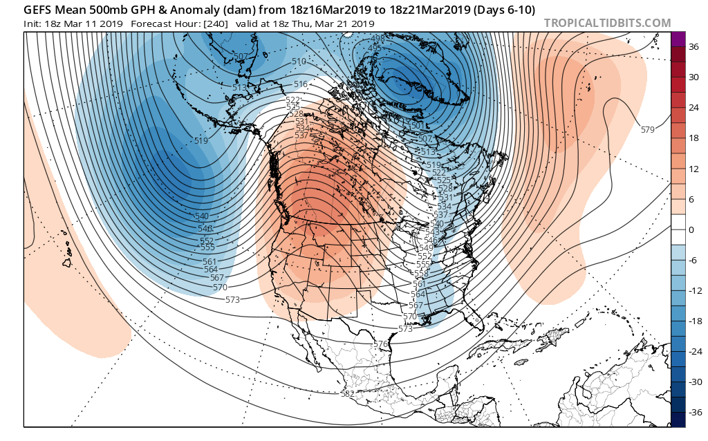
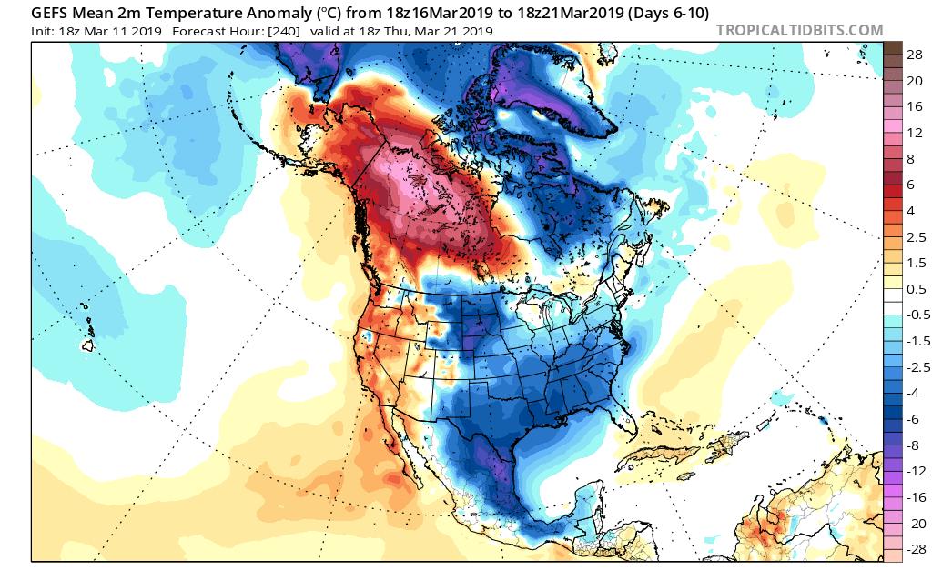
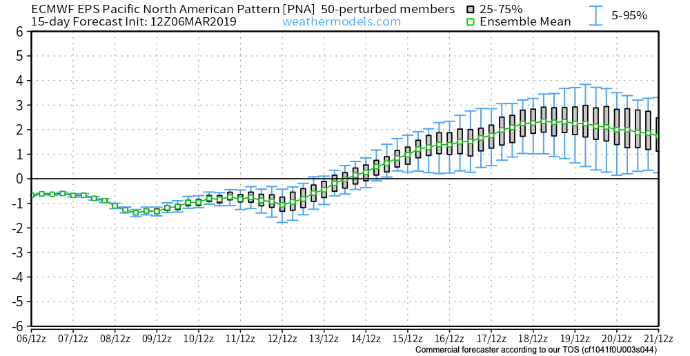
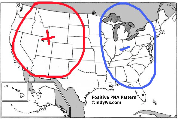
Positive PNA takes over

Unfortunately (for lovers of spring), the mid-month warm-up will be only a “tease” as we’re set to trend cooler, relative to normal, for the last 10 days of the month. The reason? A developing positive PNA.

To no surprise, we see the cooler pattern returning on the computer models:

Not only will we turn colder to close the month, but Thursday likely won’t be our last accumulating snow of the season…

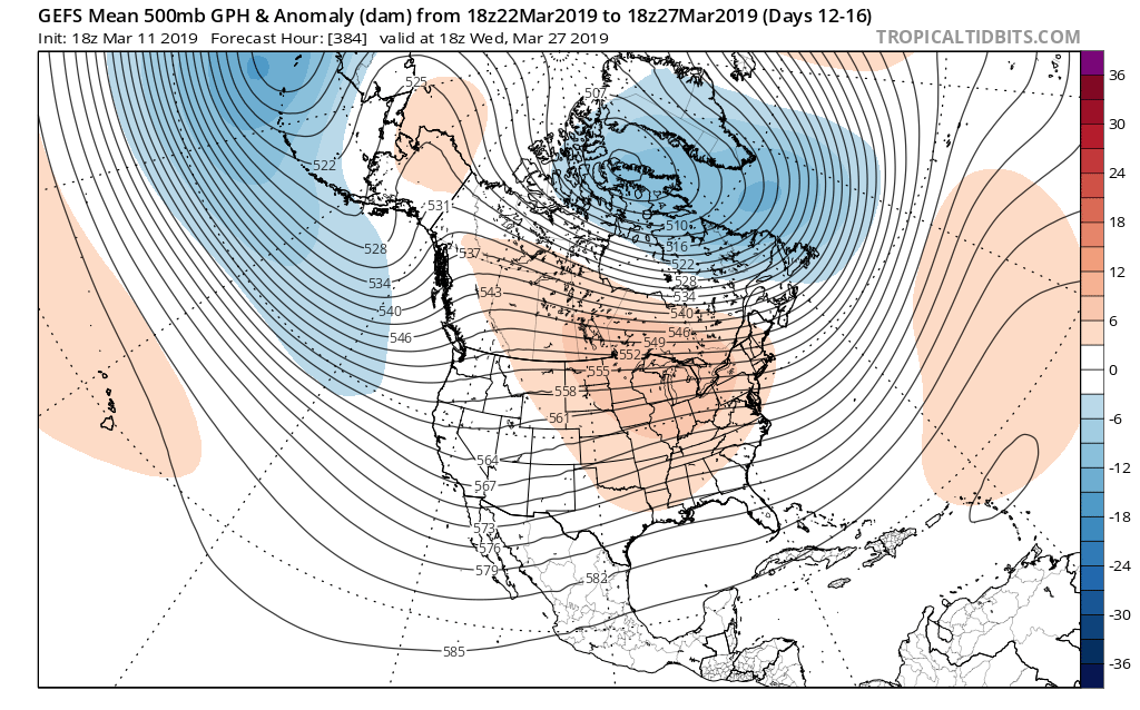
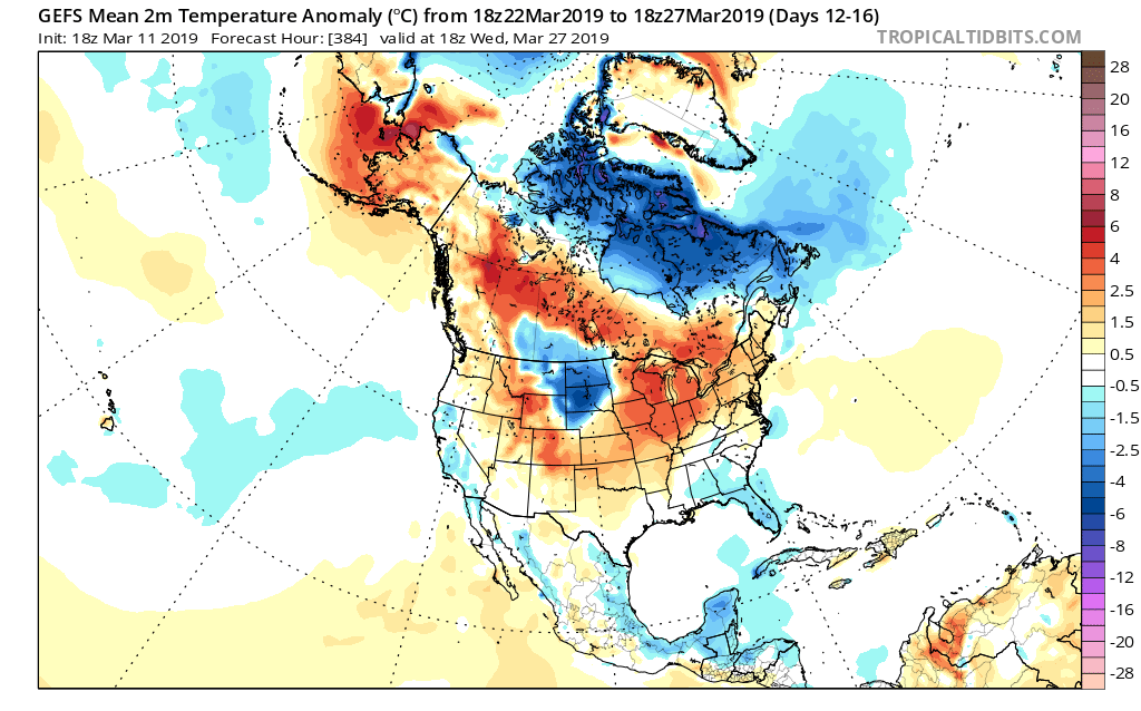
Looking Towards April

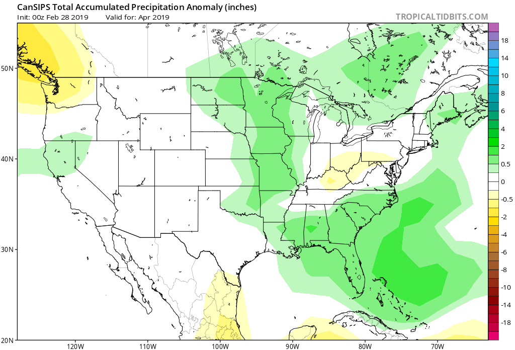
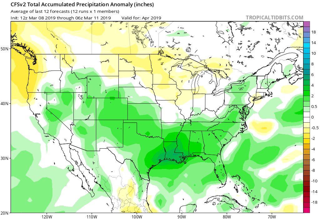
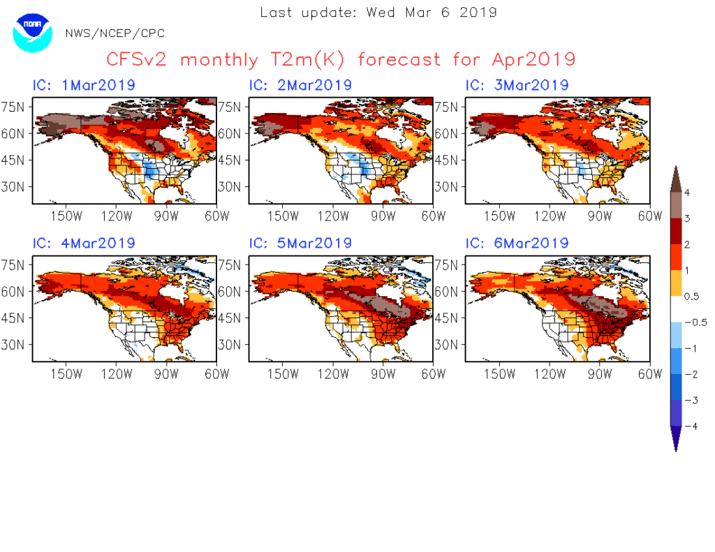
Despite the late-March “set back” to a chilly time of things, we continue to think a more sustained “stick and hold” spring pattern looms around the corner. In fact, we agree with the latest CFSv2 delivering a warmer than normal pattern for April, as a whole, to the eastern portion of the country.

Note that as we go, the model is getting warmer for April with each passing day. As things stand now, we think the trough will pull back to the west with a more sustained ridge in place across the eastern portion of the country in April. With this, a wetter than average regime likely awaits, including an uptick in severe chances further north into the region.

Permanent link to this article: https://indywx.com/2019/03/06/running-the-gamut-looking-ahead-to-april/

“Hectic” March Pattern Rumbles Along…

After tomorrow’s accumulating snow event, we’re tracking 2 storm systems and a temporary warm-up over the weekend into next week. Don’t get used to the warmer air, as a positive…

You must be logged in to view this content. Click Here to become a member of IndyWX.com for full access.  Already a member of IndyWx.com All-Access?  Log-in here.

Permanent link to this article: https://indywx.com/2019/03/06/hectic-march-pattern-rumbles-along/

Video Update On Thursday’s Accumulating Snow; Active Pattern Continues…

An active pattern continues with accumulating snow arriving Thursday and the chance of a couple of heavy rain events this weekend into the middle of next week…

You must be logged in to view this content. Click Here to become a member of IndyWX.com for full access.  Already a member of IndyWx.com All-Access?  Log-in here.

Permanent link to this article: https://indywx.com/2019/03/05/video-update-on-thursdays-accumulating-snow-active-pattern-continues/

VIDEO: All-Access Long Range Update…

This evening’s long range video update discusses the pattern drivers behind the late-March weather pattern…

You must be logged in to view this content. Click Here to become a member of IndyWX.com for full access.  Already a member of IndyWx.com All-Access?  Log-in here.

Permanent link to this article: https://indywx.com/2019/03/04/video-all-access-long-range-update/

Snow Update And Looking Ahead Towards Mid-March…

Snow will overspread central Indiana through the late morning hours into the afternoon.

While the overall idea where the accumulating snow would fall was a good one from early week, our initial expected amounts won’t come to fruition. The reason? The storm system is much weaker and faster moving than originally modeled.

Accordingly, this is a 1″ to 2″ type event for most of the area. The majority of the snow will fall from noon to 5p.

A period of snow will scoot across central Indiana from late morning into the early evening hours.

This same storm system will be responsible for a severe weather outbreak, including the possibility of a couple of strong tornadoes, across the Deep South this afternoon.

Back here on the home front, MUCH colder air will pour into the region this evening, remaining in place into the new work week. Back-to-back nights with lows in the upper 0s to lower 10s can be expected across central Indiana Monday and Tuesday mornings.

This is all part of the overall colder than normal first half of March, powered by the SOI crash (several week ago), deeply negative EPO, and MJO rumbling through the cold phases.

Additional storm dates to keep note off include Thursday night into Friday (more of a wintry threat with the 3/7-3/8 system) and Saturday into Sunday (potential strong thunderstorms with the system on 3/9-3/10).

Looking ahead, it still appears the mid-March warm-up is on track as the EPO flips to positive.

With that warm-up will also come a return of heavier precipitation events and a continued overall active storm track across the region. Precipitation looks to run above average for the mid-month stretch.

We’ll dig deeper early week on what lies ahead as we close the month of March and look ahead towards April…

Permanent link to this article: https://indywx.com/2019/03/03/snow-update-and-looking-ahead-towards-mid-march/

IndyWx.com