VIDEO: Sharply Colder Today Before A Quick Warm-Up; No Let Up To The Warm Pattern Down The Road…

Updated 02.28.24 @ 7:44a Today will serve as a reminder we are still in winter, after all, but another quick warm-up will get underway as we head through the weekend…

You must be logged in to view this content. Click Here to become a member of IndyWX.com for full access.  Already a member of IndyWx.com All-Access?  Log-in here.

Dinnertime Rambles: Active Night And Sharply Colder Wednesday…

Updated 02.27.24 @ 6:42p

As we write this update, severe storms are firing across northern IL where a Tornado Watch has been issued until 11p (eastern). Meanwhile, all is quiet on the home front, thanks to strong “capping” in the mid levels of the atmosphere. Unfortunately, that cap likely won’t hold and we still anticipate scattered strong to severe storms to impact central and southern Indiana during the overnight.

All modes of severe weather remain on the table, including damaging straight line winds, large hail, and tornadoes. Initiation of convection across central/ southern IN should come around or just after midnight and end by 3a to 4a (west to east).

Please make sure you have a means to receive the latest severe weather alerts prior to heading to bed tonight.

By the time most are waking up Wednesday, we’ll be talking about an entirely different array of conditions. Sharply colder air, light snow showers, and strong northwesterly winds will ensure to remind folks it’s late-February, after all.

VIDEO: Severe Weather Expected This Evening And Overnight; Sharply Colder Wednesday…

Updated 02.27.24 @ 5:58a An unseasonably warm and quiet daytime will take a stormy turn tonight. All modes of severe weather are in play late evening and into the overnight,…

You must be logged in to view this content. Click Here to become a member of IndyWX.com for full access.  Already a member of IndyWx.com All-Access?  Log-in here.

Monday Evening Thoughts On Storm Potential Tonight – Wednesday…

Updated 02.26.24 @ 5:51p

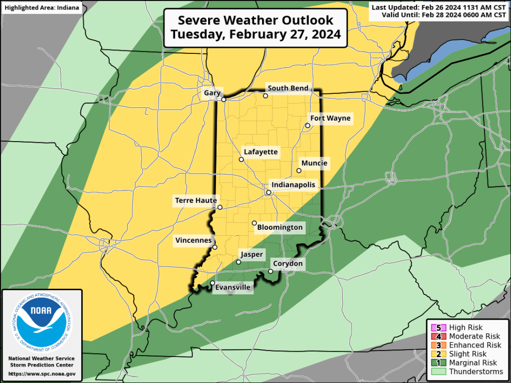
The Storm Prediction Center (SPC) has expanded the ‘marginal’ risk area within their Day 1 Outlook. This is for the potential of isolated strong cells developing later this evening and through the overnight (large hail being the biggest concern from any stronger cell that pops), but this shouldn’t be a widespread severe weather event by any stretch of the imagination.

The Day 2 Outlook remains largely unchanged from this morning across our immediate area.

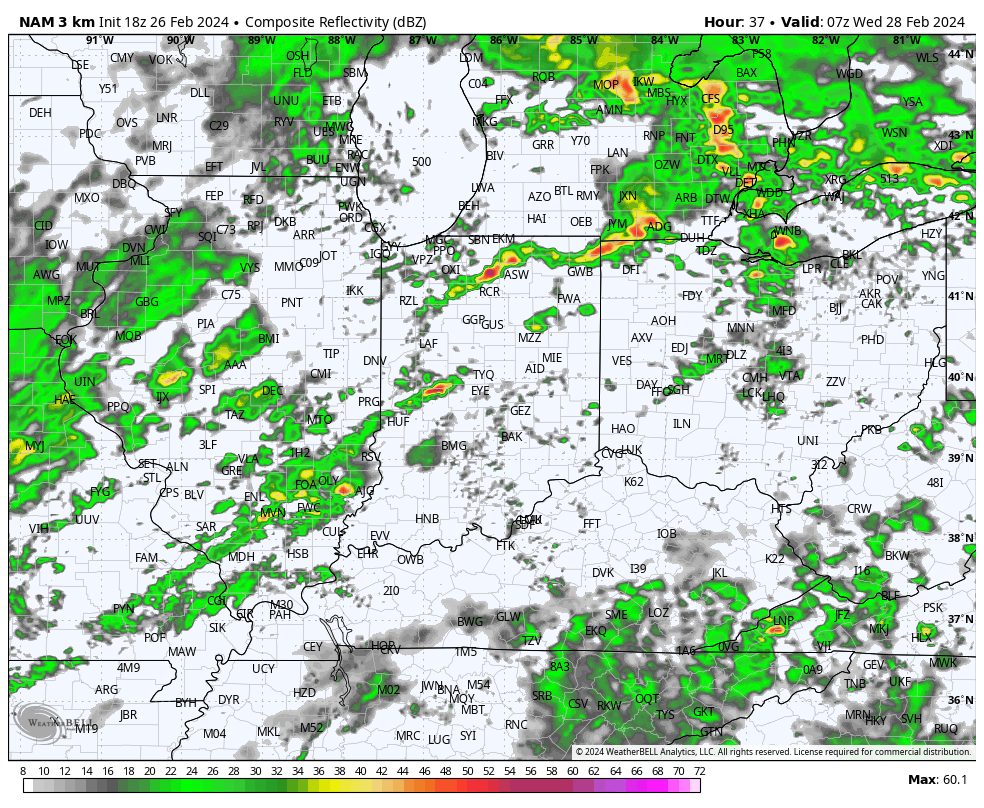
Concern remains that all modes of severe weather will be realized across northern IL and northern IN Tuesday evening into the overnight.

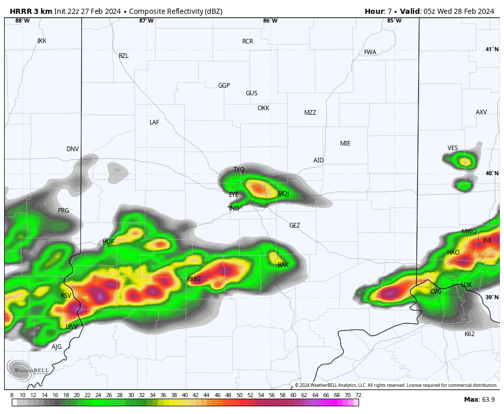
We want to reiterate that the majority of the daytime should be void of any sort of significant rain or storms across the state. It’s after 7p, and more so after 9p, that we expect discrete cells to initialize and roll across northern IN. These discrete cells will be capable of rotating (TOR potential remains), but also have the potential of damaging winds and large hail. The most widespread of evening convection should be focused north of the city, itself, but we’ll keep a close eye on tonight’s and Tuesday morning’s data.

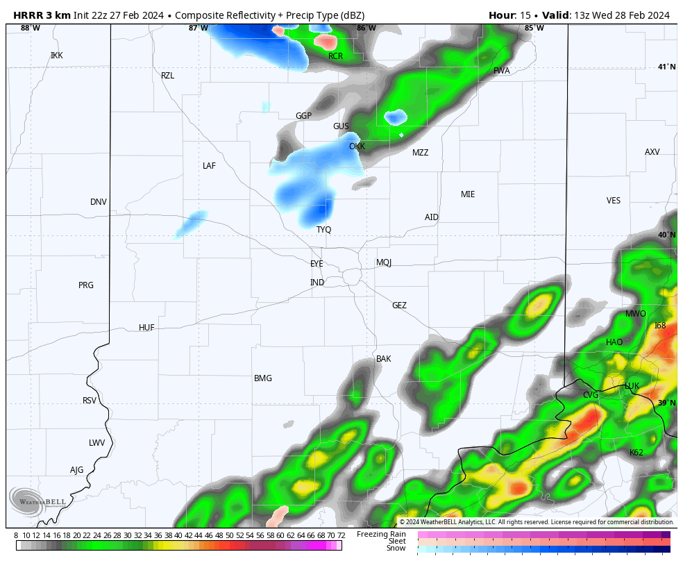
We continue to believe a more pronounced squall line will march east across the state, including central and southern Indiana, during the overnight and predawn hours and it’s with this line that an elevated damaging wind threat will be hoisted. Timing this threat out features the 2a to 5a Wednesday time block from west to east. We recommend reviewing your severe weather safety plan and have a means of receiving the latest warning information should they be issued.

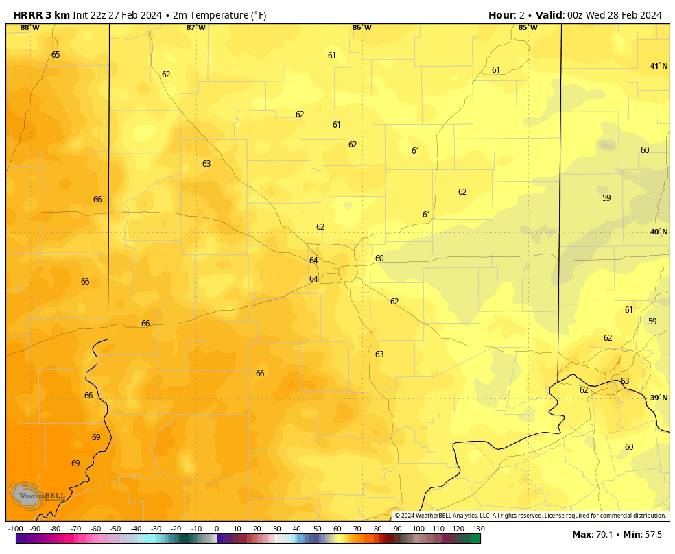
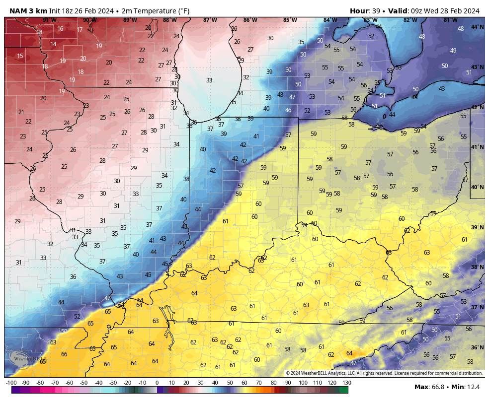
Showers and embedded thunder will remain widespread through the early morning hours before pushing off to our east by mid morning. By this time, we’ll be trending sharply colder (temperatures will fall off the cliff Wednesday morning), drier, but very windy.

Predawn highs around 60° Wednesday will be shaved by 30° by late morning along with a biting northwesterly wind gusting 30-40 MPH.

High pressure will deliver a colder, but sunny Thursday before a weak system delivers a return of clouds and light (insignificant) showers to close the work week.

The weekend continues to look mighty nice, including a quick rebound in the mercury and another taste of spring ahead of our next approaching storm early next week.

VIDEO: Forecasting Record Warmth Today; Timing Out Rounds Of Storms Late Tonight – Wednesday AM…

Updated 02.26.24 @ 7:30a We’ll go from “chamber of commerce” type weather to open the work week, including pushing for a record high later this afternoon, to rounds of storms…

You must be logged in to view this content. Click Here to become a member of IndyWX.com for full access.  Already a member of IndyWx.com All-Access?  Log-in here.