Updated 03.26.24 @ 7:30a Wind is the story this morning, and that will continue through the afternoon and evening. A “big hair warning” is in effect today. 🙂 A bit…
You must be logged in to view this content. Click Here to become a member of IndyWX.com for full access. Already a member of IndyWx.com All-Access? Log-in here.
Updated 03.25.24 @ 7:25a While the work week will open on a quiet note today, we’ll really notice an uptick in winds by afternoon and these will only continue to…
You must be logged in to view this content. Click Here to become a member of IndyWX.com for full access. Already a member of IndyWx.com All-Access? Log-in here.
While a period of unsettled weather looms late Monday and Tuesday, the majority of the upcoming week will feature quiet conditions across our neck of the woods. We’re watching Tuesday afternoon for the potential of severe weather across the state.
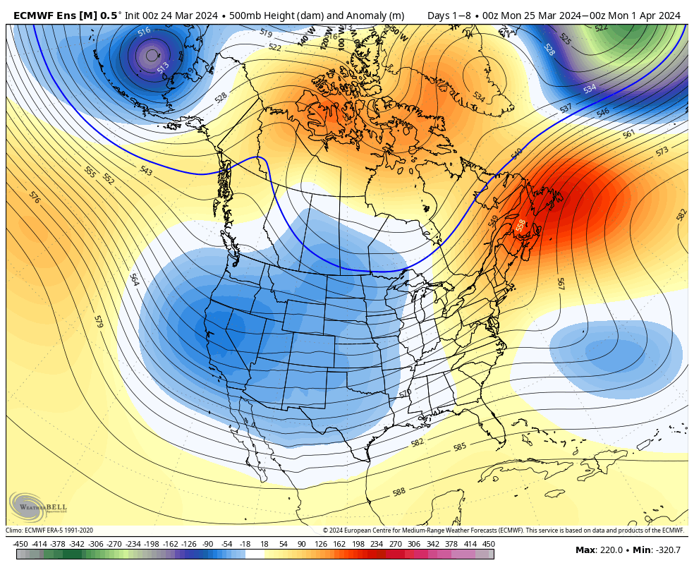
The ‘mean’ trough will settle into the western CONUS and that’s where the coldest anomalies will setup shop.
A trough will take up residence across the West with only glancing blows of cooler air, locally.
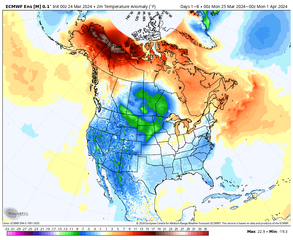
A chilly week is in store for the West with the temperature swings balancing out very close to average across our area this week.
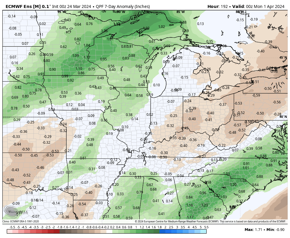
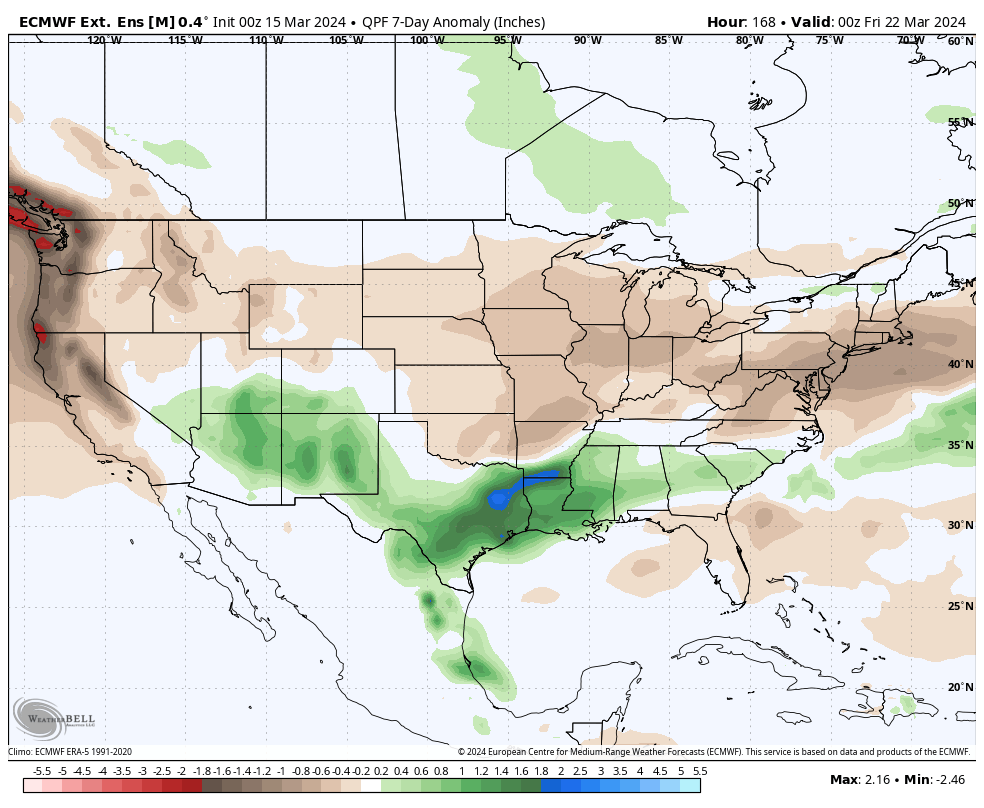
Rainfall will run average to slightly below average in the week ahead south and east.
Forecast period: 03.24.24 – 03.31.24
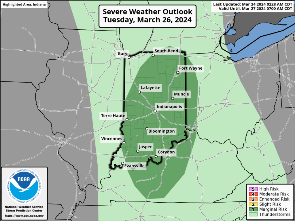
We’ll close the weekend with quiet conditions in place. Anticipate gusty winds to kick up Monday as our next storm system approaches from the west. This will also deliver a few showers Monday night before heavier rain and embedded thunder arrives Tuesday predawn. An additional round of thunderstorms is expected Tuesday afternoon and a few of these could become strong to severe (damaging straight line winds are of greatest concern, but an isolated tornado can’t be ruled out).
A cold front will sweep east and end the rain/ storm threat Tuesday night with calmer weather returning for mid and late week. The next chance of rain will arrive next weekend. Speaking of next weekend, though early, model guidance is suggestive that we may be looking at a heavy rain event around the time that we close out March and open April. Just something we’ll be keeping an eye on in the days ahead.
Updated 03.19.24 @ 5:34a It’s a cold start to the day across central IN, but this time of year, especially with enough sunshine, we can warm-up nicely. That’ll be the…
You must be logged in to view this content. Click Here to become a member of IndyWX.com for full access. Already a member of IndyWx.com All-Access? Log-in here.
Indianapolis is running right at average month to date from a rainfall perspective (1.78”).
We’re transitioning to a much drier pattern in the week ahead as a cooler, Canadian airmass dominates (for a change).
Several hard freezes (mid-upper 20s) are on tap in the upcoming 7-10 day period: Monday/ Tuesday morning and again late next week/ next weekend.
Cooler? Yes, but I still don’t see anything overly cold on the horizon as we navigate the next couple of weeks.
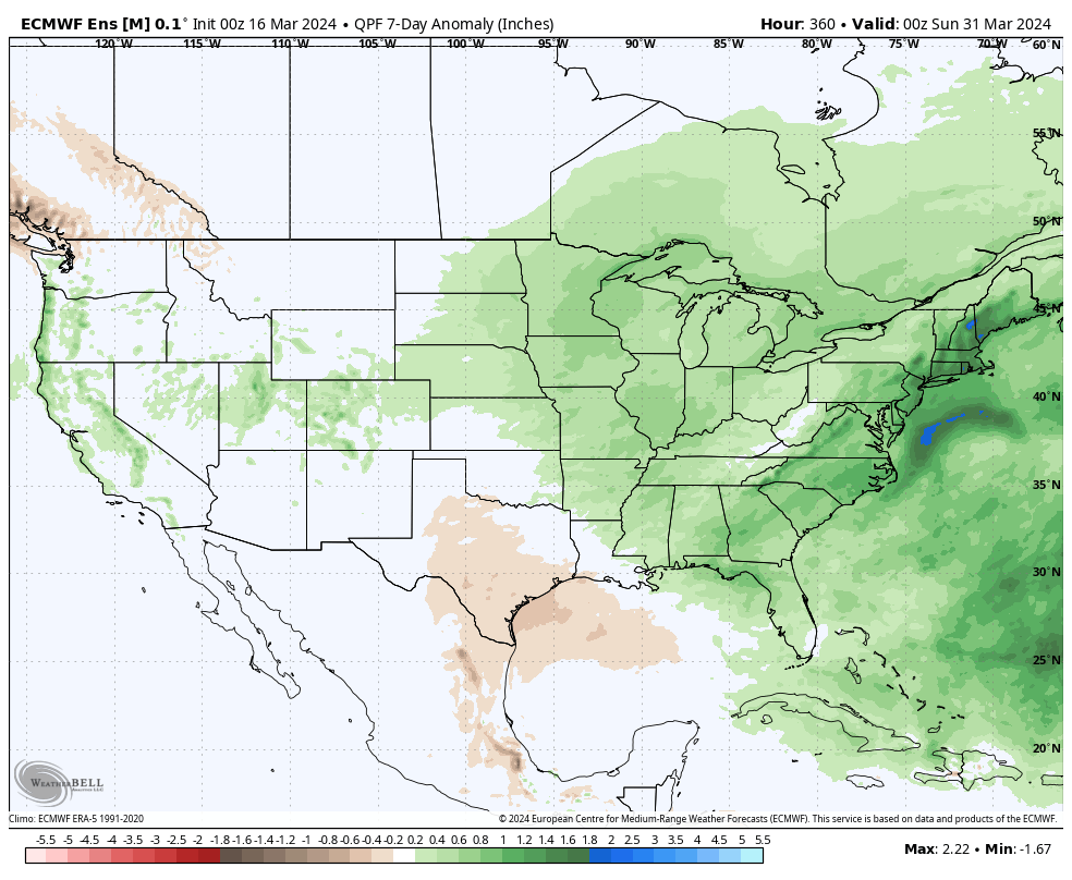
What’s more notable is the shift in the precipitation pattern over the next few weeks. The dry Week 1 (now) transitions to a significantly wetter and more active look Week 2 (below).
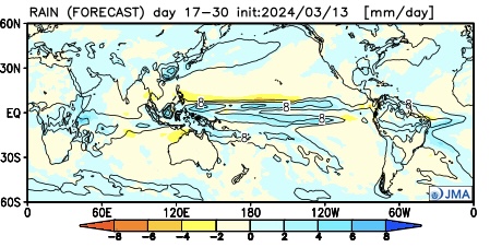
The JMA also sees the wetter regime.
This is forecast to continue in the Weeks 3/4 timeframe.
Continues to back up the idea of an active (wet) and stormy (more in the way of severe weather) spring as a whole.
Down the road, an eventual move into a hot, dry (compared to normal) summer may loom. (Yet one that is very active from a tropical perspective, continuing into the fall). More on that in the coming weeks…