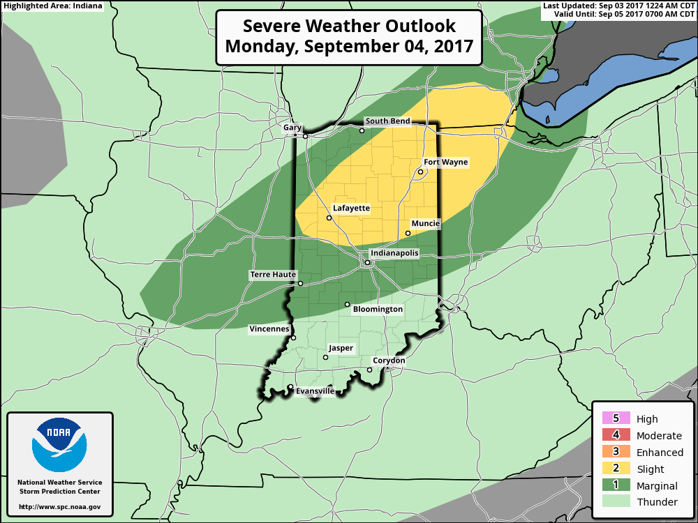
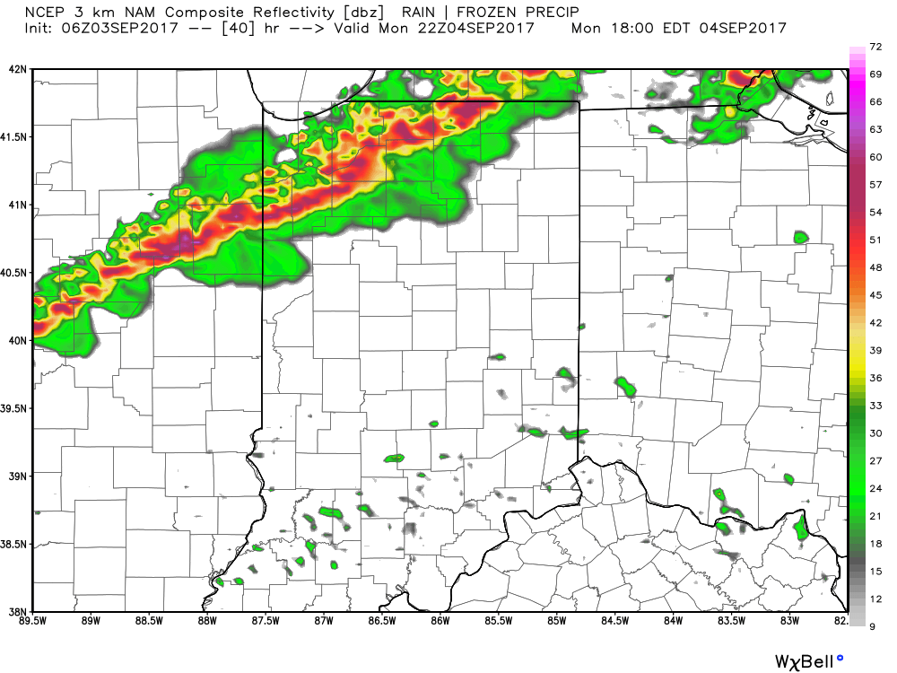
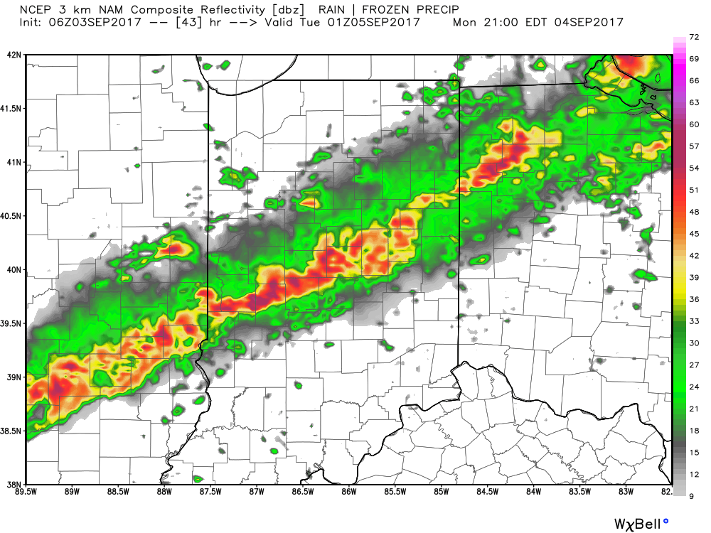
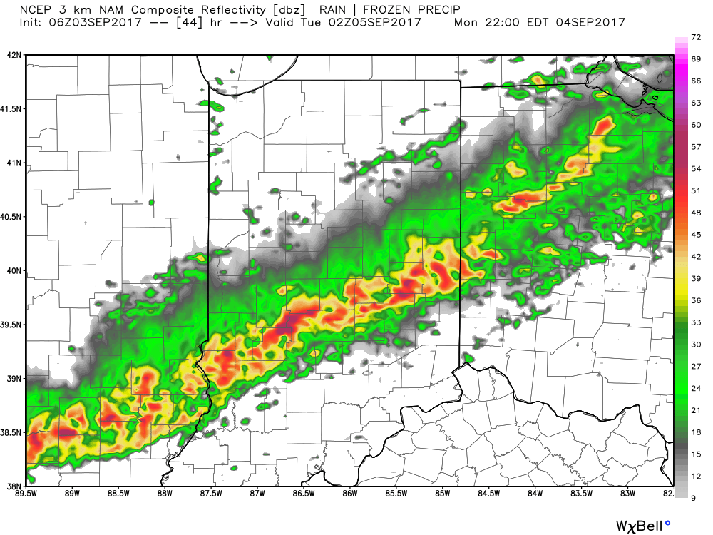
The Storm Prediction Center includes an Enhanced Risk of severe weather across north-central parts of the state this evening. Damaging winds are of greatest concern with the stronger storms embedded in a squall line that will move from north to south this evening (generally between 6p-midnight).
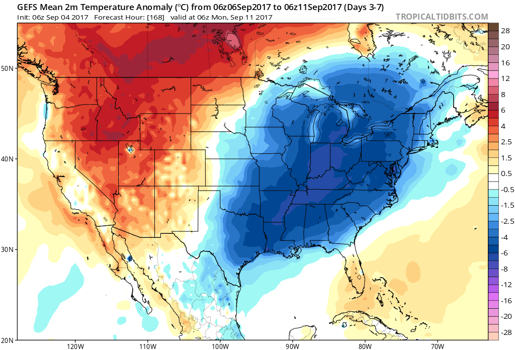
MUCH cooler air will descend into the region as we progress through the week. Temperatures will be so cool, it’ll feel more like October rather than September, including multiple nights with lows settling into the 40s and highs not making it out of the 60s.
Today will be dry and pleasant and most of Labor Day, itself, will follow suit. We’ll notice an increasingly gusty southwest wind by afternoon and this will help boost temperatures into the upper 80s Monday afternoon.
However, once to Labor Day evening, attention will shift off to our north as a line of thunderstorms approaches. A few embedded storms within this line may reach strong-to-severe levels. Damaging straight line winds are of greatest concern with the stronger storms. The Storm Prediction Center has included the region in a Slight Risk of severe weather Monday evening.
After a mostly dry and warm Labor Day, we’ll focus on the evening hours (bracketing 6p-10p) for storms to rumble in. As mentioned, a couple of these could reach strong to severe levels.
Once the front blows through, our winds will shift to the northwest and help usher in a much cooler air mass. Average highs in the upper 60s and lows in the upper 40s don’t occur until early-October. We’ll be around 30 days ahead of schedule throughout the majority of the upcoming week, as overnight lows in the upper 40s to around 50 and highs in the upper 60s to around 70 will be common.
You must be logged in to view this content. Click Here to become a member of IndyWX.com for full access. Already a member of IndyWx.com All-Access? Log-in here.
You must be logged in to view this content. Click Here to become a member of IndyWX.com for full access. Already a member of IndyWx.com All-Access? Log-in here.
You must be logged in to view this content. Click Here to become a member of IndyWX.com for full access. Already a member of IndyWx.com All-Access? Log-in here.
 MUCH cooler air will descend into the region as we progress through the week. Temperatures will be so cool, it’ll feel more like October rather than September, including multiple nights with lows settling into the 40s and highs not making it out of the 60s.