Gearing Up For The “2nd Half…”
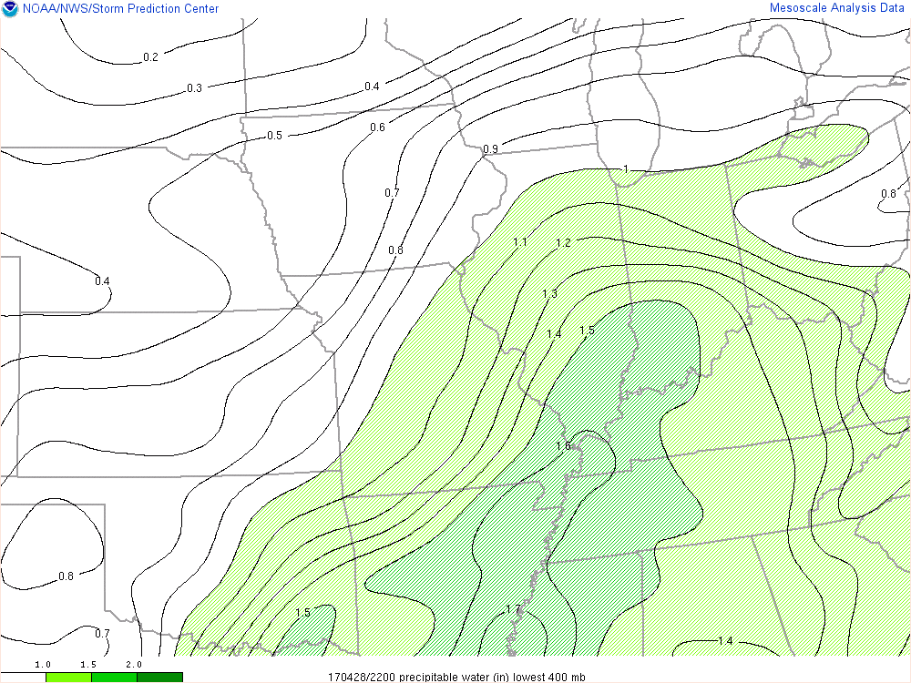
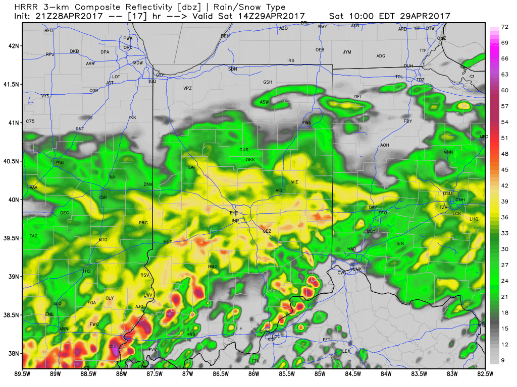
Central Indiana has enjoyed a well deserved break in the rain and thunderstorms this afternoon, but, unfortunately, stormy times will return tonight. With an increasingly moist air mass in place (warm front is currently draped across central IN and slowly lifting north), renewed heavy rain is expected tonight into Sunday. Dew points will approach 70° and precipitable water values (PWATs) will periodically reach 2″ between this evening and Sunday night. With that kind of moisture content in the atmosphere, locally heavy, flash flood-producing, rains are a “lock.” Should you live near a creek, stream, or river, please keep abreast of water levels into early next week and have a plan in place to move to higher ground.
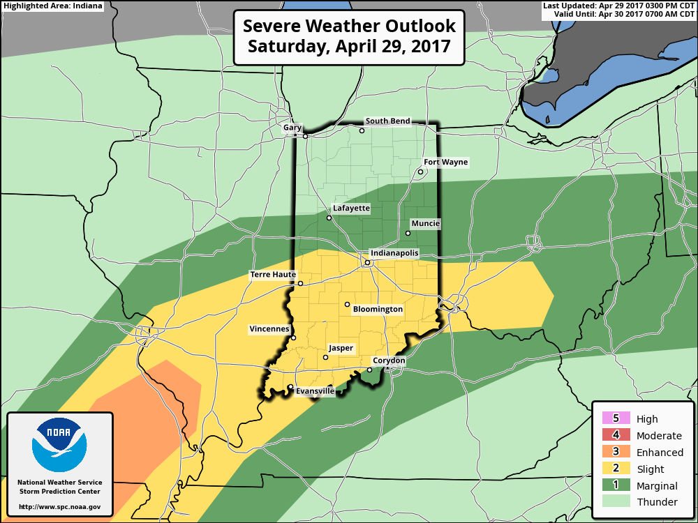
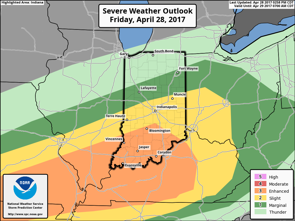
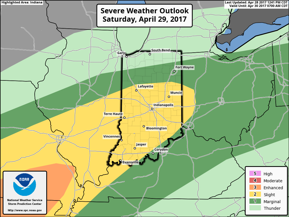
The Storm Prediction Center paints a “Slight Risk” of severe weather across central and southern Indiana tonight.
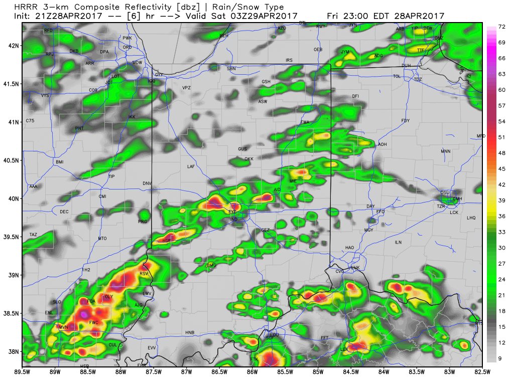
 We think an eastward-advancing line of thunderstorms will blow into central Indiana later this evening (between 9p and midnight). Some of these may reach strong to severe levels with damaging straight line winds of greatest concern. Additionally, torrential downpours will occur within this line of storms.
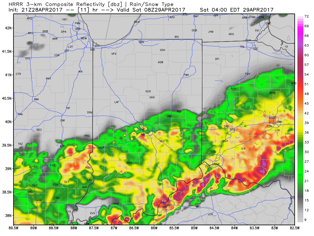
Overall coverage of rain and thunderstorms should diminish Sunday morning before ramping up and increasing in overall coverage and intensity (yet again) Sunday evening and night. In fact, we may be looking at another severe weather episode Sunday night- again with straight line damaging winds of greatest concern. By the time all is said and done we expect an additional 1″-2″ of rain across central Indiana with locally heavier 3″+ amounts where storms train over the same area. Obviously, with saturated soils in place across central Indiana, this amount of rain will create flood concerns into Monday morning. By the time we get to Monday, the big weather story will be strong and gusty NW winds, much cooler air (falling temperatures through the 50s) and nuisance-level showers.
Another heavy rain maker looms Thursday and we’ll cover that in our updated 7-day later tonight or Sunday.
 Once all is said and done, we anticipate widespread 2″-3″ rainfall totals through central Indiana, but also note there will be localized heavier amounts. Once to Monday we’ll look at a much cooler, windy, and “showery” regime. Look for falling temperatures through the day Monday and this will set the stage for the week ahead: MUCH cooler, overall…. More on that later this weekend!
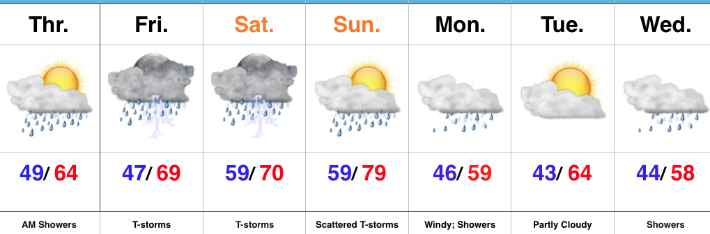 Highlights:
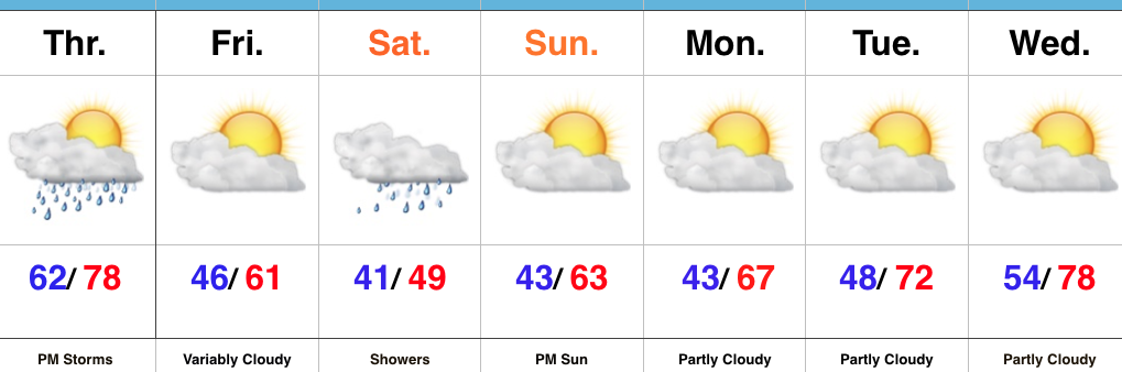 Highlights: