Category: Severe Weather

Weekly #AGwx And #Severe Weather Outlook…

Updated 03.31.24 @ 7:26a

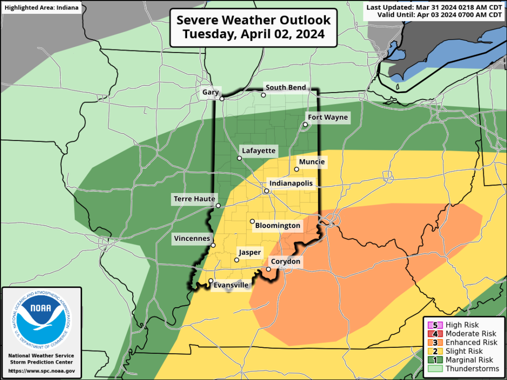
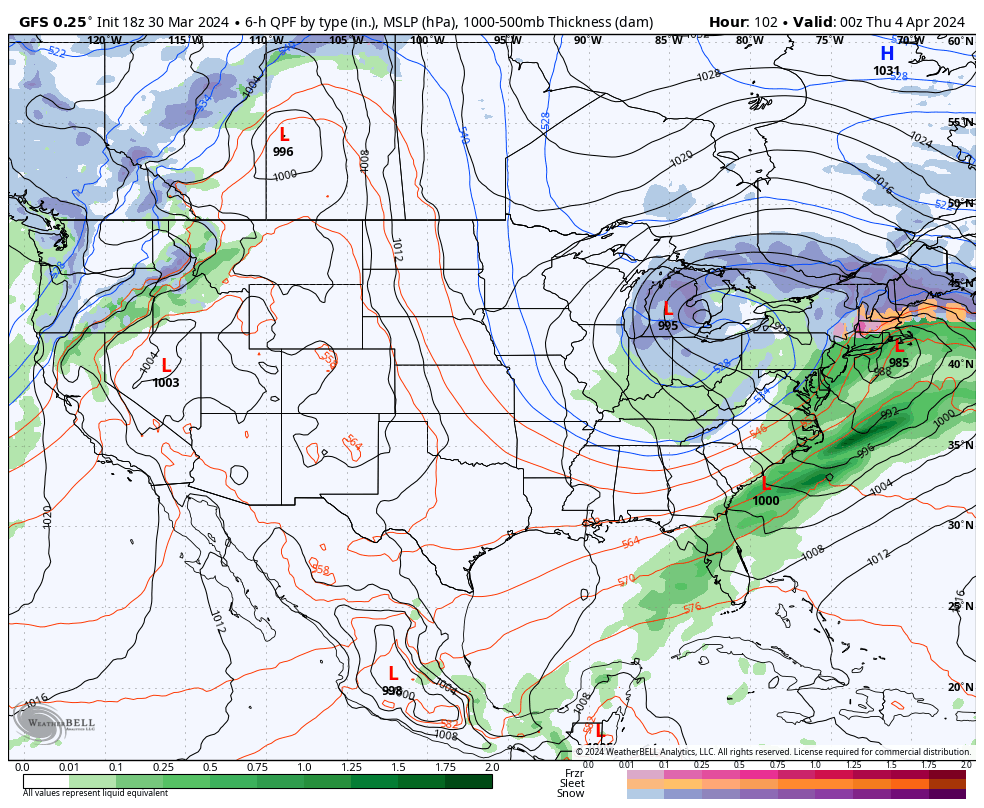
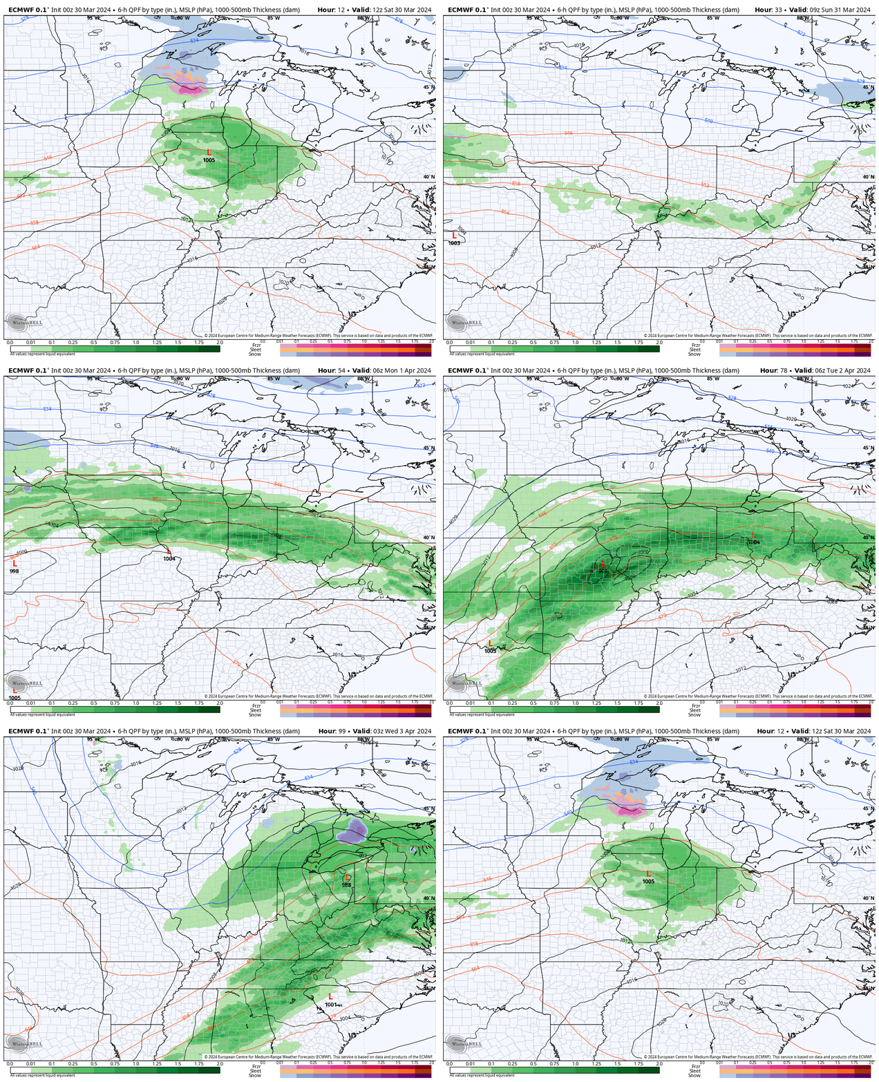
The upcoming immediate term will be headlined by a multi day heavy rain and severe weather episode. A stalled frontal boundary will serve as the pathway for multiple waves of low pressure to ride along through Tuesday. In addition to a heavy rain and flooding threat (primarily targeting immediate central and north-central Indiana), we’ll also likely have to deal with (3) rounds of severe storms. We’ll allow our short-term products to handle those severe threats, but just know all modes of severe are on the table with the greatest emphasis being on large hail with this setup. Should a couple discrete cells develop near or just south of the boundary then an elevated tornado threat would ensue. Again, we’ll have a fresh post hoisted later this afternoon or evening on that.

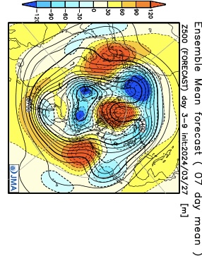
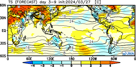
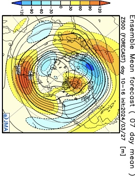
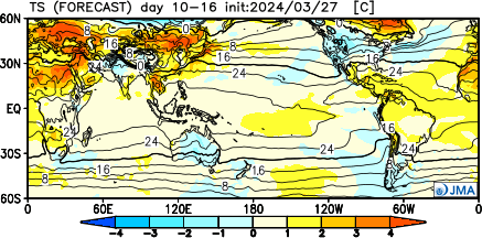
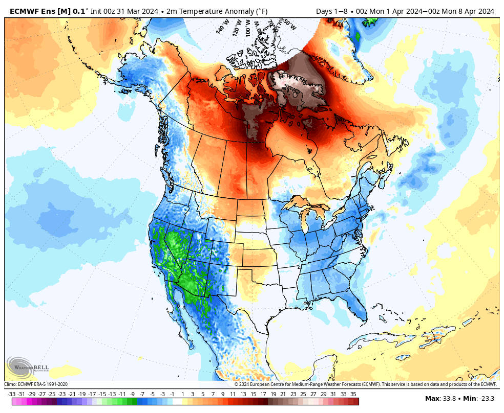
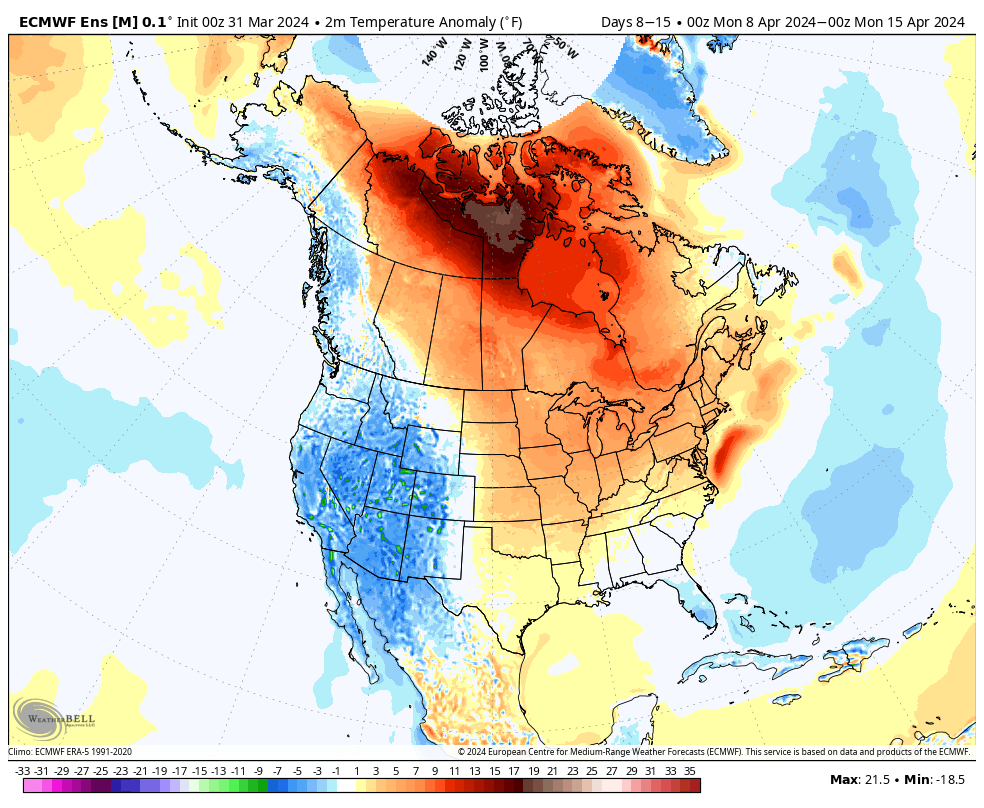
Overall, there’s no change in the idea of an active pattern continuing from Week 1 (image 1 below) into Week 2 (image 2 below).
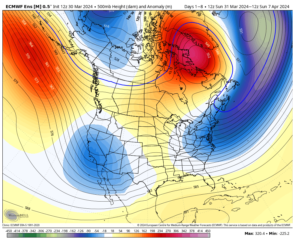
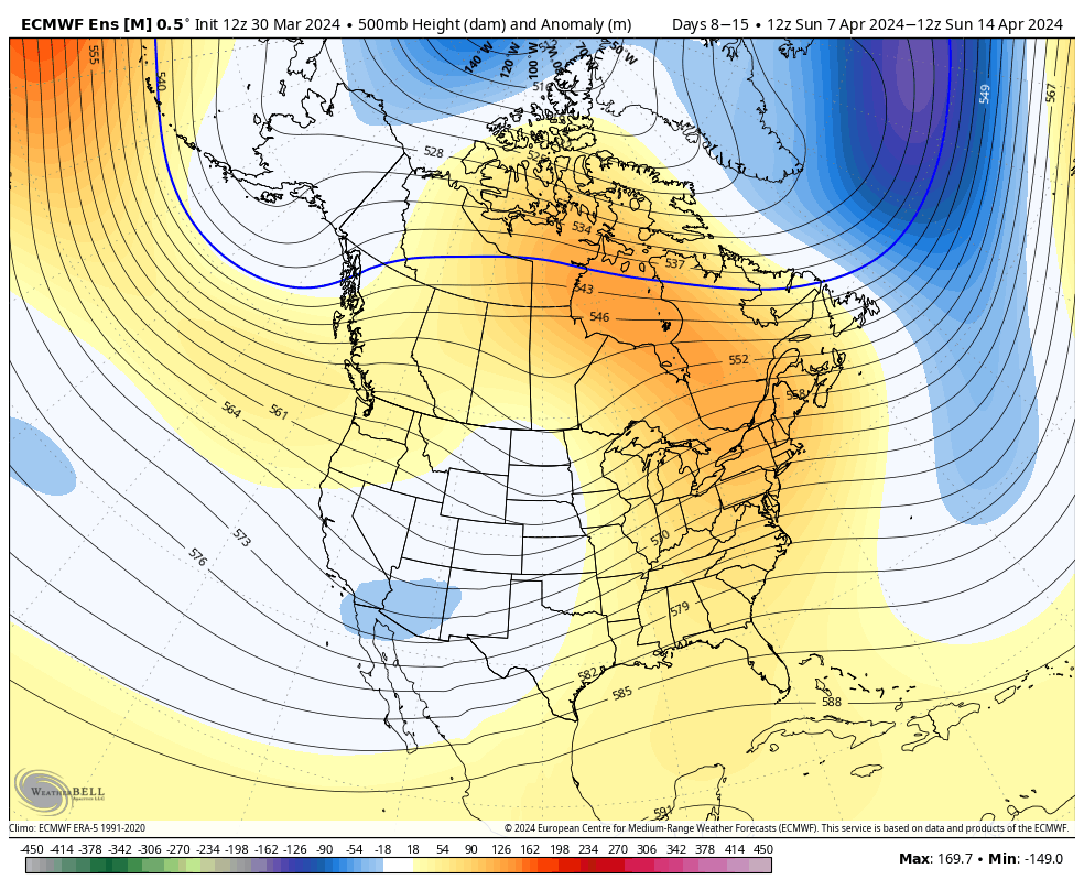
The cooler pattern behind our early week storm system will reverse in significant fashion Week 2. – Transitional regime at its finest.

Week 1 temperature anomalies
Week 2 temperature anomalies
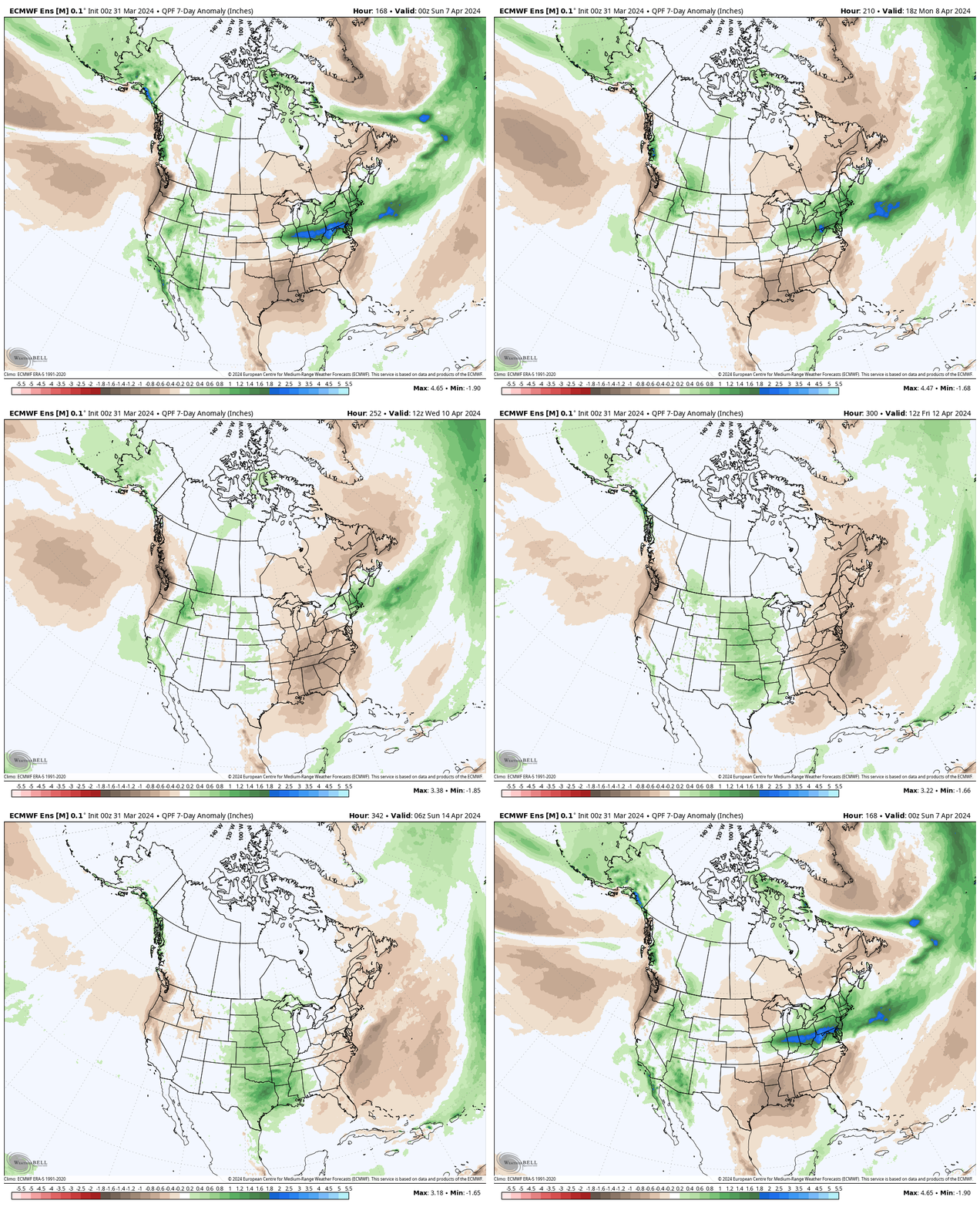
The busy nature of the pattern is reflected in the upcoming 2 week precipitation anomalies.
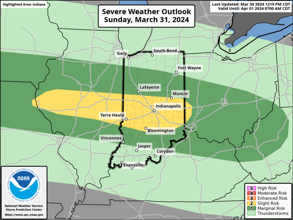
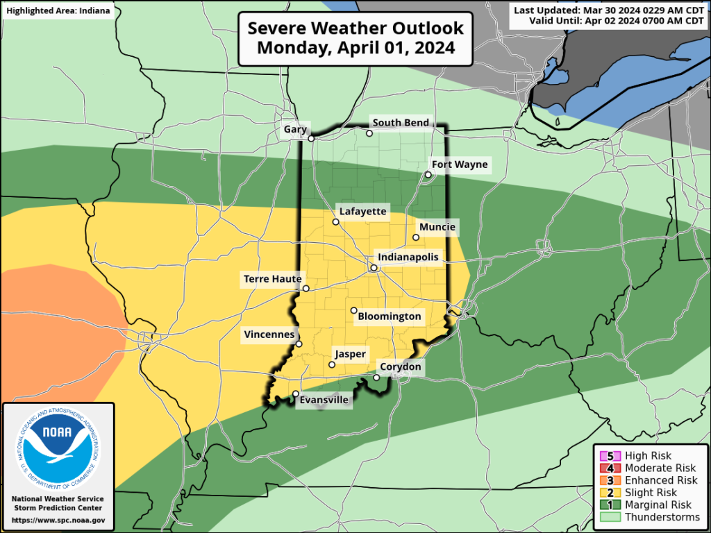
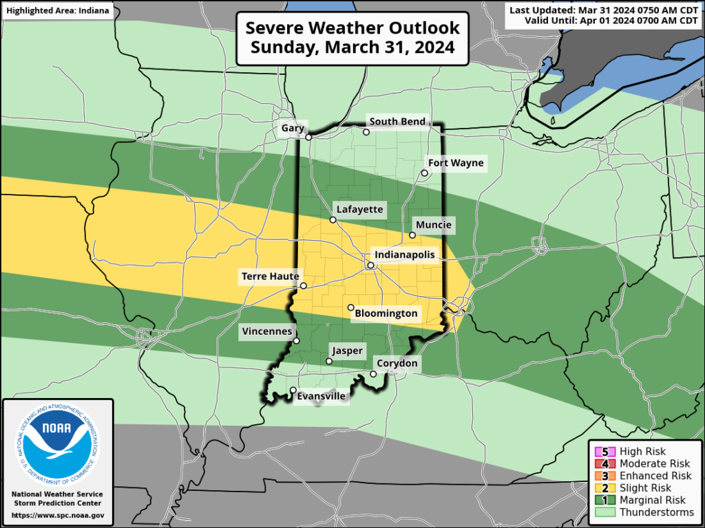
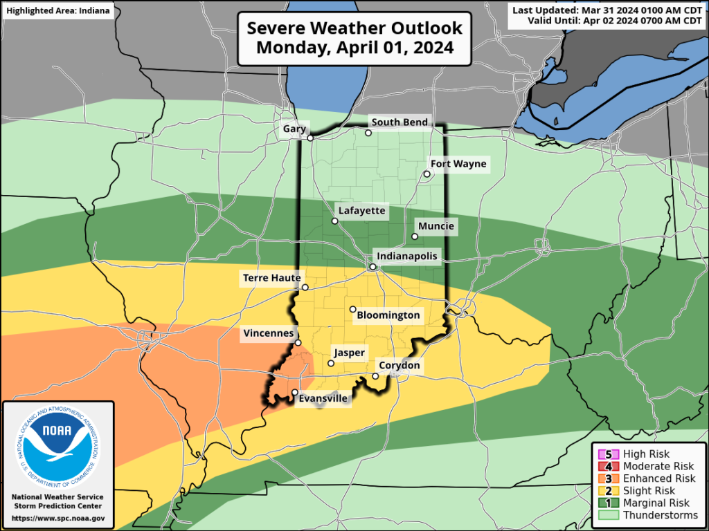
Severe weather will be possible at least across a portion of our immediate viewing area starting this evening and continuing daily through Tuesday.
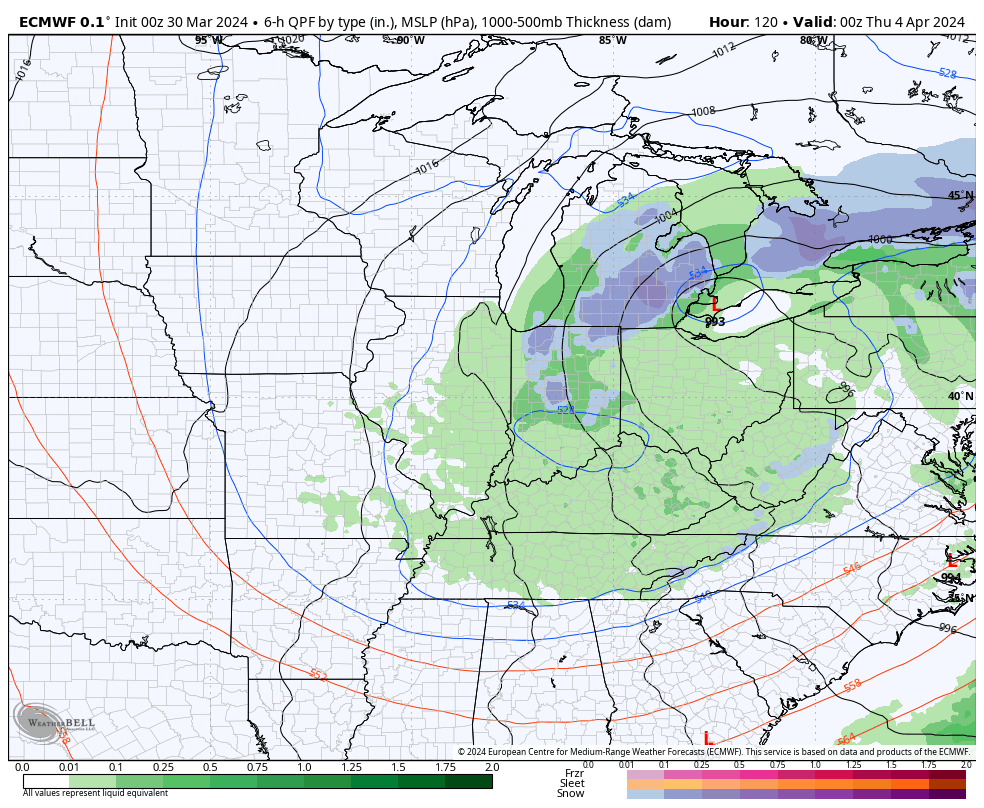
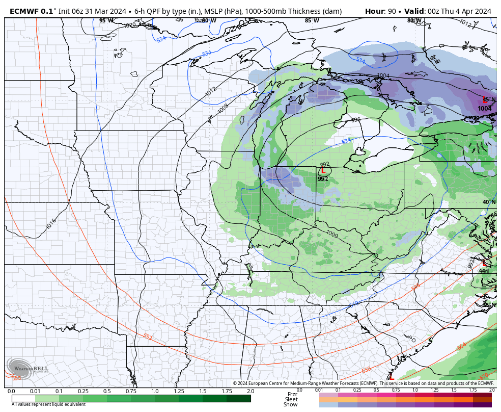
Colder air will crash in here Wednesday and as an upper low swirls overhead, wet snow will develop. Snow may even fall heavily enough to accumulate on grassy surfaces in spots Wednesday night into Thursday morning.
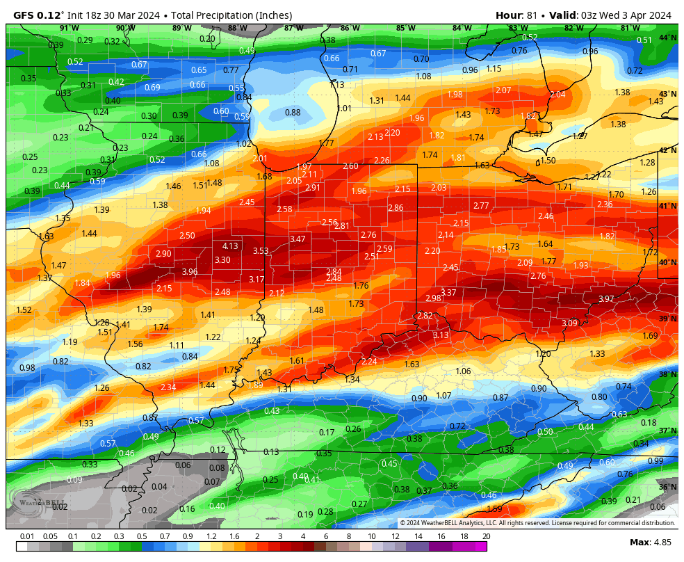
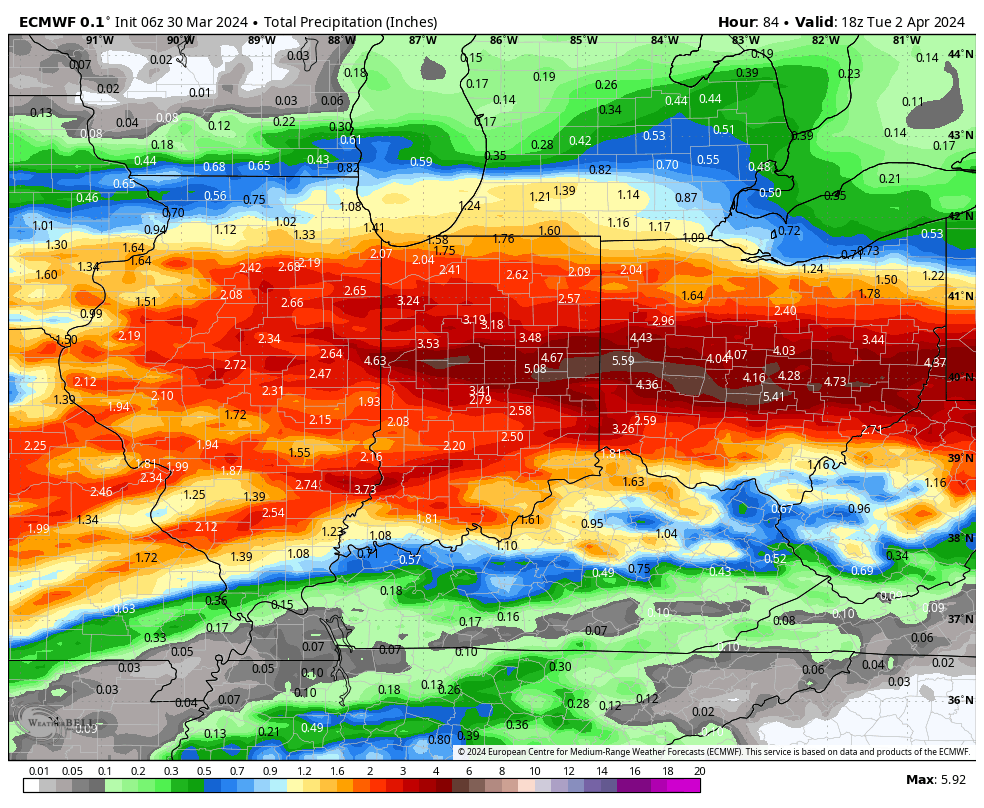
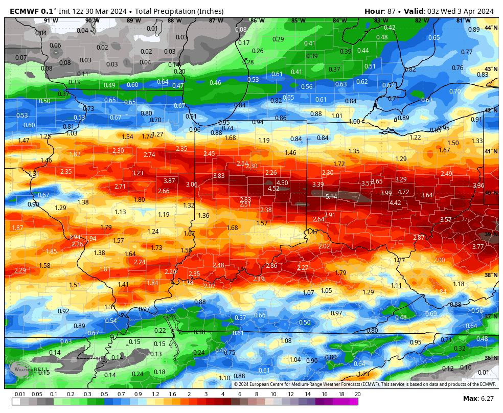
*Upcoming 10-Day Rainfall Projection: 3” to 4”+

Permanent link to this article: https://indywx.com/weekly-agwx-and-severe-weather-outlook-49/

Saturday Evening Thoughts On The Pending Heavy Rain/ Severe Event…

Updated 03.30.24 @ 5:07p

There’s not much, if anything, to change regarding the setup and anticipated outcome of the Easter Sunday through Tuesday timeframe. Periods of heavy rain will get going Sunday PM and we’ll also need to watch for the threat of severe storms not only tomorrow afternoon/ evening but again Monday.

Midday models are latching onto a widespread 2”-4”+ event.

The Storm Prediction Center (SPC) has increased the threat area tomorrow afternoon. Large hail is greatest concern but an isolated tornado can’t be ruled out.

All modes of severe are on the table Monday, including tornado potential once again.

If all this wasn’t enough already, a much colder air mass will plunge into the region by midweek allowing rain to mix with and change to wet snow Wednesday evening into Thursday morning. The snow may even be heavy enough for slushy accumulations in spots.

Spring at its finest across the great Hoosier state…

Permanent link to this article: https://indywx.com/saturday-evening-thoughts-on-the-pending-heavy-rain-severe-event/

Multiple Waves Of Heavy Rain On Deck; Severe Storm Risk As Well…

Updated 03.30.24 @ 7:16a

The combination of a quasi-stationary frontal boundary, increasingly warm and humid air, and multiple waves of low pressure riding along the aforementioned boundary will lead to several rounds of locally heavy rain and also pose a strong to severe storm risk as we go through the early stages of the new week.

Precipitable water values (PWATs) will approach 1.5” to 2” at times early week (a tough feat to come by this time of year). This only raises confidence in the opportunity for this setup to generate periods of heavy, and eventually excessive, rainfall.

Widespread 3”+ totals can be expected by the time all is said and done, with locally heavier amounts.

If the heavy rain event wasn’t enough, we also need to be on guard for the threat of severe storms Sunday and Monday.

In particular, it’s Monday’s risk of severe that has us most concerned, including all modes (hail, wind, and a TOR threat). We recommend reviewing your family’s severe weather safety plan and make sure to have a way to receive any warnings that may be issued.

The heavy rain event will come to an end by Tuesday evening, but if we didn’t have enough to track already, we’ll add in the potential of rain to mix with wet snow Wednesday. Regardless, expect a much colder and blustery time of things as this bigger storm departs by midweek.

Permanent link to this article: https://indywx.com/multiple-waves-of-heavy-rain-on-deck-severe-storm-risk-as-well/

Long Range Report: Active Pattern As We Head Into And Through April…

Updated 03.29.24 @ 6:57a

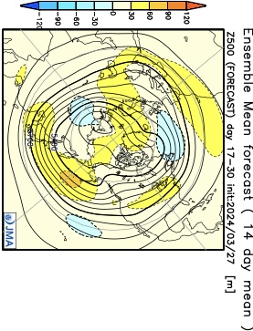
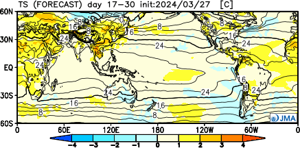
Don’t get used to any one particular pattern for any length of time over the next few weeks. “Active” will sum things up best in a single word as a transitional regime takes hold.

The NEW JMA Weeklies highlight this transitional theme best over the upcoming (4) week period.

Week 1

Week 2

Weeks 3/4

To no surprise, especially given the transitional nature of the pattern, the upcoming few weeks should feature above normal rainfall for a good chunk of the Great Lakes and Ohio Valley.

We’ll also want to keep tabs on the potential of greater than average severe weather episodes, notable considering we’re almost into April. It’s a byproduct of the “topsy-turvy” look to the overall pattern.

Pattern drivers, including the EPO, back up the transitional them over the upcoming couple weeks. Reminder, negative phase favors chilly conditions and positive phases favor milder air (compared to average). This look, too, screams wet and stormy.

Bottom line, buckle up for an active storm track and associated heavier than normal rainfall over the next few weeks. Temperature regimes will feature a bit of it all, including above and below normal periods, likely all balancing out slightly above normal when all is added up.

Permanent link to this article: https://indywx.com/long-range-report-active-pattern-as-we-head-into-and-through-april/

VIDEO: Line Of Storms To Develop This Afternoon; Busy Pattern Ahead To Close March And Open April…

Updated 03.26.24 @ 7:30a Wind is the story this morning, and that will continue through the afternoon and evening. A “big hair warning” is in effect today. 🙂 A bit…

You must be logged in to view this content. Click Here to become a member of IndyWX.com for full access.  Already a member of IndyWx.com All-Access?  Log-in here.

Permanent link to this article: https://indywx.com/video-line-of-storms-to-develop-this-afternoon-busy-pattern-ahead-to-close-march-and-open-april/