Thursday Storms Before A Cooler Trend…
 Highlights:
- Strong storms possible Thursday afternoon
- Cooler close to the work week
- Raw Saturday
- Delightful open to next week
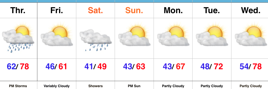
Thursday Rumbles…While storms have pressed through the northern portions of the state today, we’ve enjoyed a couple days of pleasant weather across most of central Indiana. That will come to an end Thursday as scattered to numerous showers and thunderstorms develop, especially during the afternoon into the evening hours. A few of these storms could become strong-to-severe, including damaging wind and large hail potential. The cold front will pass Thursday night and help usher in a briefly drier and much cooler air mass to close out the work week.
Our next storm system will pass south of the region Saturday and result in thickening and lowering clouds Friday evening, and showers Saturday. With a stiff east wind, showers at times, and temperatures well below average, we have the makings for a downright “raw” spring day Saturday. The second half of the weekend will easily be “the pick” as we return to drier air and increasing sunshine Sunday afternoon.
Early next week looks to get off to a pleasant start, including plentiful sunshine and moderating temperatures.
Upcoming 7-Day Precipitation Forecast:
- Snowfall: 0.00″
- Rainfall: 0.75″ – 1.25″
 Highlights:
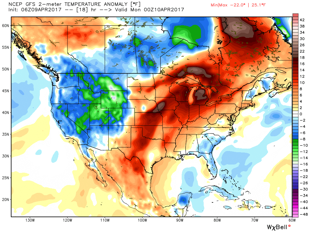
 Highs will run close to 15° above average this afternoon.
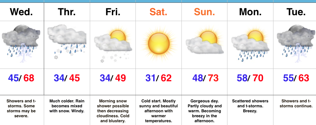
 Stormy weather returns Monday as a frontal boundary slips into the state. A couple storms may become strong or severe Monday afternoon and the Storm Prediction Center highlights northwestern portions of the state for a Slight Risk. Damaging straight line winds are of greatest concern with any severe storm that may develop.
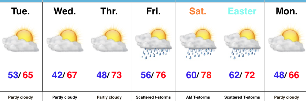
 High pressure returns for midweek and supplies a dry regime, along with increasing sunshine and temperatures that will run slightly above average (mid-40s at night and 65°-70° during the day).
 There are questions once to the end of the period as the GFS and European handle the evolution of our late-week storm differently. The GFS brings energy out into the Ohio Valley and results in unsettled weather returning Friday, continuing into Easter weekend, while the European is slower. We’ll keep an eye on things over the next few days and update accordingly. The GFS suggests some localized heavier downpours would be possible in the Friday-Sunday period as the majority of the 7-day precipitation snapshot below falls within the timeframe.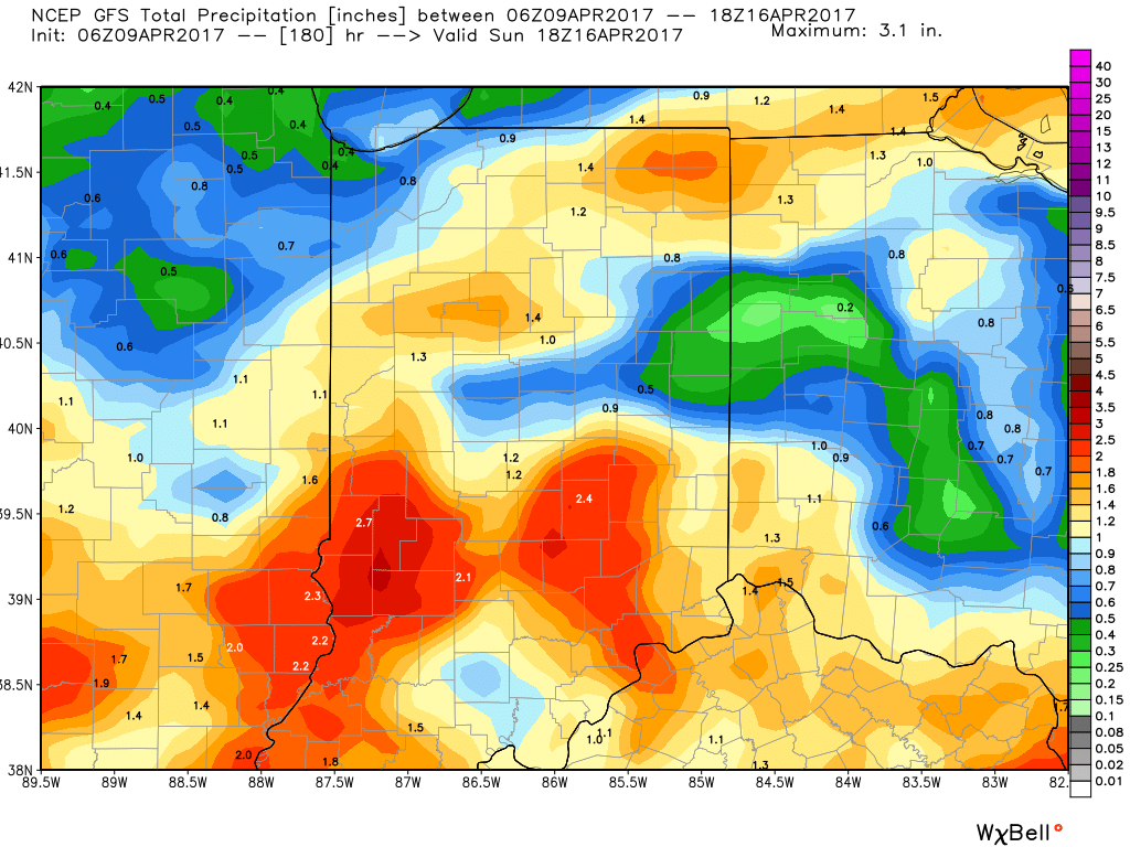
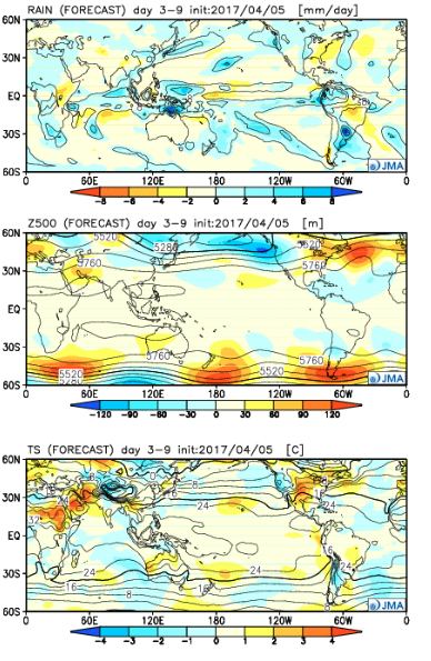 Week 2:
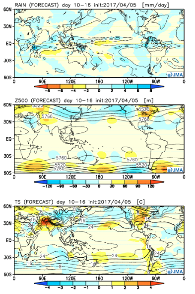 Weeks 3-4:
 The big picture is one that shows a drier pattern developing across the East during Week 1, but we caution that this drier regime doesn’t look to “lock” in. Data suggests we get back to an active pattern between Week’s 2-4, biased wetter than normal in the Mid West and Plains. The other screaming message is that a busy severe season should continue through the period. Cold sets up across the Pacific Northwest, associated with the “mean” trough position, while spring-like warmth continues to build across our region in overall terms. We know what that means as storms eject off the Rockies and track east…
 Highlights: