Tracking Two Cold Fronts; Dangerous Cold Arrives Tuesday Evening…
We’re tracking two cold fronts as we open the new work week. The first will pass without a whole lot of fanfare this evening. However, the second boundary (the true arctic front) means business Tuesday afternoon/ evening.
We notice a band of mixed precipitation moving into central IN before sunrise. This will swing through the state, changing to rain as it does so, through the morning and into the early afternoon. The reason? Just enough mild air working in on southwesterly breezes ahead of the frontal boundary.
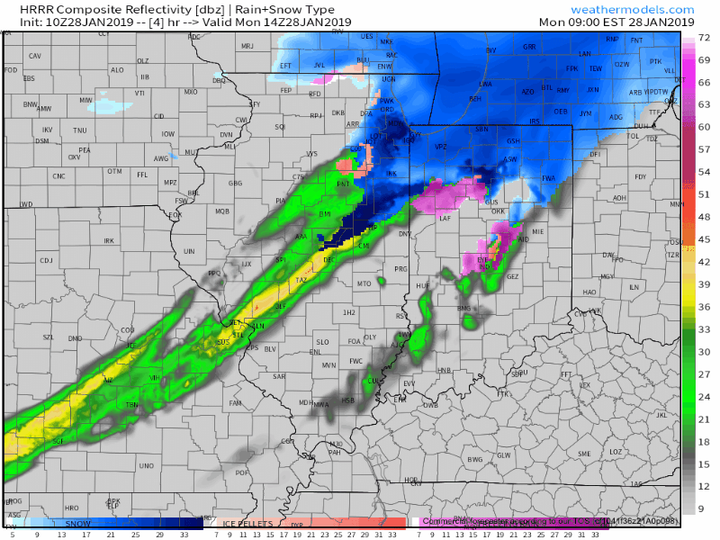
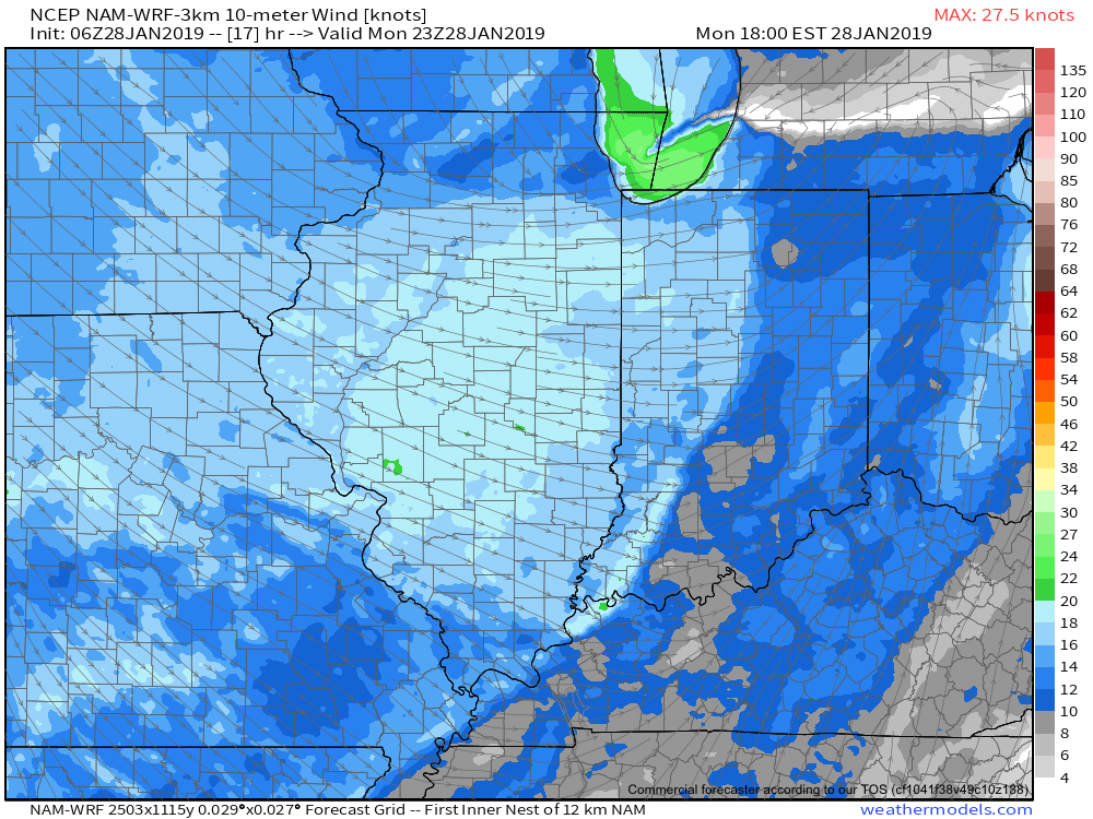
The front will pass through the city around or just after rush hour. Gusty winds and falling temperatures are ahead this evening.
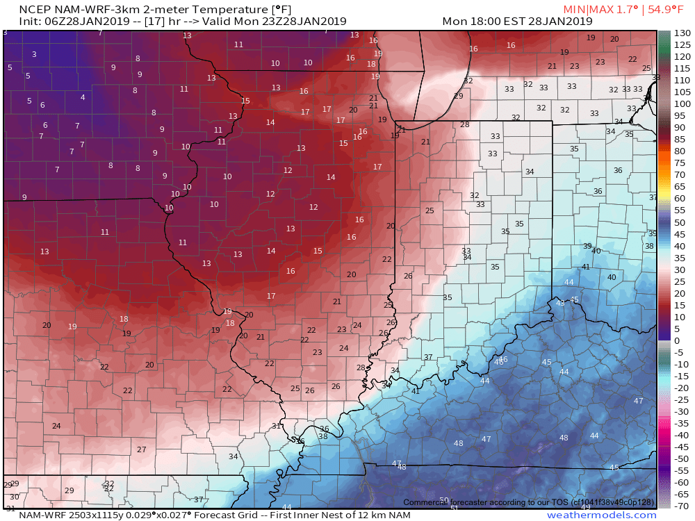
By morning, most of central Indiana will awake to temperatures in the single digits.
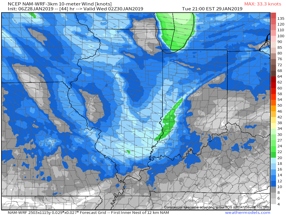
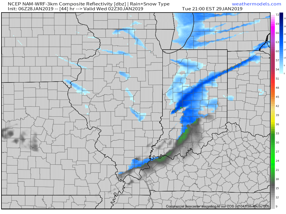
The second front (true arctic boundary) will be barreling towards the state at this time and will pass Tuesday evening. It’ll hit like a “wall” with gusty winds, brief, but intense snow squalls, and plummeting temperatures.
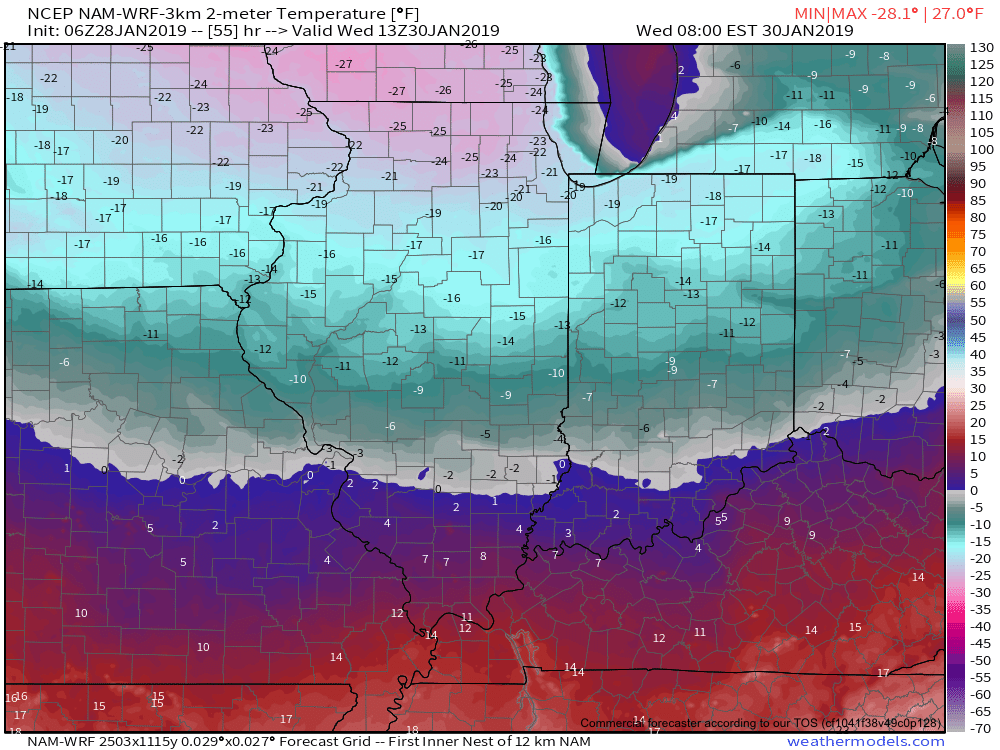
Central Indiana will be greeted with temperatures nearing 10° below zero and wind chill values of 30° to 40° below zero Wednesday morning.

Please take this cold seriously and complete preparations today. Thankfully, milder times are ahead as we head into the weekend…