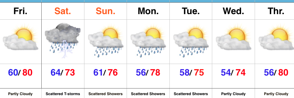
Turning Hot; Challenging NW Flow Pattern Aloft…
 Highlights:
- Storm chances for some by this afternoon/ evening
- Turning hot and humid
- Better chances of widespread rain by the middle of next week
Plan To Sweat…The period opens with a challenging northwest flow aloft. Already this morning we note a complex of showers and thunderstorms across MN and IA. This storm complex will continue to drop to the southeast and will likely impact portions of the state later this afternoon and evening- especially north and northeast areas. An additional storm complex is possible Friday.
The big story to close the week and head into the weekend will be the push of hot, humid air. Many will be close to 90 degrees tomorrow and widespread lower 90s are a lock Saturday. Plan for frequent breaks if your plans take you outside for any length of time.
As we look deeper into next week we note an increasingly wet and stormy signal on the models and will trend our forecast in that direction for the middle and latter portions of the week.
Upcoming 7-Day Precipitation Forecast:
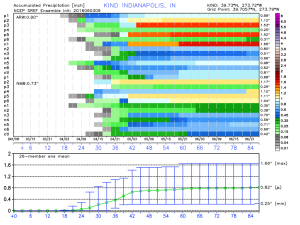
- Snowfall: 0.00″
- Rainfall: 0.50″-1.00″
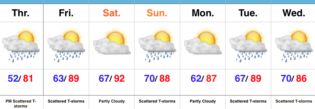
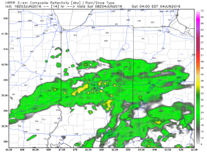 Steady rain and embedded thunderstorms will continue through the morning hours and into the afternoon.
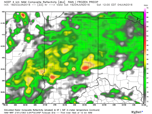
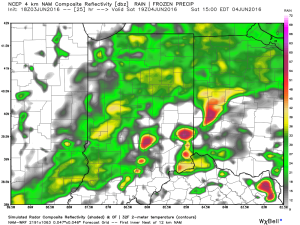 Eventually, a cold front will sweep through the state Saturday night and help “slosh” the widespread rain shield east of the region. By the time this happens, we expect widespread rainfall totals between 0.50″ and 1.00″ across central IN (with locally heavier totals).
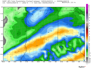
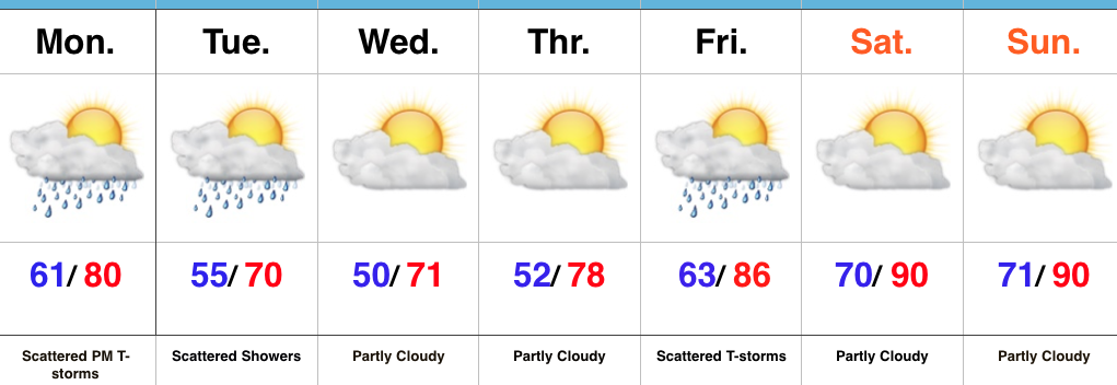
 Cooler weather will push in this weekend and continue into early and middle parts of next week. While the widespread rain will come to an end, upper level energy will remain and could help ignite scattered showers at times (particularly during the afternoon and evening hours) into early next week.