VIDEO: Quick Wednesday Evening Video Update…
You must be logged in to view this content. Click Here to become a member of IndyWX.com for full access. Already a member of IndyWx.com All-Access? Log-in here.
You must be logged in to view this content. Click Here to become a member of IndyWX.com for full access. Already a member of IndyWx.com All-Access? Log-in here.
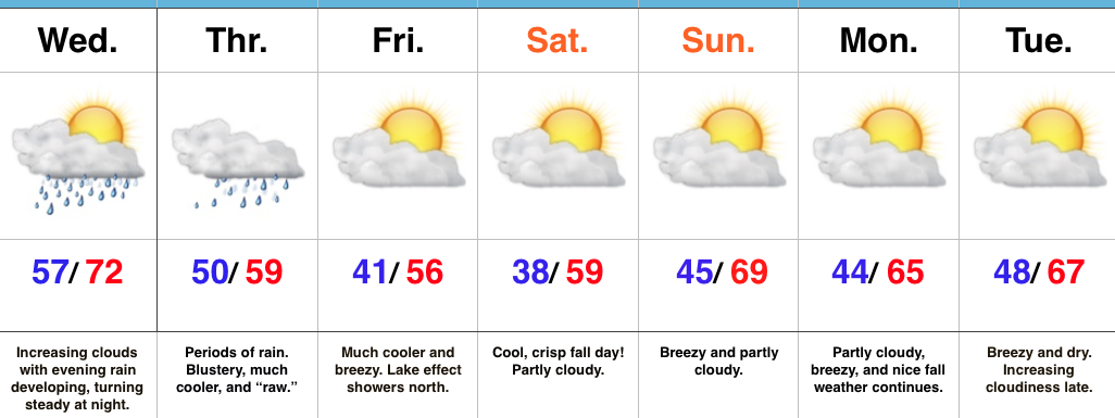 Highlights:
Find The Rain Gear…Most of Wednesday will feature dry conditions with lots of sunshine to start, but clouds will be on the increase and rain will follow. We expect rain coverage to increase from south to north as evening gives way to nighttime. This is all in association with a surface low developing along a stationary boundary to our south. This area of low pressure will track along the Ohio River (Thursday) to the interior northeast (Friday). (Indiana snow enthusiasts know that’s a perfect track for the snowy “goods” if only it was a month, or so, later). We will continue to dream… 🙂
Back to regularly scheduled programming…
Rain will grow in coverage and intensity Wednesday night into early Thursday morning and periods of rain will be with us through the day Thursday. Heaviest rains should fall through the southern half of the state (where localized 2″+ totals are possible). The other weather element we’ll have to deal with Thursday is an increasingly chilly and raw northeast wind shifting to the north late. Temperatures will remain steady and slowly fall by evening.
As the area of low pressure pulls off to the northeast, it’ll help drive the coolest air of the season southward. Patchy frost is possible for outlying areas Saturday morning. Fall foliage should be looking “really nice” this weekend across central IN.
Dry, but breezy, conditions will be with us early next week, but we’re eyeing our next storm system by the middle to latter portions of the week.
Upcoming 7-Day Precipitation Forecast:
You must be logged in to view this content. Click Here to become a member of IndyWX.com for full access. Already a member of IndyWx.com All-Access? Log-in here.
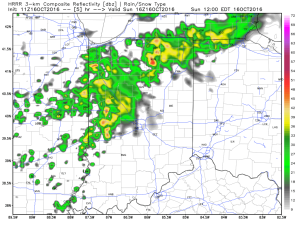
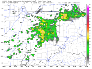
Before we talk about the warmth, we have some showers and embedded thunder to deal with across parts of the region today. Best rain chances today will be along and north of I-70, but a few showers could scoot south later this afternoon. We note most concentrated rain should fall through the early afternoon hours before moving out to allow for a dry evening.
We get back to a dry pattern Monday and Tuesday. Along with the dry conditions, unseasonably warm temperatures can be expected. Along with the summer-like feel, very strong southwest winds will be noted (gusts to 30-40 MPH).
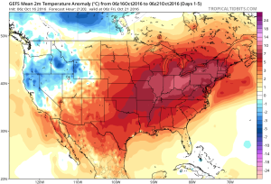
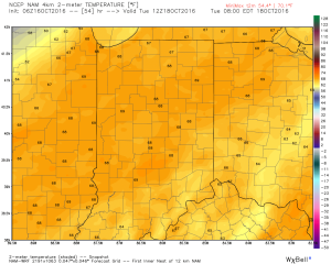
Highs Monday and Tuesday will top out in the lower to middle 80s and rival records across central IN. While that’s impressive enough, overnight lows of 65-70 are almost unheard of.
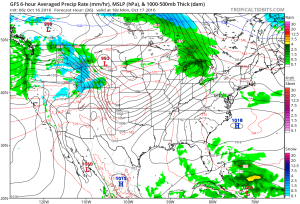
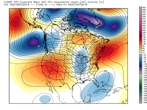
Cooler air will begin to move in by late week as a trough replaces the warm ridge. While we’re very confident on the much cooler feel, details in regards to the specifics around rain timing and amounts remain “muddy” at best. We’ll forecast best rain chances to arrive Thursday, but caution this may have to be fine tuned as we move forward. Highs that were in the 80s for early week will crash late week (upper 50s to lower 60s).
As of now, next weekend looks dry and cool, but it was only yesterday that rain chances looked like they may continue into the early portions of the weekend. Stay tuned. As previously mentioned, temperatures will be much cooler (upper 30s to lower 40s for lows and lower to middle 60s for highs).
Complete 7-day will be posted later!
 Highlights:
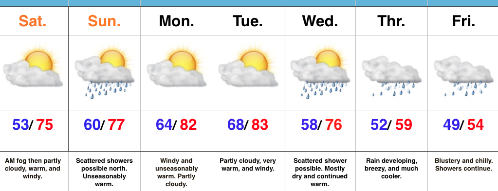
Near Record Warmth Gives Way To A Cooler Feel…We have to deal with low clouds and areas of fog this morning, but expect enough wind to mix things out and return us to a variably cloudy sky this afternoon. Significantly warmer conditions are on tap today than what we’ve dealt with over the past couple days. Winds will become gusty this afternoon (20-30 MPH).
Scattered showers will drop south Sunday. These will impact mostly northern locations (north of I-70) and won’t be a big deal.
Monday and Tuesday will feature strong and gusty southwest winds (30-40 MPH), dry conditions, and near record warmth. Highs in the lower 80s for mid October is downright impressive, but the warm overnight lows in the mid to upper 60s is almost unheard of for this time of year. Enjoy the stretch of extended summer.
Our weather pattern will offer up an increasingly chilly regime late week and the overall evolution of a storm system is still up in the air in regards to rain timing and amounts. For now we’re leaning towards a wet, chilly, and blustery forecast Thursday and Friday.
Upcoming 7-Day Precipitation Forecast: