Weekend Freeze…
 Highlights:
- Reinforcing chilly air blows in
- Weekend freeze
- Mainly dry
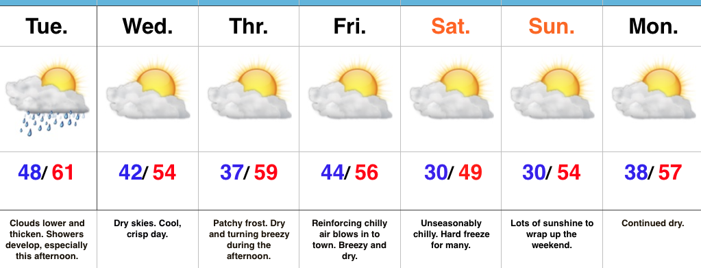
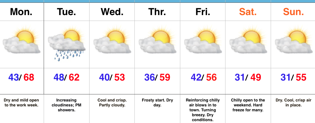
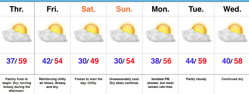
Dry; Reinforcing Chilly Air…We’ll wrap up the work week on a dry note, but a breezy one as reinforcing chilly air blows into town.
First thing’s first and that’s Thursday. Frosty conditions will greet many out the door tomorrow morning before an increasingly breezy afternoon and evening. This is ahead of a front that will sweep through here Friday and result in the coldest air of the fall season so far over the weekend. In addition to our first freeze (many neighborhoods away from the city will fall into the 20s this weekend), highs Saturday likely won’t make it out of the 40s for most.
Despite an isolated shower chance Monday, it’s a dry 7-day, along with fairly seasonable conditions when you total everything up. The potential is there for more active times just beyond the forecast period…
Upcoming 7-Day Precipitation Forecast:
- Snowfall: 0.00″
- Rainfall: Trace – 0.05″