JMA Weeklies: Cool Gives Way To More Seasonal Conditions…
The new JMA Weeklies are in and the highlights include:
- Unseasonably cool conditions Week 1
- Anomalously wet across the Southeast
- Warmer, more seasonal early-summer weather arrives
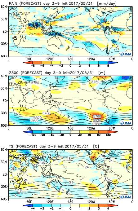
Week 1:
The pattern is dominated by an eastern trough and western ridge. Accordingly, cooler than average conditions will dominate the central and eastern portions of the country. Very wet conditions should dominate the southern and eastern tier of the country (heaviest rains should fall east and south of Indiana).
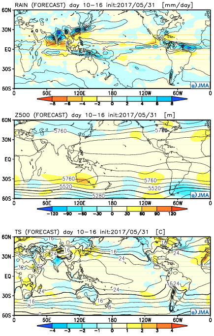
 Week 2:
The pattern begins to “relax” a bit, locally, with warmer conditions set to develop. We note three areas of anomalously wet weather- west coast, northern Plains and Southeast.
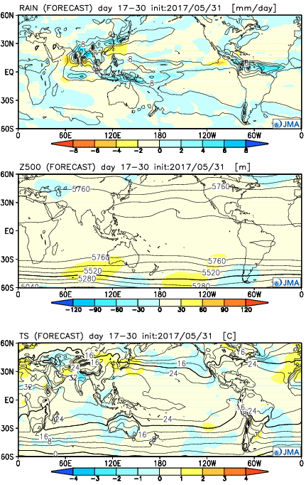
 Weeks 3-4
While the pattern doesn’t seem to promote any sort of significant heat or cool (relative to normal), this is certainly a warmer look, overall, to close the month than how we’re starting. This look would suggest warm, seasonal, summer conditions locally with average precipitation. Wet weather continues to dominate the pattern across the south and begins to emerge into the central.
 Highlights:
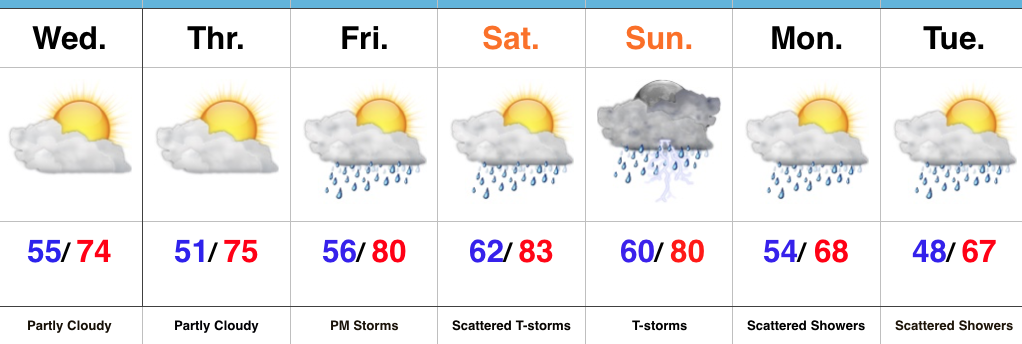
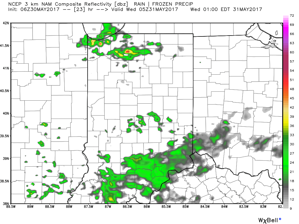 The majority of our midweek stretch looks rain-free, but more widespread showers and thunderstorms will return as we push into the weekend. Recent trends have also slowed the FROPA (frontal passage) down significantly- now perhaps not until late Sunday.
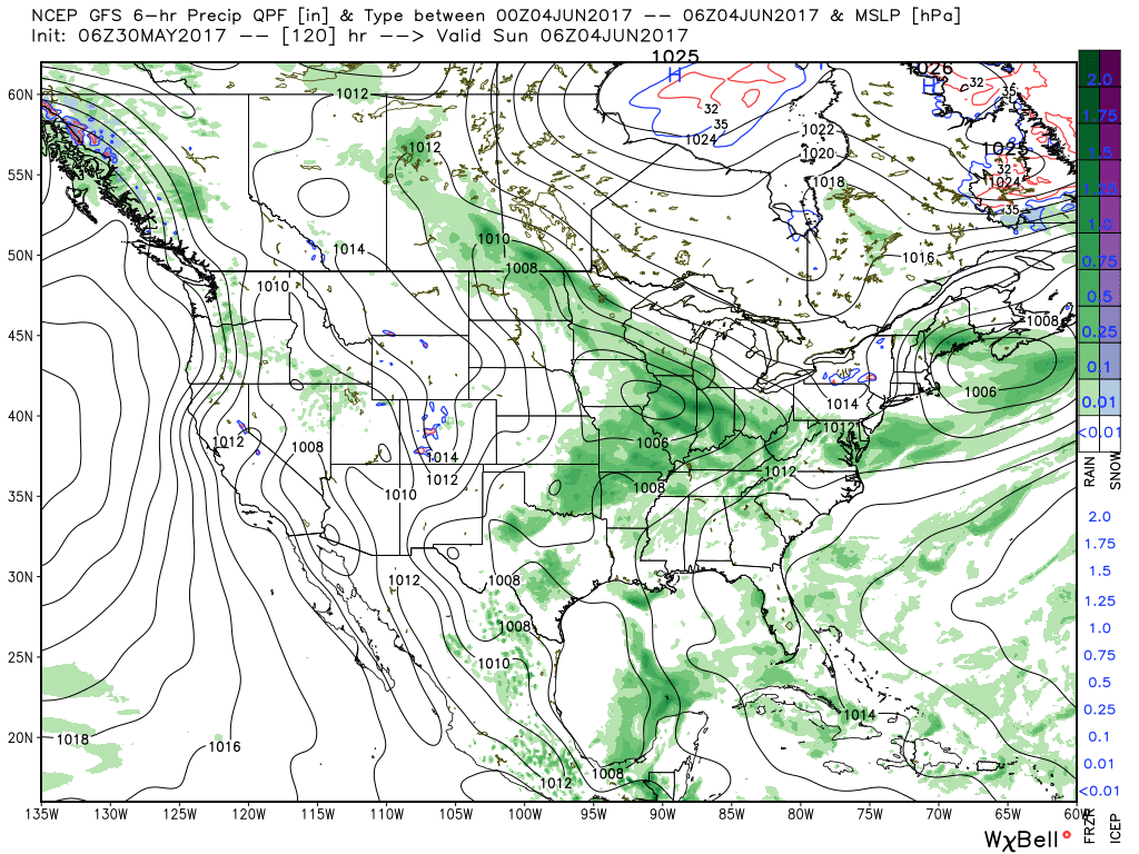 There will be dry time this weekend, but with a moisture laden air mass in place, locally heavy downpours can be expected, including rainfall potential of 1″+ this weekend for neighborhoods that get under a heavier storm.
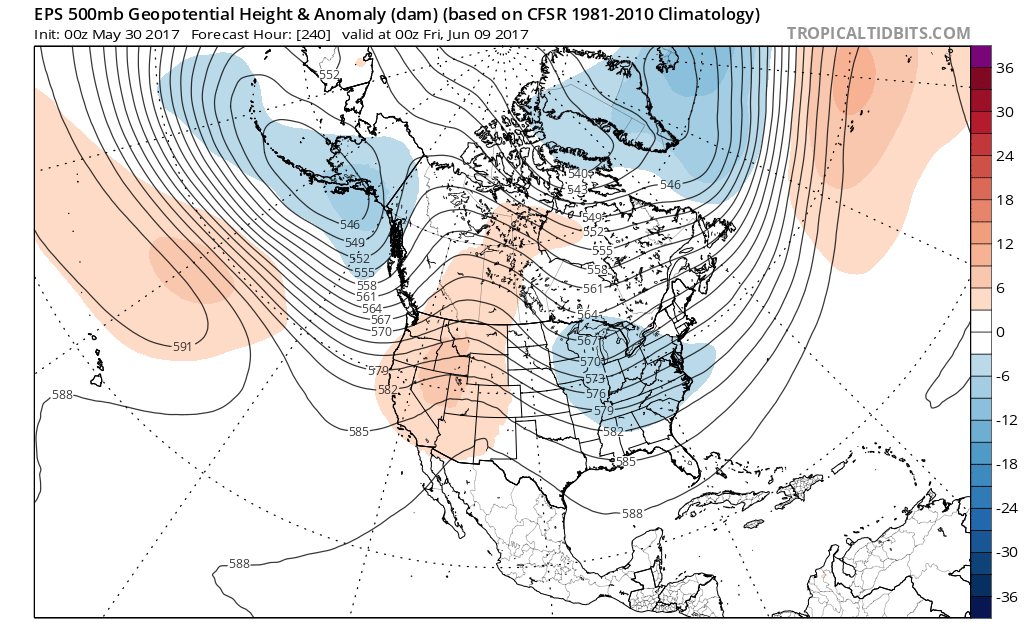 In fact, there may be a couple of days early next week where highs struggle to reach 70° with lows in the upper 40s to lower 50s. Very refreshing, indeed, for early June.
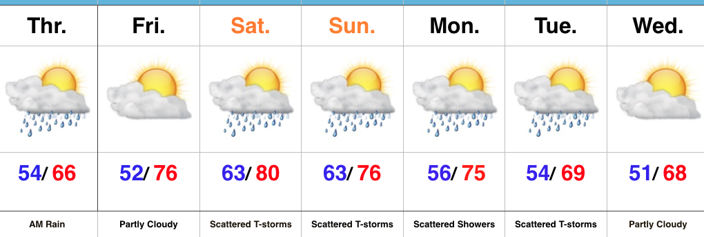 Highlights:
 While we can’t completely rule out an afternoon shower or storm Sunday, the most widespread activity should occur during the morning hours- before race time. Stay tuned. We’ll turn cooler early next week…
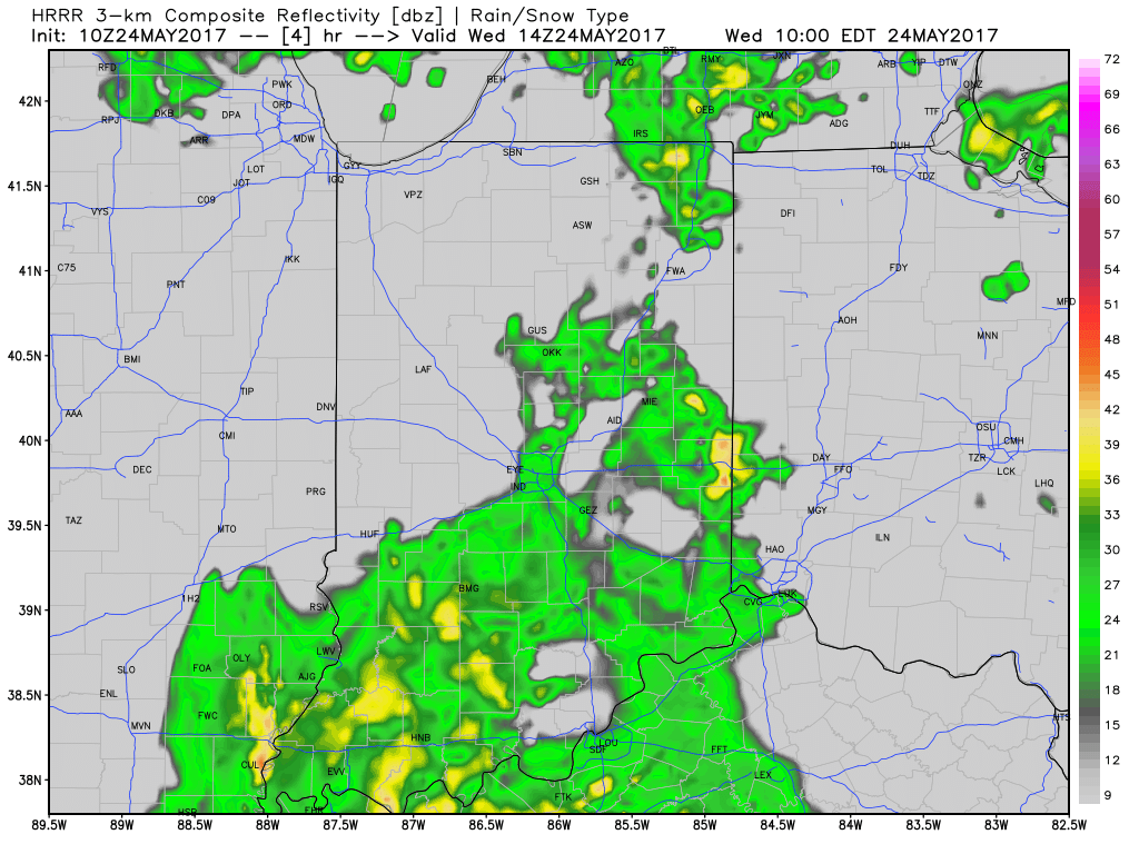
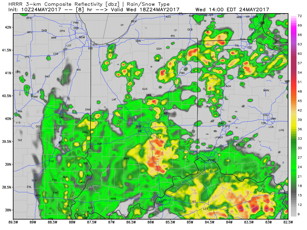
 Thankfully, rain will begin to diminish Thursday morning and we’re back to mostly dry conditions by Thursday afternoon. Before dry weather returns, some neighborhoods can expect to accumulate between 1″-2″ of rain.
 With the clouds and showers around, expect unseasonably cool conditions both today and Thursday. Highs will only reach the mid to upper 60s both days.