VIDEO: Busy Week Ahead…
You must be logged in to view this content. Click Here to become a member of IndyWX.com for full access. Already a member of IndyWx.com All-Access? Log-in here.
You must be logged in to view this content. Click Here to become a member of IndyWX.com for full access. Already a member of IndyWx.com All-Access? Log-in here.
 Highlights:
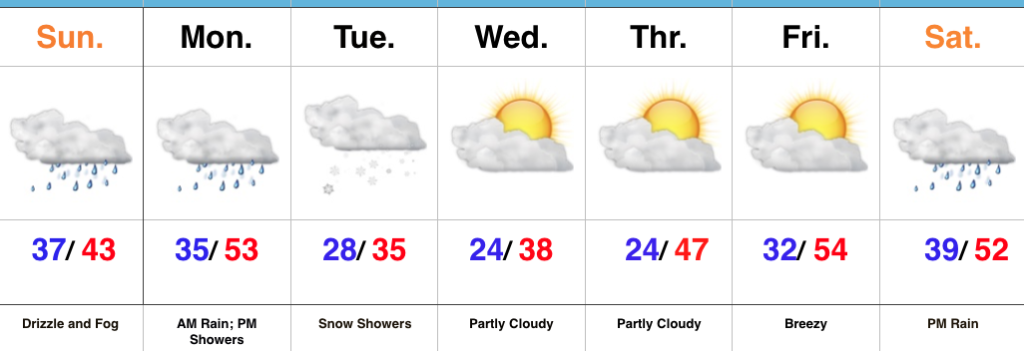
Drizzle And Fog Develops…Our Saturday opened with plentiful sunshine and milder conditions. Unfortunately, the low cloud deck invaded through the afternoon hours and will take up residence through Sunday. Fog and drizzle will develop tonight and continue through most of Sunday.
Steadier rains will arrive on the scene late Sunday night into Monday morning ahead of an approaching cold front. That cold front will sweep through the state Monday afternoon with additional showers and a dramatic wind shift. Colder air will then press into the region and as wrap around moisture swings through the state, snow showers will develop Tuesday.
As mentioned in previous posts, we’re in a transient and very active regime. Just as soon as the colder air arrives for midweek, we’ll shift our air flow around to the southwest and usher in milder times to close the week. A significant storm system is brewing next weekend. We’ll forecast increasing cloudiness Saturday with rain arriving by afternoon. We’ll have to keep tabs on next Sunday for the possibility of wintry conditions returning…
Upcoming 7-Day Precipitation Forecast:
You must be logged in to view this content. Click Here to become a member of IndyWX.com for full access. Already a member of IndyWx.com All-Access? Log-in here.
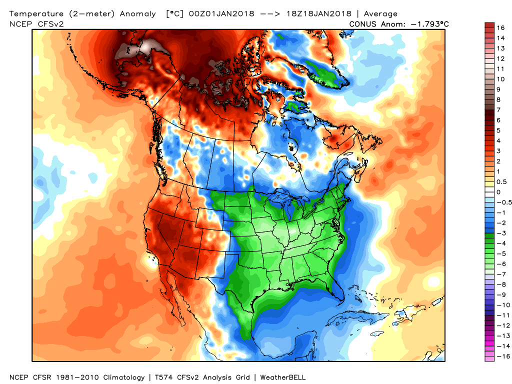
January is running more than 11.5° below average and more than 50% of the country is currently covered in snow.
 However, big changes begin to take place this weekend and will remain intact for the majority of the next couple weeks. The mean trough position will back into the west while ridging takes hold across the east. This will feature temperatures that will push to above average values and lead to an active and moist southwesterly flow.

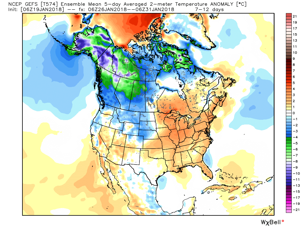
 Over the upcoming (10) days, temperatures may reach 50°, or greater, on 3 to 4 of those days. Compared to how frigid we’ve been (already had 7 mornings this month with sub-zero lows), this will feel like a heat wave.
We’ll leave you with a heads up to enjoy the January thaw (yes, even if you’re one of those winter lovers out there) as the pattern sure looks like it’ll deliver a return to bitterly cold, wintry times as we head into February… In fact, analogs would suggest once winter returns, it’s likely to remain in place deep into spring this year.
 Highlights:
Sunny And Not As Cold…The arctic high that delivered the bitterly cold conditions over the past few days is scooting off to the southeast. This will put the state under a milder (all relative :-)) southwesterly flow and temperatures will become “less harsh” as we wrap up the work week!
An approaching storm system will lead to increasing clouds during the afternoon and evening Saturday and drizzle will follow Sunday morning. As the cold front draws closer, steadier rains will arrive Sunday night into Monday. Colder times will sweep in behind the front and allow left over precipitation to end as snow showers Monday (not a big deal).
Tuesday and Wednesday will feature dry and chilly conditions.
Upcoming 7-Day Precipitation Forecast: