VIDEO: More Active Times Await…
You must be logged in to view this content. Click Here to become a member of IndyWX.com for full access. Already a member of IndyWx.com All-Access? Log-in here.
You must be logged in to view this content. Click Here to become a member of IndyWX.com for full access. Already a member of IndyWx.com All-Access? Log-in here.
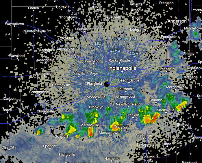
1.) A narrow, but persistent band of downpours continues to fall just south of the metro this morning. Places from Martinsville to Trafalgar and Shelbyville are enjoying needed rain this morning.
 2.) Overall, a drier air mass will build into central Indiana today and Thursday (cooler, too) before moisture returns to close the week. Scattered showers and embedded thunder are more likely Friday and again late Sunday into Monday.

 3.) Looking ahead, we notice a more active pattern is presented off the overnight GEFS model. The heat ridge backs west and sets up a busy “ring of fire” pattern with a northwest flow aloft across our region. We have a ways to go before developing consistency and overall confidence, but this is at least an encouraging sign. The end result, should this come to fruition, would be a significantly wetter open to June.

You must be logged in to view this content. Click Here to become a member of IndyWX.com for full access. Already a member of IndyWx.com All-Access? Log-in here.
You must be logged in to view this content. Click Here to become a member of IndyWX.com for full access. Already a member of IndyWx.com All-Access? Log-in here.
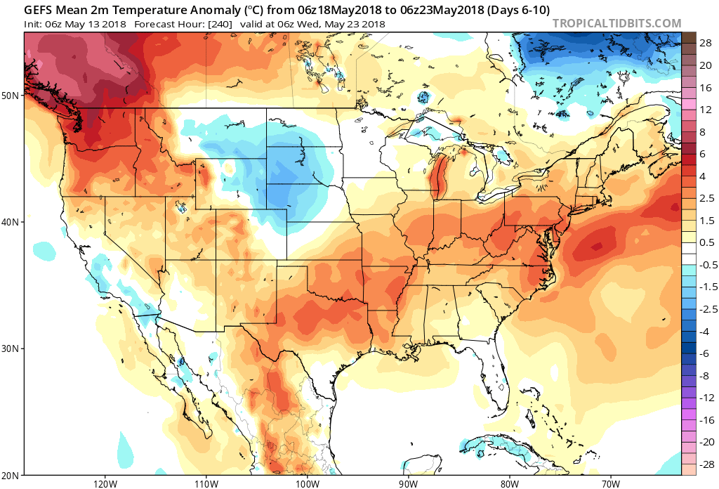
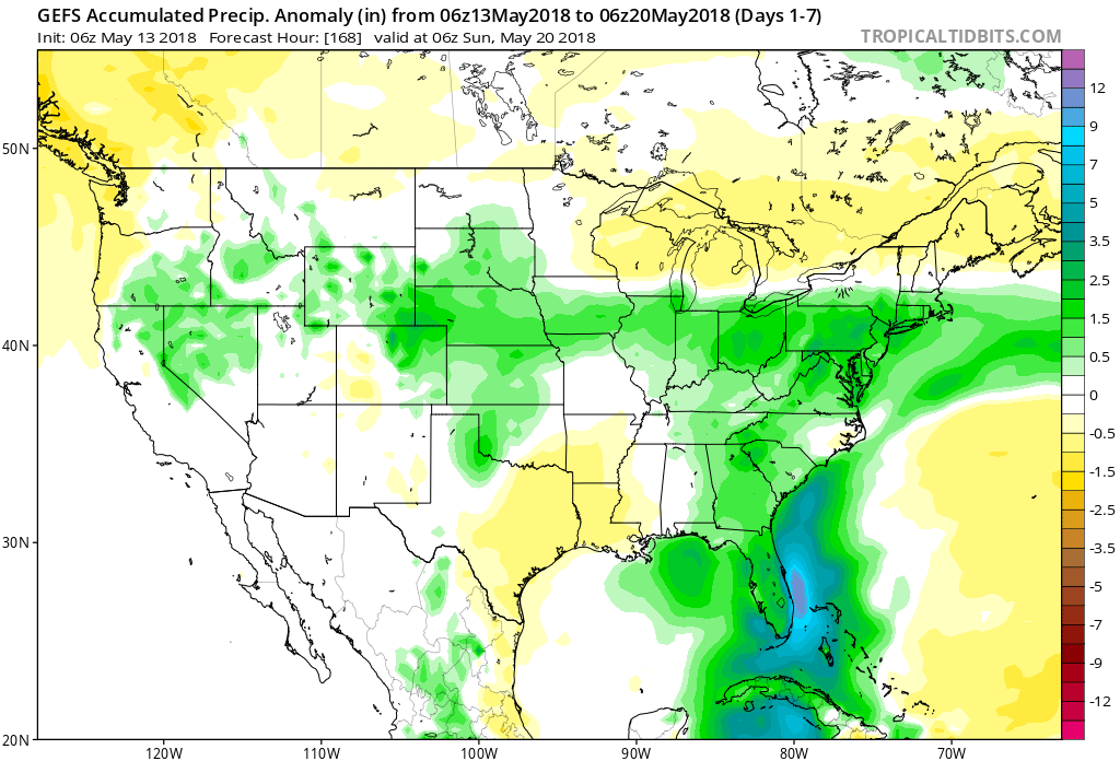
So far, May-to-date has run well above average in the temperature department (+8.5°) and below average from a precipitation perspective. While we’ll continue to run much warmer than normal through the second half of the month, we’ll begin to make up for “lost time” in the rainfall department, and that starts this week.
Daily chances of showers and thunderstorms are included in your latest 7-day and, at times, storm complexes will likely reach strong to severe levels as disturbances ride the periphery of an upper level ridge off to our south. It certainly won’t rain the entire time over the upcoming week and we’ll still enjoy more dry hours than wet and stormy. That said, for a region running around 1.5″ below average, the more active times will be a welcome sight for many. By next Sunday, we expect many area rain gauges to accumulate 1.5″ to 2.5″ of rain with locally heavier amounts.