VIDEO: Extended Quiet Stretch Of Weather…
Updated 09.25.21 @ 7:54a
You must be logged in to view this content. Click Here to become a member of IndyWX.com for full access. Already a member of IndyWx.com All-Access? Log-in here.
Updated 09.25.21 @ 7:54a
You must be logged in to view this content. Click Here to become a member of IndyWX.com for full access. Already a member of IndyWx.com All-Access? Log-in here.
Updated 09.24.21 @ 7:31a
You must be logged in to view this content. Click Here to become a member of IndyWX.com for full access. Already a member of IndyWx.com All-Access? Log-in here.
Updated 09.19.21 @ 10:20a
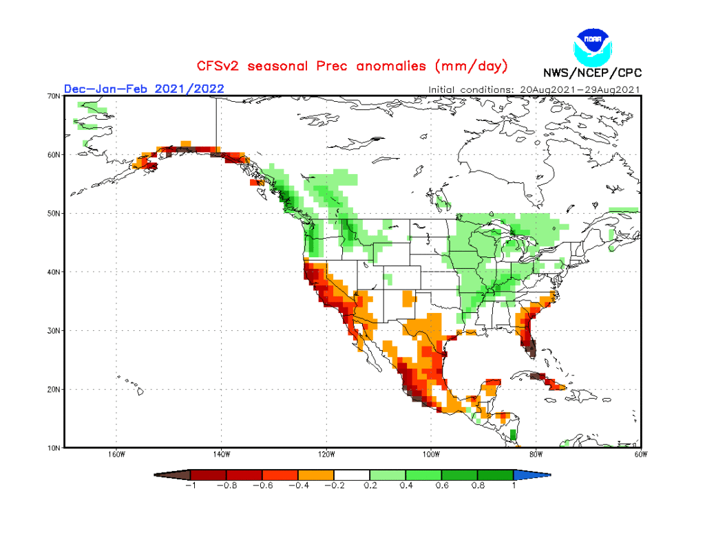
As the first strong autumn cold front takes aim on the region, it’s time to start thinking more about what lies ahead in the December-February time frame. This morning’s video dives in with some initial thoughts around just that. Is the CFSv2 seasonal precipitation projection an indication of the active winter storm track ahead? We think so…
Updated: 09.18.21 @ 1a
You must be logged in to view this content. Click Here to become a member of IndyWX.com for full access. Already a member of IndyWx.com All-Access? Log-in here.
Updated 09.17.21 @ 7:50a
You must be logged in to view this content. Click Here to become a member of IndyWX.com for full access. Already a member of IndyWx.com All-Access? Log-in here.