You must be logged in to view this content. Click Here to become a member of IndyWX.com for full access. Already a member of IndyWx.com All-Access? Log-in here.
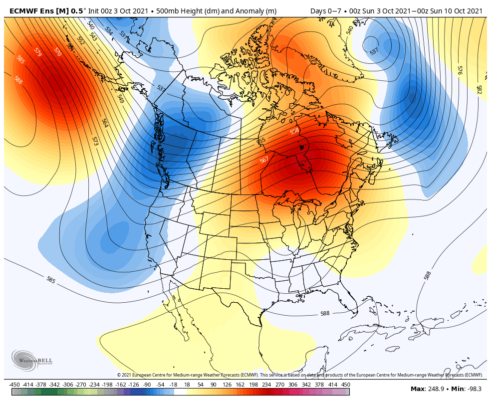
While a trough settles into the West, the eastern portion of the country will have to deal with a pesky cut off low for a good chunk of the forecast period.
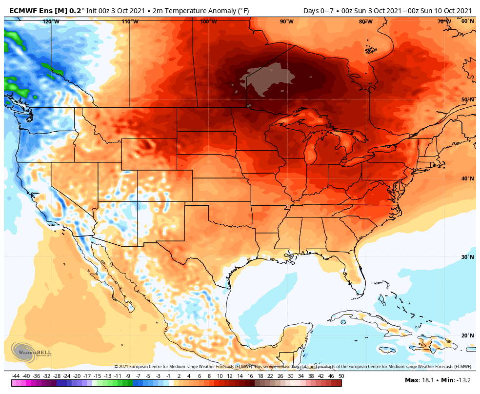
Well above normal temperatures will dominate the northern tier, Plains, and East through the period while cooler conditions settle into the West.
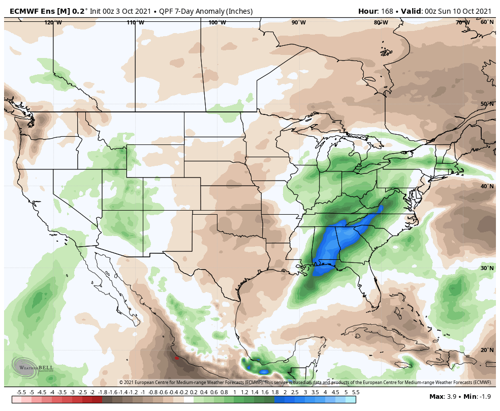
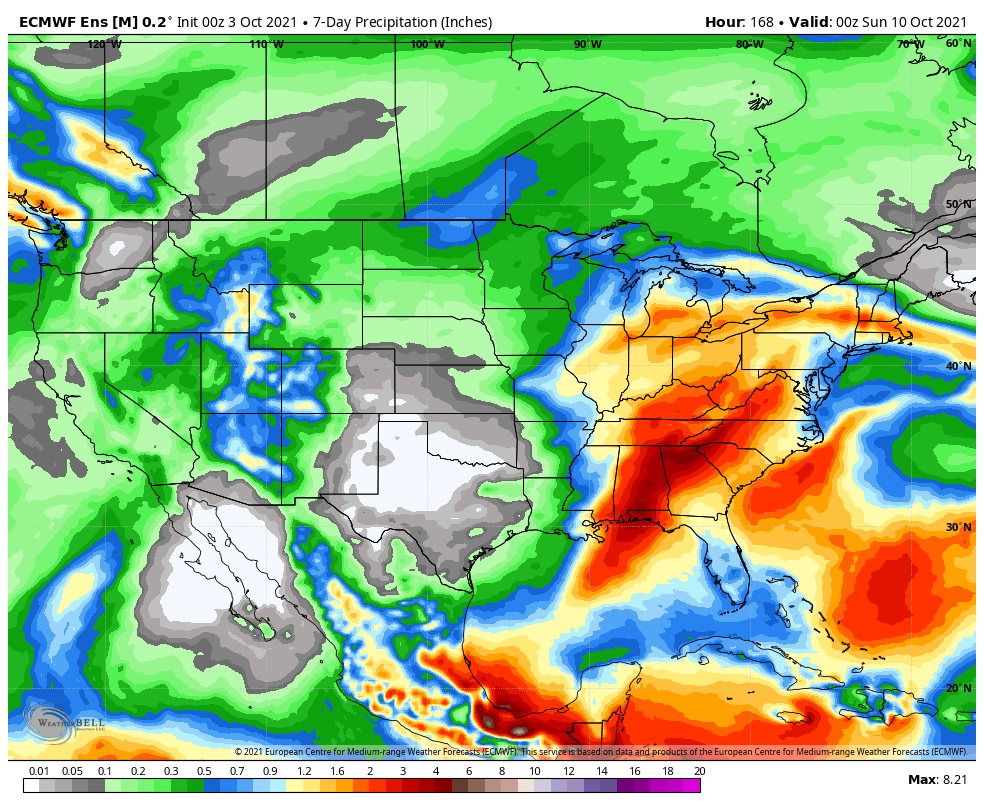
A wet pattern will be associated with the cut off low across the Deep South and Ohio Valley. Wetter conditions will also develop across the West.
We forecast central Indiana to pick up 0.50″ to 1″ of rain in the 7-day forecast period with localized heavier totals.
Forecast Period: 10.03.21 through 10.10.21
A stubborn cut off low pressure system will keep things unsettled around these parts for a good chunk of the forecast period. It certainly won’t rain the entire period, but compared to the past couple of weeks, most will notice a drastic difference in the wetter conditions. We think greatest coverage of rain will come today and midweek. By this time next week, most central Indiana rain gauges can expect to tack on an additional 0.50″ to 1″ of rain with locally heavier totals.
The other big story by late in the week will be an expanding ridge of high pressure. This will keep our region well above normal from a temperature perspective, including the likelihood of multiple days of 80°+ in the 6-10 day stretch. This will be driven by a strongly negative PNA and positive EPO and is supported by October La Ninas from the past (analogs). The persistent warmer than normal regime shouldn’t really go anywhere in the longer range. It’s not until we get to the 2nd half of November (and beyond) when we believe a more profound shift to more persistent cold lurks.
You must be logged in to view this content. Click Here to become a member of IndyWX.com for full access. Already a member of IndyWx.com All-Access? Log-in here.
You must be logged in to view this content. Click Here to become a member of IndyWX.com for full access. Already a member of IndyWx.com All-Access? Log-in here.
You must be logged in to view this content. Click Here to become a member of IndyWX.com for full access. Already a member of IndyWx.com All-Access? Log-in here.