The short-term weather pattern will continue to be dominated by rather “boring” conditions for this time of year, along with much milder than normal air. A weak frontal system will swing through here Thursday and while a light shower is possible, that’s really the only significant (if you want to call it that) weather feature through the upcoming 7-10 days.
In addition to the rather quiet weather, relative warmth will dominate as we open December. When “normals” feature lows in the upper 20s and highs in the lower 40s, actual overnight lows will only fall into the low-mid 30s and highs will reach the middle to upper 50s.
 When we look ahead, the shelf life of this warmth is certainly limited. The GEFS showcases this shift in the pattern from a warm open to the month towards a much colder pattern very nicely. The GEFS has other model support, as well.
 This is the type of dramatic shift in the overall pattern that not only threatens to “lock in” a colder than average regime, but potentially lead to plenty of wintry mischief to boot, and just in time for the holiday season.
There’s teleconnection support for the wintry shift, as well, leading to further confidence of a significant move towards cold, and potentially snowy/ icy, conditions as the true holiday and Christmas season approaches.
 To summarize, while unseasonably quiet and mild conditions will rule in the short-term, Mother Nature sure seems to have an attitude of making up for “lost time” in the medium to longer range. This is the type pattern that we’ll have to monitor the potential of some sort of leader-follower scenario as the transition from warm to cold takes place, and given the blocky nature of the pattern, it sure seems like we’re heading into a busy time of things from a wintry perspective mid and late month.
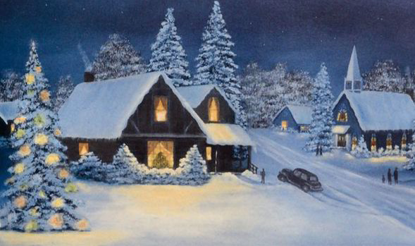
Perhaps this will be the scene as Christmas time nears across the Mid West, including central Indiana? Time will tell…

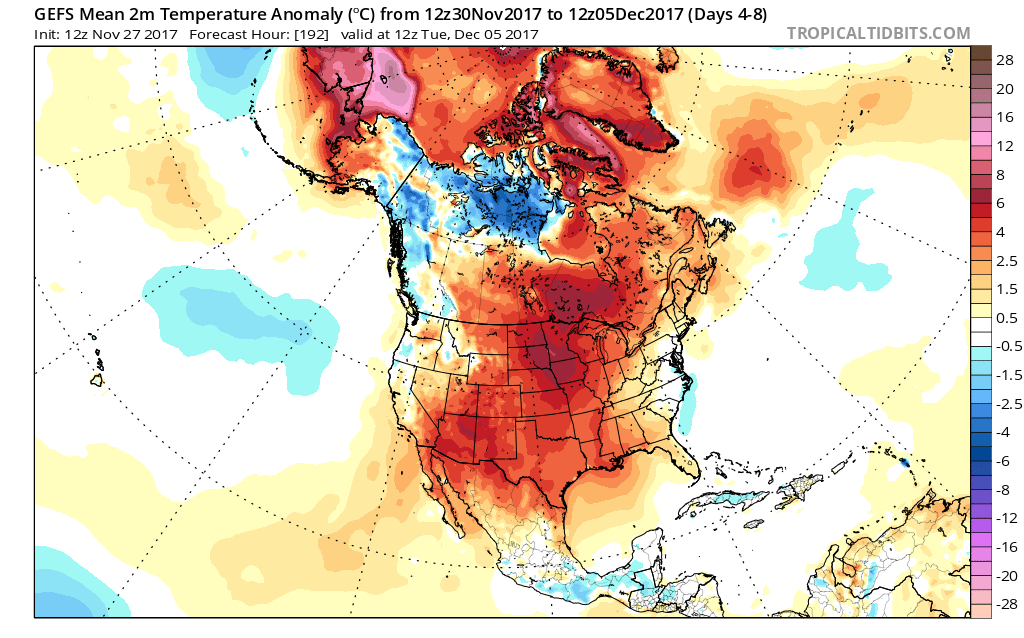
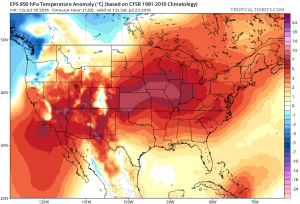
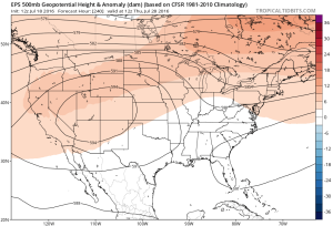
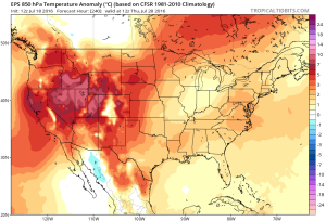
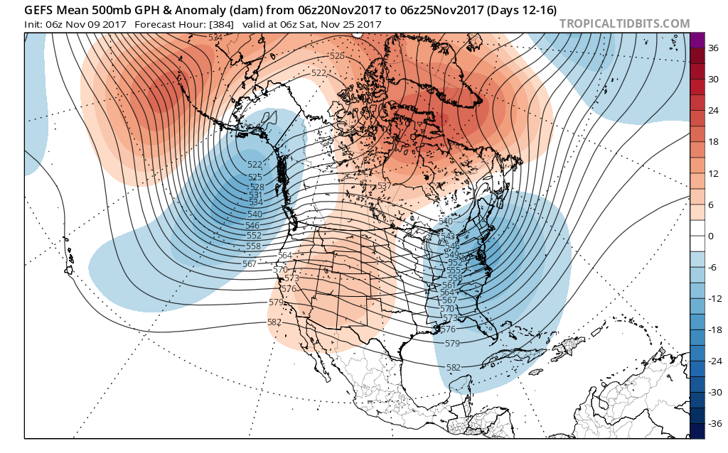 Such a pattern illustrated above, per the European ensemble (image 1) and the GFS ensemble (image 2), would help drill a tongue of unseasonably cold air through the northern Plains, into the Mid West, and across the East.
 We’ve been discussing early snow cover across Canada and the northern tier for weeks and how models would have to “correct” colder as they realize the air masses traveling over the snowpack won’t be able to modify as they normally would without that snowpack. The differences between this November and last are startling and show how the early snowpack is beginning to “feedback” on itself leading to early-season cold air.
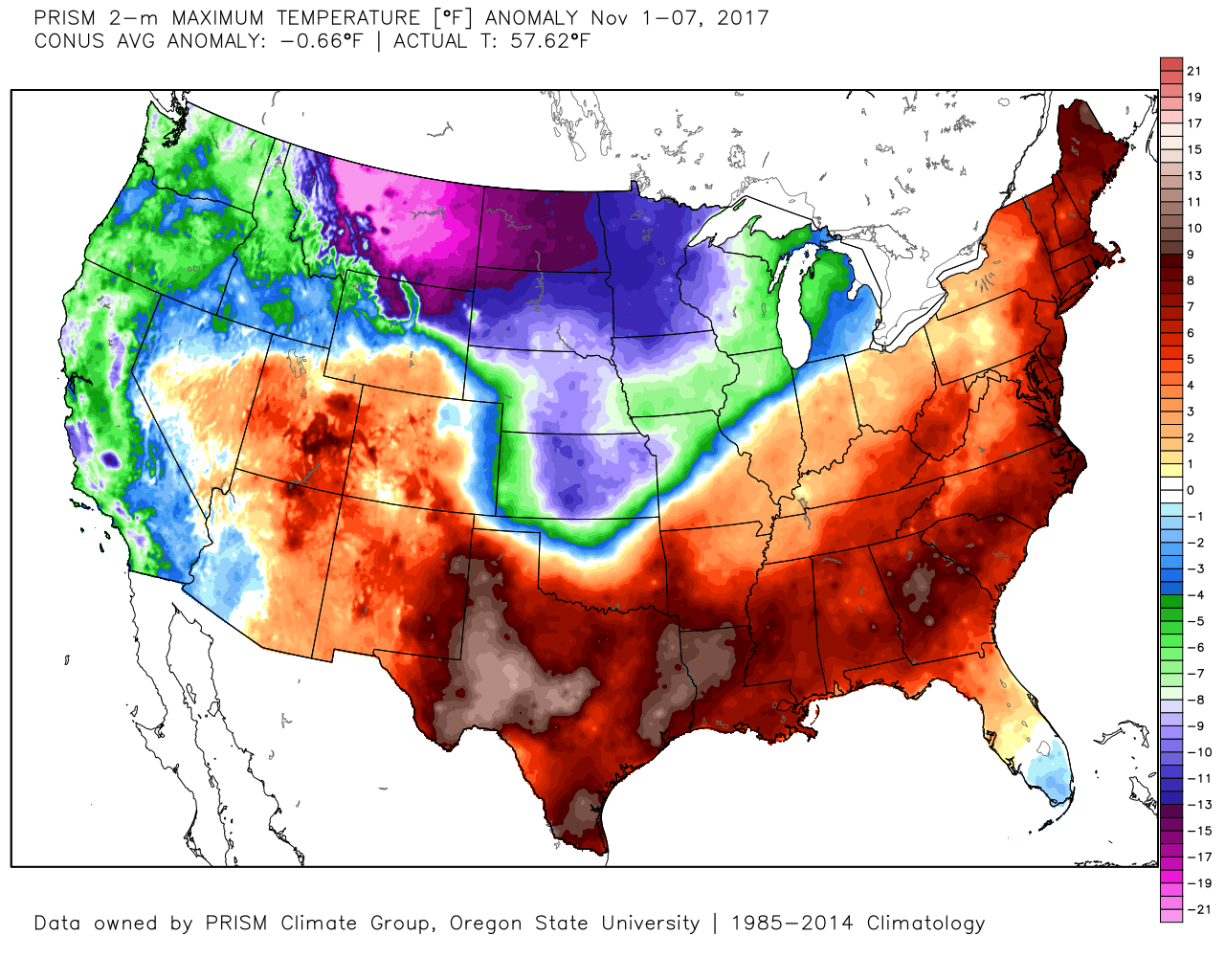
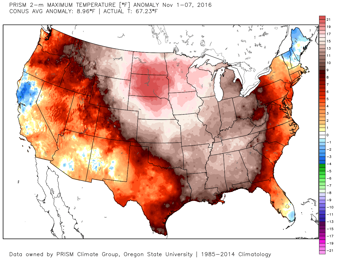 2017 snowpack and temperatures anomalies through the first week of November:
 Given the overall look to the pattern downstream, I anticipate the cold will continue to “press” and eventually overwhelm the pattern east as we progress through the second half of the month.
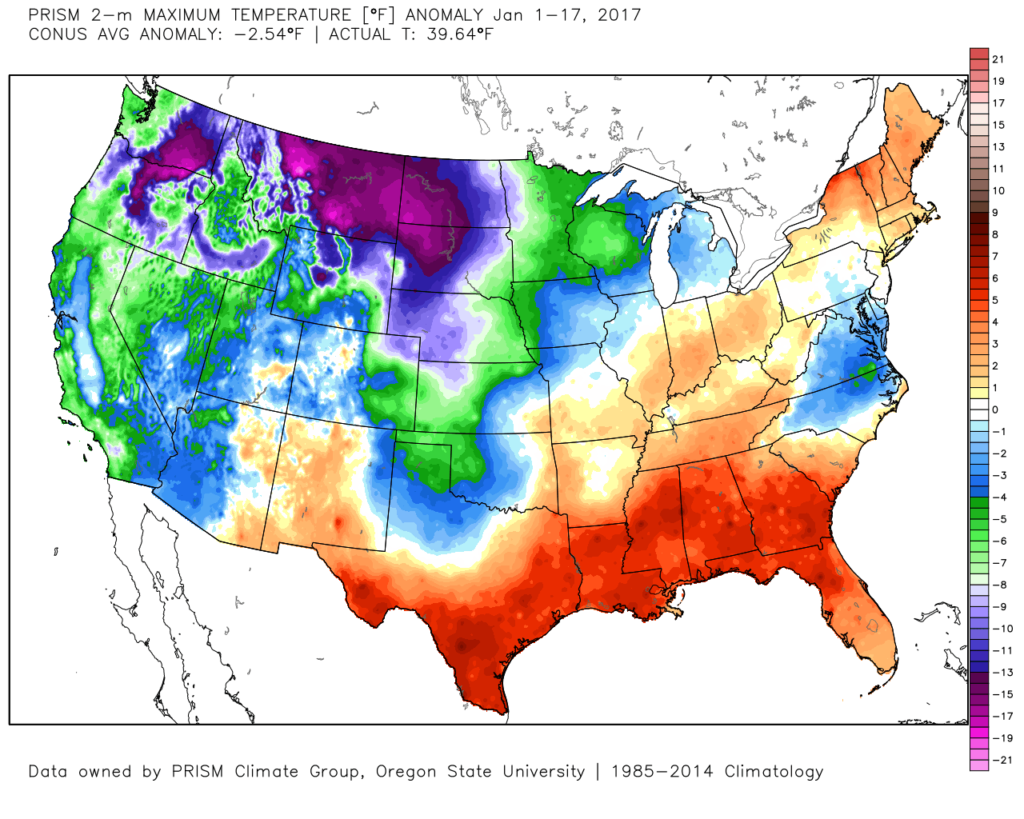 The second week of the month warmed significantly and continues, overall, for the next week.
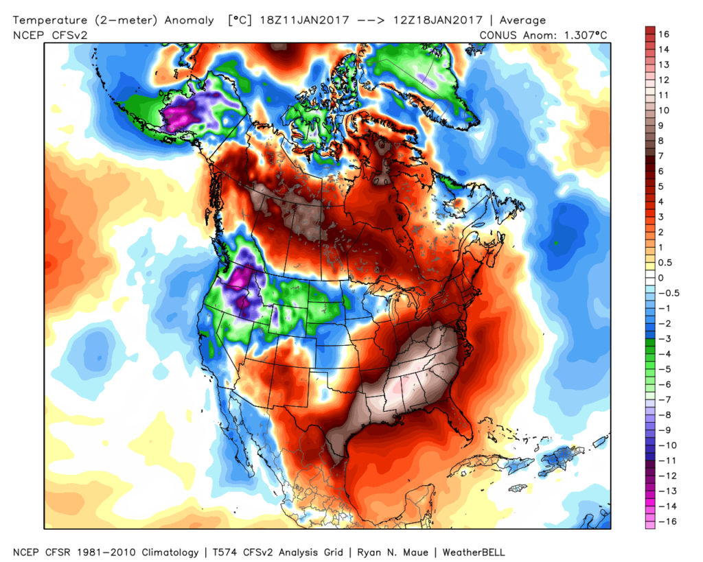 The mid-January warmth is attributed to a roaring PAC jet which is currently helping flood the country with temperatures much more like spring than the dead of winter. We continue to forecast 60+ this weekend across central IN.
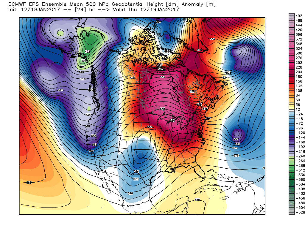 This Weekend:
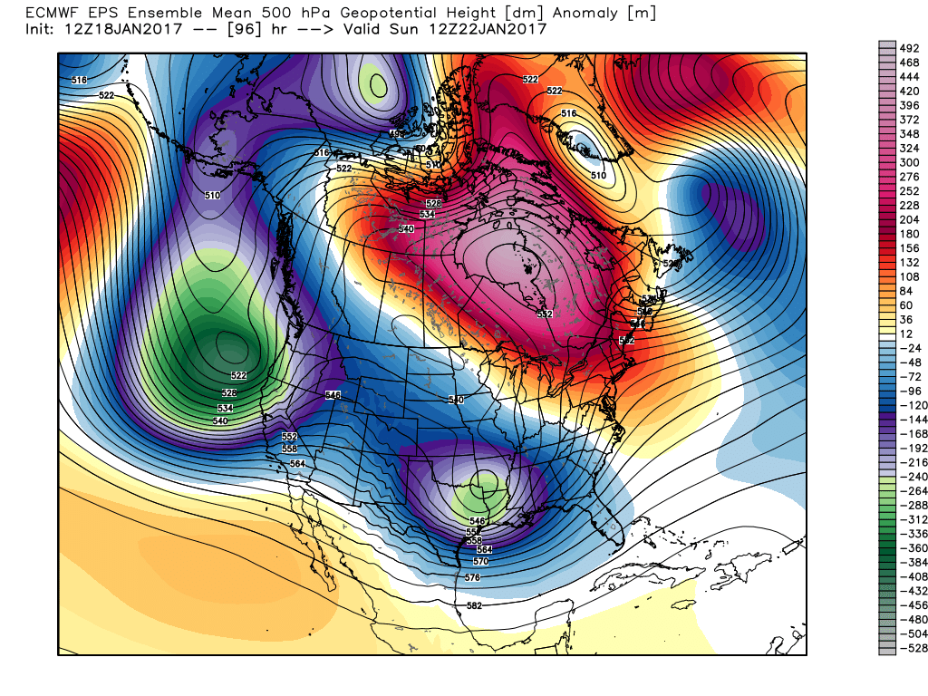 Next Thursday:
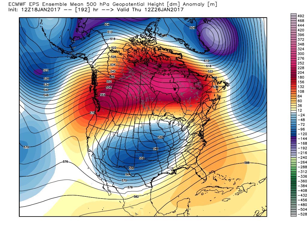 Next Weekend:
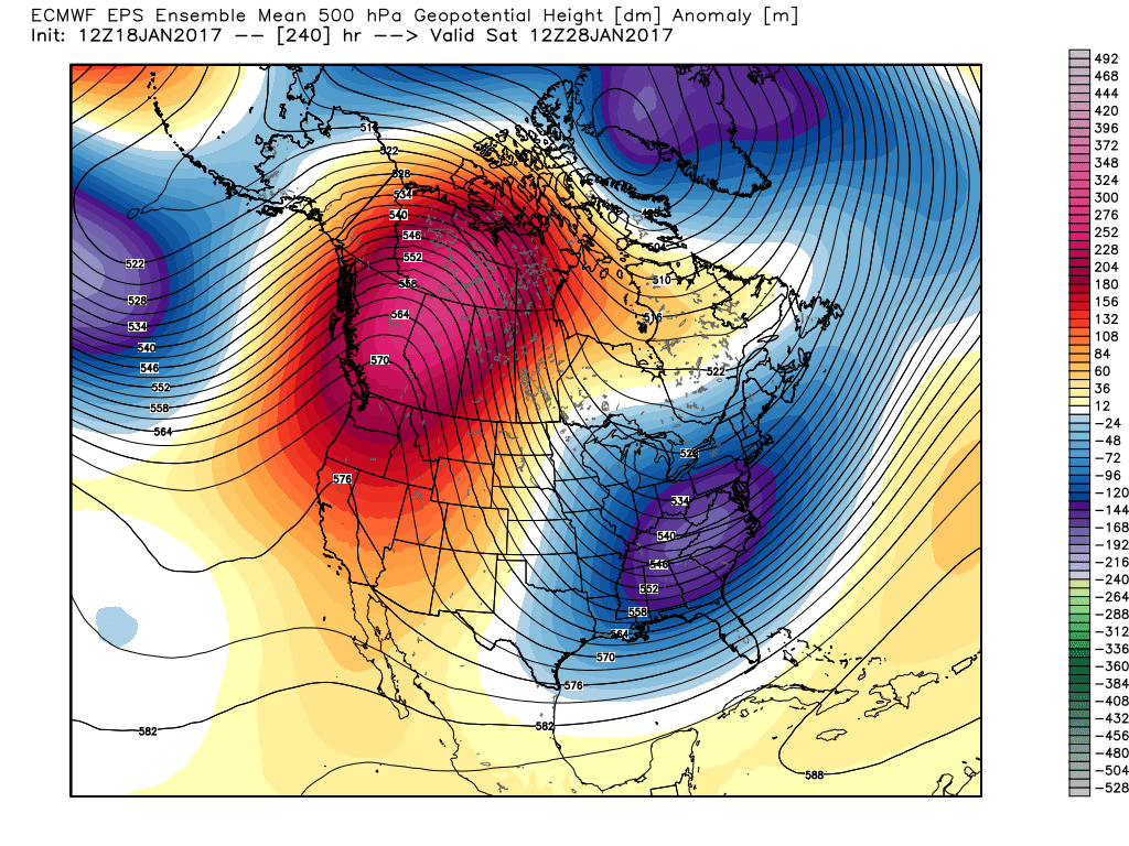 The pattern begins in the short-term with a look that will power anomalous warmth through the weekend, along with renewed rain chances Thursday night into Friday (another 1″+ for most), but begins to shift next week towards the colder look. The 2nd (weekend) storm system will be significant and poses a severe risk to the southeast region. Modeling has backed away on the heavy rain threat Sunday, but showers will be around early next week along with very windy conditions (40+ MPH gusts). Blocking is forcing the low south. By the time we get to next weekend, the pattern has done a 180 and in a position to drill unseasonably cold air back into the central and eastern portions of the country.
 Speaking of warmth, 2016 has been a very warm year.
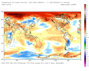 (The cold of 2014 seems so long ago…)
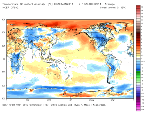 Back to present. We’ve targeted the middle part of November to finally beginning “bucking” the recent warm trend. This won’t happen overnight and will be a battle of back and forth, initially. Thus, the “step-down” label. To be clear, November, as a whole, will finish much warmer than average. It’s virtually impossible to counter the incredibly warm start. That said, we do anticipate “jabs” of colder air working in here over the next couple weeks. For instance, this weekend will feature lows in the 20s for most and highs not making it out of the 40s Saturday afternoon. (The average low and high at IND Saturday are 37 and 54).
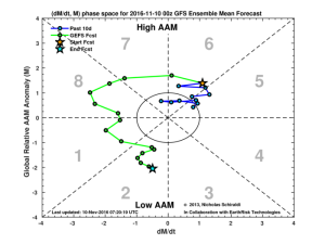
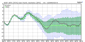
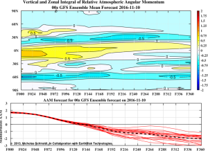 When we look at the AAM forecast (above), we note the westerlies may begin to slow (indicative of the negative values) in the 8-10 day period. This is crucial and, simply put, has to happen for the pattern to begin shifting into more of a position to allow sustained cold to enter the equation. We want to reiterate that this, in and of itself, doesn’t create the cold, but instead allows the pattern to begin shifting away from the Nino-like (warm) regime into more of a La Nina pattern, as a whole. – Hey, you have to start somewhere.
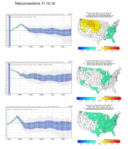 Additionally, the EPO is forecast negative off the GEFS and EPS. (Images courtesy of Weatherbell.com).
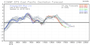
 Again, this is a cold signal. (Image courtesy of Madusweather.com).
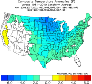 The ensemble data is also beginning to key-in on higher heights (blocking) developing over the top. Notice the significant changes in the overall look to the pattern between now and days 11-16. (Images courtesy of Weatherbell.com).
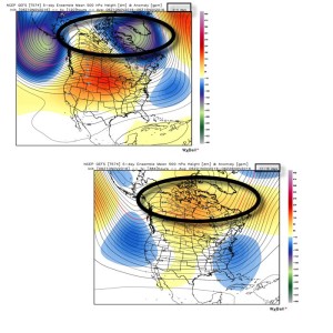 In summary, and in the face of *most* seasonal data that is screaming warm, warm, warm, we still don’t have any significant changes to our overall thinking of “step-down” mid-November giving way to more sustained wintry-like conditions in the overall sense from the Thanksgiving-Christmas period. Time will tell and only the Good Lord knows what the future holds, but we’ve done far too much work and research to throw the “game plan” in the trash before the game even begins…
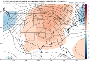
 While some oppressive heat and humidity will impact our local area to wrap up the work week and head into the weekend, this is a pattern where it’s incredibly difficult to deal with any sort of one particular weather pattern for any time of substance. Looking forward to August, we don’t see this changing. Remember that word we leaned on to begin summer? “Transient” remains the best way to describe the pattern moving forward, as well.
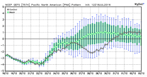
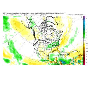 To close, we’ll leave you with a look at the latest PNA pattern. This has been the primary driver of our weather this summer, and it also argues any sort of dry, hot weather doesn’t last. Note the positive PNA returning to close July. This also lines up well with our idea of unsettled times returning…