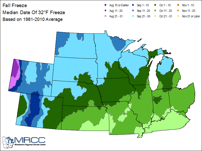
First Frost Of The Season Comes Right On Schedule…
The average date for the first frost and freeze in Indianapolis takes place on October 11th and 14th, respectively. Right on cue, the first frost of the season will take place for most central Indiana neighborhoods over the weekend. If you happen to miss out on the frosty conditions this week, reinforcing chilly air will descend on the region early next week.
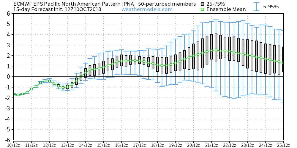
We forecast (3) of the upcoming (7) nights to fall into the 30s. This is, obviously, a significant change from the extended summer like conditions we’ve been dealing with as of late. One primary driver behind the significantly cooler pattern has to do with the change in the PNA. The shift towards a positive PNA will result in the cooler air remaining in place with more staying power than the fleeting cool shots of a few weeks ago.
 A series of cold fronts will sweep through the Ohio Valley over the upcoming couple of weeks and each will likely feature progressively cooler conditions.
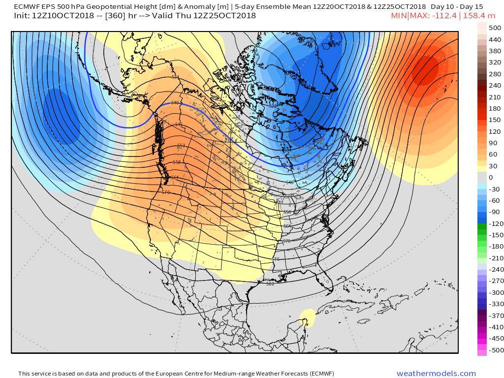
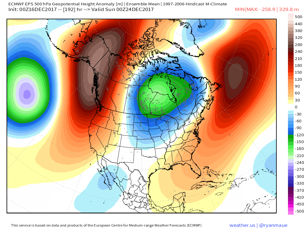
With the positive PNA in place, it’s no surprise to see the mean trough setting up shop over the eastern portion of the country.
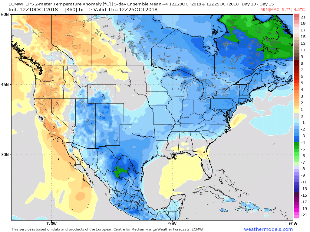
 At the surface, we see the cool pattern taking hold into not only the short-term, but the 10-15 day range, as well.
 The GEFS might be a bit quick on dropping the arctic hammer, but the consistency of the model is impressive. Meanwhile, the European (even it’s ensemble data) has been much less consistent and has really been struggling the past couple of winters, overall, as a whole.
 Let’s also keep in mind that the initial cold onslaught is coming in the face of the MJO still rumbling through the warm phases. We note the European is consistently having to correct towards a more “amped up” MJO- swinging into the cold phases as we approach mid-month. And it’s mid-February that continues to have us concerned for the potential of truly nasty, severe cold.
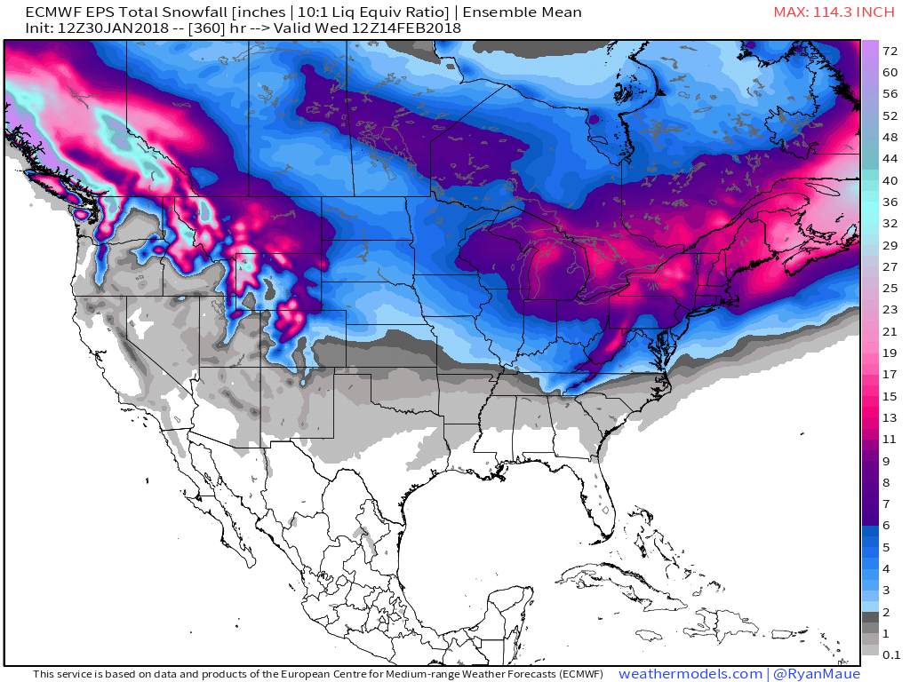
 As for snow, it’ll come in this pattern. Again, don’t get caught up in the operational output, but understand that the pattern over the upcoming 7-10 days favors numerous fast-moving snow systems. While most of these will be light, we’ll have to keep a close eye on things as the potential exists for one of these waves to spin up a moderate event.
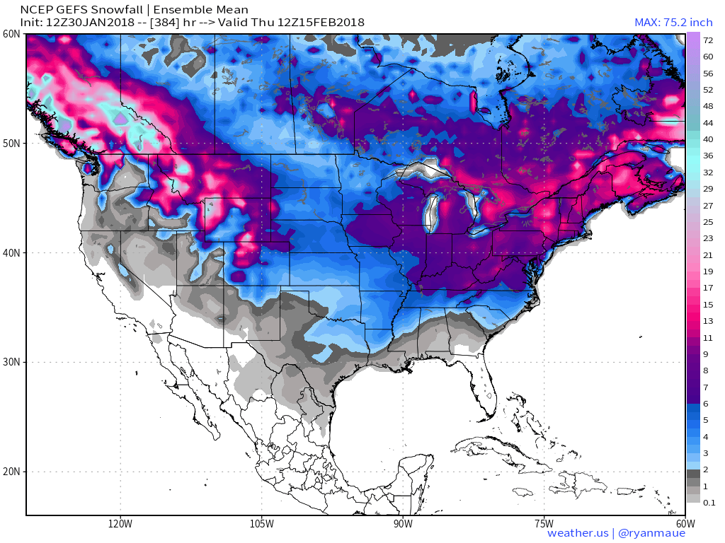
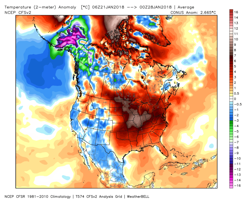 Despite the milder air over the past week, January, as a whole, is still running 4° below average at Indianapolis- a byproduct of just how frigid the first half of the month was.
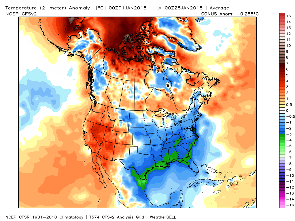 While the January thaw has been nice, times are changing and winter sure seems to be reloading for a very active second half.
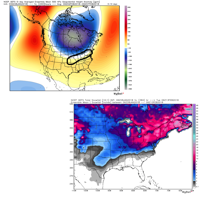 Once we get a snowpack laid down, arctic highs oozing southeast will likely lead to bitterly cold air. Recall our expectation for this pattern to yield at least (1) night of double-digit below zero lows, but it’s more towards mid-month that we think the severe cold takes hold.
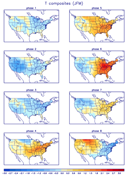
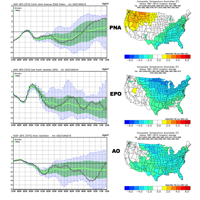 The Madden-Julian Oscillation (MJO) is forecast to rotate into the colder phase 8 as we rumble from early to mid February. Given the amplitude of the MJO, it should continue to rumble right through the cold phases of 1,2, and 3.
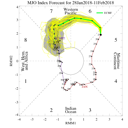
 All of these moving pieces that lead up to extended periods of cold, wintry conditions are part of a bigger outcome low solar, easterly QBO winters deal up. What we should experience with this setup is a 6-7 week period of wintry conditions, including times of severe cold. It appears to be a snowier version of what we went through late-December through mid-January. Hang in there, spring will come…eventually.
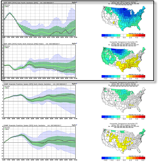 As we’d expect, as these two fight it out, a battle will ensue across the central and eventually eastern portion of the country. The negative EPO is a widespread cold pattern, while a negative PNA favors south-central and southeastern ridging (a warmer pattern).
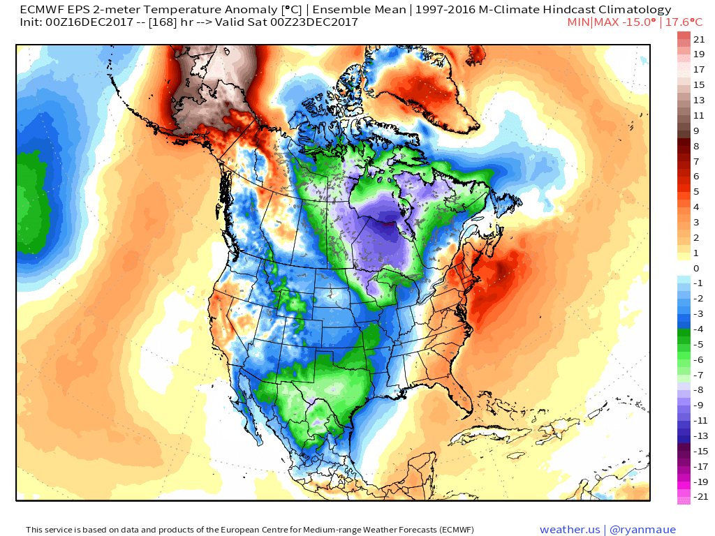
 Eventually, we expect the deeply negative EPO to take control and overwhelm the pattern with cold. However, as this transition of power takes place, the negative PNA won’t go down without a fight and will likely play a role in the weather leading up to Christmas.