Category: NAO

Short-Medium Range Update: More On The Negative NAO…

You must be logged in to view this content. Click Here to become a member of IndyWX.com for full access.  Already a member of IndyWx.com All-Access?  Log-in here.

Permanent link to this article: https://indywx.com/2019/04/04/short-medium-range-update-more-on-the-negative-nao/

Timing Out When Rain Returns And Looking Ahead To A Beautiful Close To The Week; More On The Negative NAO…

You must be logged in to view this content. Click Here to become a member of IndyWX.com for full access.  Already a member of IndyWx.com All-Access?  Log-in here.

Permanent link to this article: https://indywx.com/2019/04/03/timing-out-when-rain-returns-and-looking-ahead-to-a-beautiful-close-to-the-week-more-on-the-negative-nao/

Negative NAO Set To Present Mid-Month Headaches…

In case you missed it, you can find our April Outlook here. We want to ensure we’re very transparent and never shy away from the products we put out there. With that said, as difficult as it can be at times, it’s critically important that adjustments are made when necessary. The fact of the matter is that medium and long range modeling has had a glaring error since late winter and early spring. First, it was the EPO and now the NAO that appear to create all sorts of chaos in the medium to longer range period.

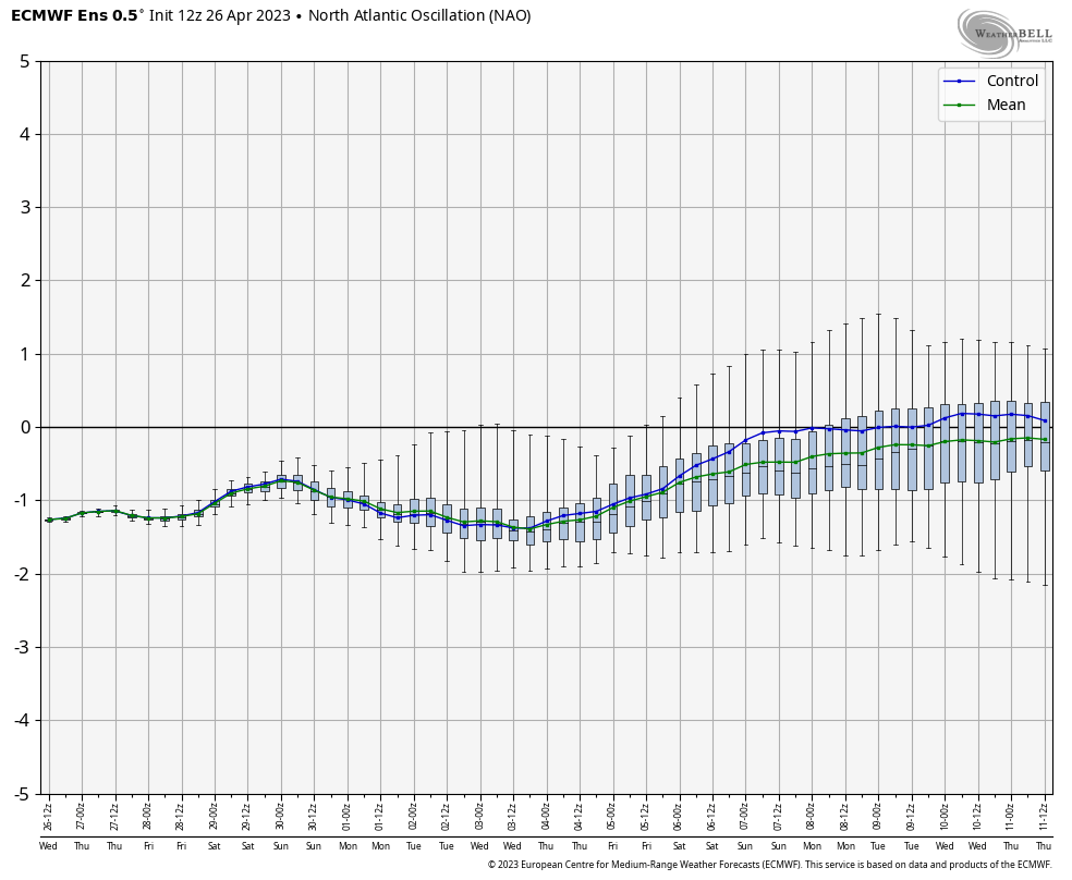
We note the NAO (or North Atlantic Oscillation) is set to drop to as negative of levels since January and some data would suggest we’re going to go even lower.

A negative NAO in April would “normally” lead to this kind of temperature pattern:

The normally reliable European model had this kind of pattern for mid-April only a couple of days ago:

Today, we’re talking about this kind of pattern for the exact same time period:

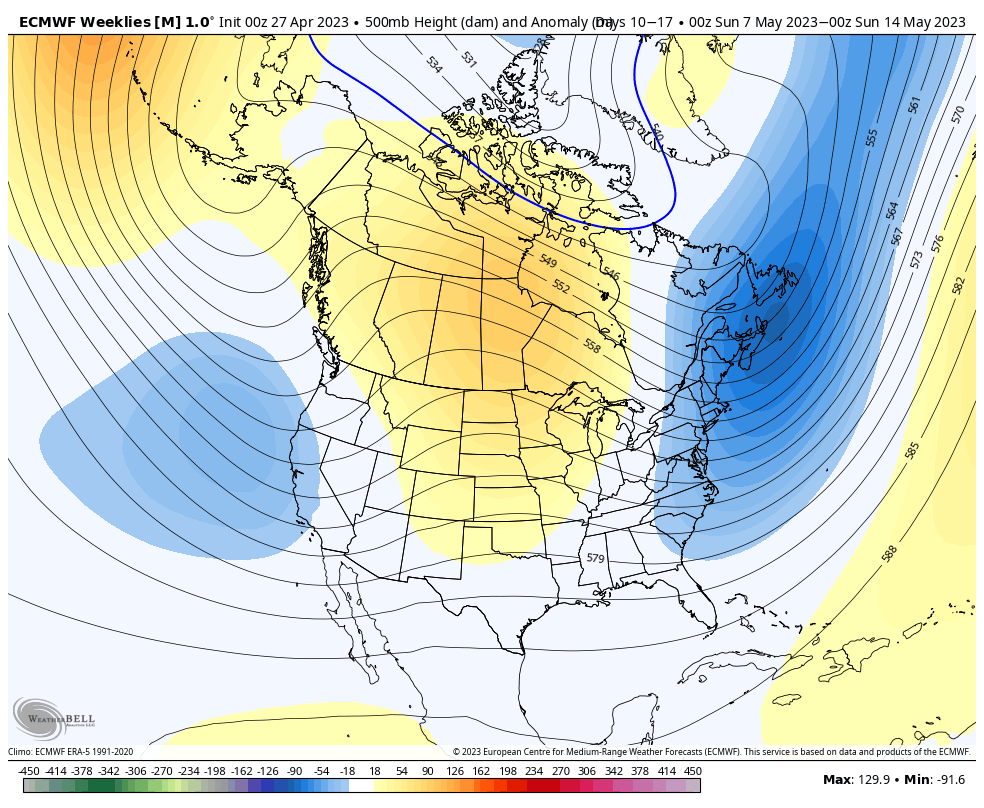
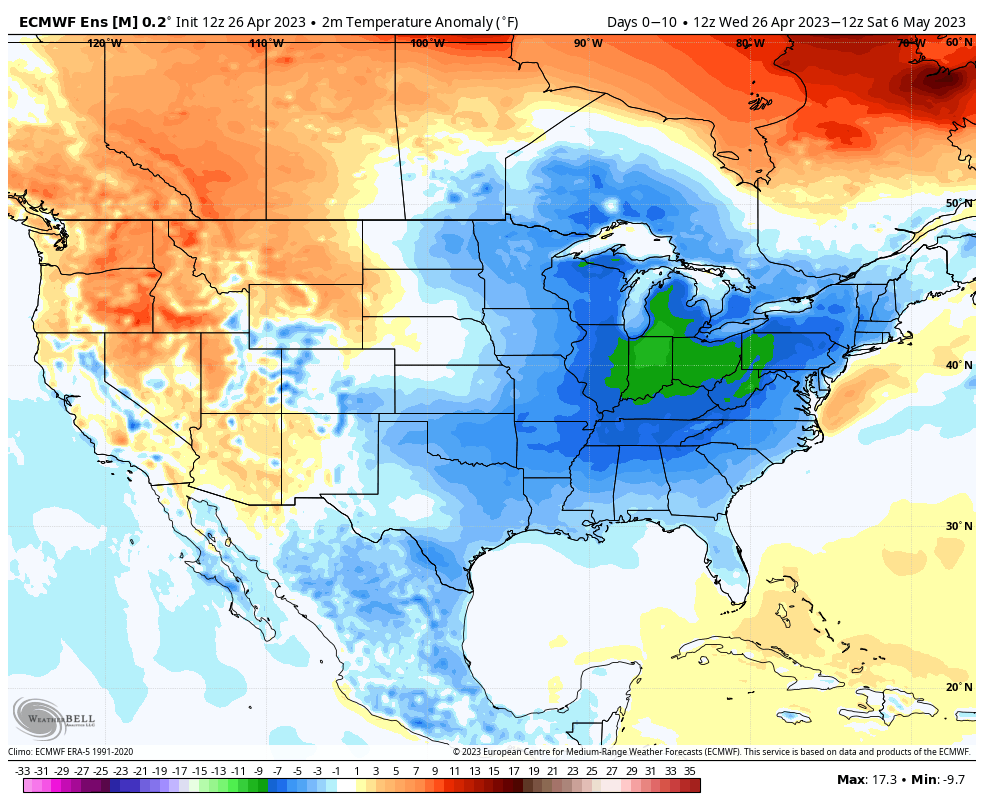
That’s a “night and day” difference. The reason? The model is beginning to catch on to the significant negative NAO developing. Accordingly, latest data delivers incredible high latitude blocking and subsequent cooler anomalies across a large portion of the Lower 48 for the mid-month period. (Note how close the below temperature pattern in the Day 10-15 time frame is to the analog a few images above. Remarkable stuff).

This time of year won’t result in sustained colder than normal conditions and transient warmth will make itself felt from time to time, but it’s a far cry from the sustained warmth originally expected for mid-April.

As we reflect back to the struggles long range models had with the negative EPO and now flip the page forward to the negative NAO problems, it certainly leads to lower than normal confidence in long range data and leads to a “cause for pause” as we put together monthly/ seasonal data into the upcoming late spring and summer months. Transitional seasons (spring and fall) can always be fickle, but some of the issues with the drivers this spring are in a different league.

Enjoy the “spring fling” that will develop late this week and weekend. The warmest air of the year is still on deck.

Longer term, well sometimes you have to throw ideas that have been made of long hours and hard work in the trash and start over from scratch…

Permanent link to this article: https://indywx.com/2019/04/02/negative-nao-set-to-present-mid-month-headaches/

Long Range Video Update: Changeable Pattern For The 2nd Half Of March Into April…

You must be logged in to view this content. Click Here to become a member of IndyWX.com for full access.  Already a member of IndyWx.com All-Access?  Log-in here.

Permanent link to this article: https://indywx.com/2019/03/07/long-range-video-update-changeable-pattern-for-the-2nd-half-of-march-into-april/

VIDEO: Updated Thoughts Around This Weekend’s Winter Storm And The Pattern Through March…

Here’s our latest thinking around this weekend’s winter storm and a long range update through the month of March…

You must be logged in to view this content. Click Here to become a member of IndyWX.com for full access.  Already a member of IndyWx.com All-Access?  Log-in here.

Permanent link to this article: https://indywx.com/2019/02/28/video-updated-thoughts-around-this-weekends-winter-storm-and-the-pattern-through-march/

All-Access Video: Looking Deeper Into The Reasons To The Cold Open To March & Mid-Month Changes…

Discussing the reasons behind the frigid open to March and the mid-month changes that await…

You must be logged in to view this content. Click Here to become a member of IndyWX.com for full access.  Already a member of IndyWx.com All-Access?  Log-in here.

Permanent link to this article: https://indywx.com/2019/02/26/all-access-video-looking-deeper-into-the-reasons-to-the-cold-open-to-march-mid-month-changes/

Frigid Open To March And Late Month Musings; Reviewing The NEW European Weeklies…

Average temperatures through the 1st (5) days of the month include highs of 46 F and a low of 29 F at Indianapolis. Instead, a frigid pattern will grip the region as we move through early March, including highs that will likely only top out in the lower to middle 20s and lows in the upper single digits to lower 10s as we move through the first week of the month (coldest centered on Sunday through next Wednesday).

Should we get any sort of snow down during the period (still up for debate as of this evening), lows will likely approach 0 F. The best opportunity for accumulating snow over the upcoming week would come Friday night into Saturday, but confidence remains low. Thereafter, we prefer the “suppressed” ideas currently portrayed by modeling as more meaningful winter storm threats impact the lower Ohio/ TN Valley and southern Appalachian region- especially with such an anomalously cold pattern in place.

Speaking of cold, the deep and expansive snowpack across the central and northern Plains won’t allow the late season taste from the arctic to modify as much as it may otherwise. As the frigid air mass settles southeast, below zero wind chill values are a good bet early next week across the northern half of the state. “Tap the breaks” on meteorological winter kicking off March 1st…

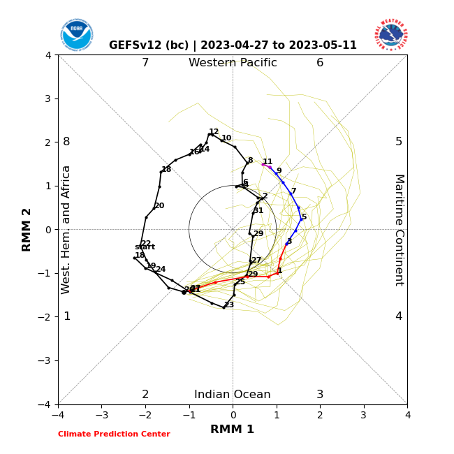
With that said, the NAO and AO are expected to remain positive and while initially “trumped” by the significantly negative EPO, this will trend positive by mid-month. These all suggest the cold is limited and that there shouldn’t be any change to the idea that we really begin to feel more spring-like by the middle of March. This is backed up by the continued idea that the MJO rumbles into Phase 4 by mid-March, as well (again argues for warmth).

Sure enough, longer range models show the ridging and associated warmer times ahead:

It should be noted that with the mean trough position taking up shop across the western portion of the country mid-March, not only should we moderate, but we should also see a return of wetter/ stormier times. With the GOM (Gulf of Mexico) running above normal, early season severe weather outbreaks will have to be closely monitored…

The new European Weeklies in this evening also back up the idea of an unseasonably cold 1st half of the month giving way to milder conditions by mid month. The model paints a drier than normal pattern over the Ohio Valley and Mid West over the next couple of weeks before wetter signals return by the middle of March.

Permanent link to this article: https://indywx.com/2019/02/25/frigid-open-to-march-and-late-month-musings-reviewing-the-new-european-weeklies/

All-Access Long Range Update: Walking Through March…

Recently, a “transient” pattern has dominated. This has kept any sort of long-lasting cold at bay and resulted in above normal precipitation. As we get set to close out February and welcome in a new month, a pattern change is on the horizon.

This overall shift in the pattern will drive a more sustained and significantly colder than normal regime southeast. In short, cold is set to “overwhelm” the pattern through the first couple of weeks of March. In the most extreme case (especially if we can get snow down), we will be able to challenge records at some point during the 1st (10) days of the month.

In spite of a neutral to positive AO and NAO, a significantly negative EPO and MJO rumbling through the cold late Feb and early March phases look to trump the otherwise warm signals. We also can’t forget about the significant SOI crash. Let’s dig into some of the latest data:

CFSv2


Note the modeling spreading the cold out during the Weeks 2-3 time period before gradually modifying things as we move into the middle and latter portion of March. The mean storm track shifts to the east during the first couple of weeks of the month (pattern will likely be dominated by more snow vs. rain events during this time period) before wetter than normal conditions return for the 2nd half of the month.

JMA Weeklies

Week 1
Week 2
Weeks 3-4

Like the CFSv2, the model overwhelms the pattern with cold during the Week 2 time period. Also similar to the CFSv2, the JMA Weeklies bring ridging back into the East and associated warmth by mid-month. While we haven’t included the precipitation anomalies in this post, the model does bring wetter than normal conditions back into the area by mid-March.

European Weeklies

The NEW European Weeklies remain consistent from Monday’s update (and data above) in delivering a very cold 1st half of March. The core of the cold looks to be centered over the upper Midwest and Northern Plains, but temperatures for the balance of the first couple weeks of the month will likely resemble what we’d expect in late January or early February vs. March. While precipitation will likely run below normal (thanks to the cold pattern), the model deliver above normal snowfall during the period. As we move into the 2nd half of the month, warmer (and wetter) conditions are shown to return.

Given all of the above, we expect the primary upper air pattern to feature a central and eastern trough through the 1st half of March before that trough settles into the West during the 2nd half of the month. This will open up the eastern portion of the country for not only warmer air, but a return of moisture-laden storm systems and the potential of strong-severe storms at times.

Permanent link to this article: https://indywx.com/2019/02/21/all-access-long-range-update-walking-through-march/

2019 Spring Outlook…

2019 IndyWx.com Spring Outlook

Forecaster: Team; Date Issued: 02.16.19

Last spring was a tale of two seasons in itself. March (featured a foot of snow) and April were significantly colder than normal and then we shifted things to summer in May (the last month of meteorological spring was close to 10 degrees above normal). As a whole, it was a quiet severe weather season.

Despite the wild swings, at the end of the day, things “balanced out” nicely across the central Ohio Valley, including central Indiana.

As we look ahead to what the 2019 version holds, here are a few headlines that have our attention:

I. Weak Nino is behaving more like a Nina (Tropical Northern Hemisphere pattern can be thanked for this).

II. Neutral NAO is expected

III. Neutral PDO (Pacific Decadal Oscillation)

In addition, we’re paying special attention to the SST configuration in the Gulf of Mexico. A warmer than average GOM can most certainly lead to a more “hyper” severe weather season as spring gets going.

The late winter/ early spring drought monitor can give a hint where early warmth may try and get going. However, this year, we can’t rely on this tool as the Plains and East, including the heart of the #AGbelt, have seen copious amounts of moisture over the winter.

Drought Monitor as of 2/14/19
December 2018 Precipitation Anomalies
January 2019 Precipitation Anomalies

Let’s look at what the model guidance is printing out for meteorological spring:

JMA

March
April
May

CFSv2

JAMSTEC

European Seasonal

Summary

We anticipate a slightly warmer than average spring season across not only central Indiana, but the Mid West and Ohio Valley region, as a whole. A weak El Nino is expected to persist into the upcoming summer and the conditions typically associated with such should eventually show themselves (as opposed to more of a Nina-like flavor now) through the spring. We agree with the consensus of model guidance above that March is likely to feature the coldest temperatures, relative to normal, and that’s primarily due to what should be a colder 1st half of the month before more bonafide spring conditions take hold the 2nd half of the month. Precipitation is anticipated to run near average, if not slightly below average, levels through the spring. As for severe weather, we expect a much busier season than last year, especially with the warm SSTs lurking in the Gulf of Mexico.

Permanent link to this article: https://indywx.com/2019/02/16/2019-spring-outlook/

Reviewing The Latest European Weeklies And Updated Long Range Thoughts…

We’re growing closer and closer towards the period we’ve been thinking would present one last round of cold, wintry weather (relative to normal) for the ’18-’19 season.

While the stormy idea will likely end up being correct, the significant cold that we thought would “spread out” (as opposed to being confined to the NW and northern Plains) is in jeopardy.

The overall upper air pattern over the upcoming few weeks will likely continue to be dominated by a mean trough position across the central and west, along with the persistent southeast ridge.

This will continue to result in above normal precipitation into the first week to 10 days of March, with a very active storm track.

From a temperature perspective, the baseline of our ideas being centered on the MJO appears to be the error in our forecast. It’s not that the MJO isn’t heading into Phase 8 (it’s officially there now, as noted below), but it appears other teleconnections are “trumping” this cold ingredient.

The combination of the positive Arctic Oscillation (AO) and negative Pacific North America pattern (PNA) are the drivers and are showing no signs of wanting to let go of the wheel.

The AO is forecast to remain strongly positive into early March.

The PNA is forecast to remain negative into early March.

Note how both of the above support that southeast ridge and associated relative warmth.

At one time, it appeared as if the North Atlantic Oscillation (NAO) would dip negative, however, that’s no longer the case.

While the active idea will come to fruition, the cold (at least to the magnitude we thought) will have a difficult time. That isn’t to say that enough cold air won’t get involved with a couple of these storms to result in wintry precipitation of significance, but rather that sustained cold will be tough to come by. Snowfall (of the heavy, wet variety) very well still could end up above normal with these moisture-laden systems over the next few weeks.

European Weekly Update

The new European Weeklies are in and follow the idea above nicely. They forecast a very stormy pattern to persist over the next few weeks with a battle ground between cold to our northwest and warmth to our southeast. We’ll have to be watchful for a couple of storm systems capable of delivering heavy amounts of precipitation. Given the teleconnection states over the next 6 weeks, it continues to look like any sort of significant wintry weather will need to take place before mid-March. Thereafter, warmer than normal times are expected, including true spring-like weather emerging. I know most can’t wait…


Permanent link to this article: https://indywx.com/2019/02/14/reviewing-the-latest-european-weeklies-and-updated-long-range-thoughts/

IndyWx.com