Category: MJO

A Teleconnection Tale…

Before we display the mean upper level pattern ahead over the next couple weeks, let’s look at some of the various teleconnections to gain some insight behind what’s driving the overall pattern.

EPO- primarily positive to strongly positive (warm signal).

WPO- primarily positive to strongly positive (warm signal).

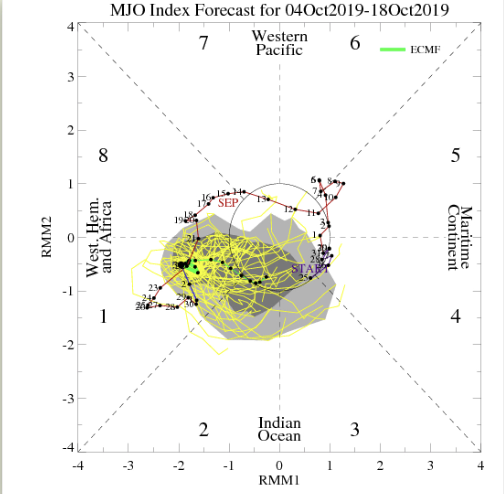
MJO- heading into Phase 6 with a look like it wants to rumble into Phase 7. This is a warm signal this time of year.

With the warm signals above, it should come as no surprise of the next couple weeks offering up a predominant eastern ridge.

Days 6-10

Days 10-14

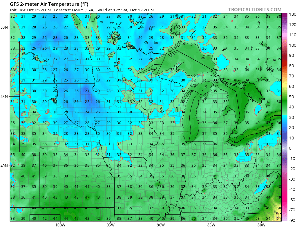
While a couple of weak cold fronts may lead to somewhat cooler air briefly, the balance of the next couple of weeks looks to offer up much more in the way of summer-like heat and well above normal warmth. It should also be noted that the overall pattern looks like a dry one over the next 10-14 days, as well.

Don’t put away that swim suit just yet!

Permanent link to this article: https://indywx.com/a-teleconnection-tale/

Pulling The Curtain Back On The Medium Range Pattern…

A cold front will sink south across the state this evening. As the front moves through the area, we expect thunderstorms to increase in coverage and intensity across northern Indiana over the next few hours. These storms should push off to the south during the overnight, weakening as they do so. We still aren’t expecting much in the way of widespread severe weather across immediate central Indiana.

Once the front passes, northwest winds will take over during the predawn hours and help push a drier and cooler brand of air south into the region.

The cold front will move through central Indiana during the overnight hours.

Thereafter, get used to unseasonably cool air, to the tune of what we’d normally expect by late September, for the 2nd half of the week- including this weekend. Mostly dry weather is expected to prevail through the period.

As we look ahead to next week, moderating temperatures are expected next Tuesday and Wednesday, including lower to middle 80s. That said, we do have questions if the warmth will have staying power.

We note the MJO “toying around” with the warmer Phase 6 for a time before returning to Phase 5 (a cooler phase this time of year).

Add in the fact that the EPS and GEFS are in disagreement in handling the EPO in the medium term and this results in lower confidence in the overall staying power of the warmth come mid month.

Unfortunately, this time of year, the tools we can really “lean on” for indications of where the longer range pattern will head are limited (compared to late fall through early spring). That’s when we can really focus on the other drivers such as the AO, NAO, PNA, recurving WPAC tropical activity, etc.

As such, while we continue to believe the pattern trends warmer after the cool spell into the weekend, patience is required with respect to the staying power of said warmth…

Permanent link to this article: https://indywx.com/pulling-the-curtain-back-on-the-medium-range-pattern/

VIDEO: Wet Sunday And Reviewing Our Official September Outlook…

You must be logged in to view this content. Click Here to become a member of IndyWX.com for full access.  Already a member of IndyWx.com All-Access?  Log-in here.

Permanent link to this article: https://indywx.com/video-wet-sunday-and-reviewing-our-official-september-outlook/

VIDEO: Short-Term Severe Threat; Looking Ahead To Late August…

You must be logged in to view this content. Click Here to become a member of IndyWX.com for full access.  Already a member of IndyWx.com All-Access?  Log-in here.

Permanent link to this article: https://indywx.com/video-short-term-severe-threat-looking-ahead-to-late-august/

Still On Track For A Cooler Pattern As Mid-July Approaches?

Through the first few days of July, it’s off to a scorching start across the Mid West, Ohio Valley, and into the Southeast. Officially, Indianapolis is running more than 4 degrees above normal through the first (4) days of the month.

As we look ahead, we wanted to review the latest data to see if the expected cooler pattern is still on deck as we approach mid month.

The short answer is yes, but after we review the upcoming 500mb transition, we have further evidence for a cooler (or at least “less hot”) change. Note how the European ensemble paints a picture of the upper ridge being directly overhead in the current term towards more of a NW flow aloft by Days 10-15.


This should result in a transition to a temperature pattern that turns more seasonable and at times even cooler than normal as we rumble into the mid-July period. The other item of note is that we’ll have to be watchful for the potential of northwest to southeast tracking clusters of storms with the heat ridge back to the southwest. This threat will come after a drier period of weather that develops the 2nd half of this weekend into much of next week.

Does the data line up with what other pattern drivers would suggest? Well, the recent big hit to the SOI would back up the idea that a trough and associated cooler pattern looms around 10-15 days after the fact (sometime around the 9th-14th time frame).

Finally, the MJO moving from Phase 1 to Phase 2 this time of year would also suggest the cooler idea has merit.

With all of that said, we continue to believe we’re on a track for a pattern that will promote a backing off of the significant heat in the days (and weeks) ahead. Especially as mid-July approaches, the temperature pattern should turn seasonable to slightly cooler than normal while the ante is also upped for the chance of multiple storm complexes to impact the area in that NW flow aloft.

Permanent link to this article: https://indywx.com/still-on-track-for-a-cooler-pattern-as-mid-july-approaches/