Long Range Update: Changes Afoot…
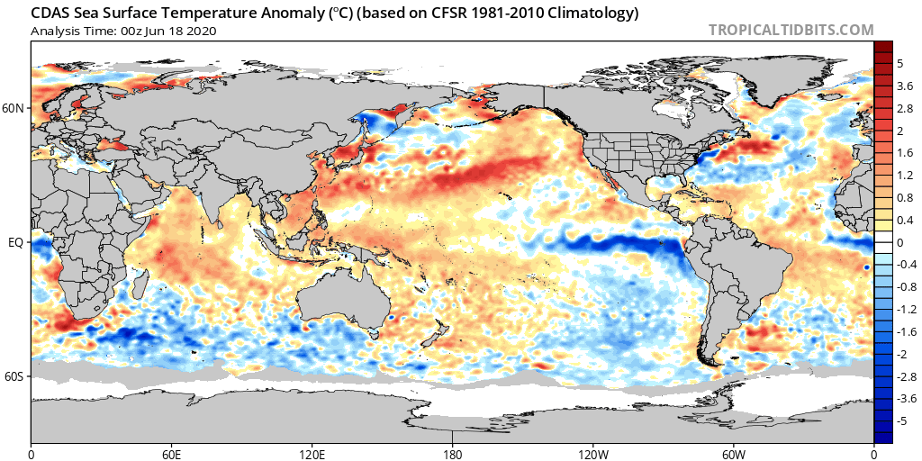
Looking at a simple snapshot of the latest sea surface temperature anomaly map would suggest a La Nina is brewing (image 1), BUT the latest SOI (Southern Oscillation Index, also knows as the SOI) suggests otherwise (images 2-3):
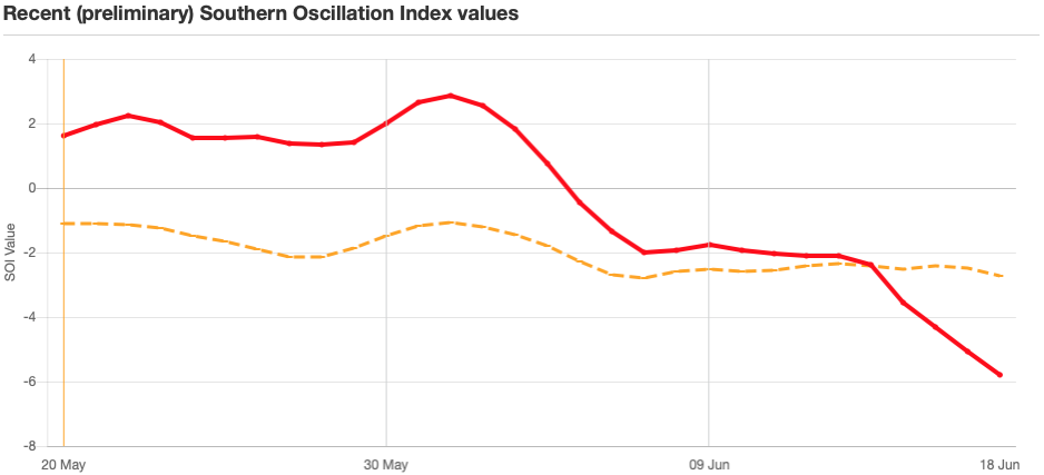
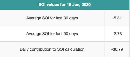
In fact, the SOI values noted would suggest an El Nino is coming on. The daily hit of more than 30 suggests some wild swings in the weather over the upcoming couple of weeks across the Lower 48. Now, we still anticipate this to transition more towards a positive direction and a subsequent La Nina to, indeed, develop by fall and winter, but this is worth continuing to pay attention to and we’ll do just that.
As we look at June to-date across central Indiana, temperatures are running a little more than 2° above normal and precipitation is just over 1″ below normal. Given the pattern ahead, we continue to like where we stand with our June forecast overall: near-average precipitation and temperatures. This will, obviously take a wetter, cooler shift in the regime as we move through the next 10-12 days. Overall, that’s where we continue to believe we’re heading.
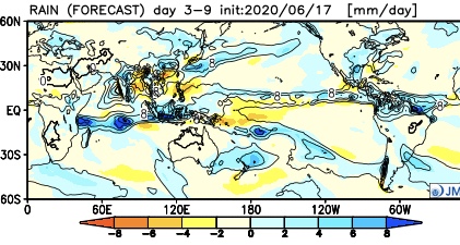
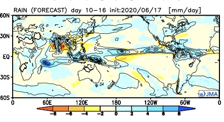
The latest JMA Weeklies hot off the press shows this big cool, wet change across our region. A series of troughs are shown to descend into the Ohio Valley during the next 10-16 days. As the individual cold fronts sweep through the region, better chances of rain will result and temperatures will run cooler than normal, overall.
Week 1

Week 2

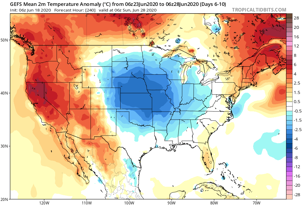
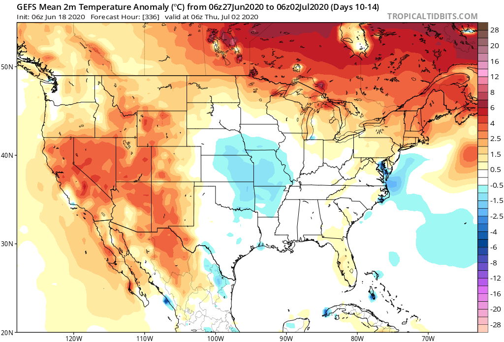
The latest GEFS data is very similar in this wet, cool shift.


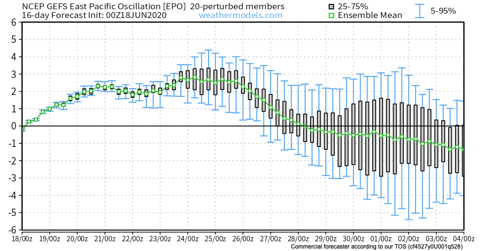
There’s support for this pattern in looking at the latest East Pacific Oscillation, as well. Negative values support central/ eastern cool and periods of transition from positive to negative (and vice-versa) also can help promote wet/ more active periods.
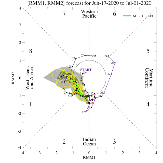
The MJO (Madden Julian Oscillation) is a “sneaky” wild card in all of this. Note how the MJO is currently shown to slowly move through Phase 2 before going into the wheelhouse and emerging into Phase 8 by month’s end. While certainly not highly amplified, this is enough to have impacts. Note that Phases 2 and 8 this time of year maintain a cooler look, locally.


In summary, though it’s certainly been dry over the past couple of weeks, we think there’s more than enough reason not to fret. Not only are we looking at a pattern that should keep the heat (at least in a prolonged sense) west of our region, but the pattern drivers above should also result in a much more active regime with frontal passages and associated areas of low pressure moving through the region. This will begin in earnest early next week and continue through Week 2.


