2018 is already flying! As we welcome in March here are the weather statistics for IND (Indianapolis).
- Average highs start off in the middle 40s on the 1st and rise to the upper 50s on the 31st
- Average lows are in the upper 20s to begin the month and increase to the upper 30s by month’s end
- We average 3.56″ of precipitation, including just under 3″ of snow
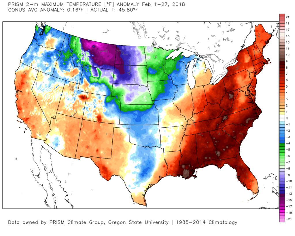
Before we look forward to March, let’s review where we’ve been in February. After a very cold start to the month, eastern ridging really flexed it’s muscle and resulted in spring-like conditions for the better part of the past couple weeks. As we type this up late on the 28th, IND is running 5° warmer than average. (It’s been a wet month, too, as we’re close to 2.5″ above normal in the precipitation department).
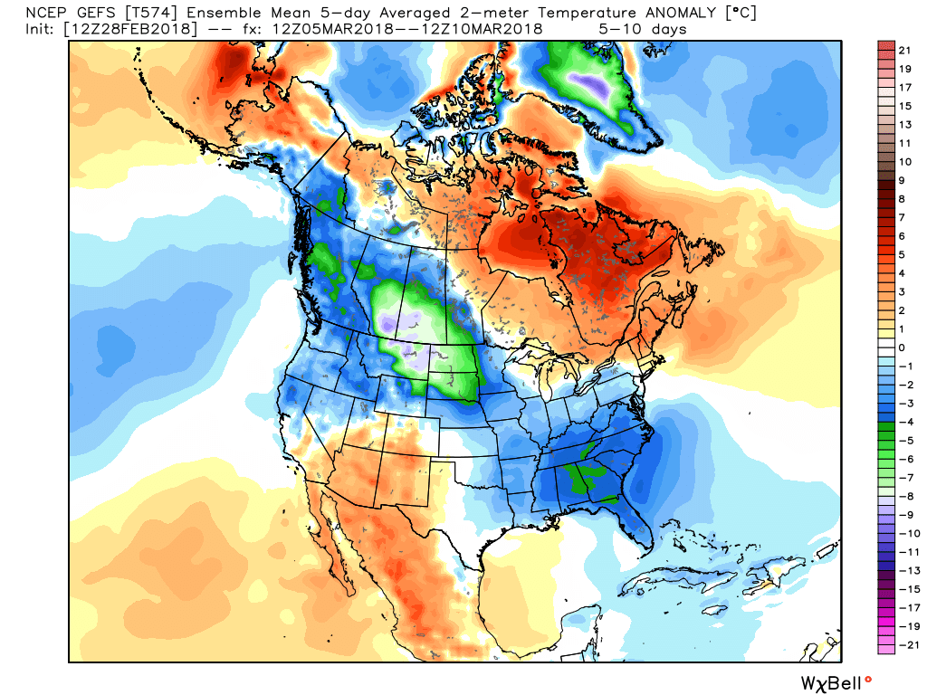
 The early spring “fling” has lulled many into believing winter’s finished. While the worst of the winter is certainly behind us, we continue to think a dose of “reality” awaits as we progress through the better part of the first half of March. To be more specific, we feel the period March 6th through the 20th will offer up below average temperatures and an active pattern- capable of producing wintry threats.
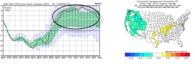
We note the (2) main drivers this time of year (the AO and NAO) are running negative through mid-month, which favors cold.
 Sure enough, modeling is going to the pattern that will produce below normal temperatures (doesn’t appear to be anything particularly frigid, but colder than average, nonetheless) through mid-month.
 With blocking in place, an undercutting jet will serve to deliver an active storm track.
 Keeping in mind March winter events need multiple items to come together to create impactful situations, it’s also important not to simply “buy in” to the idea that just because it’s been warm lately that winter is finished. March can be a wild month, as long-time Hoosiers are aware. The pattern we’re heading into over the next 10-14 days is one that’s been void most of the winter (high latitude blocking in place) and can serve as the player needed to flip a “nuisance” variety late-winter event to one that’s much more significant. We’ll need to remain on guard for the potential of one or two “more significant” wintry events as we move through the first couple weeks of the month.
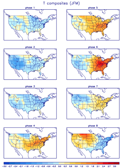
Finally, looking ahead, there’s an argument that can be made that we flip the script towards milder times through the last (10) days, or so, of March. We note (as shown above) the AO and NAO trend neutral-to-positive mid and late March. Secondly, the EPO is also expected to flip positive for the second half of the month and this is warm signal, locally, as shown. Majority of guidance also takes the MJO into the “null” phase late month.
 The end result is one that should promote colder than average times over the next couple weeks, overall, along with an active storm track. With blocking in place, the potential of one or two more significant late-winter events are on the table, and we’ll have to fine tune specifics as the individual storms come. While confidence is high that someone within the Ohio Valley region is likely to still deal with a big-hitter event, there’s no way to get specific until the individual players are on the field. Thereafter, the pattern should begin to transition to one more conducive for “stick and hold” spring conditions during the latter portion of the month.
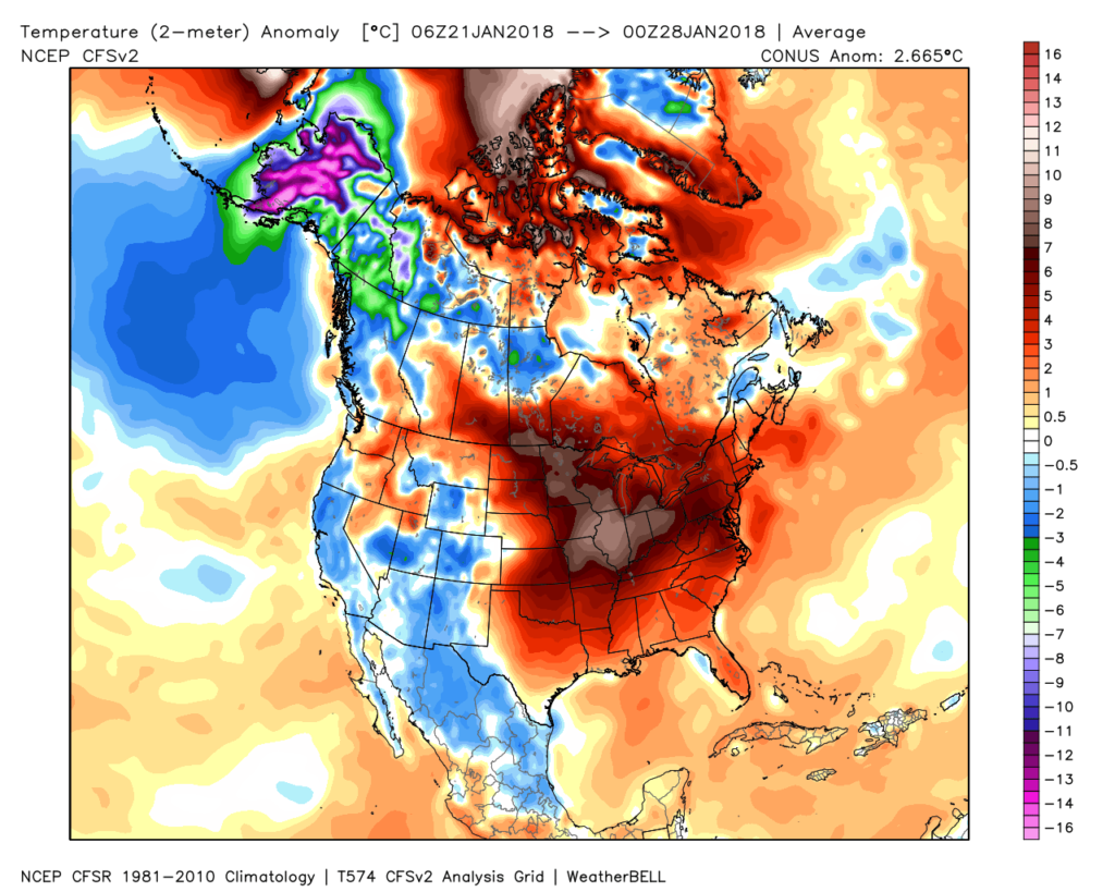 Despite the milder air over the past week, January, as a whole, is still running 4° below average at Indianapolis- a byproduct of just how frigid the first half of the month was.
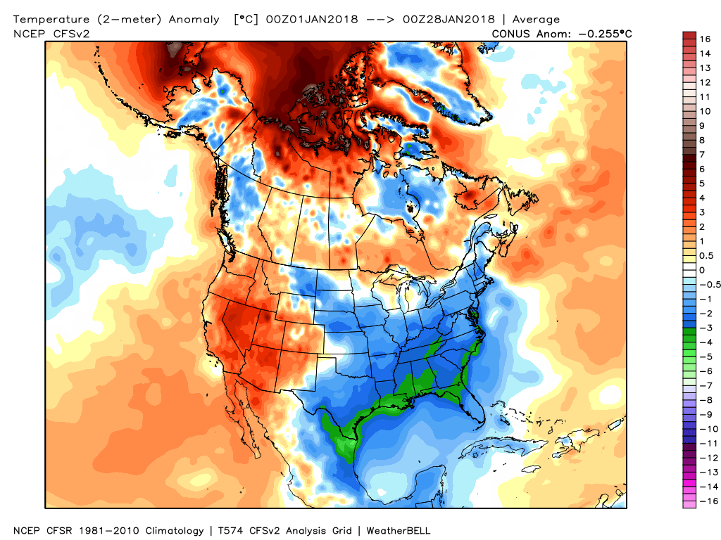 While the January thaw has been nice, times are changing and winter sure seems to be reloading for a very active second half.
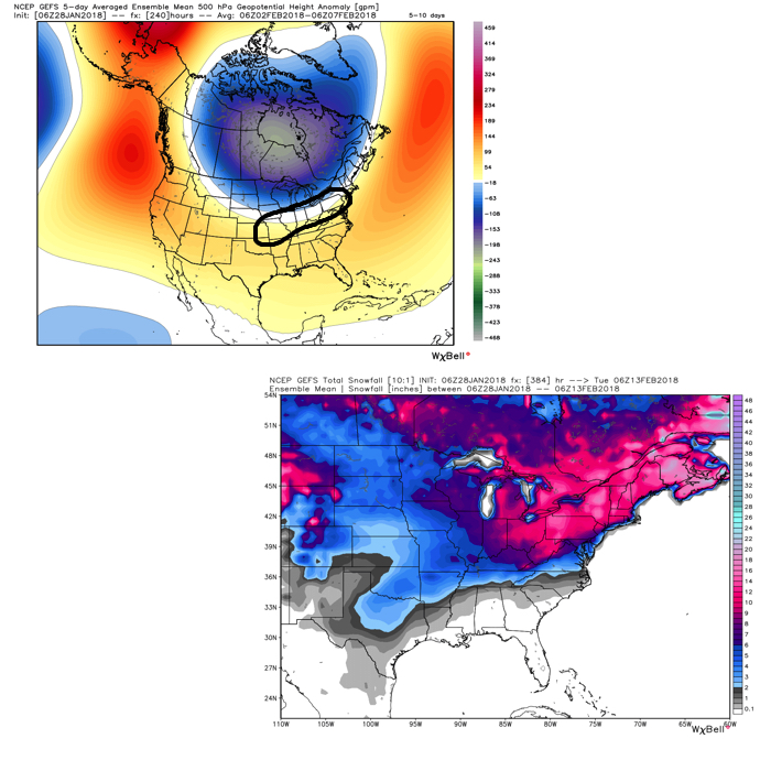 Once we get a snowpack laid down, arctic highs oozing southeast will likely lead to bitterly cold air. Recall our expectation for this pattern to yield at least (1) night of double-digit below zero lows, but it’s more towards mid-month that we think the severe cold takes hold.
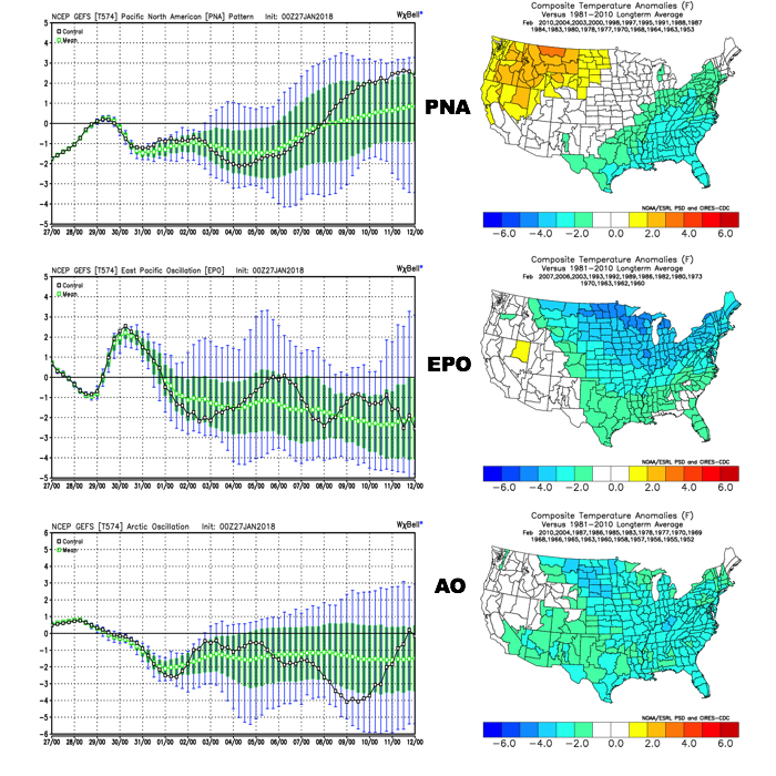 The Madden-Julian Oscillation (MJO) is forecast to rotate into the colder phase 8 as we rumble from early to mid February. Given the amplitude of the MJO, it should continue to rumble right through the cold phases of 1,2, and 3.
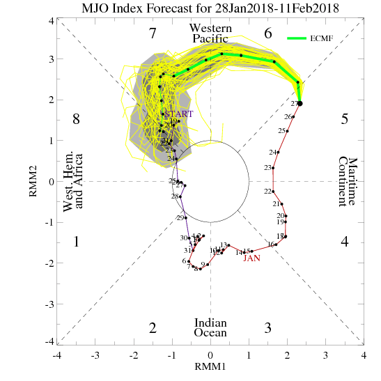
 All of these moving pieces that lead up to extended periods of cold, wintry conditions are part of a bigger outcome low solar, easterly QBO winters deal up. What we should experience with this setup is a 6-7 week period of wintry conditions, including times of severe cold. It appears to be a snowier version of what we went through late-December through mid-January. Hang in there, spring will come…eventually.