Couple Thoughts On This Weekend And Next Week’s Storms; Colder Trends Build Long Term…
Updated 01.01.24 @ 6:41p
I hope you and your family are enjoying an incredible New Year’s Day! What a game we have on our hands at halftime in the Rose Bowl.
I post this in flight back to home base from ushering in the new year in the beautiful Berkshire mountains. Our regularly scheduled client video discussions will return tomorrow morning. I trust you’ve been following along with both short and long term pattern ideas daily over the past week.
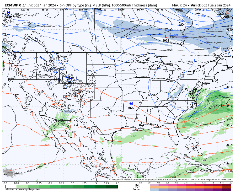
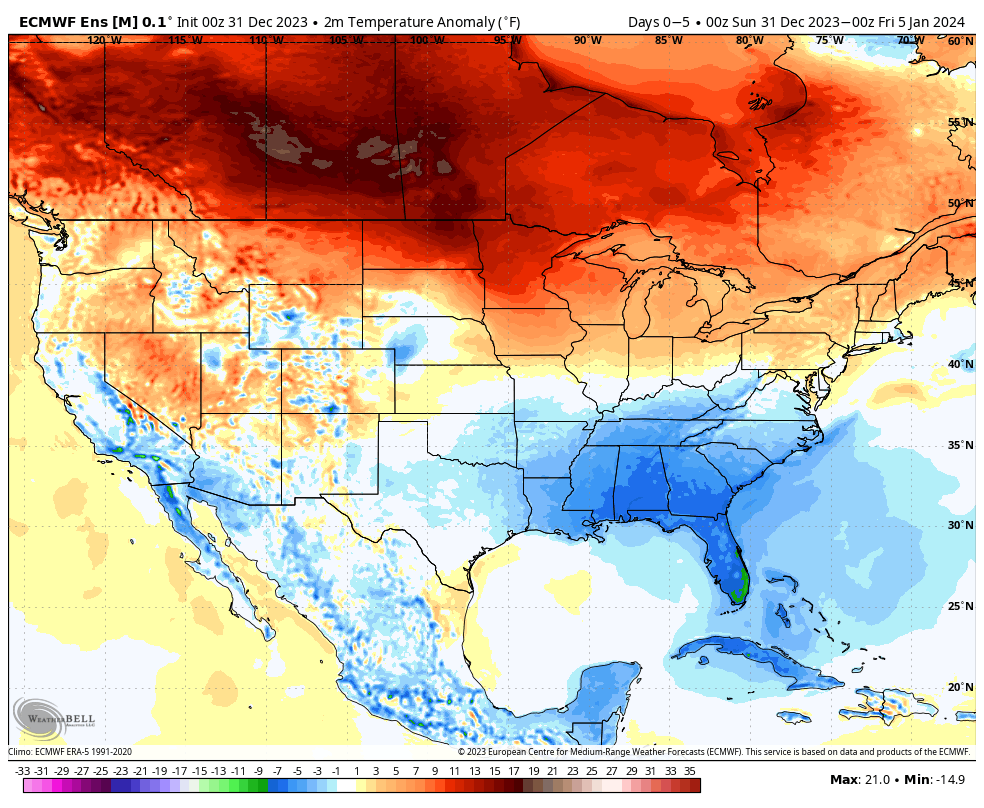
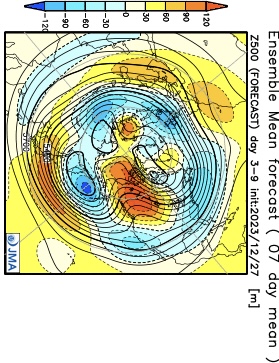
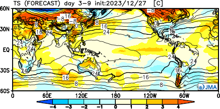
The immediate term opens with quiet and unseasonably calm conditions while the end of the upcoming 10-day stretch will end much colder. The transition between start and finish will turn much more hectic around these parts as we track not one, but two storm systems between this weekend and early next week. While there’s no doubt we’ll trend colder than average by Day 10, questions abound with just how cold we go. Should we get a snowpack down, subzero is on the table.
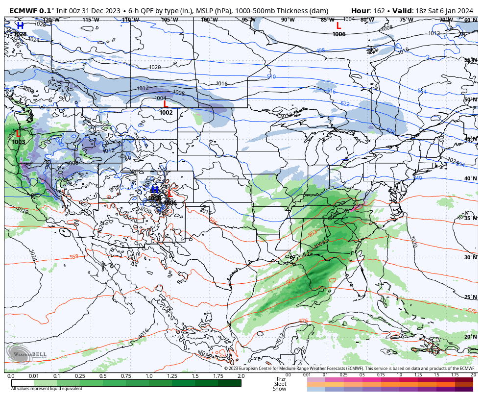
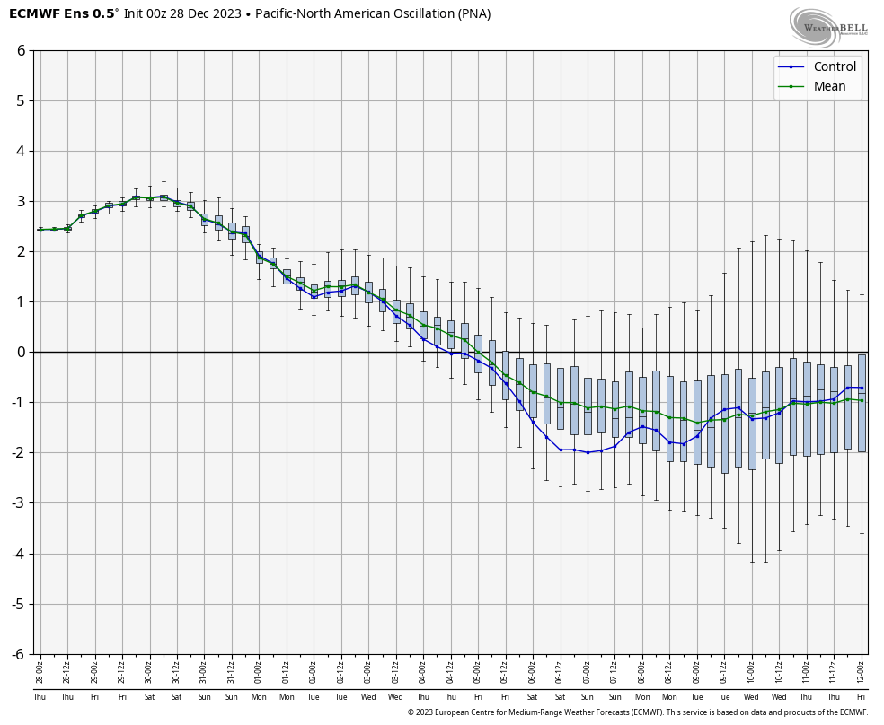
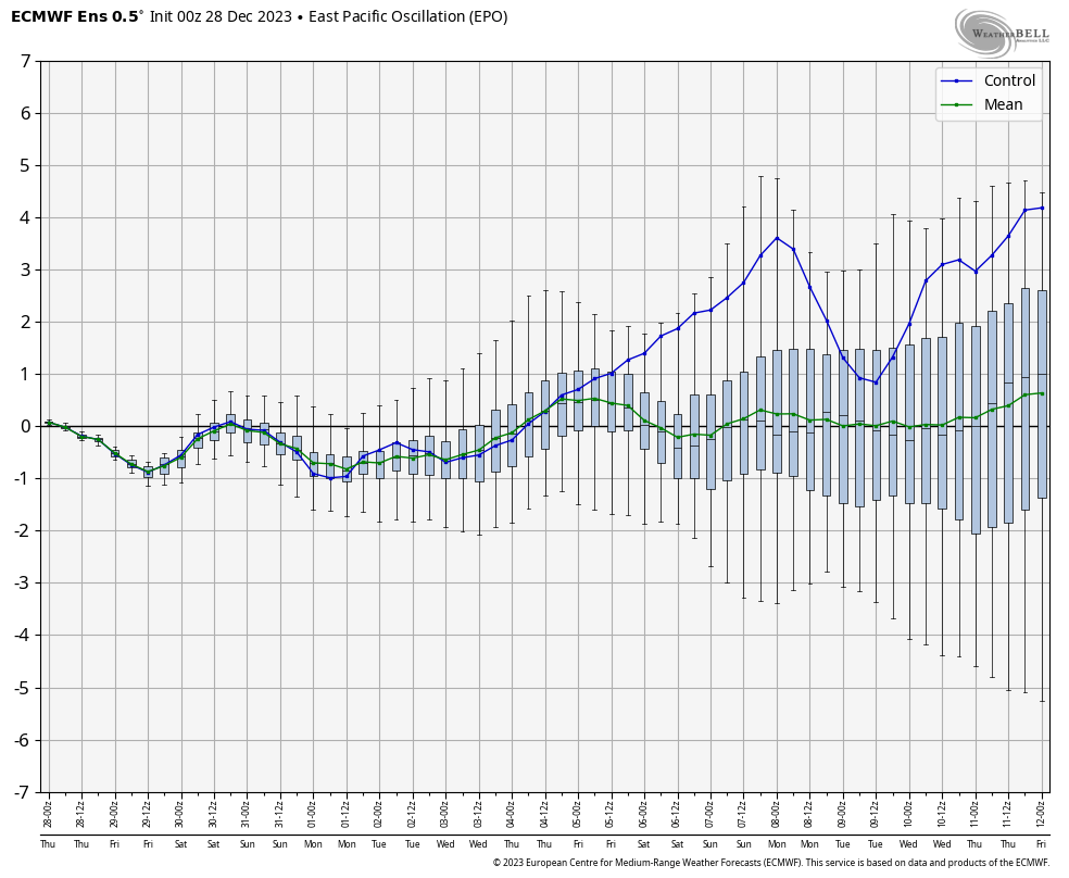
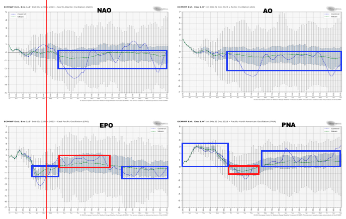
Speaking of the aforementioned more “hectic” pattern, this kicks into gear over the weekend. While modeling likes more of a suppressed track at this distance, thinking here is that guidance will start to pick up on a more organized northern piece of energy, or surface low reflection, that will accompany the primary Gulf low. I suspect a secondary, organized, shield of precipitation into the OHV region Friday night into Saturday. Will that be enough to put our neck of the woods into a winter storm risk during this timeframe? Too early to call at this distance, but given where the PNA, EPO, and Greenland Block that will be starting to mature, I’d recommend keeping an eye on what will likely be an eventual click or two northwest as the week goes along. It’s likely either a “snow or no” type situation here with storm #1, as opposed to having to worry about rain or mixing issues.
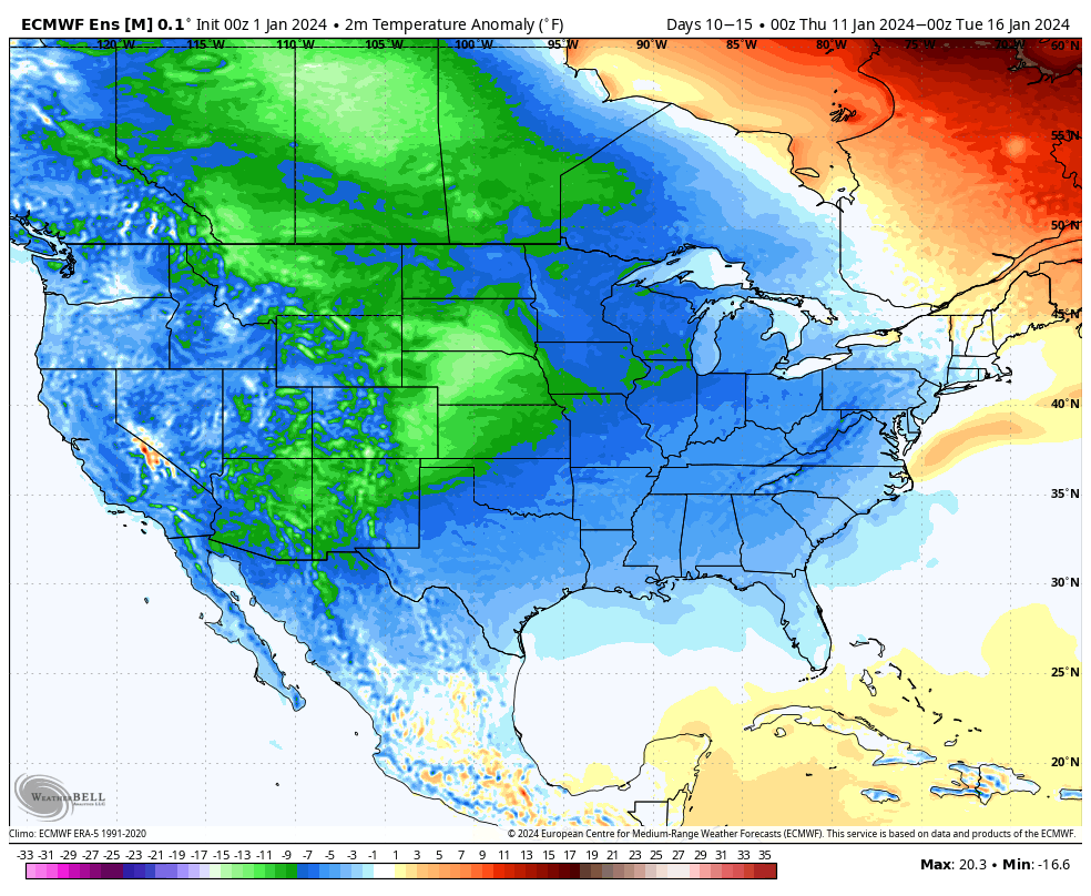
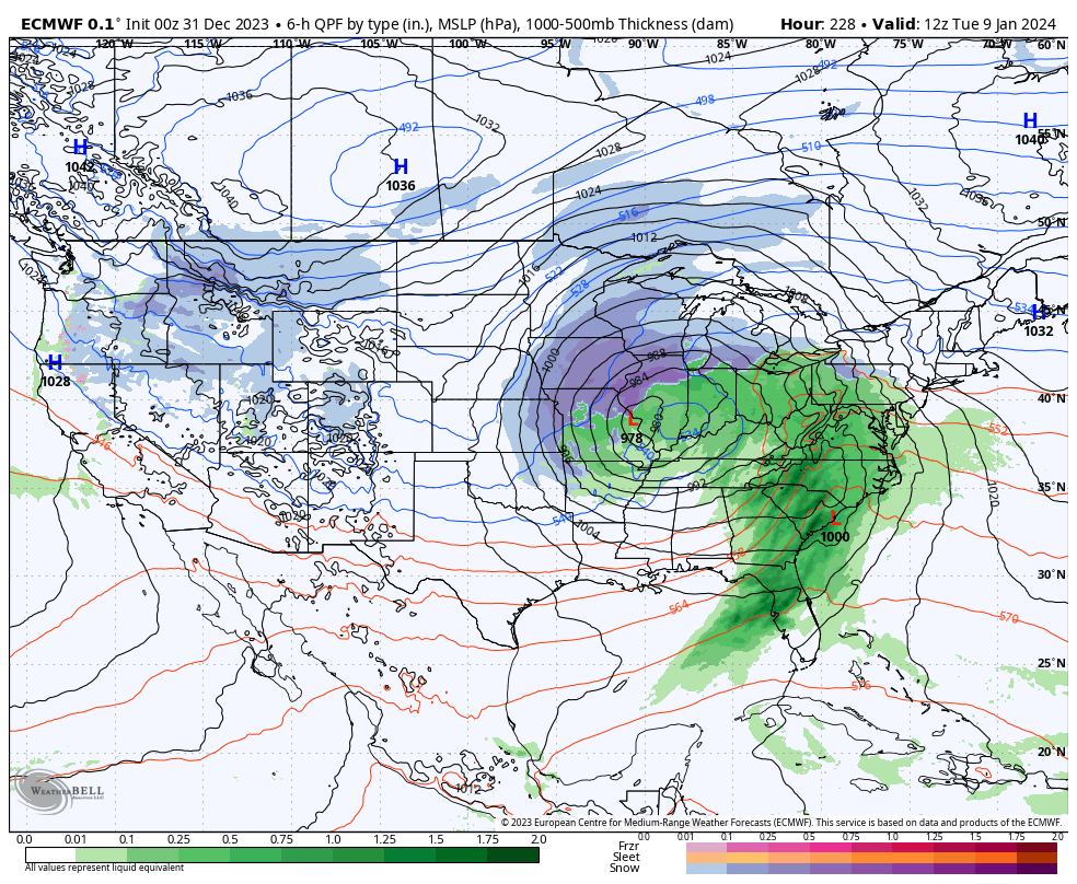
As for storm #2 early next week, our early idea takes the primary low into the OHV before a secondary low “takes over” along the eastern seaboard. The energy transfer likely brings just enough mild air north into the central Ohio Valley to create more of a rain to snow type scenario, locally. The coldest air of the season so far will likely follow in the 10-15 day.

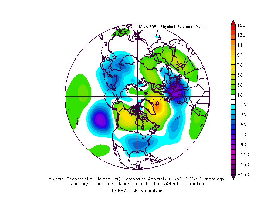
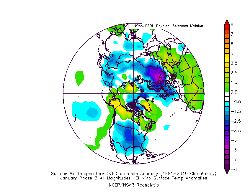
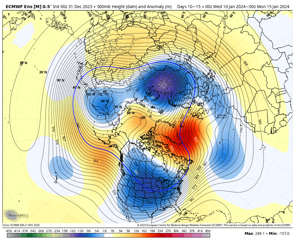
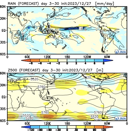
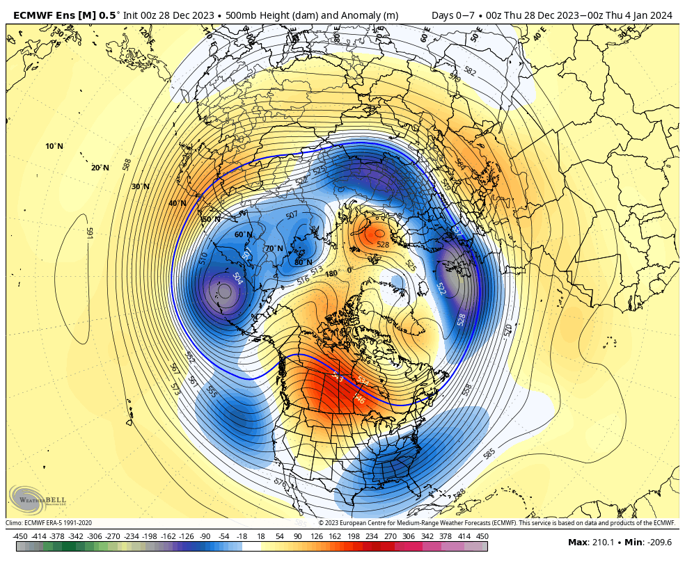
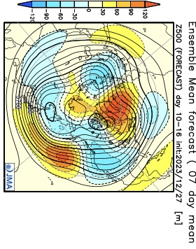
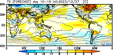
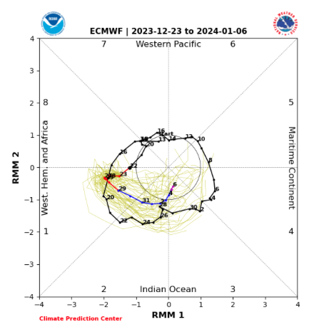
Speaking of the 10-15 day, the look above is an absolute textbook upper air pattern not only for cold, but continued opportunities of winter weather here as we rumble into mid-January. By this point, other long term pattern drivers, such as the NAO and AO (of course to go along with the MJO, PNA, and EPO) will be factored in to where we head not only for the 2nd half of the month, but into late winter and spring. Recent trends certainly suggest the colder options are gaining traction. Today’s European Weekly update reflects a more persistent stretch of high latitude blocking I can remember o/ the past few winters. This ups the ante for a stormy stretch into and through the heart of winter. Given the longer term NAO and MJO look, I’d suspect the colder threat (relative to normal) is on the table into spring this year.
Much more in the AM! Make it a great evening!