Updated 06.01.23 @ 7:46a
You must be logged in to view this content. Click Here to become a member of IndyWX.com for full access. Already a member of IndyWx.com All-Access? Log-in here.

Jun 01
Updated 06.01.23 @ 7:46a
You must be logged in to view this content. Click Here to become a member of IndyWX.com for full access. Already a member of IndyWx.com All-Access? Log-in here.
Permanent link to this article: https://indywx.com/lr-update-closer-look-at-the-expected-june-pattern-drivers/
May 27
Updated 05.27.23 @ 10:32a
Meteorological summer (June through August) is only a few days away and, as you’d imagine, hotter days are on tap. BUT…we continue to believe the 90° days will be brief over the next couple of weeks.
Note the upper pattern evolution shown below. Upper ridging briefly expands over the northern Great Lakes into the Ohio Valley and north-central in the Day 2-7 time period. However, by the Day 10-15 period, that same ridge has retrograded northwest in significant fashion and a significant eastern trough takes up residence.
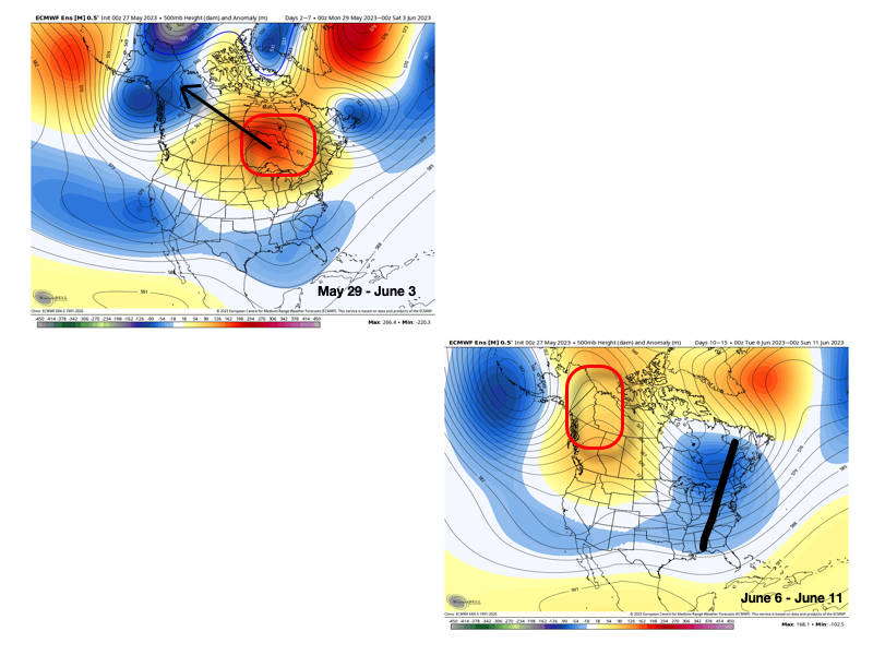
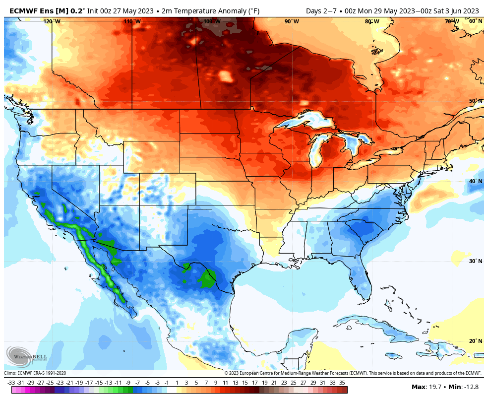
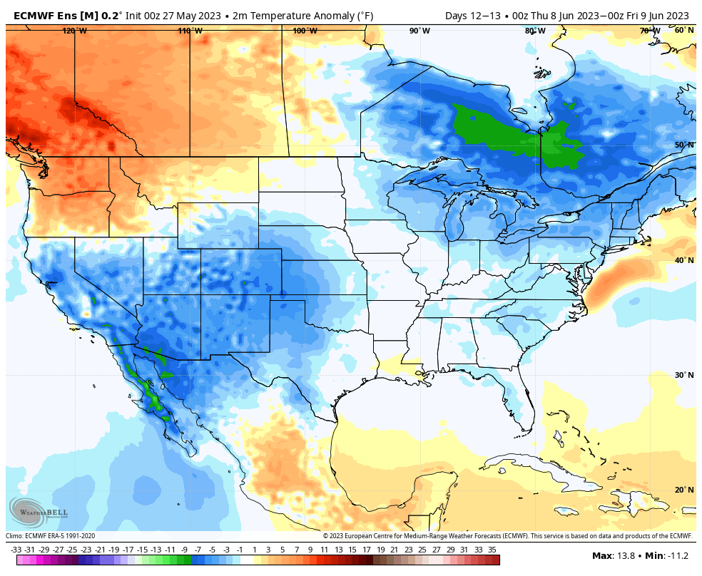
The transitional hotter pattern of next week will be replaced with cooler than normal temperatures during the second full week of June.
The reason for such a pattern transition as noted above has to do with (2) primary drivers: the EPO tanking negative just past the beginning of the month and the PNA spiking strongly positive.
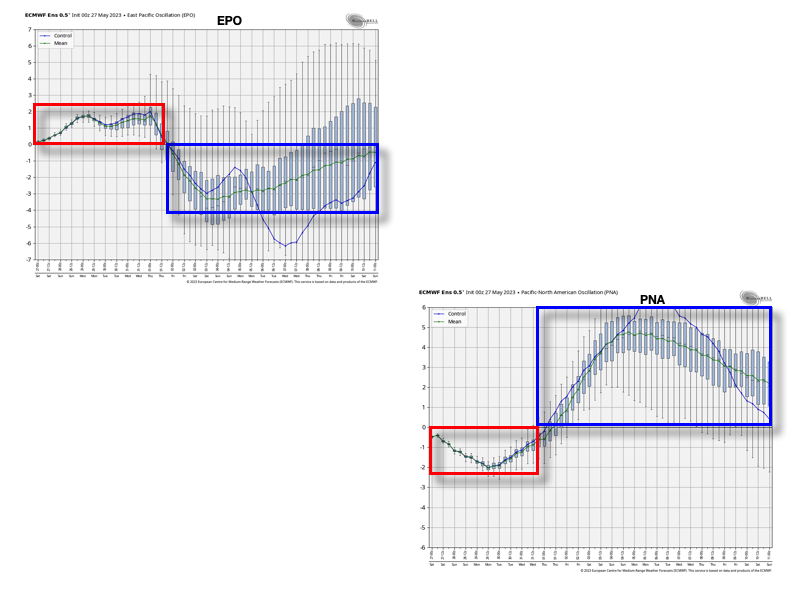
These will work in tandem to pull that upper ridge and associated hot dome into what will likely be more of a permanent June position while the ‘mean’ trough will likely reside in the eastern portion of the country for the better part of the first month of meteorological summer.
While still not an overly wet pattern by any stretch of the imagination (remember, we don’t think wholesale changes take place in the precipitation pattern until the 2nd half of the summer this year), the transition of regimes will likely generate at least better opportunities for needed moisture in the Week 2-3 period.

Permanent link to this article: https://indywx.com/doubling-down-on-the-june-pattern-transition/
May 25
Updated 05.25.23 @ 9:44a
You must be logged in to view this content. Click Here to become a member of IndyWX.com for full access. Already a member of IndyWx.com All-Access? Log-in here.
Permanent link to this article: https://indywx.com/lr-update-next-weeks-heat-doesnt-last-pattern-turns-much-cooler-in-the-week-2-time-period/
May 19
Updated 05.19.23 @ 8:58a
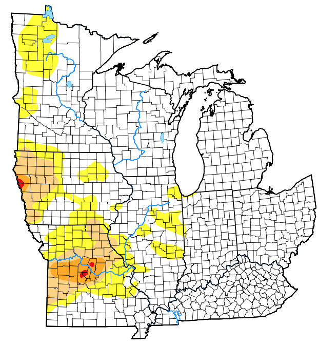
The latest drought monitor (from May 18th) only shows portions of far western Indiana in “abnormally dry,” or D0 intensity.
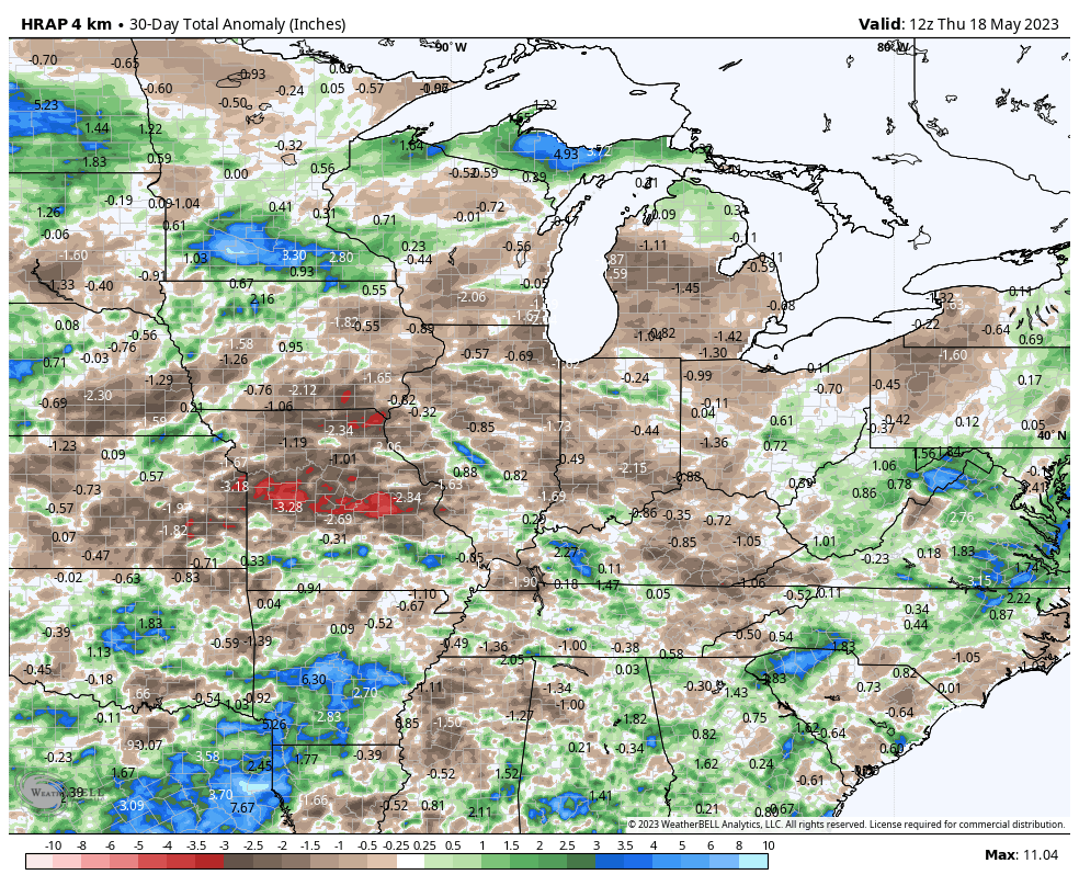
Rainfall over the past (30) days has been hit and miss- not what one ideally wants to see this time of year as feedback can take hold quickly.
Officially, IND is running 3.4″ below normal in the rainfall department since April 1st.
A cold front will press through central Indiana this evening and offer up a smattering of showers and thunderstorms. While some lucky folks will pick up a half inch, or so, most will likely only accumulate rainfall totals between 0.10″ and 0.30″.
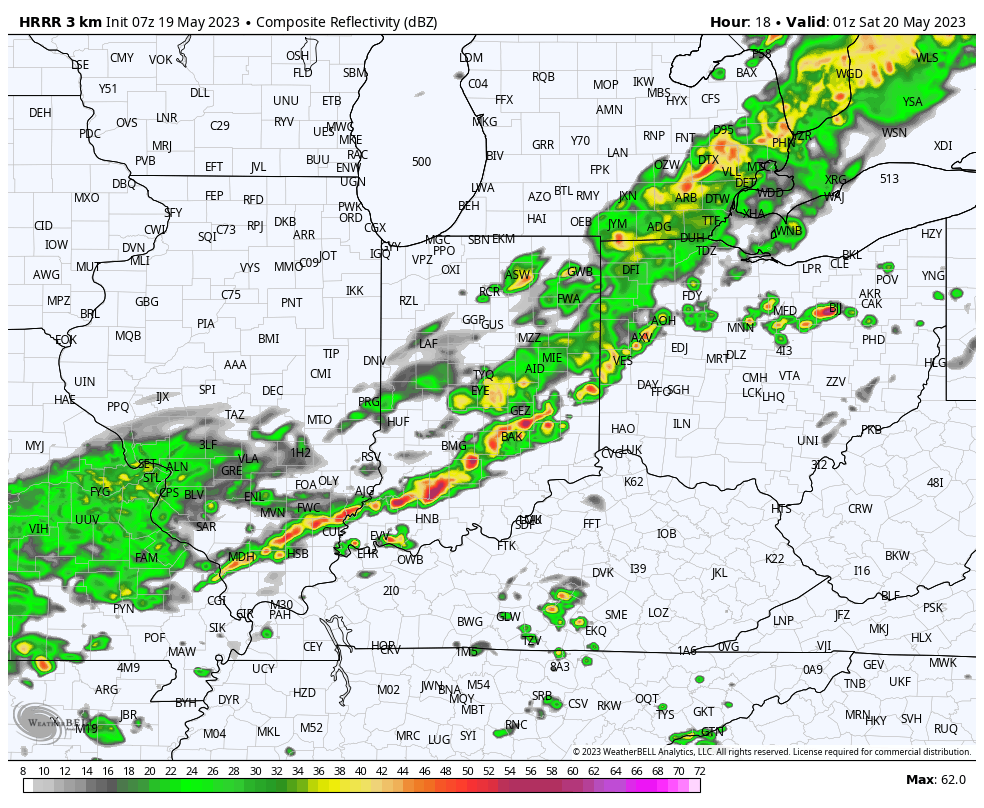

After this, dry times return through the weekend and next week, as a whole. In fact, the pattern long term looks significantly drier than normal through the month of June.

Without question, we’ll see the drought monitor begin to include more of the Ohio Valley in abnormally dry or “droughty” conditions in the coming weeks.
As the Nino matures, the middle and back half of summer should take on an increasingly wet look, but that’s not before 4-6 weeks of the current dry pattern getting even drier…
Permanent link to this article: https://indywx.com/dry-times-likely-become-a-bigger-issue-before-the-pattern-shifts/
May 18
Updated 05.18.23 @ 9:15p
You must be logged in to view this content. Click Here to become a member of IndyWX.com for full access. Already a member of IndyWx.com All-Access? Log-in here.
Permanent link to this article: https://indywx.com/lr-update-june-pattern-evolution/